Filters: Tags: Potomac (X)
25 results (11ms)|
Filters
Date Range
Types Contacts
Categories Tag Types Tag Schemes |
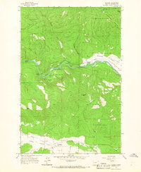
USGS Historical Quadrangle in GeoPDF.
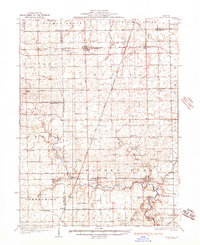
This data set contains imagery from the National Agriculture Imagery Program (NAIP). The NAIP program is administered by USDA FSA and has been established to support two main FSA strategic goals centered on agricultural production. These are, increase stewardship of America's natural resources while enhancing the environment, and to ensure commodities are procured and distributed effectively and efficiently to increase food security. The NAIP program supports these goals by acquiring and providing ortho imagery that has been collected during the agricultural growing season in the U.S. The NAIP ortho imagery is tailored to meet FSA requirements and is a fundamental tool used to support FSA farm and conservation programs....
This data set contains imagery from the National Agriculture Imagery Program (NAIP). The NAIP program is administered by USDA FSA and has been established to support two main FSA strategic goals centered on agricultural production. These are, increase stewardship of America's natural resources while enhancing the environment, and to ensure commodities are procured and distributed effectively and efficiently to increase food security. The NAIP program supports these goals by acquiring and providing ortho imagery that has been collected during the agricultural growing season in the U.S. The NAIP ortho imagery is tailored to meet FSA requirements and is a fundamental tool used to support FSA farm and conservation programs....
This dataset was created to support the Washington D.C. StreamStats project funded by the Washington D.C. Department of Energy and Environment (DOEE). The dataset contains digital elevation model (DEM), flow direction and catchment layers that were conditioned using Washingtons D.C.’s stormwater network layer. The data are hosted online as a component of the USGS StreamStats web application (https://streamstats.usgs.gov), where users can interact with a map of Washington D.C.’s stormwater pipe system and National Hydrography Dataset (NHD) “best resolution” blue lines to delineate drainage basins that account for pipe flow. This project utilized 1-meter (high resolution) terrain products, which improves upon existing...
This data set contains imagery from the National Agriculture Imagery Program (NAIP). The NAIP program is administered by USDA FSA and has been established to support two main FSA strategic goals centered on agricultural production. These are, increase stewardship of America's natural resources while enhancing the environment, and to ensure commodities are procured and distributed effectively and efficiently to increase food security. The NAIP program supports these goals by acquiring and providing ortho imagery that has been collected during the agricultural growing season in the U.S. The NAIP ortho imagery is tailored to meet FSA requirements and is a fundamental tool used to support FSA farm and conservation programs....
This data set contains imagery from the National Agriculture Imagery Program (NAIP). The NAIP program is administered by USDA FSA and has been established to support two main FSA strategic goals centered on agricultural production. These are, increase stewardship of America's natural resources while enhancing the environment, and to ensure commodities are procured and distributed effectively and efficiently to increase food security. The NAIP program supports these goals by acquiring and providing ortho imagery that has been collected during the agricultural growing season in the U.S. The NAIP ortho imagery is tailored to meet FSA requirements and is a fundamental tool used to support FSA farm and conservation programs....
In lieu of a uniform mapping of the Chesapeake and Ohio Canal National Historical Park corridor at very high-resolution using UAS, this study developed a multi-scale workflow, where (1) geospatial modeling methods and (2) historic image analysis were used to constrain the areal extent of (3) detailed field and unmanned aerial systems (UAS) observation. Geospatial Modeling Methods: Harperella habitat characteristics reported by literature sources and corroborated by extremely limited harperella occurrence data (in the form of GPS locations), were compiled into a geospatial prediction model (GPM) to characterize the extent of harperella habitat for the region between Sideling Hill Wildlife Management Area and Harper’s...
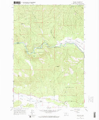
USGS Historical Quadrangle in GeoPDF.
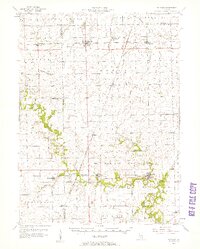
This data set contains imagery from the National Agriculture Imagery Program (NAIP). The NAIP program is administered by USDA FSA and has been established to support two main FSA strategic goals centered on agricultural production. These are, increase stewardship of America's natural resources while enhancing the environment, and to ensure commodities are procured and distributed effectively and efficiently to increase food security. The NAIP program supports these goals by acquiring and providing ortho imagery that has been collected during the agricultural growing season in the U.S. The NAIP ortho imagery is tailored to meet FSA requirements and is a fundamental tool used to support FSA farm and conservation programs....
This Data Release contains data on fish species abundance for selected streams of the Potomac River basin in eastern North America. This dataset supports analysis of karst streams in the Chesapeake Bay headwaters region and was funded by USGS Chesapeake Bay studies.
USGS Historical Quadrangle in GeoPDF.
This data set contains imagery from the National Agriculture Imagery Program (NAIP). The NAIP program is administered by USDA FSA and has been established to support two main FSA strategic goals centered on agricultural production. These are, increase stewardship of America's natural resources while enhancing the environment, and to ensure commodities are procured and distributed effectively and efficiently to increase food security. The NAIP program supports these goals by acquiring and providing ortho imagery that has been collected during the agricultural growing season in the U.S. The NAIP ortho imagery is tailored to meet FSA requirements and is a fundamental tool used to support FSA farm and conservation programs....
USGS Historical Quadrangle in GeoPDF.
This data was created to support the Washington D.C. StreamStats project funded by the Washington D.C. Department of Energy and Environment (DOEE). The data release contains high-resolution (1-meter) land cover data layers for Washington D.C. and its tributaries that represent canopy cover, canopy cover with building and road coverage removed (“pervious canopy”), impervious cover, slope (in units of percent rise), and 30-year normal annual precipitation (1991-2020). The data are hosted online as a component of the USGS StreamStats web application (https://streamstats.usgs.gov), where users can interact with a map of Washington D.C.’s stormwater pipe system and delineate drainage basins that account for pipe flow....
This data set contains imagery from the National Agriculture Imagery Program (NAIP). The NAIP program is administered by USDA FSA and has been established to support two main FSA strategic goals centered on agricultural production. These are, increase stewardship of America's natural resources while enhancing the environment, and to ensure commodities are procured and distributed effectively and efficiently to increase food security. The NAIP program supports these goals by acquiring and providing ortho imagery that has been collected during the agricultural growing season in the U.S. The NAIP ortho imagery is tailored to meet FSA requirements and is a fundamental tool used to support FSA farm and conservation programs....
This data set contains imagery from the National Agriculture Imagery Program (NAIP). The NAIP program is administered by USDA FSA and has been established to support two main FSA strategic goals centered on agricultural production. These are, increase stewardship of America's natural resources while enhancing the environment, and to ensure commodities are procured and distributed effectively and efficiently to increase food security. The NAIP program supports these goals by acquiring and providing ortho imagery that has been collected during the agricultural growing season in the U.S. The NAIP ortho imagery is tailored to meet FSA requirements and is a fundamental tool used to support FSA farm and conservation programs....
USGS Historical Quadrangle in GeoPDF.
The goal of the Atlantic Subsurface Stratigraphic Initiative (ASSI) is to create isopach and structural contour maps for all Coastal Plain formations within the Salisbury Embayment of Maryland and Virginia. Detailed information regarding thicknesses and extent of formations across state boundaries can then be utilized for more accurate documentation of the subaerial extent of aquifers across states. In support of this goal, lower Paleogene sediment elevation and thickness information from approximately 600+ data points from wells, cores, outcrops, and geologic maps were obtained from published and unpublished resources. Analyses started with production of a structure contour map of the unconformable contact of the...
From 16 June to 30 July, 2021, a Virginia Tech team of 4-6 sampled the fish community in 30 Shenandoah Valley streams (Virginia and West Virginia, USA) as part of a larger stream-health study including other teams who surveyed geomorphology, water quality, flow, temperature, macroinvertebrates, and fish health at the same 30 streams. The fish community team also sampled three additional bonus streams (SiteID's FOLL, NAKE, and TUMB) during 19-22 August, 2021. These 33 streams had upstream drainage areas of 7 to 46 sq. km and included 4 James River tributaries (SiteID's POAG, MLRB, CEDR, PISG), one Potomac River tributary (HARL), and 28 Shenandoah River tributaries. At each stream, we sampled fish from two reaches...
Categories: Data;
Types: Map Service,
OGC WFS Layer,
OGC WMS Layer,
OGC WMS Service;
Tags: Augusta,
Berkeley,
Clarke,
Ecology,
Jefferson,
Data described herein was collected by USGS personnel and the project funded by USGS. Northern snakehead specimens were collected from the Potomac River and its tributaries by regional natural resource management agencies in the course of their field investigations working with this priority invasive aquatic species. Specimens were provided to USGS for the purpose of conducting health related assessments of northern snakehead in the region, with approximately 90 specimens evaluated grossly and histologically for the presence of lesions and abnormalities. Data presented here was collected seasonally (spring through fall) in 2006 and from 2015 to 2017. Data for each specimen includes date and location of collection,...
Categories: Data;
Tags: Aquatic Biology,
Candidate publication,
Complete,
Connected,
Kearneysville, WV,
|

|
