Filters
Date Range
Types
Contacts
Tag Types
Tag Schemes
|
This data set contains imagery from the National Agriculture Imagery Program (NAIP). The NAIP program is administered by USDA FSA and has been established to support two main FSA strategic goals centered on agricultural production. These are increase stewardship of America's natural resources while enhancing the environment, and to ensure commodities are procured and distributed effectively and efficiently to increase food security. The NAIP program supports these goals by acquiring and providing ortho imagery that has been collected during the agricultural growing season in the U.S. The NAIP ortho imagery is tailored to meet FSA requirements and is a fundamental tool used to support FSA farm and conservation programs....
Types: Citation;
Tags: 3.75 x 3.75 minute,
4310328,
46033,
Aerial Compliance,
CUSTER CO SD FSA, All tags...
Compliance,
Custer,
Digital Ortho rectified Image,
Downloadable Data,
JPEG 2000,
JPEG2000,
NAIP,
Ortho Rectification,
Orthoimagery,
PRINGLE,
PRINGLE, NW,
Quarter Quadrangle,
SD,
SD033,
USDA National Agriculture Imagery Program (NAIP),
farming,
imageryBaseMapsEarthCover, Fewer tags
This data set contains imagery from the National Agriculture Imagery Program (NAIP). The NAIP program is administered by USDA FSA and has been established to support two main FSA strategic goals centered on agricultural production. These are increase stewardship of America's natural resources while enhancing the environment, and to ensure commodities are procured and distributed effectively and efficiently to increase food security. The NAIP program supports these goals by acquiring and providing ortho imagery that has been collected during the agricultural growing season in the U.S. The NAIP ortho imagery is tailored to meet FSA requirements and is a fundamental tool used to support FSA farm and conservation programs....
Types: Citation;
Tags: 3.75 x 3.75 minute,
4310328,
46033,
Aerial Compliance,
CUSTER CO SD FSA, All tags...
Compliance,
Custer,
Digital Ortho rectified Image,
Downloadable Data,
JPEG 2000,
JPEG2000,
NAIP,
Ortho Rectification,
Orthoimagery,
PRINGLE,
PRINGLE, SE,
Quarter Quadrangle,
SD,
SD033,
USDA National Agriculture Imagery Program (NAIP),
farming,
imageryBaseMapsEarthCover, Fewer tags
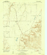
USGS Historical Quadrangle in GeoPDF.
Tags: 7.5 x 7.5 minute,
Downloadable Data,
GeoPDF,
GeoTIFF,
Historical Topographic Maps, All tags...
Historical Topographic Maps 7.5 x 7.5 Minute Map Series,
Map,
Pringle,
TX,
imageryBaseMapsEarthCover, Fewer tags

This geospatial database covers vegetation land cover and land use for Wind Cave National Park and surrounding areas and is authorized as part of the USGS/NPS Vegetation Mapping Program http://www.usgs.gov/core_science_systems/csas/vip/index.html. The program is administered by the Biological Resources Division (BRD) of the United States Geological Survey (USGS). This mapping effort was performed by the US Bureau of Reclamation's (USBR) Remote Sensing and GIS Group, Technical Service Center, Denver, CO. The vegetation mapping program is part of a larger Inventory and Monitoring (I&M) program started by the National Park Service (NPS) http://science.nature.nps.gov/im/. I&M goals are, among others, to map the vegetation...
Tags: National Park,
National Park Service,
Pringle,
South Dakota,
Wind Cave, All tags...
Wind Cave National Park,
alliance,
association,
land cover,
land use,
vegetation, Fewer tags
This data set contains imagery from the National Agriculture Imagery Program (NAIP). The NAIP program is administered by USDA FSA and has been established to support two main FSA strategic goals centered on agricultural production. These are increase stewardship of America's natural resources while enhancing the environment, and to ensure commodities are procured and distributed effectively and efficiently to increase food security. The NAIP program supports these goals by acquiring and providing ortho imagery that has been collected during the agricultural growing season in the U.S. The NAIP ortho imagery is tailored to meet FSA requirements and is a fundamental tool used to support FSA farm and conservation programs....
Types: Citation;
Tags: 3.75 x 3.75 minute,
4310328,
46033,
Aerial Compliance,
CUSTER CO SD FSA, All tags...
Compliance,
Custer,
Digital Ortho rectified Image,
Downloadable Data,
JPEG 2000,
JPEG2000,
NAIP,
Ortho Rectification,
Orthoimagery,
PRINGLE,
PRINGLE, SW,
Quarter Quadrangle,
SD,
SD033,
USDA National Agriculture Imagery Program (NAIP),
farming,
imageryBaseMapsEarthCover, Fewer tags
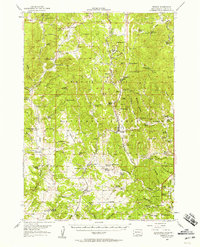
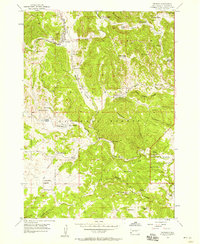
USGS Historical Quadrangle in GeoPDF.
Tags: 15 x 15 minute,
Downloadable Data,
GeoPDF,
GeoTIFF,
Historical Topographic Maps, All tags...
Historical Topographic Maps 15 x 15 Minute Map Series,
Map,
Pringle,
SD,
imageryBaseMapsEarthCover, Fewer tags
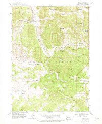
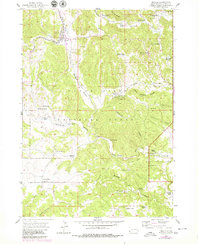
USGS Historical Quadrangle in GeoPDF.
Tags: 7.5 x 7.5 minute,
Downloadable Data,
GeoPDF,
GeoTIFF,
Historical Topographic Maps, All tags...
Historical Topographic Maps 7.5 x 7.5 Minute Map Series,
Map,
Pringle,
SD,
imageryBaseMapsEarthCover, Fewer tags
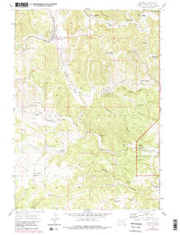
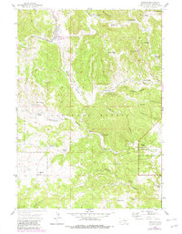
USGS Historical Quadrangle in GeoPDF.
Tags: 7.5 x 7.5 minute,
Downloadable Data,
GeoPDF,
GeoTIFF,
Historical Topographic Maps, All tags...
Historical Topographic Maps 7.5 x 7.5 Minute Map Series,
Map,
Pringle,
SD,
imageryBaseMapsEarthCover, Fewer tags
This data set contains imagery from the National Agriculture Imagery Program (NAIP). The NAIP program is administered by USDA FSA and has been established to support two main FSA strategic goals centered on agricultural production. These are increase stewardship of America's natural resources while enhancing the environment, and to ensure commodities are procured and distributed effectively and efficiently to increase food security. The NAIP program supports these goals by acquiring and providing ortho imagery that has been collected during the agricultural growing season in the U.S. The NAIP ortho imagery is tailored to meet FSA requirements and is a fundamental tool used to support FSA farm and conservation programs....
Types: Citation;
Tags: 3.75 x 3.75 minute,
4310328,
46033,
Aerial Compliance,
CUSTER CO SD FSA, All tags...
Compliance,
Custer,
Digital Ortho rectified Image,
Downloadable Data,
JPEG 2000,
JPEG2000,
NAIP,
Ortho Rectification,
Orthoimagery,
PRINGLE,
PRINGLE, NE,
Quarter Quadrangle,
SD,
SD033,
USDA National Agriculture Imagery Program (NAIP),
farming,
imageryBaseMapsEarthCover, Fewer tags
This data set contains imagery from the National Agriculture Imagery Program (NAIP). The NAIP program is administered by USDA FSA and has been established to support two main FSA strategic goals centered on agricultural production. These are increase stewardship of America's natural resources while enhancing the environment, and to ensure commodities are procured and distributed effectively and efficiently to increase food security. The NAIP program supports these goals by acquiring and providing ortho imagery that has been collected during the agricultural growing season in the U.S. The NAIP ortho imagery is tailored to meet FSA requirements and is a fundamental tool used to support FSA farm and conservation programs....
Types: Citation;
Tags: 3.75 x 3.75 minute,
3510105,
48233,
Aerial Compliance,
Compliance, All tags...
Digital Ortho rectified Image,
Downloadable Data,
HUTCHINSON CO TX FSA,
Hutchinson,
JPEG 2000,
JPEG2000,
NAIP,
Ortho Rectification,
Orthoimagery,
PRINGLE,
PRINGLE, NE,
Quarter Quadrangle,
TX,
TX233,
USDA National Agriculture Imagery Program (NAIP),
farming,
imageryBaseMapsEarthCover, Fewer tags
USGS Historical Quadrangle in GeoPDF.
Tags: 7.5 x 7.5 minute,
Downloadable Data,
GeoPDF,
GeoTIFF,
Historical Topographic Maps, All tags...
Historical Topographic Maps 7.5 x 7.5 Minute Map Series,
Map,
Pringle,
SD,
imageryBaseMapsEarthCover, Fewer tags
This data set contains imagery from the National Agriculture Imagery Program (NAIP). The NAIP program is administered by USDA FSA and has been established to support two main FSA strategic goals centered on agricultural production. These are increase stewardship of America's natural resources while enhancing the environment, and to ensure commodities are procured and distributed effectively and efficiently to increase food security. The NAIP program supports these goals by acquiring and providing ortho imagery that has been collected during the agricultural growing season in the U.S. The NAIP ortho imagery is tailored to meet FSA requirements and is a fundamental tool used to support FSA farm and conservation programs....
Types: Citation;
Tags: 3.75 x 3.75 minute,
3510105,
48233,
Aerial Compliance,
Compliance, All tags...
Digital Ortho rectified Image,
Downloadable Data,
HUTCHINSON CO TX FSA,
Hutchinson,
JPEG 2000,
JPEG2000,
NAIP,
Ortho Rectification,
Orthoimagery,
PRINGLE,
PRINGLE, SE,
Quarter Quadrangle,
TX,
TX233,
USDA National Agriculture Imagery Program (NAIP),
farming,
imageryBaseMapsEarthCover, Fewer tags
USGS Historical Quadrangle in GeoPDF.
Tags: 7.5 x 7.5 minute,
Downloadable Data,
GeoPDF,
GeoTIFF,
Historical Topographic Maps, All tags...
Historical Topographic Maps 7.5 x 7.5 Minute Map Series,
Map,
Pringle,
SD,
imageryBaseMapsEarthCover, Fewer tags
This data set contains imagery from the National Agriculture Imagery Program (NAIP). The NAIP program is administered by USDA FSA and has been established to support two main FSA strategic goals centered on agricultural production. These are increase stewardship of America's natural resources while enhancing the environment, and to ensure commodities are procured and distributed effectively and efficiently to increase food security. The NAIP program supports these goals by acquiring and providing ortho imagery that has been collected during the agricultural growing season in the U.S. The NAIP ortho imagery is tailored to meet FSA requirements and is a fundamental tool used to support FSA farm and conservation programs....
Types: Citation;
Tags: 3.75 x 3.75 minute,
3510105,
48233,
Aerial Compliance,
Compliance, All tags...
Digital Ortho rectified Image,
Downloadable Data,
HUTCHINSON CO TX FSA,
Hutchinson,
JPEG 2000,
JPEG2000,
NAIP,
Ortho Rectification,
Orthoimagery,
PRINGLE,
PRINGLE, NW,
Quarter Quadrangle,
TX,
TX233,
USDA National Agriculture Imagery Program (NAIP),
farming,
imageryBaseMapsEarthCover, Fewer tags
This data set contains imagery from the National Agriculture Imagery Program (NAIP). The NAIP program is administered by USDA FSA and has been established to support two main FSA strategic goals centered on agricultural production. These are increase stewardship of America's natural resources while enhancing the environment, and to ensure commodities are procured and distributed effectively and efficiently to increase food security. The NAIP program supports these goals by acquiring and providing ortho imagery that has been collected during the agricultural growing season in the U.S. The NAIP ortho imagery is tailored to meet FSA requirements and is a fundamental tool used to support FSA farm and conservation programs....
Types: Citation;
Tags: 3.75 x 3.75 minute,
3510105,
48233,
Aerial Compliance,
Compliance, All tags...
Digital Ortho rectified Image,
Downloadable Data,
HUTCHINSON CO TX FSA,
Hutchinson,
JPEG 2000,
JPEG2000,
NAIP,
Ortho Rectification,
Orthoimagery,
PRINGLE,
PRINGLE, SW,
Quarter Quadrangle,
TX,
TX233,
USDA National Agriculture Imagery Program (NAIP),
farming,
imageryBaseMapsEarthCover, Fewer tags
USGS Historical Quadrangle in GeoPDF.
Tags: 7.5 x 7.5 minute,
Downloadable Data,
GeoPDF,
GeoTIFF,
Historical Topographic Maps, All tags...
Historical Topographic Maps 7.5 x 7.5 Minute Map Series,
Map,
Pringle,
SD,
imageryBaseMapsEarthCover, Fewer tags
|
|

