Filters: Tags: Río Bravo (X)
25 results (29ms)|
Filters
Date Range
Extensions Types
Contacts
Categories Tag Types
|
This dataset contains the input files, script, and output files regarding 110 years of daily regulated (observed) and naturalized streamflow (million cubic meters/day) for ten gauge stations in the Rio Grande/Bravo basin. The gauge stations included are at Amistad, Anzalduas, Artesia, Below Presidio, Laredo, Conchos Outlet, Foster Ranch, Laredo, Pecos Outlet, Salado River, and San Juan River.
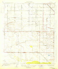
USGS Historical Quadrangle in GeoPDF.
This data set contains imagery from the National Agriculture Imagery Program (NAIP). The NAIP program is administered by USDA FSA and has been established to support two main FSA strategic goals centered on agricultural production. These are, increase stewardship of America's natural resources while enhancing the environment, and to ensure commodities are procured and distributed effectively and efficiently to increase food security. The NAIP program supports these goals by acquiring and providing ortho imagery that has been collected during the agricultural growing season in the U.S. The NAIP ortho imagery is tailored to meet FSA requirements and is a fundamental tool used to support FSA farm and conservation programs....
Data were used for a total of 97 climate projection scenarios in this study. These scenarios show monthly and annual streamflow in the Rio Grande main channel at the pair of USGS gauges at San Marcial, representing the inflows to Elephant Butte reservoir from 2022 to 2099. Townsend and Gutzler (2020) developed an adjustment procedure to convert natural flows projected by the U.S. Bureau of Reclamation at the Elephant Butte dam to realistic flow values at San Marcial (at the upstream end of Elephant Butte Reservoir) to account for upstream water management. The scenarios cover a range of dry (average annual projected flow less than the historical value) to wet (average annual projected flow higher than the historical...
Categories: Data;
Tags: Climate conditions projection,
Global Climate Models,
Normalization methods,
Rio Bravo,
Rio Grande,
The Rio Grande-Rio Bravo Basin Subset Data were used to produce the digitalization of the River extent of water related models.
Categories: Data;
Types: Downloadable,
Map Service,
OGC WFS Layer,
OGC WMS Layer,
Shapefile;
Tags: Hydraulics,
Hydrologic,
Optimization,
Rio Bravo,
Rio Grande,
Create an inventory of water-related models that have been developed for the Rio Grande/Bravo basin. The summary includes a description of model river extent, spatial and temporal resolution, time period, model type, and their possible application for testing environmental flows or climate change future alternatives.
Categories: Data;
Types: Citation,
Downloadable,
Map Service,
OGC WFS Layer,
OGC WMS Layer,
Shapefile;
Tags: Hydraulics,
Hydrologic,
Optimization,
Rio Bravo,
Rio Grande,
Categories: Publication;
Types: Citation;
Tags: Hydraulics,
Hydrologic,
Optimization,
Rio Bravo,
Rio Grande,
This data set contains imagery from the National Agriculture Imagery Program (NAIP). The NAIP program is administered by USDA FSA and has been established to support two main FSA strategic goals centered on agricultural production. These are, increase stewardship of America's natural resources while enhancing the environment, and to ensure commodities are procured and distributed effectively and efficiently to increase food security. The NAIP program supports these goals by acquiring and providing ortho imagery that has been collected during the agricultural growing season in the U.S. The NAIP ortho imagery is tailored to meet FSA requirements and is a fundamental tool used to support FSA farm and conservation programs....
This data set contains imagery from the National Agriculture Imagery Program (NAIP). The NAIP program is administered by USDA FSA and has been established to support two main FSA strategic goals centered on agricultural production. These are, increase stewardship of America's natural resources while enhancing the environment, and to ensure commodities are procured and distributed effectively and efficiently to increase food security. The NAIP program supports these goals by acquiring and providing ortho imagery that has been collected during the agricultural growing season in the U.S. The NAIP ortho imagery is tailored to meet FSA requirements and is a fundamental tool used to support FSA farm and conservation programs....
USGS Historical Quadrangle in GeoPDF.
The main source of surface water for irrigation in the study area is the Rio Grande River. The upstream reservoirs, Elephant Butte and Caballo, are used to regulate river flow into the study area. In order to estimate the future surface water availability, we developed a model and routed the reservoir inflow projections at the USGS San Marcial through the reservoir system. The data are available in csv worksheet as open source for free public use.
Categories: Data;
Tags: Caballo Reservoir,
Elephant Butte Reservoir,
Irrigation water resources,
Reservoir routing,
Rio Bravo,
Groundwater resources are important for irrigated agricultural activities in the region. Farmers use groundwater to compensate for insufficient surface water availability. The data are stored in a csv file titled 'Monthly Groundwater Projections' (groundwater_availability_projections.csv). The columns represent monthly groundwater pumping rates (m3/day) while the rows represent months and dates. The data are open source and available for free public use.
Categories: Data;
Tags: Fresh Groundwater,
Groundwater Resources,
Irrigation Water Resources,
Rio Bravo,
Rio Grande,
This database provides crop coefficients and start and termination dates for more than 40 crops grown in the Rio Grande/Bravo basin. It was created drawing on a literature and dataset review covering resources from the State Agricultural Extension Services (Colorado State University, New Mexico State University, and Texas A&M University), the USDA (U.S. Department of Agriculture), AgriMet, and the FAO (Food and Agriculture Organization). The database provides crop coefficients from plant emergence (or break dormancy in the case of perennials) to termination (harvest or dormancy), as well earliest planting date, killing frost temperature and cumulative growing degree days up to emergence, full cover and termination....
Categories: Data;
Tags: Crop coefficient,
Evapotranspiration,
Harvesting Date,
Rio Bravo,
Rio Grande,
This UNOFFICIAL United States-Mexico boundary dataset was developed by the U.S. Geological Survey’s Border Environmental Health Initiative (BEHI) (http://borderhealth.cr.usgs.gov/index.html), to be used as a common boundary for the clipping and geometric integration of binational geospatial datasets. It provides a single boundary that has been used throughout the project, but is not representative of any officially recognized international boundary. International borders politically divide the landscape but rarely represent barriers for environmental issues. The major issues surrounding the U.S.-Mexico border involve economics and population growth that present challenges to environmental management and natural...
USGS Historical Quadrangle in GeoPDF.
USGS Historical Quadrangle in GeoPDF.
This data set contains imagery from the National Agriculture Imagery Program (NAIP). The NAIP program is administered by USDA FSA and has been established to support two main FSA strategic goals centered on agricultural production. These are, increase stewardship of America's natural resources while enhancing the environment, and to ensure commodities are procured and distributed effectively and efficiently to increase food security. The NAIP program supports these goals by acquiring and providing ortho imagery that has been collected during the agricultural growing season in the U.S. The NAIP ortho imagery is tailored to meet FSA requirements and is a fundamental tool used to support FSA farm and conservation programs....
USGS Historical Quadrangle in GeoPDF.
This project inventories and reviews available water resource models used to meet multiple (and often competing) water resource management objectives. Water resource modeling tools have been developed for many different regions and sub-basins of the Rio Grande/Bravo (RGB). Each of these tools have specific objectives, whether it is to explore drought mitigation alternatives, conflict resolution, climate change evaluation, tradeoff and economic synergies, water allocation, reservoir operations, or collaborative planning. We specifically evaluate the applicability of those models to evaluating trade-offs in meeting societal and environmental flow requirements to recover native ecosystems. This work communicates the...
This is one of five general categories that contain the water related elements of the Rio Grande/Bravo basin. This category includes boundaries of the United States and Mexico as well as the States, Counties, and Municipalities that overlap with the basin boundary. This category includes also the extent and location of the cities within the basin and the current and historic population of such cities.
Categories: Data;
Types: Citation,
Downloadable,
Map Service,
OGC WFS Layer,
OGC WMS Layer,
Shapefile;
Tags: Boundaries,
Counties,
Country boundary,
Municipalities,
Rio Bravo,
|

|
