Filters: Tags: ROLL (X)
38 results (74ms)|
Filters
Date Range
Extensions Types Contacts
Categories Tag Types Tag Schemes |
This item represents a set of aerial photographs currently housed in the California Geological Survey Menlo Park office. Quads include: El Centro, Death Valley, Goldfield, Los Angeles, Mariposa, Needles, Salton Sea, San Bernardino, Santa Ana, Trona, Walker Lake. Photo scale: 1:125000. Coverage includes: diagonal NW to SE flight lines.
Categories: Physical Item;
Tags: Roll
This item represents a set of aerial photographs currently housed in the California Geological Survey Menlo Park office. Quads include: Los Angeles. Photo scale: 1:32000. Coverage includes: Sierra Madre Mountains to Tehachapi Mountains, Santa Ynez Mountains, Mint Canyon to Palmdale.
Categories: Physical Item;
Tags: Roll
This data set contains imagery from the National Agriculture Imagery Program (NAIP). The NAIP program is administered by USDA FSA and has been established to support two main FSA strategic goals centered on agricultural production. These are increase stewardship of America's natural resources while enhancing the environment, and to ensure commodities are procured and distributed effectively and efficiently to increase food security. The NAIP program supports these goals by acquiring and providing ortho imagery that has been collected during the agricultural growing season in the U.S. The NAIP ortho imagery is tailored to meet FSA requirements and is a fundamental tool used to support FSA farm and conservation programs....
This data set contains imagery from the National Agriculture Imagery Program (NAIP). The NAIP program is administered by USDA FSA and has been established to support two main FSA strategic goals centered on agricultural production. These are increase stewardship of America's natural resources while enhancing the environment, and to ensure commodities are procured and distributed effectively and efficiently to increase food security. The NAIP program supports these goals by acquiring and providing ortho imagery that has been collected during the agricultural growing season in the U.S. The NAIP ortho imagery is tailored to meet FSA requirements and is a fundamental tool used to support FSA farm and conservation programs....
This item represents a set of aerial photographs currently housed in the California Geological Survey Menlo Park office. Quads include: Monterey (Santa Cruz). Photo scale: 1:33400. Coverage includes: between Hwy 101 and coastline, Monterey County.
Categories: Physical Item;
Tags: Roll
This item represents a set of aerial photographs currently housed in the California Geological Survey Menlo Park office. Quads include: Monterey (Santa Cruz), Sacramento, San Francisco, San Jose, Santa Rosa. Photo scale: 1:69000. Coverage includes: rectangle bounded by Clear Lake, Vacaville, Watsonville and the Pacific Ocean.
Categories: Physical Item;
Tags: Roll
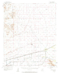
USGS Historical Quadrangle in GeoPDF.
This data set contains imagery from the National Agriculture Imagery Program (NAIP). The NAIP program is administered by USDA FSA and has been established to support two main FSA strategic goals centered on agricultural production. These are, increase stewardship of America's natural resources while enhancing the environment, and to ensure commodities are procured and distributed effectively and efficiently to increase food security. The NAIP program supports these goals by acquiring and providing ortho imagery that has been collected during the agricultural growing season in the U.S. The NAIP ortho imagery is tailored to meet FSA requirements and is a fundamental tool used to support FSA farm and conservation programs....
This data set contains imagery from the National Agriculture Imagery Program (NAIP). The NAIP program is administered by USDA FSA and has been established to support two main FSA strategic goals centered on agricultural production. These are, increase stewardship of America's natural resources while enhancing the environment, and to ensure commodities are procured and distributed effectively and efficiently to increase food security. The NAIP program supports these goals by acquiring and providing ortho imagery that has been collected during the agricultural growing season in the U.S. The NAIP ortho imagery is tailored to meet FSA requirements and is a fundamental tool used to support FSA farm and conservation programs....
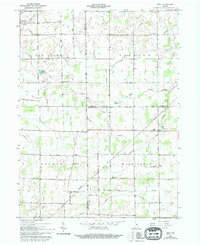
USGS Historical Quadrangle in GeoPDF.
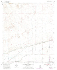
USGS Historical Quadrangle in GeoPDF.
This item represents a set of aerial photographs currently housed in the California Geological Survey Menlo Park office. Quads include: Bakersfield, Los Angeles, San Bernardino, San Luis Obispo, Santa Maria. Photo scale: 1:62500. Coverage includes: top 1/2 of Los Angeles Sheet.
Categories: Physical Item;
Tags: Roll
This item represents a set of aerial photographs currently housed in the California Geological Survey Menlo Park office. Quads include: Monterey (Santa Cruz). Photo scale: 1:33400. Coverage includes: between Hwy 101 & coastline from Los Padres National Forest south to county line.
Categories: Physical Item;
Tags: Roll
This data set contains imagery from the National Agriculture Imagery Program (NAIP). The NAIP program is administered by USDA FSA and has been established to support two main FSA strategic goals centered on agricultural production. These are increase stewardship of America's natural resources while enhancing the environment, and to ensure commodities are procured and distributed effectively and efficiently to increase food security. The NAIP program supports these goals by acquiring and providing ortho imagery that has been collected during the agricultural growing season in the U.S. The NAIP ortho imagery is tailored to meet FSA requirements and is a fundamental tool used to support FSA farm and conservation programs....
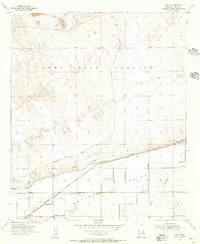
USGS Historical Quadrangle in GeoPDF.
This data set contains imagery from the National Agriculture Imagery Program (NAIP). The NAIP program is administered by USDA FSA and has been established to support two main FSA strategic goals centered on agricultural production. These are, increase stewardship of America's natural resources while enhancing the environment, and to ensure commodities are procured and distributed effectively and efficiently to increase food security. The NAIP program supports these goals by acquiring and providing ortho imagery that has been collected during the agricultural growing season in the U.S. The NAIP ortho imagery is tailored to meet FSA requirements and is a fundamental tool used to support FSA farm and conservation programs....
This item represents a set of aerial photographs currently housed in the California Geological Survey Menlo Park office. Quads include: Los Angeles. Photo scale: 1:32000. Coverage includes: Sierra Madre Mountains to Tehachapi Mountains, Santa Ynez Mountains, Mint Canyon to Palmdale.
Categories: Physical Item;
Tags: Roll
This item represents a set of aerial photographs currently housed in the California Geological Survey Menlo Park office. Quads include: Monterey (Santa Cruz). Photo scale: 1:33400. Coverage includes: between Hwy 101 and coastline, Monterey County.
Categories: Physical Item;
Tags: Roll
This item represents a set of aerial photographs currently housed in the California Geological Survey Menlo Park office. Quads include: Redding, Santa Rosa, Weed, Ukiah. Photo scale: 1:130000. Coverage includes: along Humboldt County to Mendocino County.
Categories: Physical Item;
Tags: Roll
|

|
