Filters: Tags: Refuge (X)
31 results (111ms)|
Filters
Date Range
Extensions (Less) Types (Less) Contacts (Less)
Categories (Less) Tag Types Tag Schemes
|
BLM Surface Management Agency Layer
Types: Downloadable;
Tags: BLM,
Bankhead-Jones,
Bureau of Land Management,
Bureau of Reclamation,
DOI,
This dataset represents public and non-governmental organizations (NGO) beaches in the North and Mid-Atlantic. The data are part of a larger project, Inventory of Habitat Modifications to Sandy Oceanfront Beaches in the U.S. Atlantic Coast Breeding Range of the Piping Plover (Charadrius melodus) as of 2015: Maine to North Carolina. Beachfront land parcels in public or NGO ownership were delineated from a variety of sources, including county or municipal parcel data available online to the public (see Table 1 of Rice 2015b for a full list of sources consulted for Maine to New York). Public and NGO-owned beachfront parcels are delineated with narrow, lime green lines in Google Earth Pro. The public / NGO line segments...
Categories: Data;
Types: ArcGIS REST Map Service,
ArcGIS Service Definition,
Downloadable,
Map Service;
Tags: Connecticut,
Delaware,
Long Island Sound,
Maine,
Maryland,
This "Surface Management Agency" data layer portrays tracts of federal land for the United States and classifies these holdings by administrative agency. Multiple federal agencies have contributed to the contents of this layer and it is in a continuous state of update. Source and date of feature updates are tracked to the feature level.
Types: Downloadable;
Tags: BLM,
Bankhead-Jones,
Bureau of Land Management,
Bureau of Reclamation,
DOI,
This "Surface Management Agency" data layer portrays tracts of federal land for the United States and classifies these holdings by administrative agency. Multiple federal agencies have contributed to the contents of this layer and it is in a continuous state of update. Source and date of feature updates are tracked to the feature level.
Types: Downloadable;
Tags: Authorization,
BLM,
Bankhead-Jones,
Bureau of Land Management,
Bureau of Reclamation,
This "Surface Management Agency" data layer portrays tracts of federal land for the United States and classifies these holdings by administrative agency. Multiple federal agencies have contributed to the contents of this layer and it is in a continuous state of update. Source and date of feature updates are tracked to the feature level.
Types: Downloadable;
Tags: BLM,
Bankhead-Jones,
Bureau of Land Management,
Bureau of Reclamation,
CBR,
This "Surface Management Agency" data layer portrays tracts of federal land for the United States and classifies these holdings by administrative agency. Multiple federal agencies have contributed to the contents of this layer and it is in a continuous state of update. Source and date of feature updates are tracked to the feature level. The dataset was clipped to the ecoregion boundary and queried for National parks, National Preserves, and National Wildlife Refuges.
Types: Downloadable;
Tags: BLM,
Bankhead-Jones,
Bureau of Land Management,
Bureau of Reclamation,
DOI,
This "Surface Management Agency" data layer portrays tracts of federal land for the United States and classifies these holdings by administrative agency. Multiple federal agencies have contributed to the contents of this layer and it is in a continuous state of update. Source and date of feature updates are tracked to the feature level.
Types: Downloadable;
Tags: BLM,
Bankhead-Jones,
Bureau of Land Management,
Bureau of Reclamation,
DOI,
It is important to note that just because an area has high mineral potential does not mean it will be developed. There are several factors that go into starting up a mining endeavor. Also areas with high mineral potential inside protected areas are not likely to be developed.
Areas established by the Legislature for management of forest, recreational and historical purposes; to protect and preserve natural habitat for fish and/or wildlife and special restrictions not specifically tied to any of the previously mentioned purposes. This shape file characterizes the geographic representation of land parcels within the State of Alaska contained by the Legislatively Designated Area category. It has been extracted from data sets used to produce the State status plats. This data set includes cases noted on the digital status plats up to one day prior to data extraction. Each feature has an associated attribute record, including a Land Administration System (LAS) file-type and file-number which...
Types: Downloadable;
Tags: BLM,
Bald Eagle Preserve,
Bison Range Area,
Bureau of Land Management,
CHA,
Areas established by the Legislature for management of forest, recreational and historical purposes; to protect and preserve natural habitat for fish and/or wildlife and special restrictions not specifically tied to any of the previously mentioned purposes. This shape file characterizes the geographic representation of land parcels within the State of Alaska contained by the Legislatively Designated Area category. It has been extracted from data sets used to produce the State status plats. This data set includes cases noted on the digital status plats up to one day prior to data extraction. Each feature has an associated attribute record, including a Land Administration System (LAS) file-type and file-number which...
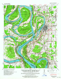
USGS Historical Quadrangle in GeoPDF.
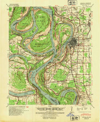
USGS Historical Quadrangle in GeoPDF.

USGS Historical Quadrangle in GeoPDF.
This data layer depicts the external boundaries of lands and waters that are approved for acquisition by the U.S. Fish and Wildlife Service (USFWS) in North America, U.S. Trust Territories and Possessions. The primary source for this information is the USFWS Realty program.
This "Surface Management Agency" data layer portrays tracts of federal land for the United States and classifies these holdings by administrative agency. Multiple federal agencies have contributed to the contents of this layer and it is in a continuous state of update. Source and date of feature updates are tracked to the feature level.
Types: Downloadable;
Tags: BLM,
Bankhead-Jones,
Bureau of Land Management,
Bureau of Reclamation,
DOI,
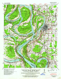
USGS Historical Quadrangle in GeoPDF.
This "Surface Management Agency" data layer portrays tracts of federal land for the United States and classifies these holdings by administrative agency. Multiple federal agencies have contributed to the contents of this layer and it is in a continuous state of update. Source and date of feature updates are tracked to the feature level.
Types: Downloadable;
Tags: Authorization,
BLM,
Bankhead-Jones,
Bureau of Land Management,
Bureau of Reclamation,
BLM Surface Management Agency Layer
Types: Downloadable;
Tags: BLM,
Bankhead-Jones,
Bureau of Land Management,
Bureau of Reclamation,
DOI,
This "Surface Management Agency" data layer portrays tracts of federal land for the United States and classifies these holdings by administrative agency. Multiple federal agencies have contributed to the contents of this layer and it is in a continuous state of update. Source and date of feature updates are tracked to the feature level.
Types: Downloadable;
Tags: BLM,
Bankhead-Jones,
Bureau of Land Management,
Bureau of Reclamation,
DOI,
|

|
