Filters: Tags: Rhode Island (X)
717 results (18ms)|
Filters
Date Range
Extensions
Types
Contacts
Categories Tag Types
|
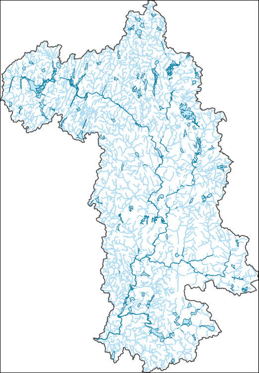
The National Hydrography Dataset (NHD) is a feature-based database that interconnects and uniquely identifies the stream segments or reaches that make up the nation's surface water drainage system. NHD data was originally developed at 1:100,000-scale and exists at that scale for the whole country. This high-resolution NHD, generally developed at 1:24,000/1:12,000 scale, adds detail to the original 1:100,000-scale NHD. (Data for Alaska, Puerto Rico and the Virgin Islands was developed at high-resolution, not 1:100,000 scale.) Local resolution NHD is being developed where partners and data exist. The NHD contains reach codes for networked features, flow direction, names, and centerline representations for areal water...
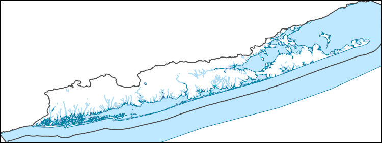
The National Hydrography Dataset (NHD) is a feature-based database that interconnects and uniquely identifies the stream segments or reaches that make up the nation's surface water drainage system. NHD data was originally developed at 1:100,000-scale and exists at that scale for the whole country. This high-resolution NHD, generally developed at 1:24,000/1:12,000 scale, adds detail to the original 1:100,000-scale NHD. (Data for Alaska, Puerto Rico and the Virgin Islands was developed at high-resolution, not 1:100,000 scale.) Local resolution NHD is being developed where partners and data exist. The NHD contains reach codes for networked features, flow direction, names, and centerline representations for areal water...
This shapefile is the official boundary of the Atlantic Coastal Fish Habitat Partnership. The boundary was originally developed by the United States Fish and Wildlife Service and was updated in 2013 to reflect revisions from the Atlantic Coastal Fish Habitat Partnership, a recognized Fish Habitat Partnership (FHP) of the National Fish Habitat Partnership.
Categories: Data;
Types: ArcGIS REST Map Service,
ArcGIS Service Definition,
Downloadable,
Map Service;
Tags: ACFHP,
Analytical boundary,
Aquatic habitats,
Boundaries,
Connecticut,
This service definition contains landscape factors representing human disturbances summarized to local and network catchments of river reaches for the state of Ohio. This dataset is the result of clipping the feature class 'NFHAP 2010 HCI Scores and Human Disturbance Data for the Conterminous United States linked to NHDPLUSV1.gdb' to the state boundary of Ohio. Landscape factors include land uses, population density, roads, dams, mines, and point-source pollution sites. The source datasets that were compiled and attributed to catchments were identified as being: (1) meaningful for assessing fish habitat; (2) consistent across the entire study area in the way that they were assembled; (3) representative of conditions...
Categories: Data;
Types: ArcGIS REST Map Service,
ArcGIS Service Definition,
Downloadable,
Map Service;
Tags: Anthropogenic factors,
Aquatic habitats,
Atlantic Coast FHP,
Catchment areas,
Connecticut,
This service definition contains landscape factors representing human disturbances summarized to local and network catchments of river reaches for the state of Montana. This dataset is the result of clipping the feature class 'NFHAP 2010 HCI Scores and Human Disturbance Data for the Conterminous United States linked to NHDPLUSV1.gdb' to the state boundary of Montana. Landscape factors include land uses, population density, roads, dams, mines, and point-source pollution sites. The source datasets that were compiled and attributed to catchments were identified as being: (1) meaningful for assessing fish habitat; (2) consistent across the entire study area in the way that they were assembled; (3) representative of...
Categories: Data;
Types: ArcGIS REST Map Service,
ArcGIS Service Definition,
Downloadable,
Map Service;
Tags: Anthropogenic factors,
Aquatic habitats,
Atlantic Coast FHP,
Catchment areas,
Connecticut,
This service definition contains landscape factors representing human disturbances summarized to local and network catchments of river reaches for the state of New York. This dataset is the result of clipping the feature class 'NFHAP 2010 HCI Scores and Human Disturbance Data for the Conterminous United States linked to NHDPLUSV1.gdb' to the state boundary of New York. Landscape factors include land uses, population density, roads, dams, mines, and point-source pollution sites. The source datasets that were compiled and attributed to catchments were identified as being: (1) meaningful for assessing fish habitat; (2) consistent across the entire study area in the way that they were assembled; (3) representative of...
Categories: Data;
Types: ArcGIS REST Map Service,
ArcGIS Service Definition,
Downloadable,
Map Service;
Tags: Anthropogenic factors,
Aquatic habitats,
Atlantic Coast FHP,
Catchment areas,
Connecticut,
This service definition contains landscape factors representing human disturbances summarized to local and network catchments of river reaches for the state of Tennessee. This dataset is the result of clipping the feature class 'NFHAP 2010 HCI Scores and Human Disturbance Data for the Conterminous United States linked to NHDPLUSV1.gdb' to the state boundary of Tennessee. Landscape factors include land uses, population density, roads, dams, mines, and point-source pollution sites. The source datasets that were compiled and attributed to catchments were identified as being: (1) meaningful for assessing fish habitat; (2) consistent across the entire study area in the way that they were assembled; (3) representative...
Categories: Data;
Types: ArcGIS REST Map Service,
ArcGIS Service Definition,
Downloadable,
Map Service;
Tags: Anthropogenic factors,
Aquatic habitats,
Atlantic Coast FHP,
Catchment areas,
Connecticut,
This service definition contains landscape factors representing human disturbances summarized to local and network catchments of river reaches for the Ohio River Basin Fish Habitat Partnership. This dataset is the result of clipping the feature class 'NFHAP 2010 HCI Scores and Human Disturbance Data for the Conterminous United States linked to NHDPLUSV1.gdb' to the boundary of the Ohio River Basin Fish Habitat Partnership. Landscape factors include land uses, population density, roads, dams, mines, and point-source pollution sites. The source datasets that were compiled and attributed to catchments were identified as being: (1) meaningful for assessing fish habitat; (2) consistent across the entire study area in...
Categories: Data;
Types: ArcGIS REST Map Service,
ArcGIS Service Definition,
Downloadable,
Map Service;
Tags: Anthropogenic factors,
Aquatic habitats,
Atlantic Coast FHP,
Catchment areas,
Connecticut,

This dataset, termed "GAGES II", an acronym for Geospatial Attributes of Gages for Evaluating Streamflow, version II, provides geospatial data and classifications for 9,322 stream gages maintained by the U.S. Geological Survey (USGS). It is an update to the original GAGES, which was published as a Data Paper on the journal Ecology's website (Falcone and others, 2010b) in 2010. The GAGES II dataset consists of gages which have had either 20+ complete years (not necessarily continuous) of discharge record since 1950, or are currently active, as of water year 2009, and whose watersheds lie within the United States, including Alaska, Hawaii, and Puerto Rico. Reference gages were identified based on indicators that they...
Types: Map Service,
OGC WFS Layer,
OGC WMS Layer,
OGC WMS Service;
Tags: Alabama,
Alaska,
All 50 states,
Arizona,
Arkansas,
This U.S. Geological Survey data release presents tabular data on nitrogen concentrations and loads for multiple nitrogen species, and river discharge data used in the analysis of data collected from October 1994 to September 2016. Data on flow and nitrogen concentrations were analyzed using the USGS EGRET R package, and the method of WRTDS (Weighted Regression on Time Discharge and Season). Data and outputs summarized are for water-quality data collected from 18 water-quality monitoring stations in the Long Island Sound watershed. Specific data in tabular format for this release include: calculated annual nitrogen concentration and loads, calculated annual flow-normalized nitrogen concentrations and loads by water...
The State Geologic Map Compilation (SGMC) geodatabase of the conterminous United States (https://doi.org/10.5066/F7WH2N65) represents a seamless, spatial database of 48 State geologic maps that range from 1:50,000 to 1:1,000,000 scale. A national digital geologic map database is essential in interpreting other datasets that support numerous types of national-scale studies and assessments, such as those that provide geochemistry, remote sensing, or geophysical data. The SGMC is a compilation of the individual U.S. Geological Survey releases of the Preliminary Integrated Geologic Map Databases for the United States. The SGMC geodatabase also contains updated data for seven States and seven entirely new State geologic...
Categories: Data,
Data Release - Revised;
Types: ArcGIS REST Map Service,
ArcGIS Service Definition,
Downloadable,
Map Service;
Tags: Alabama,
Arizona,
Arkansas,
California,
Colorado,
WHISPers stands for Wildlife Health Information Sharing Partnership - event reporting system. It is a web-based repository for sharing basic information about historic and ongoing wildlife mortality (death) and morbidity (illness) events. The system possesses a searchable archive of wildlife mortality and morbidity event data that is available to the public. The information is opportunistically collected and does not reflect all the mortality events that occur in North America.
Human-use pharmaceutical, pesticide, and wastewater indicator compounds were analyzed at the U.S. Geological Survey, National Water Quality Laboratory, Denver, Colorado, in wadeable streams in 4 Regional Stream Quality Assessments: Northeast (NESQA), Southeast (SESQA), Pacific Northwest (PNSQA) and California (CSQA). Multiple (with few exceptions) samplings occurred at each site, during base flow, between 2014 and 2017. Sites were located in the headwaters of perennial, wadeable streams in urban and agricultural watersheds. Site selection and methodology for each assessment can be found in Van Meter and others (2015), Sheibley and others (2015), Van Meter and others (2017), Coles and others (2016), Van Meter and...
This data release contains input data used in model development and TIF raster files used to predict the probability of low dissolved oxygen (DO) and high dissolved iron (Fe) in groundwater within the glacial aquifer system in the northern continental United States. Input data include measured DO and Fe concentrations at groundwater wells, and associated predictor variable data. The probability of low DO and high Fe was predicted using boosted regression tree methods using the gbm package in R (v. 4.0.0) in RStudio (v. 1.2.5042). The response variables for individual models were the occurrence of: (1) DO ≤0.5 mg/L, (2) DO ≤2 mg/L, and (3) Fe >100 µg/L. Water-quality data were compiled from three sources, as described...
Categories: Data;
Types: Map Service,
OGC WFS Layer,
OGC WMS Layer,
OGC WMS Service;
Tags: Connecticut,
Geochemistry,
Hydrology,
Idaho,
Illinois,
The Gap Analysis Project (GAP) Analytical Database represents a synthesis of three core datasets for the conterminous U.S. Specifically 1) the GAP/LANDFIRE National Terrestrial Ecosystems_2011; 2) the Protected Areas Database of the United States (PAD-US) 1.4; and 3) the Species Ranges and Habitat Distribution Models for all terrestrial vertebrates. This database provides a mechanism to effiiently obtain summary statistics of those for a variety of spatial extents, including US states, US counties, Landscape Conservation Cooperation Network Areas, EPA's Level III-IV Ecoregions of the United States, and Level I-III Ecoregions of North America and 12-digit (6th level) hydrologic units. Disclaimer for Approved Database...
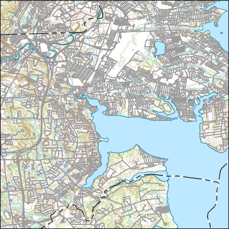
Layers of geospatial data include contours, boundaries, land cover, hydrography, roads, transportation, geographic names, structures, and other selected map features.
Types: Citation;
Tags: 7.5 x 7.5 minute,
7.5 x 7.5 minute,
Combined Vector,
Combined Vector,
Combined Vector,
This data set represents the results of calculations of hazard curves for a grid of points with a spacing of 0.05 degrees in latitude and longitude. It represents the chance of experiencing damaging earthquakes for fixed ground shaking levels that corresponds with MMI = VI. The values are obtained by averaging the probability of experiencing MMI = VI based on a peak ground acceleration value of 0.1155 g for site class D, and the probability of experiencing MMI = VI based on 1.0-second spectral acceleration value of 0.102 g for site class D. The data are for the Central and Eastern United States and are based on the one-year model.
Categories: Data;
Types: Citation,
Downloadable,
Map Service,
OGC WFS Layer,
OGC WMS Layer,
Shapefile;
Tags: Alabama,
Arizona,
Arkansas,
Colorado,
Connecticut,
This data set represents the hazard curves for a grid of points with a spacing of 0.05 degrees in latitude and longitude. It represents the annual rate of exceedance versus peak ground acceleration.
This data set provides industrial-scale onshore wind turbine locations, corresponding facility information, and turbine technical specifications, in the United States to March 2014. The database has nearly 49,000 wind turbine records that have been collected, digitized, locationally verified, and internally quality assured and quality controlled. Turbines from the Federal Aviation Administration Digital Obstacle File, product date March 2, 2014, were used as the primary source of turbine data points. Verification of the position of turbines was done by visual interpretation using high-resolution aerial imagery in ESRI ArcGIS Desktop. Turbines without Federal Aviation Administration Obstacle Repository System (FAA...
Categories: Data;
Types: ArcGIS REST Map Service,
Citation,
Map Service;
Tags: Alabama,
Alaska,
Arizona,
Arkansas,
California,
This shapefile contains landscape factors representing human disturbances summarized to local and network catchments of river reaches for the Driftless Area Restoration Effort. This dataset is the result of clipping the feature class 'NFHAP 2010 HCI Scores and Human Disturbance Data for the Conterminous United States linked to NHDPLUSV1.gdb' to the boundary of the Driftless Area Restoration Effort. Landscape factors include land uses, population density, roads, dams, mines, and point-source pollution sites. The source datasets that were compiled and attributed to catchments were identified as being: (1) meaningful for assessing fish habitat; (2) consistent across the entire study area in the way that they were assembled;...
Categories: Data;
Types: ArcGIS REST Map Service,
Downloadable,
Map Service,
OGC WFS Layer,
OGC WMS Layer,
Shapefile;
Tags: Anthropogenic factors,
Aquatic habitats,
Atlantic Coast FHP,
Catchment areas,
Connecticut,
|

|
