Filters: Tags: Roads (X) > Types: Citation (X)
33 results (10ms)|
Filters
Date Range
Extensions Types
Contacts
Categories Tag Types
|
This data set contains imagery from the National Agriculture Imagery Program (NAIP). The NAIP program is administered by USDA FSA and has been established to support two main FSA strategic goals centered on agricultural production. These are increase stewardship of America's natural resources while enhancing the environment, and to ensure commodities are procured and distributed effectively and efficiently to increase food security. The NAIP program supports these goals by acquiring and providing ortho imagery that has been collected during the agricultural growing season in the U.S. The NAIP ortho imagery is tailored to meet FSA requirements and is a fundamental tool used to support FSA farm and conservation programs....
This dataset represents roads in the Crown of the Continent Ecosystem (with a 50km buffer). Developed with the most recently available data and represents roads in ~2016. This dataset was developed by the Crown Managers Partnership, as part of a transboundary collaborative management initiative for the Crown of the Continent Ecosystem, based on commonly identified management priorities that are relevant at the landscape scale. The CMP is collaborative group of land managers, scientists, and stakeholder in the CCE. For more information on the CMP and its collaborators, programs, and projects please visit: http://crownmanagers.org/ This dataset has been produced by merging the "National Road Network (NRN) - AB,...
Categories: Data;
Types: Citation,
Downloadable,
Map Service,
OGC WFS Layer,
OGC WMS Layer,
Shapefile;
Tags: Alberta,
B.C,
CCE,
MSDI,
Montana,
This layer represents the roads for the Crown of the Continent Ecosystem. The data are a compilation from multiple sources.
Categories: Data;
Types: Citation,
Downloadable,
Map Service,
OGC WFS Layer,
OGC WMS Layer,
Shapefile;
Tags: CCE,
CCE,
CMP,
CMP,
Crown Managers Partnership,
Synopsis: In an attempt to better characterize the influence of human settlement patterns on wolf distribution, this paper examined how radio-collared gray wolves responded to different road types and human presence at the boundaries of Kenai National Wildlife Refuge in south-central Alaska. Wolves tended to avoid oilfield access roads that were open to the public, but were attracted to gated pipeline access roads and secondary gravel roads with limited human use. The low use access and secondary roads likely provided an easy travel corridor for wolves. Prior to intensive trapping and hunting from 1978-1979, wolves demonstrated little territorial adjustment in response to a heavily used highway. However, only after...
Categories: Publication;
Types: Citation,
Map Service,
OGC WFS Layer,
OGC WMS Layer,
OGC WMS Service;
Tags: Alaska,
Alaska,
Canis lupus,
Coastal hemlock forest,
Kenai Peninsula,
U.S. Fish and Wildlife Service Road Inventory
Categories: Data;
Types: ArcGIS REST Map Service,
ArcGIS Service Definition,
Citation,
Downloadable,
Map Service,
OGC WFS Layer,
OGC WMS Layer,
Shapefile;
Tags: Bridge,
CRV,
Condition,
Culvert,
GIS,
A vector line file of public/private streets compiled from orthoimagery and other sources that is attributed with street names, addresses, route numbers, routing attributes, and includes a related table of alternate/alias street names. If the purpose of using NYS Streets is for geocoding, the New York State Office of Information Technology Services (NYS ITS) has a publicly available geocoding service which includes the NYS Streets along with other layers. For more information about the geocoding service, please visit http://gis.ny.gov/gisdata/inventories/details.cfm?DSID=1278.
Categories: Data;
Types: ArcGIS REST Map Service,
ArcGIS Service Definition,
Citation,
Downloadable,
Map Service;
Tags: ALIS,
ALIS,
Accident Location Information System,
Accident Location Information System,
Centerline,
This dataset is one of a suite of products from the Nature’s Network project (naturesnetwork.org). Nature’s Network is a collaborative effort to identify shared priorities for conservation in the Northeast, considering the value of fish and wildlife species and the natural areas they inhabit. This dataset represents the relative potential to improve local aquatic connectivity by upgrading road-stream crossings. The model incorporates survey data from the North Atlantic Aquatic Connectivity Collaborative (NAACC). To view the current NAACC database go to https://streamcontinuity.org/database.htm. The Road Stream Crossing Upgrade Effects dataset and other datasets that augment or complement aquatic connectivity are...
Categories: Data;
Types: ArcGIS REST Map Service,
ArcGIS Service Definition,
Citation,
Downloadable,
Map Service;
Tags: Culverts,
Culverts,
Data,
LCC Network Science Catalog,
Nature’s Network,
Conclusions: Grizzly bears can use roaded habitats, but spatial avoidance will increase and survival will decrease as traffic levels, road densities and human settlement increases. Road density standards and road closure programmes should be developed and that these programmes incorporate seasonal habitat requirements of grizzly bears. Thresholds/Learnings: More than 80% of bear sitings occurred in blocks of undisturbed habitat >900 ha Synopsis: The study examined the relationships between grizzly bears, habitat and roads in the Swan Mountains, Montana. The study showed complex spatial and temporal relationships between grizzly bears and habitat resources. Resource selection was expressed relative to strength...
Categories: Publication;
Types: Citation,
Map Service,
OGC WFS Layer,
OGC WMS Layer,
OGC WMS Service;
Tags: Crown of the Continent/Greater Yellowstone Ecoregion,
Land use configuration,
Montana,
Swan Mountain Range,
grizzly bears,
This report is synthesizes and summarizes major findings from literature relating to the direct and indirect ecological impacts of paved highways on birds. It represents a meta-analysis of contributing factors of road mortality, effects of roadway lighting, traffic noise, traffic volume, and roadway contaminants on bird populations, which may help guide conservation efforts within the Yellowstone to Yukon ecoregion. Traffic volume and noise are believed to be the most important factors affecting breeding bird population densities near roads. The number of affected species increases with traffic volume but the relationship appears to reach threshold at an average daily traffic volume of 30,000 vehicles a day. In...
Synopsis: Remotely sensed data and GIS were used to compare the effects of clear-cutting and road-building on the landscape pattern of the Bighorn National Forest, Wyoming. Landscape patterns were quantified for each of 12 watersheds on a series of four maps that differed only in the degree of clear-cutting and road density. Researchers analyzed several landscape pattern metrics for the landscape as a whole and for the lodgepole pine and spruce/fir cover classes across the four maps to determine the relative effects of clear-cutting and road building on the pattern of each watershed. At both the landscape and cover class scales, clear-cutting and road building resulted in increased fragmentation as represented...
Categories: Publication;
Types: Citation,
Map Service,
OGC WFS Layer,
OGC WMS Layer,
OGC WMS Service;
Tags: Land use configuration,
Landscape fragmentation,
Natural cover amount,
Wyoming,
configuration,
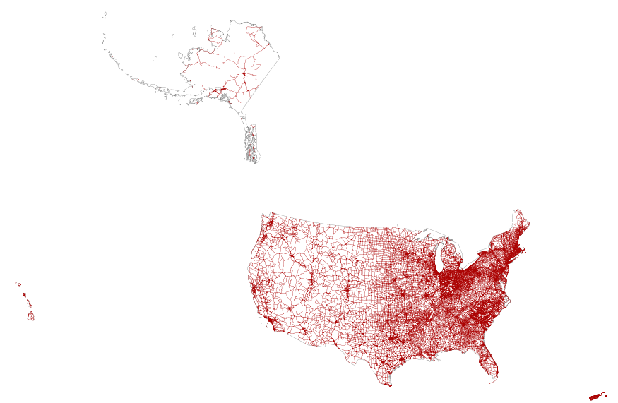
This map layer portrays the major roads in the United States, Puerto Rico, and the U.S. Virgin Islands. The file was produced by joining the individual State roads layers from the National Highway Planning Network (NHPN), Geographic Data Technology (GDT) Dynamap, and TIGER/Line files. This is a revised version of the July 2012 map layer.
This data set contains imagery from the National Agriculture Imagery Program (NAIP). The NAIP program is administered by USDA FSA and has been established to support two main FSA strategic goals centered on agricultural production. These are increase stewardship of America's natural resources while enhancing the environment, and to ensure commodities are procured and distributed effectively and efficiently to increase food security. The NAIP program supports these goals by acquiring and providing ortho imagery that has been collected during the agricultural growing season in the U.S. The NAIP ortho imagery is tailored to meet FSA requirements and is a fundamental tool used to support FSA farm and conservation programs....
This data set contains imagery from the National Agriculture Imagery Program (NAIP). The NAIP program is administered by USDA FSA and has been established to support two main FSA strategic goals centered on agricultural production. These are increase stewardship of America's natural resources while enhancing the environment, and to ensure commodities are procured and distributed effectively and efficiently to increase food security. The NAIP program supports these goals by acquiring and providing ortho imagery that has been collected during the agricultural growing season in the U.S. The NAIP ortho imagery is tailored to meet FSA requirements and is a fundamental tool used to support FSA farm and conservation programs....
Conclusions:Woodland caribou cross roads less than expected for all time periods except calving and use areas close to roads less frequently than expected. Roads are semipermeable barriers to caribou movement with the greatest barrier effects occurring during late winter.Thresholds/Learnings:
Categories: Publication;
Types: Citation;
Tags: Alberta,
Land use configuration,
Landscape fragmentation,
boreal mixed-wood and peatland,
caribou,
Conclusions: Grizzly bears avoid high volume roads (25,000 vehicles/day). High quality habitat determines movement decisions relative to roads. Grizzly bears will cross high volume roads to access high-quality habitat. Grizzly bears use areas close to roads more than expected, in particular low-volume roads (10,000 vehicles/day). Prevent loss of habitat connectivity with the following mitigation: maintain high-quality habitat adjacent to roads, install continuous highway fencing and create wildlife passages. Thresholds/Learnings: Synopsis: The study examined the relationships among grizzly bears, their habitats and roads in Banff National Park, a protected area characterized by a major transportation corridor. This...
Categories: Publication;
Types: Citation,
Map Service,
OGC WFS Layer,
OGC WMS Layer,
OGC WMS Service;
Tags: Alberta,
Banff-Bow Valley,
Land use configuration,
Landscape fragmentation,
connectivity,
Conclusions: Despite the fact that valuable grizzly habitat tends to coincide with the location of roads, grizzlies strongly avoided roads regardless of traffic volume, suggesting that even a few vehicles can displace bears from adjacent habitats. Thresholds/Learnings: Grizzlies strongly avoided areas within 100m of all roads Synopsis: This study aimed to determine whether grizzly bears were displaced by roads associated with resource extraction industries in the Rocky Mountains. Since many habitats close to roads contained important bear foods, researchers expected bears to frequent these roads, despite the presence of human activity. However, study results indicated that grizzlies strongly avoided roads regardless...
Categories: Publication;
Types: Citation,
Map Service,
OGC WFS Layer,
OGC WMS Layer,
OGC WMS Service;
Tags: Alberta,
Canadian Rockies/forest,
Land use configuration,
Landscape fragmentation,
grizzly bears,
This dataset shows the density of the intercepts of roads and streams in the Crown of the Continent and a 50km buffer. This dataset has been produced by merging the “National Road Network (NRN) - AB, Alberta” shapefile obtained from GeoBase , Digital Road Atlas (DRA) of British Colombia from GeoBC and “Roads from the Montana Transportation Framework MSDI” for Montana, US Provided by Montana State Library. This dataset was developed by the Crown Managers Partnership, as part of a transboundary collaborative management initiative for the Crown of the Continent Ecosystem, based on commonly identified management priorities that are relevant at the landscape scale. The CMP is collaborative group of land managers, scientists,...
Categories: Data;
Types: Citation,
Downloadable,
Map Service,
OGC WFS Layer,
OGC WMS Layer,
Shapefile;
Tags: Alberta,
Alberta,
B.C,
B.C,
CCE,
Conclusions: Caribou mortalities attributed to wolf predation were generally closer to a corridor, indicating that linear corridors may enhance wolf predation efficiency. Therefore, caribou existing closer to linear corridors are at a higher risk of depredation than those farther from corridors. Thresholds/Learnings: Synopsis: This study tested the hypothesis that linear corridors affect caribou and wolf activities by examining the distribution of telemetry locations of caribou and wolves, as well as locations of caribou mortality and caribou predation by wolves relative to linear corridors caused by roads, seismic lines, power lines, and pipeline rights-of-way. Caribou mortalities attributed to wolf predation...
Categories: Publication;
Types: Citation,
Map Service,
OGC WFS Layer,
OGC WMS Layer,
OGC WMS Service;
Tags: Alberta,
Canis lupus,
Human disturbance,
Hunting,
Industrial,
Conclusions: Summarizes findings from a review of literature intended to identify critical thresholds for conservation based in empirical studies of landscape fragmentation. Presents a conceptual overview of landscape fragmentation and habitat loss, as well as guidelines and thresholds relating to landscape indicators such as patch size, habitat amount, edge effects, riparian buffers, and habitat connectivity. Thresholds/Learnings: Many. See Kennedy et al. 2003. Synopsis: This report summarizes findings from a review of literature intended to identify critical thresholds for conservation based in empirical studies of landscape fragmentation. In presenting a conceptual overview of landscape fragmentation and habitat...
Categories: Publication;
Types: Citation,
Map Service,
OGC WFS Layer,
OGC WMS Layer,
OGC WMS Service;
Tags: Agriculture,
Biodiversity,
Conservation,
Dams,
Ecosystems,
This shapefile represents the number of road-stream intersections per watershed reported in crossings per km2 in the Crown of the Continent Ecosystem This dataset was developed by the Crown Managers Partnership, as part of a transboundary collaborative management initiative for the Crown of the Continent Ecosystem, based on commonly identified management priorities that are relevant at the landscape scale. The CMP is collaborative group of land managers, scientists, and stakeholder in the CCE. For more information on the CMP and its collaborators, programs, and projects please visit: http://crownmanagers.orgMethods:In order to identify where roads and streams intersect throughout the entire CCE, we used:A. Roads_CCE_2000c_20150606;...
Categories: Data;
Types: Citation,
Downloadable,
Map Service,
OGC WFS Layer,
OGC WMS Layer,
Shapefile;
Tags: Alberta,
British Columbia,
CCE,
CMP,
Crossings,
|

|
