Filters
Date Range
Types
Contacts
Tag Types
Tag Schemes
|
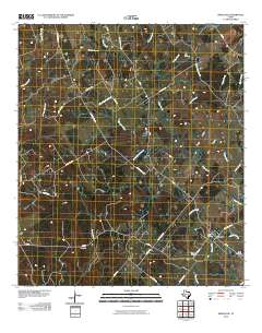
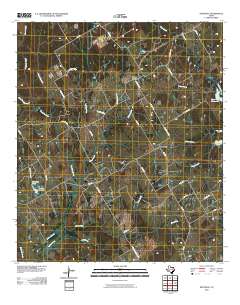
This data set contains imagery from the National Agriculture Imagery Program (NAIP). The NAIP program is administered by USDA FSA and has been established to support two main FSA strategic goals centered on agricultural production. These are increase stewardship of America's natural resources while enhancing the environment, and to ensure commodities are procured and distributed effectively and efficiently to increase food security. The NAIP program supports these goals by acquiring and providing ortho imagery that has been collected during the agricultural growing season in the U.S. The NAIP ortho imagery is tailored to meet FSA requirements and is a fundamental tool used to support FSA farm and conservation programs....
Types: Citation;
Tags: 3.75 x 3.75 minute,
3109658,
48395,
Aerial Compliance,
BAILEYVILLE, All tags...
BAILEYVILLE, NE,
Compliance,
Digital Ortho rectified Image,
Downloadable Data,
JPEG 2000,
JPEG2000,
NAIP,
Ortho Rectification,
Orthoimagery,
Quarter Quadrangle,
ROBERTSON CO TX FSA,
Robertson,
TX,
TX395,
USDA National Agriculture Imagery Program (NAIP),
farming,
imageryBaseMapsEarthCover, Fewer tags
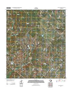
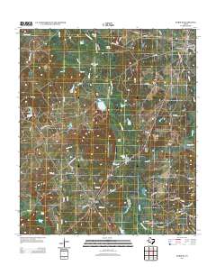
This data set contains imagery from the National Agriculture Imagery Program (NAIP). The NAIP program is administered by USDA FSA and has been established to support two main FSA strategic goals centered on agricultural production. These are increase stewardship of America's natural resources while enhancing the environment, and to ensure commodities are procured and distributed effectively and efficiently to increase food security. The NAIP program supports these goals by acquiring and providing ortho imagery that has been collected during the agricultural growing season in the U.S. The NAIP ortho imagery is tailored to meet FSA requirements and is a fundamental tool used to support FSA farm and conservation programs....
Types: Citation;
Tags: 3.75 x 3.75 minute,
3109658,
48395,
Aerial Compliance,
BAILEYVILLE, All tags...
BAILEYVILLE, SW,
Compliance,
Digital Ortho rectified Image,
Downloadable Data,
JPEG 2000,
JPEG2000,
NAIP,
Ortho Rectification,
Orthoimagery,
Quarter Quadrangle,
ROBERTSON CO TX FSA,
Robertson,
TX,
TX395,
USDA National Agriculture Imagery Program (NAIP),
farming,
imageryBaseMapsEarthCover, Fewer tags
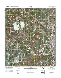
This data set contains imagery from the National Agriculture Imagery Program (NAIP). The NAIP program is administered by USDA FSA and has been established to support two main FSA strategic goals centered on agricultural production. These are increase stewardship of America's natural resources while enhancing the environment, and to ensure commodities are procured and distributed effectively and efficiently to increase food security. The NAIP program supports these goals by acquiring and providing ortho imagery that has been collected during the agricultural growing season in the U.S. The NAIP ortho imagery is tailored to meet FSA requirements and is a fundamental tool used to support FSA farm and conservation programs....
Types: Citation;
Tags: 3.75 x 3.75 minute,
3109659,
48395,
Aerial Compliance,
Compliance, All tags...
Digital Ortho rectified Image,
Downloadable Data,
HAMMOND,
HAMMOND, NE,
JPEG 2000,
JPEG2000,
NAIP,
Ortho Rectification,
Orthoimagery,
Quarter Quadrangle,
ROBERTSON CO TX FSA,
Robertson,
TX,
TX395,
USDA National Agriculture Imagery Program (NAIP),
farming,
imageryBaseMapsEarthCover, Fewer tags
This data set contains imagery from the National Agriculture Imagery Program (NAIP). The NAIP program is administered by USDA FSA and has been established to support two main FSA strategic goals centered on agricultural production. These are increase stewardship of America's natural resources while enhancing the environment, and to ensure commodities are procured and distributed effectively and efficiently to increase food security. The NAIP program supports these goals by acquiring and providing ortho imagery that has been collected during the agricultural growing season in the U.S. The NAIP ortho imagery is tailored to meet FSA requirements and is a fundamental tool used to support FSA farm and conservation programs....
Types: Citation;
Tags: 3.75 x 3.75 minute,
3109660,
48395,
Aerial Compliance,
Compliance, All tags...
Digital Ortho rectified Image,
Downloadable Data,
JPEG 2000,
JPEG2000,
NAIP,
OWENSVILLE,
OWENSVILLE, SW,
Ortho Rectification,
Orthoimagery,
Quarter Quadrangle,
ROBERTSON CO TX FSA,
Robertson,
TX,
TX395,
USDA National Agriculture Imagery Program (NAIP),
farming,
imageryBaseMapsEarthCover, Fewer tags

This data set contains imagery from the National Agriculture Imagery Program (NAIP). The NAIP program is administered by USDA FSA and has been established to support two main FSA strategic goals centered on agricultural production. These are, increase stewardship of America's natural resources while enhancing the environment, and to ensure commodities are procured and distributed effectively and efficiently to increase food security. The NAIP program supports these goals by acquiring and providing ortho imagery that has been collected during the agricultural growing season in the U.S. The NAIP ortho imagery is tailored to meet FSA requirements and is a fundamental tool used to support FSA farm and conservation programs....
Types: Citation;
Tags: 21201,
3.75 x 3.75 minute,
3808440,
Aerial Compliance,
Compliance, All tags...
Digital Ortho rectified Image,
Downloadable Data,
JPEG2000,
KY,
KY201,
NAIP,
Ortho Rectification,
Orthoimagery,
PIQUA,
PIQUA, NE,
Quarter Quadrangle,
ROBERTSON CO KY FSA,
Robertson,
USDA National Agriculture Imagery Program (NAIP),
farming, Fewer tags
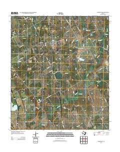
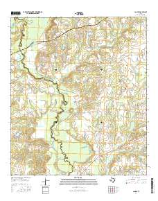
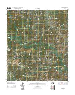
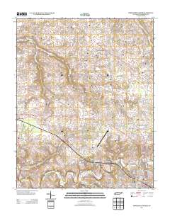
Layered GeoPDF 7.5 Minute Quadrangle Map. Layers of geospatial data include orthoimagery, roads, grids, geographic names, elevation contours, hydrography, and other selected map features.
Tags: 7.5 x 7.5 minute,
Downloadable Data,
EarthCover,
GeoPDF,
Hammond, TX, All tags...
Imagery and Base Maps,
Map,
Milam,
Public Land Survey System,
Robertson,
Texas,
U.S. National Grid,
US,
US Topo,
US Topo Historical,
United States,
boundary,
contour,
geographic names,
hydrography,
imageryBaseMapsEarthCover,
orthoimage,
structures,
topographic,
transportation,
woodland, Fewer tags
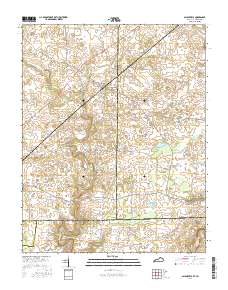
Layered GeoPDF 7.5 Minute Quadrangle Map. Layers of geospatial data include orthoimagery, roads, grids, geographic names, elevation contours, hydrography, and other selected map features.
Tags: 7.5 x 7.5 minute,
Allensville, KY-TN,
Downloadable Data,
EarthCover,
GeoPDF, All tags...
Imagery and Base Maps,
Kentucky,
Logan,
Map,
Montgomery,
Public Land Survey System,
Robertson,
Tennessee,
Todd,
U.S. National Grid,
US,
US Topo,
US Topo Historical,
United States,
boundary,
contour,
geographic names,
hydrography,
imageryBaseMapsEarthCover,
orthoimage,
structures,
topographic,
transportation,
woodland, Fewer tags
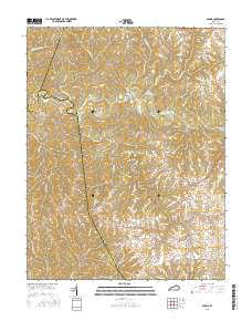
Layered GeoPDF 7.5 Minute Quadrangle Map. Layers of geospatial data include orthoimagery, roads, grids, geographic names, elevation contours, hydrography, and other selected map features.
Tags: 7.5 x 7.5 minute,
Bracken,
Downloadable Data,
EarthCover,
GeoPDF, All tags...
Imagery and Base Maps,
Kentucky,
Map,
Mason,
Public Land Survey System,
Robertson,
Sardis, KY,
U.S. National Grid,
US,
US Topo,
US Topo Historical,
United States,
boundary,
contour,
geographic names,
hydrography,
imageryBaseMapsEarthCover,
orthoimage,
structures,
topographic,
transportation,
woodland, Fewer tags
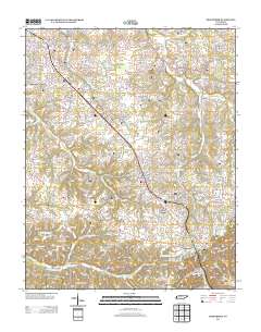
Layered GeoPDF 7.5 Minute Quadrangle Map. Layers of geospatial data include orthoimagery, roads, grids, geographic names, elevation contours, hydrography, and other selected map features.
Tags: 7.5 x 7.5 minute,
Davidson,
Downloadable Data,
EarthCover,
GeoPDF, All tags...
Greenbrier, TN,
Imagery and Base Maps,
Map,
Public Land Survey System,
Robertson,
Sumner,
Tennessee,
U.S. National Grid,
US,
US Topo,
US Topo Historical,
United States,
boundary,
contour,
geographic names,
hydrography,
imageryBaseMapsEarthCover,
orthoimage,
structures,
topographic,
transportation,
woodland, Fewer tags
Layered GeoPDF 7.5 Minute Quadrangle Map. Layers of geospatial data include orthoimagery, roads, grids, geographic names, elevation contours, hydrography, and other selected map features.
Tags: 7.5 x 7.5 minute,
Brazos,
Canary, TX,
Downloadable Data,
EarthCover, All tags...
GeoPDF,
Imagery and Base Maps,
Leon,
Madison,
Map,
Public Land Survey System,
Robertson,
Texas,
U.S. National Grid,
US,
US Topo,
US Topo Historical,
United States,
boundary,
contour,
geographic names,
hydrography,
imageryBaseMapsEarthCover,
orthoimage,
structures,
topographic,
transportation,
woodland, Fewer tags
Layered GeoPDF 7.5 Minute Quadrangle Map. Layers of geospatial data include orthoimagery, roads, grids, geographic names, elevation contours, hydrography, and other selected map features.
Tags: 7.5 x 7.5 minute,
Brazos,
Downloadable Data,
EarthCover,
GeoPDF, All tags...
Imagery and Base Maps,
Map,
Robertson,
Texas,
U.S. National Grid,
US,
US Topo,
US Topo Historical,
United States,
Wheelock, TX,
contour,
geographic names,
hydrography,
orthoimage,
topographic,
transportation, Fewer tags
Layered GeoPDF 7.5 Minute Quadrangle Map. Layers of geospatial data include orthoimagery, roads, grids, geographic names, elevation contours, hydrography, and other selected map features.
Tags: 7.5 x 7.5 minute,
Brazos,
Downloadable Data,
Dunn Creek, TX,
EarthCover, All tags...
GeoPDF,
Imagery and Base Maps,
Map,
Public Land Survey System,
Robertson,
Texas,
U.S. National Grid,
US,
US Topo,
US Topo Historical,
United States,
boundary,
contour,
geographic names,
hydrography,
imageryBaseMapsEarthCover,
orthoimage,
structures,
topographic,
transportation,
woodland, Fewer tags
Layered GeoPDF 7.5 Minute Quadrangle Map. Layers of geospatial data include orthoimagery, roads, grids, geographic names, elevation contours, hydrography, and other selected map features.
Tags: 7.5 x 7.5 minute,
Brazos,
Bryan West, TX,
Downloadable Data,
EarthCover, All tags...
GeoPDF,
Imagery and Base Maps,
Map,
Public Land Survey System,
Robertson,
Texas,
U.S. National Grid,
US,
US Topo,
US Topo Historical,
United States,
boundary,
contour,
geographic names,
hydrography,
imageryBaseMapsEarthCover,
orthoimage,
structures,
topographic,
transportation,
woodland, Fewer tags
Layered GeoPDF 7.5 Minute Quadrangle Map. Layers of geospatial data include orthoimagery, roads, grids, geographic names, elevation contours, hydrography, and other selected map features.
Tags: 7.5 x 7.5 minute,
Downloadable Data,
EarthCover,
GeoPDF,
Imagery and Base Maps, All tags...
Limestone,
Map,
Oletha, TX,
Public Land Survey System,
Robertson,
Texas,
U.S. National Grid,
US,
US Topo,
US Topo Historical,
United States,
boundary,
contour,
geographic names,
hydrography,
imageryBaseMapsEarthCover,
orthoimage,
structures,
topographic,
transportation,
woodland, Fewer tags
Layered GeoPDF 7.5 Minute Quadrangle Map. Layers of geospatial data include orthoimagery, roads, grids, geographic names, elevation contours, hydrography, and other selected map features.
Tags: 7.5 x 7.5 minute,
Downloadable Data,
EarthCover,
GeoPDF,
Imagery and Base Maps, All tags...
Limestone,
Map,
Petteway, TX,
Robertson,
Texas,
U.S. National Grid,
US,
US Topo,
US Topo Historical,
United States,
contour,
geographic names,
hydrography,
orthoimage,
topographic,
transportation, Fewer tags
Layered GeoPDF 7.5 Minute Quadrangle Map. Layers of geospatial data include orthoimagery, roads, grids, geographic names, elevation contours, hydrography, and other selected map features.
Tags: 7.5 x 7.5 minute,
Downloadable Data,
EarthCover,
GeoPDF,
Imagery and Base Maps, All tags...
Leon,
Map,
Marquez, TX,
Public Land Survey System,
Robertson,
Texas,
U.S. National Grid,
US,
US Topo,
US Topo Historical,
United States,
boundary,
contour,
geographic names,
hydrography,
imageryBaseMapsEarthCover,
orthoimage,
structures,
topographic,
transportation,
woodland, Fewer tags
Layered GeoPDF 7.5 Minute Quadrangle Map. Layers of geospatial data include orthoimagery, roads, grids, geographic names, elevation contours, hydrography, and other selected map features.
Tags: 7.5 x 7.5 minute,
Downloadable Data,
EarthCover,
GeoPDF,
Imagery and Base Maps, All tags...
Map,
Public Land Survey System,
Robertson,
Springfield North, TN,
Tennessee,
U.S. National Grid,
US,
US Topo,
US Topo Historical,
United States,
boundary,
contour,
geographic names,
hydrography,
imageryBaseMapsEarthCover,
orthoimage,
structures,
topographic,
transportation,
woodland, Fewer tags
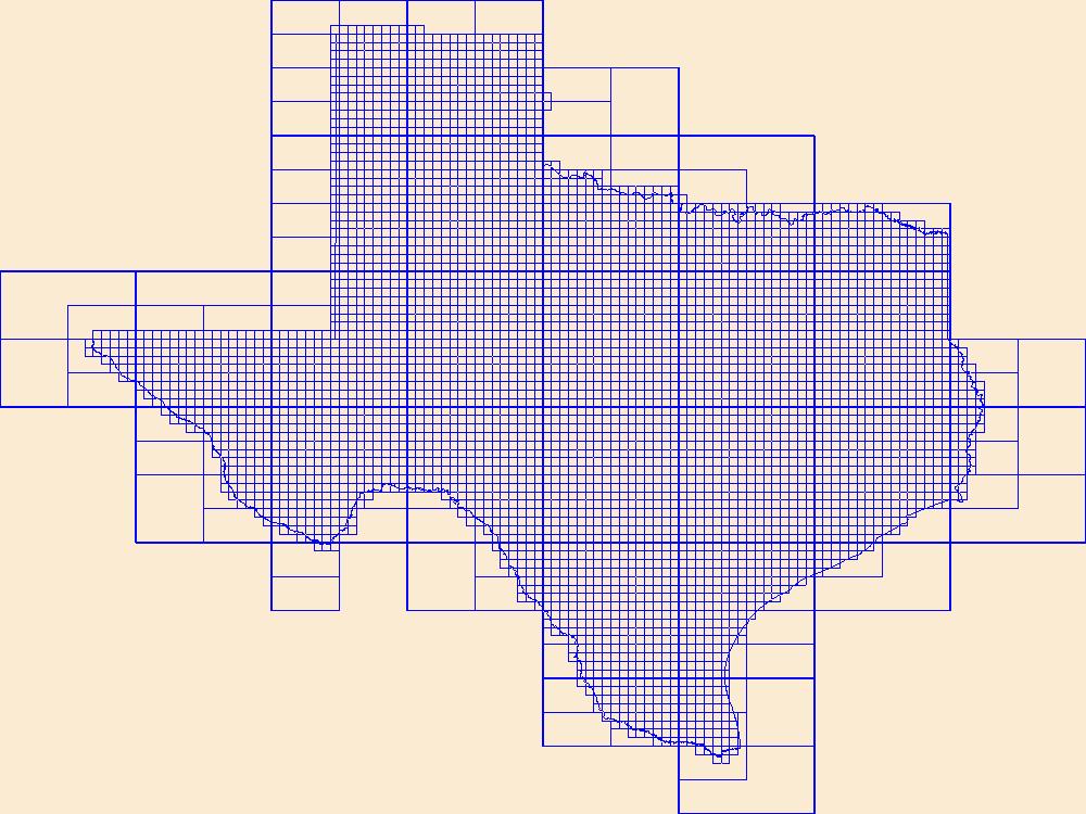
This data represents the map extent for current and historical USGS topographic maps for the United States and Territories, including 1 X 2 Degree, 1 X 1 Degree, 30 X 60 Minute, 15 X 15 Minute, 7.5 X 7.5 Minute, and 3.75 X 3.75 Minute. The grid was generated using ESRI ArcInfo GIS software.
Types: Citation;
Tags: Anderson,
Andrews,
Angelina,
Aransas,
Archer, All tags...
Armstrong,
Atascosa,
Austin,
Bailey,
Bandera,
Bastrop,
Baylor,
Bee,
Bell,
Bexar,
Blanco,
Borden,
Bosque,
Boundaries,
Bowie,
Brazoria,
Brazos,
Brewster,
Briscoe,
Brooks,
Brown,
Burleson,
Burnet,
Caldwell,
Calhoun,
Callahan,
Cameron,
Camp,
Carson,
Cass,
Castro,
Chambers,
Cherokee,
Childress,
Clay,
Cochran,
Coke,
Coleman,
Collin,
Collingsworth,
Colorado,
Comal,
Comanche,
Concho,
Cooke,
Coryell,
Cottle,
Crane,
Crockett,
Crosby,
Culberson,
Dallam,
Dallas,
Dawson,
DeWitt,
Deaf Smith,
Delta,
Denton,
Dickens,
Dimmit,
Donley,
Downloadable Data,
Duval,
Eastland,
Ector,
Edwards,
El Paso,
Ellis,
Erath,
Esri Shapefile nan,
Falls,
Fannin,
Fayette,
Fisher,
Floyd,
Foard,
Fort Bend,
Franklin,
Freestone,
Frio,
Gaines,
Galveston,
Garza,
Gillespie,
Glasscock,
Goliad,
Gonzales,
Gray,
Grayson,
Gregg,
Grimes,
Guadalupe,
Hale,
Hall,
Hamilton,
Hansford,
Hardeman,
Hardin,
Harris,
Harrison,
Hartley,
Haskell,
Hays,
Hemphill,
Henderson,
Hidalgo,
Hill,
Hockley,
Hood,
Hopkins,
Houston,
Howard,
Hudspeth,
Hunt,
Hutchinson,
Irion,
Jack,
Jackson,
Jasper,
Jeff Davis,
Jefferson,
Jim Hogg,
Jim Wells,
Johnson,
Jones,
Karnes,
Kaufman,
Kendall,
Kenedy,
Kent,
Kerr,
Kimble,
King,
Kinney,
Kleberg,
Knox,
La Salle,
Lamar,
Lamb,
Lampasas,
Lavaca,
Lee,
Leon,
Liberty,
Limestone,
Lipscomb,
Live Oak,
Llano,
Loving,
Lubbock,
Lynn,
Madison,
Map Indices,
Map Indices,
Map Indices,
Marion,
Martin,
Mason,
Matagorda,
Maverick,
McCulloch,
McLennan,
McMullen,
Medina,
Menard,
Midland,
Milam,
Mills,
Mitchell,
Montague,
Montgomery,
Moore,
Morris,
Motley,
Nacogdoches,
Navarro,
Newton,
Nolan,
Nueces,
Ochiltree,
Oldham,
Orange,
Palo Pinto,
Panola,
Parker,
Parmer,
Pecos,
Polk,
Potter,
Presidio,
Rains,
Randall,
Reagan,
Real,
Red River,
Reeves,
Refugio,
Roberts,
Robertson,
Rockwall,
Runnels,
Rusk,
Sabine,
San Augustine,
San Jacinto,
San Patricio,
San Saba,
Schleicher,
Scurry,
Shackelford,
Shapefile,
Shelby,
Sherman,
Smith,
Somervell,
Starr,
State,
State,
Stephens,
Sterling,
Stonewall,
Sutton,
Swisher,
TX,
Tarrant,
Taylor,
Terrell,
Terry,
Texas,
Throckmorton,
Titus,
Tom Green,
Travis,
Trinity,
Tyler,
US,
United States,
United States of America,
Upshur,
Upton,
Uvalde,
Val Verde,
Van Zandt,
Victoria,
Walker,
Waller,
Ward,
Washington,
Webb,
Wharton,
Wheeler,
Wichita,
Wilbarger,
Willacy,
Williamson,
Wilson,
Winkler,
Wise,
Wood,
Yoakum,
Young,
Zapata,
Zavala,
cells,
map indices,
polygon grid, Fewer tags
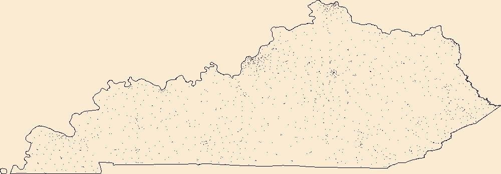
Geospatial data includes structures and other selected map features.
Tags: Adair,
Allen,
Anderson,
Ballard,
Barren, All tags...
Bath,
Bell,
Boone,
Bourbon,
Boyd,
Boyle,
Bracken,
Breathitt,
Breckinridge,
Bullitt,
Butler,
Caldwell,
Calloway,
Campbell,
Campground,
Carlisle,
Carroll,
Carter,
Casey,
Christian,
Clark,
Clay,
Clinton,
College / University,
Courthouse,
Crittenden,
Cumberland,
Daviess,
Downloadable Data,
Edmonson,
Elliott,
Esri File GeoDatabase 10,
Estill,
Fayette,
FileGDB,
Fire Station/ EMS Station,
Fleming,
Floyd,
Franklin,
Fulton,
Gallatin,
Garrard,
Grant,
Graves,
Grayson,
Green,
Greenup,
Hancock,
Hardin,
Harlan,
Harrison,
Hart,
Henderson,
Henry,
Hickman,
Hopkins,
Hospital/Medical Center,
Information Center,
Jackson,
Jefferson,
Jessamine,
Johnson,
KY,
Kenton,
Kentucky,
Knott,
Knox,
Larue,
Laurel,
Law Enforcement,
Lawrence,
Lee,
Leslie,
Letcher,
Lewis,
Lincoln,
Livingston,
Logan,
Lyon,
Madison,
Magoffin,
Marion,
Marshall,
Martin,
Mason,
McCracken,
McCreary,
McLean,
Meade,
Menifee,
Mercer,
Metcalfe,
Monroe,
Montgomery,
Morgan,
Muhlenberg,
National Structures Dataset (NSD),
National Structures Dataset (NSD),
Nelson,
Nicholas,
Ohio,
Oldham,
Owen,
Owsley,
Pendleton,
Perry,
Pike,
Post Office,
Powell,
Prison/ Correctional Facility,
Pulaski,
Robertson,
Rockcastle,
Rowan,
Russell,
School,
School:Elementary,
School:High School,
School:Middle School,
Scott,
Shelby,
Simpson,
Spencer,
State,
State,
State Capitol,
Structures,
Taylor,
Technical School,
Todd,
Town Hall,
Trade School,
Trailhead,
Trigg,
Trimble,
US,
Union,
United States,
Visitor Center,
Warren,
Washington,
Wayne,
Webster,
Whitley,
Wolfe,
Woodford,
structure, Fewer tags
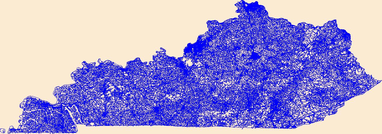
Layers of geospatial data include roads, airports, trails, and railroads.
Tags: Adair,
Airport Complex,
Airport Point,
Airport Runway,
Airports, All tags...
Airstrips,
Allen,
Anderson,
Ballard,
Barren,
Bath,
Bell,
Boone,
Bourbon,
Boyd,
Boyle,
Bracken,
Breathitt,
Breckinridge,
Bullitt,
Butler,
Caldwell,
Calloway,
Campbell,
Carlisle,
Carroll,
Carter,
Casey,
Christian,
Clark,
Clay,
Clinton,
Crittenden,
Cumberland,
Daviess,
Downloadable Data,
Edmonson,
Elliott,
Estill,
Fayette,
Fleming,
Floyd,
Franklin,
Fulton,
Gallatin,
Garrard,
GeoPackage,
Geographic names,
Grant,
Graves,
Grayson,
Green,
Greenup,
Hancock,
Hardin,
Harlan,
Harrison,
Hart,
Henderson,
Henry,
Hickman,
Hopkins,
Jackson,
Jefferson,
Jessamine,
Johnson,
KY,
Kenton,
Kentucky,
Knott,
Knox,
Larue,
Laurel,
Lawrence,
Lee,
Leslie,
Letcher,
Lewis,
Lincoln,
Livingston,
Logan,
Lyon,
Madison,
Magoffin,
Marion,
Marshall,
Martin,
Mason,
McCracken,
McCreary,
McLean,
Meade,
Menifee,
Mercer,
Metcalfe,
Monroe,
Montgomery,
Morgan,
Muhlenberg,
National Transportation Dataset (NTD),
National Transportation Dataset (NTD),
Nelson,
Nicholas,
Ohio,
Oldham,
Open Geospatial Consortium GeoPackage 1.2,
Owen,
Owsley,
Pendleton,
Perry,
Pike,
Powell,
Pulaski,
Railways,
Roads,
Robertson,
Rockcastle,
Rowan,
Russell,
Scott,
Shelby,
Simpson,
Spencer,
State,
State,
Taylor,
Todd,
Trail,
Trails,
Transportation,
Transportation,
Trigg,
Trimble,
US,
Union,
United States,
Warren,
Washington,
Waterway,
Wayne,
Webster,
Whitley,
Wolfe,
Woodford,
transportation, Fewer tags
|
|

