Filters: Tags: Rocky Mountain National Park (X)
215 results (46ms)|
Filters
Date Range
Extensions Types
Contacts
Categories Tag Types
|
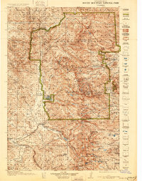
USGS Historical Quadrangle in GeoPDF.
This data release contains water-quality and discharge data collected at seven stream sites and one groundwater spring in Rocky Mountain National Park (RMNP), Colorado by the U.S. Geological Survey (USGS) from 10/1/2010 to 9/30/2019 using in-situ sensors and field meters. Data were collected for the purpose of quantifying downstream transport of aquatic carbon and exchange fluxes of dissolved carbon dioxide (CO₂) from streams. Parameters include daily mean discharge, dissolved CO₂, water temperature, atmospheric pressure, dissolved oxygen, fluorescent dissolved organic matter (fDOM), nitrate, specific conductance, turbidity, and corrected fDOM from 10/1/2010 to 9/30/2019 (DailyData.csv). Hourly mean dissolved CO₂,...
Categories: Data,
Data Release - Revised;
Tags: CO₂,
Colorado,
Hydrology,
Rocky Mountain National Park,
USGS Science Data Catalog (SDC),
Album caption: Proposed Rocky Mountain (Estes) National Park, Colorado; foreign geographers on the Transcontinental Excursion of 1912, conducted by the American Geographical Society of New York, at Cornoa on the "Moffat Road," September, 1912. Elevation about 11,660 feet. Snowballing all the year. Picture by R.B. Marshall, Chief Geographer. Handwritten notes on album caption: James Peak quad Index card: Geographical party conducted by W.M. Davis. Grand County, Colorado. 1912.
Categories: Image;
Types: Map Service,
OGC WFS Layer,
OGC WMS Layer,
OGC WMS Service;
Tags: Grand County, Colorado,
Marshall, Robert B. Collection,
National Parks,
Photographers,
Rocky Mountain National Park,
Album caption: Rocky Mountain National Park, Colorado. Stunted pine at timberline on Sheep Mountain, southeast of Odessa Lake. The trunk of the dead tree is nearly 3 feet in diameter. W.T. Lee. July 9, 1916.
Categories: Image;
Types: Map Service,
OGC WFS Layer,
OGC WMS Layer,
OGC WMS Service;
Tags: Lee, W.T. Collection,
National Parks,
Photographers,
Rocky Mountain National Park,
Rocky Mountain National Park,
Album caption: Rocky Mountain National Park, Colorado. General view of Estes Park from the top of Twin Sisters. W.T. Lee. July 19, 1916.
Categories: Image;
Types: Map Service,
OGC WFS Layer,
OGC WMS Layer,
OGC WMS Service;
Tags: Lee, W.T. Collection,
National Parks,
Photographers,
Rocky Mountain National Park,
Rocky Mountain National Park,
Album caption: Rocky Mountain National Park, Colorado. Bear Lake and Hallett Peak. W.T. Lee. August 3, 1916.
Categories: Image;
Types: Map Service,
OGC WFS Layer,
OGC WMS Layer,
OGC WMS Service;
Tags: Lee, W.T. Collection,
National Parks,
Photographers,
Rocky Mountain National Park,
Rocky Mountain National Park,
Album caption: Rocky Mountain National Park, Colorado. Timberline trees on Sheep Mountain. The stunted branches are so inflexible t-- see dead tree in foreground - that one can walk on top of them but cannot push through. Lee, W.T. July 9, 1916.
Categories: Image;
Types: Map Service,
OGC WFS Layer,
OGC WMS Layer,
OGC WMS Service;
Tags: Lee, W.T. Collection,
National Parks,
Photographers,
Rocky Mountain National Park,
Rocky Mountain National Park,
Rocky Mountain National Park, Colorado. Hikers in The Narrows on Longs Peak. Photo by E.A. Mills.
Categories: Image;
Types: Map Service,
OGC WFS Layer,
OGC WMS Layer,
OGC WMS Service;
Tags: Lee, W.T. Collection,
National Parks,
Photographers,
Rocky Mountain National Park,
photo print
Album caption and index card: Long's Peak and Lily Lake. [Rocky Mountain National Park] Boulder and Larimer Counties, Colorado. 1873.
Categories: Image;
Types: Map Service,
OGC WFS Layer,
OGC WMS Layer,
OGC WMS Service;
Tags: Boulder County, Colorado,
Expeditions,
Hayden Survey,
Jackson, W.H. 1873 Series,
Jackson, W.H. Collection,
Rocky Mountain National Park, Colorado.E.A. Mills feeding one of his pet chipmunks at Longs Peak Inn. 1916.
Categories: Image;
Types: Map Service,
OGC WFS Layer,
OGC WMS Layer,
OGC WMS Service;
Tags: Lee, W.T. Collection,
National Parks,
Photographers,
Rocky Mountain National Park,
photo print
Album caption: Rocky Mountain National Park, Colorado. High drive - View of Flattop and neighboring mountains, showing the high peneplain. W.T. Lee. August 26, 1916. Published as Plate 3-A in U.S. Geological Survey Bulletin 730-A.
Categories: Image;
Types: Map Service,
OGC WFS Layer,
OGC WMS Layer,
OGC WMS Service;
Tags: Lee, W.T. Collection,
National Parks,
Photographers,
Rocky Mountain National Park,
Rocky Mountain National Park,
Album caption: Rocky Mountain National Park, Colorado. Snow bank in the cirque at the head of Fall River near the point where the proposed road to Grand Lake crosses the Continental Divide - shows the relatively smooth top of the range in which the cirques are cut. The snow is carried by the prevailing westerly winds from the high surfaces into the cirques. W.T. Lee. July 4, 1916.
Categories: Image;
Types: Map Service,
OGC WFS Layer,
OGC WMS Layer,
OGC WMS Service;
Tags: Lee, W.T. Collection,
National Parks,
Photographers,
Rocky Mountain National Park,
Rocky Mountain National Park,
Album caption: Proposed Rocky Mountain (Estes) National Park, Colorado; looking south to Mount James, from Corona. Picture by R.B. Marshall, Chief Geographer. 1912. Handwritten notes on album caption: James Peak quad. No index card
Categories: Image;
Types: Map Service,
OGC WFS Layer,
OGC WMS Layer,
OGC WMS Service;
Tags: Marshall, Robert B. Collection,
National Park,
Photographers,
Rocky Mountain National Park,
Topography A,
Album caption: Reproduction of six views taken by the Union Pacific Railroad, of scenes in Rocky Mountain National Park, Colorado, and grouped as they were when used by Congressman Taylor when the Bill created the Park was under discussion on the floor of the House of Representatives. Handwritten notes on album caption: Long's Peak quad. No index card.
Categories: Image;
Types: Map Service,
OGC WFS Layer,
OGC WMS Layer,
OGC WMS Service;
Tags: Marshall, Robert B. Collection,
National Park,
Photographers,
Rocky Mountain National Park,
Topography A,
Rocky Mountain National Park, Colorado. Longs Peak, viewed from near the head of the Little Thompson River. 1873. U.S. Geological and Geographical Survey of the Territories (Hayden Survey).
Categories: Image;
Types: Map Service,
OGC WFS Layer,
OGC WMS Layer,
OGC WMS Service;
Tags: Four Great Surveys of the West,
Hayden Survey,
Jackson, W.H. Collection,
Pioneer Photographers,
Rocky Mountain National Park,
Album caption: Proposed Rocky Mountain (Estes) National Park, Colorado. Looking south across Moraine Park. Longs Peak in distance. Picture by R.B. Marshall, Chief Geographer, 1912. Handwritten notes on album caption: Longs Peak quad., Larimer County No index card Note on photograph: Negative destroyed by authority of administrative geologist
Categories: Image;
Types: Map Service,
OGC WFS Layer,
OGC WMS Layer,
OGC WMS Service;
Tags: Larimer County, Colorado,
Marshall, Robert B. Collection,
National Park,
Photographers,
Rocky Mountain National Park,
Album caption and index card: Rocky Mountain National Park, Colorado, picture by Union Pacific Railroad, 1913. In Big Thompson Canyon. Althought the road from Estes Park village to Fort Collins was built first in 1903, it was not perfected for automobiles until several years later. It is almost as good as the scenery. Note: Whenever this photograph is reproduced, it must have stated immediately beneath the reproduction: "Courtesy of the Union Pacific Railroad." Handwritten notes on album caption: Long's Peak quad., Larimer County, Colo.
Categories: Image;
Types: Map Service,
OGC WFS Layer,
OGC WMS Layer,
OGC WMS Service;
Tags: Larimer County, Colorado,
National Park,
Rocky Mountain National Park,
Topography A,
photo print
Album caption: Proposed Rocky Mountain (Estes) National Park, Colorado. Thompson River Canyon and Automobile Road, from Loveland to Estes Park. Picture by R.B. Marshall, Chief Geographer, 1912. Handwritten notes on album caption: Mt. Olympus quad., Larimer County No index card
Categories: Image;
Types: Map Service,
OGC WFS Layer,
OGC WMS Layer,
OGC WMS Service;
Tags: Larimer County, Colorado,
Marshall, Robert B. Collection,
National Park,
Photographers,
Rocky Mountain National Park,
Album caption and index card: Estes Park and range from Longs Peak and Flattop. August 3, 1916. Handwritten notes on album caption: Larimer Co, Colo.
Categories: Image;
Types: Map Service,
OGC WFS Layer,
OGC WMS Layer,
OGC WMS Service;
Tags: Lee, W.T. Collection,
National Parks,
Photographers,
Rocky Mountain National Park,
Rocky Mountain National Park, Colorado,
Album caption: Rocky Mountain National Park, Colorado. Thunder Lake and Mount Alice. W.T. Lee. July 28, 1916. (panorama)
Categories: Image;
Types: Map Service,
OGC WFS Layer,
OGC WMS Layer,
OGC WMS Service;
Tags: Lee, W.T. Collection,
National Parks,
Photographers,
Rocky Mountain National Park,
Rocky Mountain National Park,
|

|
