Filters: Tags: SEASIDE (X)
26 results (25ms)|
Filters
Date Range
Extensions Types Contacts
Categories Tag Types Tag Schemes |
This data set contains imagery from the National Agriculture Imagery Program (NAIP). The NAIP program is administered by USDA FSA and has been established to support two main FSA strategic goals centered on agricultural production. These are, increase stewardship of America's natural resources while enhancing the environment, and to ensure commodities are procured and distributed effectively and efficiently to increase food security. The NAIP program supports these goals by acquiring and providing ortho imagery that has been collected during the agricultural growing season in the U.S. The NAIP ortho imagery is tailored to meet FSA requirements and is a fundamental tool used to support FSA farm and conservation programs....
This part of DS 781 presents data for the paleoshorelines for the geologic and geomorphic map of the Offshore of Monterey map area, California. The vector data file is included in "Paleoshorelines_OffshoreMonterey.zip," which is accessible from https://doi.org/10.5066/F70Z71C8. These data accompany the pamphlet and map sheets of Johnson, S.Y., Dartnell, P., Hartwell, S.R., Cochrane, G.R., Golden, N.E., Watt, J.T., Davenport, C.W., Kvitek, R.G., Erdey, M.D., Krigsman, L.M., Sliter, R.W., and Maier, K.L. (S.Y. Johnson and S.A. Cochran, eds.), 2016, California State Waters Map Series—Offshore of Monterey, California: U.S. Geological Survey Open-File Report 2016–1110, pamphlet 44 p., 10 sheets, scale 1:24,000, https://doi.org/10.3133/ofr20161110.
Categories: Data;
Types: Citation,
Downloadable,
Map Service,
OGC WFS Layer,
OGC WMS Layer,
Shapefile;
Tags: Bathymetry,
CMHRP,
Coastal and Marine Hazards and Resources Program,
Marina,
Monterey,
This part of DS 781 presents data for the bathymetry map of the Offshore of Monterey map area, California. Bathymetry data are provided as separate grids depending on resolution. This metadata file refers to the data included in "BathymetryHS_2m_OffshoreMonterey.zip," which is accessible from https://doi.org/10.5066/F70Z71C8. These data accompany the pamphlet and map sheets of Johnson, S.Y., Dartnell, P., Hartwell, S.R., Cochrane, G.R., Golden, N.E., Watt, J.T., Davenport, C.W., Kvitek, R.G., Erdey, M.D., Krigsman, L.M., Sliter, R.W., and Maier, K.L. (S.Y. Johnson and S.A. Cochran, eds.), 2016, California State Waters Map Series—Offshore of Monterey, California: U.S. Geological Survey Open-File Report 2016–1110,...
Categories: Data;
Types: Downloadable,
GeoTIFF,
Map Service,
Raster;
Tags: Backscatter,
Bathymetry,
Bathymetry,
CMHRP,
Coastal and Marine Hazards and Resources Program,
This part of DS 781 presents fold data for the geologic and geomorphic map of the Offshore of Monterey map area, California. The vector data file is included in "Folds_OffshoreMonterey.zip," which is accessible from https://doi.org/10.5066/F70Z71C8. These data accompany the pamphlet and map sheets of Johnson, S.Y., Dartnell, P., Hartwell, S.R., Cochrane, G.R., Golden, N.E., Watt, J.T., Davenport, C.W., Kvitek, R.G., Erdey, M.D., Krigsman, L.M., Sliter, R.W., and Maier, K.L. (S.Y. Johnson and S.A. Cochran, eds.), 2016, California State Waters Map Series—Offshore of Monterey, California: U.S. Geological Survey Open-File Report 2016–1110, pamphlet 44 p., 10 sheets, scale 1:24,000, https://doi.org/10.3133/ofr20161110....
Categories: Data;
Types: Citation,
Downloadable,
Map Service,
OGC WFS Layer,
OGC WMS Layer,
Shapefile;
Tags: Bathymetry,
CMHRP,
Coastal and Marine Hazards and Resources Program,
Continental/Island Shelf,
Marina,
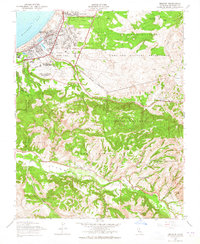
USGS Historical Quadrangle in GeoPDF.
This part of DS 781 presents data for the seafloor-character map of the Offshore of Monterey map area, California. Seafloor-character data are provided as two separate grids depending on resolution of the mapping system and processing method. The raster data file is included in "SeafloorCharacter_2m_OffshoreMonterey.zip," which is accessible from https://doi.org/10.5066/F70Z71C8. These data accompany the pamphlet and map sheets of Johnson, S.Y., Dartnell, P., Hartwell, S.R., Cochrane, G.R., Golden, N.E., Watt, J.T., Davenport, C.W., Kvitek, R.G., Erdey, M.D., Krigsman, L.M., Sliter, R.W., and Maier, K.L. (S.Y. Johnson and S.A. Cochran, eds.), 2016, California State Waters Map Series—Offshore of Monterey, California:...
Categories: Data;
Types: Downloadable,
GeoTIFF,
Map Service,
Raster;
Tags: Backscatter,
Bathymetry,
Bathymetry,
CMHRP,
Coastal and Marine Hazards and Resources Program,
This part of DS 781 presents data for the acoustic-backscatter map of the Offshore of Monterey map area, California. Backscatter data are provided as separate grids depending on resolution. This metadata file refers to the data included in "Backscatter_5m_OffshoreMonterey.zip," which is accessible from https://doi.org/10.5066/F70Z71C8. These data accompany the pamphlet and map sheets of Johnson, S.Y., Dartnell, P., Hartwell, S.R., Cochrane, G.R., Golden, N.E., Watt, J.T., Davenport, C.W., Kvitek, R.G., Erdey, M.D., Krigsman, L.M., Sliter, R.W., and Maier, K.L. (S.Y. Johnson and S.A. Cochran, eds.), 2016, California State Waters Map Series—Offshore of Monterey, California: U.S. Geological Survey Open-File Report...
Categories: Data;
Types: Downloadable,
GeoTIFF,
Map Service,
Raster;
Tags: Backscatter,
Bathymetry,
Bathymetry,
CMHRP,
Coastal and Marine Hazards and Resources Program,
This part of DS 781 presents data for the bathymetry map of the Offshore of Monterey map area, California. Bathymetry data are provided as separate grids depending on resolution. This metadata file refers to the data included in "Bathymetry_5m_OffshoreMonterey.zip," which is accessible from https://doi.org/10.5066/F70Z71C8. These data accompany the pamphlet and map sheets of Johnson, S.Y., Dartnell, P., Hartwell, S.R., Cochrane, G.R., Golden, N.E., Watt, J.T., Davenport, C.W., Kvitek, R.G., Erdey, M.D., Krigsman, L.M., Sliter, R.W., and Maier, K.L. (S.Y. Johnson and S.A. Cochran, eds.), 2016, California State Waters Map Series—Offshore of Monterey, California: U.S. Geological Survey Open-File Report 2016–1110, pamphlet...
Categories: Data;
Types: Citation,
Downloadable,
GeoTIFF,
Map Service,
Raster;
Tags: Backscatter,
Bathymetry,
Bathymetry,
CMHRP,
Coastal and Marine Hazards and Resources Program,
This data set contains imagery from the National Agriculture Imagery Program (NAIP). The NAIP program is administered by USDA FSA and has been established to support two main FSA strategic goals centered on agricultural production. These are, increase stewardship of America's natural resources while enhancing the environment, and to ensure commodities are procured and distributed effectively and efficiently to increase food security. The NAIP program supports these goals by acquiring and providing ortho imagery that has been collected during the agricultural growing season in the U.S. The NAIP ortho imagery is tailored to meet FSA requirements and is a fundamental tool used to support FSA farm and conservation programs....
This part of DS 781 presents data for the acoustic-backscatter map of the Offshore of Monterey map area, California. Backscatter data are provided as separate grids depending on resolution. This metadata file refers to the data included in "Backscatter_7125_OffshoreMonterey.zip," which is accessible from https://doi.org/10.5066/F70Z71C8. These data accompany the pamphlet and map sheets of Johnson, S.Y., Dartnell, P., Hartwell, S.R., Cochrane, G.R., Golden, N.E., Watt, J.T., Davenport, C.W., Kvitek, R.G., Erdey, M.D., Krigsman, L.M., Sliter, R.W., and Maier, K.L. (S.Y. Johnson and S.A. Cochran, eds.), 2016, California State Waters Map Series—Offshore of Monterey, California: U.S. Geological Survey Open-File Report...
Categories: Data;
Types: Downloadable,
GeoTIFF,
Map Service,
Raster;
Tags: Backscatter,
Bathymetry,
Bathymetry,
CMHRP,
Coastal and Marine Hazards and Resources Program,
This data set contains imagery from the National Agriculture Imagery Program (NAIP). The NAIP program is administered by USDA FSA and has been established to support two main FSA strategic goals centered on agricultural production. These are, increase stewardship of America's natural resources while enhancing the environment, and to ensure commodities are procured and distributed effectively and efficiently to increase food security. The NAIP program supports these goals by acquiring and providing ortho imagery that has been collected during the agricultural growing season in the U.S. The NAIP ortho imagery is tailored to meet FSA requirements and is a fundamental tool used to support FSA farm and conservation programs....
This part of DS 781 presents data for the seafloor-character map of the Offshore of Monterey map area, California. Seafloor-character data are provided as two separate grids depending on resolution of the mapping system and processing method. The raster data file is included in "SeafloorCharacter_5m_OffshoreMonterey.zip," which is accessible from https://doi.org/10.5066/F70Z71C8. These data accompany the pamphlet and map sheets of Johnson, S.Y., Dartnell, P., Hartwell, S.R., Cochrane, G.R., Golden, N.E., Watt, J.T., Davenport, C.W., Kvitek, R.G., Erdey, M.D., Krigsman, L.M., Sliter, R.W., and Maier, K.L. (S.Y. Johnson and S.A. Cochran, eds.), 2016, California State Waters Map Series—Offshore of Monterey, California:...
Categories: Data;
Types: Downloadable,
GeoTIFF,
Map Service,
Raster;
Tags: Backscatter,
Bathymetry,
Bathymetry,
CMHRP,
Coastal and Marine Hazards and Resources Program,
This part of DS 781 presents fault data for the geologic and geomorphic map of the Offshore of Monterey map area, California. The vector data file is included in "Faults_OffshoreMonterey.zip," which is accessible from https://doi.org/10.5066/F70Z71C8. These data accompany the pamphlet and map sheets of Johnson, S.Y., Dartnell, P., Hartwell, S.R., Cochrane, G.R., Golden, N.E., Watt, J.T., Davenport, C.W., Kvitek, R.G., Erdey, M.D., Krigsman, L.M., Sliter, R.W., and Maier, K.L. (S.Y. Johnson and S.A. Cochran, eds.), 2016, California State Waters Map Series—Offshore of Monterey, California: U.S. Geological Survey Open-File Report 2016–1110, pamphlet 44 p., 10 sheets, scale 1:24,000, https://doi.org/10.3133/ofr20161110....
Categories: Data;
Types: Citation,
Downloadable,
Map Service,
OGC WFS Layer,
OGC WMS Layer,
Shapefile;
Tags: Bathymetry,
CMHRP,
Coastal and Marine Hazards and Resources Program,
Continental/Island Shelf,
Marina,
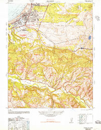
USGS Historical Quadrangle in GeoPDF.
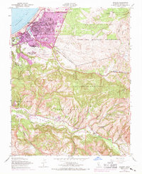
USGS Historical Quadrangle in GeoPDF.
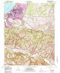
USGS Historical Quadrangle in GeoPDF.
This part of DS 781 presents data for the habitat map of the seafloor of the Offshore of Monterey map area, California. The vector data file is included in "Habitat_OffshoreMonterey.zip," which is accessible from https://doi.org/10.5066/F70Z71C8. These data accompany the pamphlet and map sheets of Johnson, S.Y., Dartnell, P., Hartwell, S.R., Cochrane, G.R., Golden, N.E., Watt, J.T., Davenport, C.W., Kvitek, R.G., Erdey, M.D., Krigsman, L.M., Sliter, R.W., and Maier, K.L. (S.Y. Johnson and S.A. Cochran, eds.), 2016, California State Waters Map Series—Offshore of Monterey, California: U.S. Geological Survey Open-File Report 2016–1110, pamphlet 44 p., 10 sheets, scale 1:24,000, https://doi.org/10.3133/ofr20161110....
Categories: Data;
Types: Citation,
Downloadable,
Map Service,
OGC WFS Layer,
OGC WMS Layer,
Shapefile;
Tags: Backscatter,
Bathymetry,
Bathymetry,
CMHRP,
Coastal and Marine Hazards and Resources Program,
This data set contains imagery from the National Agriculture Imagery Program (NAIP). The NAIP program is administered by USDA FSA and has been established to support two main FSA strategic goals centered on agricultural production. These are, increase stewardship of America's natural resources while enhancing the environment, and to ensure commodities are procured and distributed effectively and efficiently to increase food security. The NAIP program supports these goals by acquiring and providing ortho imagery that has been collected during the agricultural growing season in the U.S. The NAIP ortho imagery is tailored to meet FSA requirements and is a fundamental tool used to support FSA farm and conservation programs....
This part of DS 781 presents data for the geologic and geomorphic map of the Offshore of Monterey map area, California. The vector data file is included in "Geology_OffshoreMonterey.zip," which is accessible from https://doi.org/10.5066/F70Z71C8. These data accompany the pamphlet and map sheets of Johnson, S.Y., Dartnell, P., Hartwell, S.R., Cochrane, G.R., Golden, N.E., Watt, J.T., Davenport, C.W., Kvitek, R.G., Erdey, M.D., Krigsman, L.M., Sliter, R.W., and Maier, K.L. (S.Y. Johnson and S.A. Cochran, eds.), 2016, California State Waters Map Series—Offshore of Monterey, California: U.S. Geological Survey Open-File Report 2016–1110, pamphlet 44 p., 10 sheets, scale 1:24,000, https://doi.org/10.3133/ofr20161110....
Categories: Data;
Types: Citation,
Downloadable,
Map Service,
OGC WFS Layer,
OGC WMS Layer,
Shapefile;
Tags: Bathymetry,
CMHRP,
Coastal and Marine Hazards and Resources Program,
Continental/Island Shelf,
Marina,
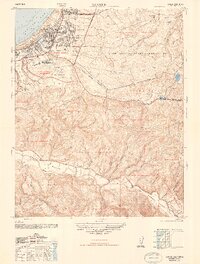
USGS Historical Quadrangle in GeoPDF.
|

|
