Filters: Tags: SEPARATION CANYON (X)
7 results (58ms)|
Filters
Date Range
Types Contacts
Categories Tag Types Tag Schemes |
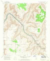
USGS Historical Quadrangle in GeoPDF.
This data set contains imagery from the National Agriculture Imagery Program (NAIP). The NAIP program is administered by USDA FSA and has been established to support two main FSA strategic goals centered on agricultural production. These are, increase stewardship of America's natural resources while enhancing the environment, and to ensure commodities are procured and distributed effectively and efficiently to increase food security. The NAIP program supports these goals by acquiring and providing ortho imagery that has been collected during the agricultural growing season in the U.S. The NAIP ortho imagery is tailored to meet FSA requirements and is a fundamental tool used to support FSA farm and conservation programs....
These data are aerial image-derived, classification maps of tamarisk (Tamarisk spp.) in the riparian zone of the Colorado River from Glen Canyon Dam to Separation Canyon, a total river distance of 412 km. The classification maps are published in GIS vector format. Two maps are published: 1) a classification of tamarisk from a 0.2 m resolution multispectral image dataset acquired in May 2009 (Tamarisk Classification 2009), and 2) a classification of tamarisk impacted by the tamarisk beetle (Diorhabda carinulata) from a 0.2 m resolution multispectral image dataset acquired in May 2013 (Beetle Impact Classification 2013). Tamarisk presence in 2009 was classified using the Mahalanobis Distance method with a total of...
These data are remote sensing image-based classification maps of unvegetated river-derived sand along the Colorado River. One map is based on imagery acquired in May 2013 and is a classification of sand located above the wetted river channel in the imagery which was acquired at the approximate contemporary low-flow river discharge of 8,000 cubic feet per second (227 cubic meters per second) and extends from Glen Canyon Dam at Lake Powell to Separation Canyon at Lake Mead, a total distance of approximately 255 river miles (410 river kilometer). Three other maps are based on imagery acquired in May 2002, 2009, and 2013, respectively, and are classifications of sand located above the wetted river channel (at river...
This data set contains imagery from the National Agriculture Imagery Program (NAIP). The NAIP program is administered by USDA FSA and has been established to support two main FSA strategic goals centered on agricultural production. These are, increase stewardship of America's natural resources while enhancing the environment, and to ensure commodities are procured and distributed effectively and efficiently to increase food security. The NAIP program supports these goals by acquiring and providing ortho imagery that has been collected during the agricultural growing season in the U.S. The NAIP ortho imagery is tailored to meet FSA requirements and is a fundamental tool used to support FSA farm and conservation programs....
This data set contains imagery from the National Agriculture Imagery Program (NAIP). The NAIP program is administered by USDA FSA and has been established to support two main FSA strategic goals centered on agricultural production. These are, increase stewardship of America's natural resources while enhancing the environment, and to ensure commodities are procured and distributed effectively and efficiently to increase food security. The NAIP program supports these goals by acquiring and providing ortho imagery that has been collected during the agricultural growing season in the U.S. The NAIP ortho imagery is tailored to meet FSA requirements and is a fundamental tool used to support FSA farm and conservation programs....
This data set contains imagery from the National Agriculture Imagery Program (NAIP). The NAIP program is administered by USDA FSA and has been established to support two main FSA strategic goals centered on agricultural production. These are, increase stewardship of America's natural resources while enhancing the environment, and to ensure commodities are procured and distributed effectively and efficiently to increase food security. The NAIP program supports these goals by acquiring and providing ortho imagery that has been collected during the agricultural growing season in the U.S. The NAIP ortho imagery is tailored to meet FSA requirements and is a fundamental tool used to support FSA farm and conservation programs....
|

|
