Filters
Date Range
Types
Contacts
Tag Types
Tag Schemes
|
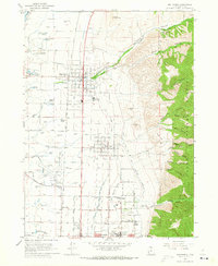
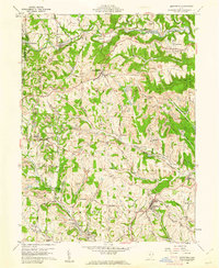
USGS Historical Quadrangle in GeoPDF.
Tags: 7.5 x 7.5 minute,
Downloadable Data,
GeoPDF,
GeoTIFF,
Historical Topographic Maps, All tags...
Historical Topographic Maps 7.5 x 7.5 Minute Map Series,
Map,
Smithfield,
UT,
imageryBaseMapsEarthCover, Fewer tags
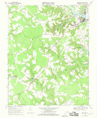
USGS Historical Quadrangle in GeoPDF.
Tags: 7.5 x 7.5 minute,
Downloadable Data,
GeoPDF,
GeoTIFF,
Historical Topographic Maps, All tags...
Historical Topographic Maps 7.5 x 7.5 Minute Map Series,
Map,
Smithfield,
VA,
imageryBaseMapsEarthCover, Fewer tags
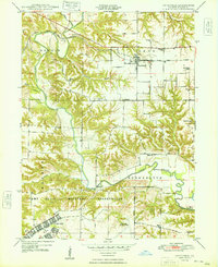
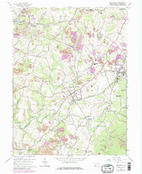
USGS Historical Quadrangle in GeoPDF.
Tags: 7.5 x 7.5 minute,
Downloadable Data,
GeoPDF,
GeoTIFF,
Historical Topographic Maps, All tags...
Historical Topographic Maps 7.5 x 7.5 Minute Map Series,
IL,
Map,
Smithfield,
imageryBaseMapsEarthCover, Fewer tags
This data set contains imagery from the National Agriculture Imagery Program (NAIP). The NAIP program is administered by USDA FSA and has been established to support two main FSA strategic goals centered on agricultural production. These are, increase stewardship of America's natural resources while enhancing the environment, and to ensure commodities are procured and distributed effectively and efficiently to increase food security. The NAIP program supports these goals by acquiring and providing ortho imagery that has been collected during the agricultural growing season in the U.S. The NAIP ortho imagery is tailored to meet FSA requirements and is a fundamental tool used to support FSA farm and conservation programs....
Types: Citation;
Tags: 17057,
3.75 x 3.75 minute,
4009038,
Aerial Compliance,
Compliance, All tags...
Digital Ortho rectified Image,
Downloadable Data,
FULTON CO IL FSA,
Fulton,
IL,
IL057,
JPEG2000,
NAIP,
Ortho Rectification,
Orthoimagery,
Quarter Quadrangle,
SMITHFIELD,
SMITHFIELD, NW,
USDA National Agriculture Imagery Program (NAIP),
farming, Fewer tags

These polygon boundaries, inundation extents, and depth rasters were created to provide an extent of flood inundation along the Neuse River within the community of Smithfield, North Carolina. The upstream and downstream reach extent is determined by the location of high-water marks, not extending the boundary far past the outermost high-water marks. In areas of uncertainty of flood extent, the model boundary is lined up with the flood inundation polygon extent. This boundary polygon was used to extract the final flood inundation polygon and depth layer from the flood water surface raster file. The passage of Hurricane Matthew through central and eastern North Carolina during October 7-9, 2016, brought heavy rainfall...
Types: Citation;
Tags: North Carolina,
Smithfield,
boundary,
extent,
flood, All tags...
flood inundation maps,
flooded area,
geospatial analysis,
high-water marks,
river/stream,
study area, Fewer tags
USGS Historical Quadrangle in GeoPDF.
Tags: 7.5 x 7.5 minute,
Downloadable Data,
GeoPDF,
GeoTIFF,
Historical Topographic Maps, All tags...
Historical Topographic Maps 7.5 x 7.5 Minute Map Series,
IL,
Map,
Smithfield,
imageryBaseMapsEarthCover, Fewer tags
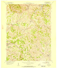
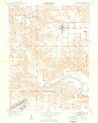
USGS Historical Quadrangle in GeoPDF.
Tags: 7.5 x 7.5 minute,
Downloadable Data,
GeoPDF,
GeoTIFF,
Historical Topographic Maps, All tags...
Historical Topographic Maps 7.5 x 7.5 Minute Map Series,
KY,
Map,
Smithfield,
imageryBaseMapsEarthCover, Fewer tags

This data set contains imagery from the National Agriculture Imagery Program (NAIP). The NAIP program is administered by USDA FSA and has been established to support two main FSA strategic goals centered on agricultural production. These are, increase stewardship of America's natural resources while enhancing the environment, and to ensure commodities are procured and distributed effectively and efficiently to increase food security. The NAIP program supports these goals by acquiring and providing ortho imagery that has been collected during the agricultural growing season in the U.S. The NAIP ortho imagery is tailored to meet FSA requirements and is a fundamental tool used to support FSA farm and conservation programs....
Types: Citation;
Tags: 21185,
3.75 x 3.75 minute,
3808538,
Aerial Compliance,
Compliance, All tags...
Digital Ortho rectified Image,
Downloadable Data,
JPEG2000,
KY,
KY185,
NAIP,
OLDHAM CO KY FSA,
Oldham,
Ortho Rectification,
Orthoimagery,
Quarter Quadrangle,
SMITHFIELD,
SMITHFIELD, SE,
USDA National Agriculture Imagery Program (NAIP),
farming, Fewer tags

This data set contains imagery from the National Agriculture Imagery Program (NAIP). The NAIP program is administered by USDA FSA and has been established to support two main FSA strategic goals centered on agricultural production. These are, increase stewardship of America's natural resources while enhancing the environment, and to ensure commodities are procured and distributed effectively and efficiently to increase food security. The NAIP program supports these goals by acquiring and providing ortho imagery that has been collected during the agricultural growing season in the U.S. The NAIP ortho imagery is tailored to meet FSA requirements and is a fundamental tool used to support FSA farm and conservation programs....
Types: Citation;
Tags: 3.75 x 3.75 minute,
3907910,
42051,
Aerial Compliance,
Compliance, All tags...
Digital Ortho rectified Image,
Downloadable Data,
FAYETTE CO PA FSA,
Fayette,
JPEG2000,
NAIP,
Ortho Rectification,
Orthoimagery,
PA,
PA051,
Quarter Quadrangle,
SMITHFIELD,
SMITHFIELD, NW,
USDA National Agriculture Imagery Program (NAIP),
farming, Fewer tags
This data set contains imagery from the National Agriculture Imagery Program (NAIP). The NAIP program is administered by USDA FSA and has been established to support two main FSA strategic goals centered on agricultural production. These are, increase stewardship of America's natural resources while enhancing the environment, and to ensure commodities are procured and distributed effectively and efficiently to increase food security. The NAIP program supports these goals by acquiring and providing ortho imagery that has been collected during the agricultural growing season in the U.S. The NAIP ortho imagery is tailored to meet FSA requirements and is a fundamental tool used to support FSA farm and conservation programs....
Types: Citation;
Tags: 17057,
3.75 x 3.75 minute,
4009038,
Aerial Compliance,
Compliance, All tags...
Digital Ortho rectified Image,
Downloadable Data,
FULTON CO IL FSA,
Fulton,
IL,
IL057,
JPEG2000,
NAIP,
Ortho Rectification,
Orthoimagery,
Quarter Quadrangle,
SMITHFIELD,
SMITHFIELD, NE,
USDA National Agriculture Imagery Program (NAIP),
farming, Fewer tags
USGS Historical Quadrangle in GeoPDF.
Tags: 7.5 x 7.5 minute,
Downloadable Data,
GeoPDF,
GeoTIFF,
Historical Topographic Maps, All tags...
Historical Topographic Maps 7.5 x 7.5 Minute Map Series,
Map,
Smithfield,
UT,
imageryBaseMapsEarthCover, Fewer tags

This data set contains imagery from the National Agriculture Imagery Program (NAIP). The NAIP program is administered by USDA FSA and has been established to support two main FSA strategic goals centered on agricultural production. These are, increase stewardship of America's natural resources while enhancing the environment, and to ensure commodities are procured and distributed effectively and efficiently to increase food security. The NAIP program supports these goals by acquiring and providing ortho imagery that has been collected during the agricultural growing season in the U.S. The NAIP ortho imagery is tailored to meet FSA requirements and is a fundamental tool used to support FSA farm and conservation programs....
Types: Citation;
Tags: 3.75 x 3.75 minute,
3607603,
51093,
Aerial Compliance,
Compliance, All tags...
Digital Ortho rectified Image,
Downloadable Data,
ISLE OF WIGHT CO VA FSA,
Isle of Wight,
JPEG2000,
NAIP,
Ortho Rectification,
Orthoimagery,
Quarter Quadrangle,
SMITHFIELD,
SMITHFIELD, SW,
USDA National Agriculture Imagery Program (NAIP),
VA,
VA093,
farming, Fewer tags

This data set contains imagery from the National Agriculture Imagery Program (NAIP). The NAIP program is administered by USDA FSA and has been established to support two main FSA strategic goals centered on agricultural production. These are, increase stewardship of America's natural resources while enhancing the environment, and to ensure commodities are procured and distributed effectively and efficiently to increase food security. The NAIP program supports these goals by acquiring and providing ortho imagery that has been collected during the agricultural growing season in the U.S. The NAIP ortho imagery is tailored to meet FSA requirements and is a fundamental tool used to support FSA farm and conservation programs....
Types: Citation;
Tags: 3.75 x 3.75 minute,
4111110,
49005,
Aerial Compliance,
CACHE CO UT FSA, All tags...
Cache,
Compliance,
Digital Ortho rectified Image,
Downloadable Data,
JPEG2000,
NAIP,
Ortho Rectification,
Orthoimagery,
Quarter Quadrangle,
SMITHFIELD,
SMITHFIELD, NE,
USDA National Agriculture Imagery Program (NAIP),
UT,
UT005,
farming, Fewer tags
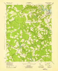
USGS Historical Quadrangle in GeoPDF.
Tags: 7.5 x 7.5 minute,
Downloadable Data,
GeoPDF,
GeoTIFF,
Historical Topographic Maps, All tags...
Historical Topographic Maps 7.5 x 7.5 Minute Map Series,
Map,
PA,
Smithfield,
imageryBaseMapsEarthCover, Fewer tags

USGS Historical Quadrangle in GeoPDF.
Tags: 15 x 15 minute,
Downloadable Data,
GeoPDF,
GeoTIFF,
Historical Topographic Maps, All tags...
Historical Topographic Maps 15 x 15 Minute Map Series,
Map,
Smithfield,
VA,
imageryBaseMapsEarthCover, Fewer tags
USGS Historical Quadrangle in GeoPDF.
Tags: 7.5 x 7.5 minute,
Downloadable Data,
GeoPDF,
GeoTIFF,
Historical Topographic Maps, All tags...
Historical Topographic Maps 7.5 x 7.5 Minute Map Series,
Map,
Smithfield,
VA,
imageryBaseMapsEarthCover, Fewer tags
USGS Historical Quadrangle in GeoPDF.
Tags: 7.5 x 7.5 minute,
Downloadable Data,
GeoPDF,
GeoTIFF,
Historical Topographic Maps, All tags...
Historical Topographic Maps 7.5 x 7.5 Minute Map Series,
Map,
OH,
Smithfield,
imageryBaseMapsEarthCover, Fewer tags
|
|

