Filters: Tags: SPEARFISH (X)
33 results (40ms)|
Filters
Date Range
Types Contacts
Categories Tag Types Tag Schemes |
This data set contains imagery from the National Agriculture Imagery Program (NAIP). The NAIP program is administered by USDA FSA and has been established to support two main FSA strategic goals centered on agricultural production. These are increase stewardship of America's natural resources while enhancing the environment, and to ensure commodities are procured and distributed effectively and efficiently to increase food security. The NAIP program supports these goals by acquiring and providing ortho imagery that has been collected during the agricultural growing season in the U.S. The NAIP ortho imagery is tailored to meet FSA requirements and is a fundamental tool used to support FSA farm and conservation programs....
This data set contains imagery from the National Agriculture Imagery Program (NAIP). The NAIP program is administered by USDA FSA and has been established to support two main FSA strategic goals centered on agricultural production. These are increase stewardship of America's natural resources while enhancing the environment, and to ensure commodities are procured and distributed effectively and efficiently to increase food security. The NAIP program supports these goals by acquiring and providing ortho imagery that has been collected during the agricultural growing season in the U.S. The NAIP ortho imagery is tailored to meet FSA requirements and is a fundamental tool used to support FSA farm and conservation programs....
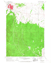
USGS Historical Quadrangle in GeoPDF.
Core Research Center, core D109, from well operated by HOME PETROLEUM CORPRaw Properties from download, web scrape, MapServer, and Macrostrat API{"Lib Num": "D109", "API Num": "3300901776", "Operator": "HOME PETROLEUM CORP", "Well Name": "34-17 BRANDJORD", "Field": "NORTHROTH", "State": "ND", "County": "BOTTINEAU", "Type": "SLABBED", "Photos": "F", "Thin Sec": "F", "Analysis": "F", "Latitude": "48.938605", "Longitude": "-100.804842", "coordinates_geohash": "cb8q6jh0hcjv", "Source": "FROM STATE RECORDS", "Security Flag": "NO SPECIAL RESTRICTIONS", "crc_collection_name": "core", "sb_parent_id": "4f4e49dae4b07f02db5e0486", "intervals": [{"Formation": "SPEARFISH", "Age": "TRIA", "Min Depth": "3138", "Max Depth": "3165"}],...
Categories: Physical Item;
Tags: Fox Hills Formation,
Fox Hills Formation,
Late Cretaceous,
SPEARFISH,
TRIA,
Core Research Center, core C569, from well operated by KENNEDY & MITCHELLRaw Properties from download, web scrape, MapServer, and Macrostrat API{"Lib Num": "C569", "API Num": "3300901692", "Operator": "KENNEDY & MITCHELL", "Well Name": "55-753-3 ORKE-CAKBURY", "Field": "WILDCAT", "State": "ND", "County": "BOTTINEAU", "Type": "SLABBED", "Photos": "F", "Thin Sec": "F", "Analysis": "F", "Latitude": "48.902687", "Longitude": "-100.53122", "coordinates_geohash": "cb8w0q7quc94", "Source": "FROM STATE RECORDS", "Security Flag": "NO SPECIAL RESTRICTIONS", "crc_collection_name": "core", "sb_parent_id": "4f4e49dae4b07f02db5e0486", "intervals": [{"Formation": "SPEARFISH", "Age": "TRIA", "Min Depth": "2982", "Max Depth": "3087"}],...
Categories: Physical Item;
Tags: Hell Creek Formation,
Hell Creek Formation,
Late Cretaceous,
SPEARFISH,
TRIA,
Core Research Center, core B899, from well operated by BASS ENTERPRISESRaw Properties from download, web scrape, MapServer, and Macrostrat API{"Lib Num": "B899", "API Num": "4902720405", "Operator": "BASS ENTERPRISES", "Well Name": "12-1 BASS BARBER FEDERAL", "Field": "WILDCAT", "State": "WY", "County": "NIOBRARA", "Type": "SLABBED", "Photos": "T", "Thin Sec": "F", "Analysis": "F", "Latitude": "43.10874", "Longitude": "-104.60036", "coordinates_geohash": "9xtt5z8qdgwd", "Source": "FROM STATE RECORDS", "Security Flag": "NO SPECIAL RESTRICTIONS", "crc_collection_name": "core", "sb_parent_id": "4f4e49dae4b07f02db5e0486", "intervals": [{"Formation": "CANYON SPRINGS", "Age": "JURA", "Min Depth": "8521", "Max Depth":...
Core Research Center, core C770, from well operated by NORCEN ENERGY RESRaw Properties from download, web scrape, MapServer, and Macrostrat API{"Lib Num": "C770", "API Num": "3300901599", "Operator": "NORCEN ENERGY RES", "Well Name": "34-1 LINDSTROM NORCEN FEE", "Field": "WILDCAT", "State": "ND", "County": "BOTTINEAU", "Type": "SLABBED", "Photos": "T", "Thin Sec": "T", "Analysis": "T", "Latitude": "48.993553", "Longitude": "-100.760749", "coordinates_geohash": "cb8qeph20k5z", "Source": "FROM STATE RECORDS", "Security Flag": "NO SPECIAL RESTRICTIONS", "crc_collection_name": "core", "sb_parent_id": "4f4e49dae4b07f02db5e0486", "intervals": [{"Formation": "SPEARFISH", "Age": "TRIA", "Min Depth": "2966", "Max Depth":...
Categories: Physical Item;
Tags: Fox Hills Formation,
Fox Hills Formation,
Late Cretaceous,
SPEARFISH,
TRIA,
Core Research Center, core R367, from well operated by KENNEDY & MITCHELLRaw Properties from download, web scrape, MapServer, and Macrostrat API{"Lib Num": "R367", "API Num": "3300901643", "Operator": "KENNEDY & MITCHELL", "Well Name": "55-752-1 MAGNUSON", "Field": "WILDCAT", "State": "ND", "County": "BOTTINEAU", "Type": "SLABBED", "Photos": "T", "Thin Sec": "F", "Analysis": "F", "Latitude": "48.960876", "Longitude": "-100.613317", "coordinates_geohash": "cb8qw3p9gbc3", "Source": "FROM STATE RECORDS", "Security Flag": "NO SPECIAL RESTRICTIONS", "crc_collection_name": "core", "sb_parent_id": "4f4e49dae4b07f02db5e0486", "intervals": [{"Formation": "SPEARFISH", "Age": "TRIA", "Min Depth": "3001", "Max Depth": "3102"}],...
Categories: Physical Item;
Tags: Fox Hills Formation,
Fox Hills Formation,
Late Cretaceous,
SPEARFISH,
TRIA,
Core Research Center, cutting HH01396, from well operated by NADEL & GUSSMANRaw Properties from download, web scrape, MapServer, and Macrostrat API{"Lib Num": "HH01396", "API Num": "2502522844", "Operator": "NADEL & GUSSMAN", "Well Name": "STRONGFORD FEE 24-34 (VIEWING ONLY, NO SAMPLING)", "Field": "WILDCAT", "State": "MT", "County": "FALLON", "Thin Sec": "F", "Analysis": "F", "Latitude": "45.8844111", "Longitude": "-104.1255472", "coordinates_geohash": "c8jvn9404fht", "Source": "PROVIDED BY DONOR", "Min": "0", "Max": "9150", "Security Flag": "VIEWING ALLOWED, NO SAMPLING", "crc_collection_name": "cutting", "sb_parent_id": "4f4e49d8e4b07f02db5df2d2", "intervals": [{"Formation": "SPEARFISH", "Age": null, "Min Depth":...
Categories: Physical Item;
Tags: Danian,
Ludlow Member,
Ludlow Member of Fort Union Formation,
MISSION CANYON,
NIOBRARA,
This data set contains imagery from the National Agriculture Imagery Program (NAIP). The NAIP program is administered by USDA FSA and has been established to support two main FSA strategic goals centered on agricultural production. These are increase stewardship of America's natural resources while enhancing the environment, and to ensure commodities are procured and distributed effectively and efficiently to increase food security. The NAIP program supports these goals by acquiring and providing ortho imagery that has been collected during the agricultural growing season in the U.S. The NAIP ortho imagery is tailored to meet FSA requirements and is a fundamental tool used to support FSA farm and conservation programs....
Core Research Center, cutting HH01399, from well operated by NADEL & GUSSMANRaw Properties from download, web scrape, MapServer, and Macrostrat API{"Lib Num": "HH01399", "API Num": "2501121369", "Operator": "NADEL & GUSSMAN", "Well Name": "HAT CREEK FED 1 (VIEWING ONLY, NO SAMPLING)", "Field": "REPEAT", "State": "MT", "County": "CARTER", "Thin Sec": "F", "Analysis": "F", "Latitude": "45.7836", "Longitude": "-104.07576", "coordinates_geohash": "c8jurwwkg18s", "Source": "PROVIDED BY DONOR", "Min": "0", "Max": "8682", "Security Flag": "VIEWING ALLOWED, NO SAMPLING", "crc_collection_name": "cutting", "sb_parent_id": "4f4e49d8e4b07f02db5df2d2", "intervals": [{"Formation": "RED RIVER", "Age": null, "Min Depth": "8449",...
Categories: Physical Item;
Tags: Danian,
Ludlow Member,
Ludlow Member of Fort Union Formation,
NEWBERRY,
RED RIVER,
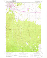
USGS Historical Quadrangle in GeoPDF.
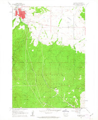
USGS Historical Quadrangle in GeoPDF.
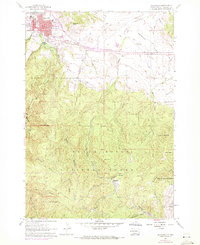
USGS Historical Quadrangle in GeoPDF.
Core Research Center, core E249, from well operated by AXEM RESOURCESRaw Properties from download, web scrape, MapServer, and Macrostrat API{"Lib Num": "E249", "API Num": "3300901950", "Operator": "AXEM RESOURCES", "Well Name": "15-22 LAKEVIEW", "Field": "WILDCAT", "State": "ND", "County": "BOTTINEAU", "Type": "SLABBED", "Photos": "T", "Thin Sec": "F", "Analysis": "F", "Latitude": "48.924059", "Longitude": "-101.024532", "coordinates_geohash": "cb8nm4k5mc95", "Source": "FROM STATE RECORDS", "Security Flag": "VIEWING ALLOWED, NO SAMPLING UNLESS APPROVED", "crc_collection_name": "core", "sb_parent_id": "4f4e49dae4b07f02db5e0486", "intervals": [{"Formation": "SPEARFISH", "Age": "PERM", "Min Depth": "3368", "Max Depth":...
Core Research Center, core S785, from well operated by PHILLIPS PETROLEUMRaw Properties from download, web scrape, MapServer, and Macrostrat API{"Lib Num": "S785", "API Num": "2510521355", "Operator": "PHILLIPS PETROLEUM", "Well Name": "1-24 THOENY FEDERAL A", "Field": "WILDCAT", "State": "MT", "County": "VALLEY", "Type": "SLABBED", "Photos": "F", "Thin Sec": "F", "Analysis": "F", "Latitude": "48.868131", "Longitude": "-106.945601", "coordinates_geohash": "c8eyn2ht6zuh", "Source": "FROM STATE RECORDS", "Security Flag": "NO SPECIAL RESTRICTIONS", "crc_collection_name": "core", "sb_parent_id": "4f4e49dae4b07f02db5e0486", "intervals": [{"Formation": "SPEARFISH", "Age": "TRIA", "Min Depth": "4508", "Max Depth": "4509"},...
Categories: Physical Item;
Tags: Bearpaw Formation,
Bearpaw Formation,
CHARLES /SALT/,
Campanian,
MISS,
USGS Historical Quadrangle in GeoPDF.
Core Research Center, core R253, from well operated by AMOCO PRODUCTIONRaw Properties from download, web scrape, MapServer, and Macrostrat API{"Lib Num": "R253", "API Num": "4902720145", "Operator": "AMOCO PRODUCTION", "Well Name": "2 HAT CREEK", "Field": "HAT CREEK", "State": "WY", "County": "NIOBRARA", "Type": "FULL", "Photos": "F", "Thin Sec": "F", "Analysis": "F", "Latitude": "42.93142", "Longitude": "-104.83383", "coordinates_geohash": "9xtknrqmdswx", "Source": "FROM STATE RECORDS", "Security Flag": "NO SPECIAL RESTRICTIONS", "crc_collection_name": "core", "sb_parent_id": "4f4e49dae4b07f02db5e0486", "intervals": [{"Formation": "CANYON SPRINGS", "Age": "JURA", "Min Depth": "10925", "Max Depth": "11005"}, {"Formation":...
Categories: Physical Item;
Tags: CANYON SPRINGS,
Fort Union Formation - Tullock Member,
JURA,
Paleocene,
SPEARFISH,
Core Research Center, core C547, from well operated by KENNEDY & MITCHELLRaw Properties from download, web scrape, MapServer, and Macrostrat API{"Lib Num": "C547", "API Num": "3300901687", "Operator": "KENNEDY & MITCHELL", "Well Name": "55-753-2 SJULE CARBURY", "Field": "WILDCAT", "State": "ND", "County": "BOTTINEAU", "Type": "SLABBED", "Photos": "T", "Thin Sec": "F", "Analysis": "F", "Latitude": "48.913081", "Longitude": "-100.557929", "coordinates_geohash": "cb8qr8rgq7jt", "Source": "FROM STATE RECORDS", "Security Flag": "NO SPECIAL RESTRICTIONS", "crc_collection_name": "core", "sb_parent_id": "4f4e49dae4b07f02db5e0486", "intervals": [{"Formation": "SPEARFISH", "Age": "TRIA", "Min Depth": "2948", "Max Depth":...
Categories: Physical Item;
Tags: Fox Hills Formation,
Fox Hills Formation,
Late Cretaceous,
SPEARFISH,
TRIA,
Core Research Center, cutting HH01737, from well operated by SPYGLASS CEDAR CREEKRaw Properties from download, web scrape, MapServer, and Macrostrat API{"Lib Num": "HH01737", "API Num": "4006320605", "Operator": "SPYGLASS CEDAR CREEK", "Well Name": "4-16 STATE", "Field": "WILDCAT", "State": "SD", "County": "HARDING", "Thin Sec": "F", "Analysis": "T", "Latitude": "45.61614", "Longitude": "-103.64551", "coordinates_geohash": "c8n792ptk8f6", "Source": "PROVIDED BY DONOR", "Min": "850", "Max": "5970", "Security Flag": null, "crc_collection_name": "cutting", "sb_parent_id": "4f4e49d8e4b07f02db5df2d2", "intervals": [{"Formation": "MINNELUSA", "Age": "PERMIAN", "Min Depth": "5685", "Max Depth": "5970"}, {"Formation": "OPECHE",...
|

|
