Filters: Tags: SPRING (X)
159 results (49ms)|
Filters
Date Range
Extensions Types
Contacts
Categories Tag Types Tag Schemes |
Detrended, modelled first leaf dates for 856 sites across North America for the period 1900–2008 are used to examine how the El Niño Southern Oscillation (ENSO) and the Pacific Decadal Oscillation (PDO) separately and together might influence the timing of spring. Although spring (mean March through April) ENSO and PDO signals are apparent in first leaf dates, the signals are not statistically significant (at a 95% confidence level (p < 0.05)) for most sites. The most significant ENSO/PDO signal in first leaf dates occurs for El Niño and positive PDO conditions. An analysis of the spatial distributions of first leaf dates for separate and combined ENSO/PDO conditions features a northwest–southeast dipole that is...
The National Hydrography Dataset (NHD) is a feature-based database that interconnects and uniquely identifies the stream segments or reaches that make up the nation's surface water drainage system. NHD data was originally developed at 1:100,000-scale and exists at that scale for the whole country. This high-resolution NHD, generally developed at 1:24,000/1:12,000 scale, adds detail to the original 1:100,000-scale NHD. (Data for Alaska, Puerto Rico and the Virgin Islands was developed at high-resolution, not 1:100,000 scale.) Local resolution NHD is being developed where partners and data exist. The NHD contains reach codes for networked features, flow direction, names, and centerline representations for areal water...
The NHDPlus Version 1.0 is an integrated suite of application-ready geospatial data sets that incorporate many of the best features of the National Hydrography Dataset (NHD) and the National Elevation Dataset (NED). The NHDPlus includes a stream network (based on the 1:100,000-scale NHD), improved networking, naming, and "value-added attributes" (VAA's). NHDPlus also includes elevation-derived catchments (drainage areas) produced using a drainage enforcement technique first broadly applied in New England, and thus dubbed "The New-England Method". This technique involves "burning-in" the 1:100,000-scale NHD and when available building "walls" using the national Watershed Boundary Dataset (WBD). The resulting modified...
These data were released prior to the October 1, 2016 effective date for the USGS’s policy dictating the review, approval, and release of scientific data as referenced in USGS Survey Manual Chapter 502.8 Fundamental Science Practices: Review and Approval of Scientific Data for Release. This map shows the USGS (United States Geologic Survey), NWIS (National Water Inventory System) Hydrologic Data Sites for Millard County, Utah. The scope and purpose of NWIS is defined on the web site: http://water.usgs.gov/public/pubs/FS/FS-027-98/
These data were released prior to the October 1, 2016 effective date for the USGS’s policy dictating the review, approval, and release of scientific data as referenced in USGS Survey Manual Chapter 502.8 Fundamental Science Practices: Review and Approval of Scientific Data for Release. This map shows the USGS (United States Geologic Survey), NWIS (National Water Inventory System) Hydrologic Data Sites for Juab County, Utah. The scope and purpose of NWIS is defined on the web site: http://water.usgs.gov/public/pubs/FS/FS-027-98/
What are current conditions for important park natural resources? What are the critical data and knowledge gaps? What are some of the factors that are influencing park resource conditions? Natural Resource Condition Assessments (NRCAs) evaluate and report on the above for a subset of important natural resources in national park units (hereafter, parks). Focal study resources and indicators are selected on a park-by-park basis, guided by use of structured resource assessment and reporting frameworks. Considerations include park resource setting and enabling legislation (what are this park's most important natural resources?) and presently available data and expertise (what can be evaluated at this time?). In addition...
Categories: Data;
Types: ArcGIS REST Map Service,
Map Service,
OGC WFS Layer,
OGC WMS Layer,
OGC WMS Service;
Tags: Chihuahuan Desert,
English,
GIS,
Madrean,
Mojave Desert,
A Vision for the Chihuahuan Desert The Chihuahuan Desert, shared by two nations, is one of the most biologically rich desert ecoregions in the world, alive with large mammals, birds, reptiles and an unmatched diversity of cactus species. The desert’s rivers, streams and springs are considered to be of global significance, home to fish species found nowhere else on earth. Our vision is a Chihuahuan Desert where governments, local communities, non-governmental organizations, academic institutions, landowners, and other stakeholders are working together to ensure that the richness and diversity of wildlife, habitats, natural communities, and ecological processes of the Chihuahuan Desert are conserved and, where necessary,...
Types: Map Service,
OGC WFS Layer,
OGC WMS Layer,
OGC WMS Service;
Tags: Chihuahuan Desert,
assessment,
biodiversity,
connectivity,
development,
The National Forest Management Act (NFMA) of 1976 requires every national forest or grassland managed by the U.S. Forest Service to develop and maintain a Land and Resource Management Plan (often referred to as a forest plan). The forest plan is the principle long-range guidance document for each forest or grassland, providing direction for project and activity decision making. Forest plans articulate goals and objectives, the kinds of uses that are suitable for areas of a national forest, management standards and guidelines that apply to different kinds of activities, and the designation of special areas like Research Natural Areas. Forest plans are strategic in nature and do not compel any action or authorize...
Types: Map Service,
OGC WFS Layer,
OGC WMS Layer,
OGC WMS Service;
Tags: Arizona,
New Mexico,
desert,
fire,
grassland,
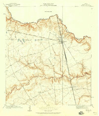
USGS Historical Quadrangle in GeoPDF.
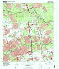
USGS Historical Quadrangle in GeoPDF.

The Watershed Boundary Dataset (WBD) from The National Map (TNM) defines the perimeter of drainage areas formed by the terrain and other landscape characteristics. The drainage areas are nested within each other so that a large drainage area, such as the Upper Mississippi River, will be composed of multiple smaller drainage areas, such as the Wisconsin River. Each of these smaller areas can further be subdivided into smaller and smaller drainage areas. The WBD uses six different levels in this hierarchy, with the smallest averaging about 30,000 acres. The WBD is made up of polygons nested into six levels of data respectively defined by Regions, Subregions, Basins, Subbasins, Watersheds, and Subwatersheds. For additional...

The USGS National Hydrography Dataset (NHD) service from The National Map (TNM) is a comprehensive set of digital spatial data that encodes information about naturally occurring and constructed bodies of surface water (lakes, ponds, and reservoirs), paths through which water flows (canals, ditches, streams, and rivers), and related entities such as point features (springs, wells, stream gages, and dams). The information encoded about these features includes classification and other characteristics, delineation, geographic name, position and related measures, a "reach code" through which other information can be related to the NHD, and the direction of water flow. The network of reach codes delineating water and...

USGS Historical Quadrangle in GeoPDF.
These data were released prior to the October 1, 2016 effective date for the USGS’s policy dictating the review, approval, and release of scientific data as referenced in USGS Survey Manual Chapter 502.8 Fundamental Science Practices: Review and Approval of Scientific Data for Release. This map shows the USGS (United States Geologic Survey), NWIS (National Water Inventory System) Hydrologic Data Sites for Weber County, Utah. The scope and purpose of NWIS is defined on the web site: https://water.usgs.gov/public/pubs/FS/FS-027-98/
These data were released prior to the October 1, 2016 effective date for the USGS’s policy dictating the review, approval, and release of scientific data as referenced in USGS Survey Manual Chapter 502.8 Fundamental Science Practices: Review and Approval of Scientific Data for Release. This map shows the USGS (United States Geologic Survey), NWIS (National Water Inventory System) Hydrologic Data Sites for Beaver County, Utah. The scope and purpose of NWIS is defined on the web site: http://water.usgs.gov/public/pubs/FS/FS-027-98/
These data were released prior to the October 1, 2016 effective date for the USGS’s policy dictating the review, approval, and release of scientific data as referenced in USGS Survey Manual Chapter 502.8 Fundamental Science Practices: Review and Approval of Scientific Data for Release. This map shows the USGS (United States Geologic Survey), NWIS (National Water Inventory System) Hydrologic Data Sites for Boxelder County, Utah. The scope and purpose of NWIS is defined on the web site: http://water.usgs.gov/public/pubs/FS/FS-027-98/
These data were released prior to the October 1, 2016 effective date for the USGS’s policy dictating the review, approval, and release of scientific data as referenced in USGS Survey Manual Chapter 502.8 Fundamental Science Practices: Review and Approval of Scientific Data for Release. This map shows the USGS (United States Geologic Survey), NWIS (National Water Inventory System) Hydrologic Data Sites for Carbon County, Utah. The scope and purpose of NWIS is defined on the web site: http://water.usgs.gov/public/pubs/FS/FS-027-98/
These data were released prior to the October 1, 2016 effective date for the USGS’s policy dictating the review, approval, and release of scientific data as referenced in USGS Survey Manual Chapter 502.8 Fundamental Science Practices: Review and Approval of Scientific Data for Release. This map shows the USGS (United States Geologic Survey), NWIS (National Water Inventory System) Hydrologic Data Sites for Emery County, Utah. The scope and purpose of NWIS is defined on the web site: http://water.usgs.gov/public/pubs/FS/FS-027-98/
These data were released prior to the October 1, 2016 effective date for the USGS’s policy dictating the review, approval, and release of scientific data as referenced in USGS Survey Manual Chapter 502.8 Fundamental Science Practices: Review and Approval of Scientific Data for Release. This map shows the USGS (United States Geologic Survey), NWIS (National Water Inventory System) Hydrologic Data Sites for Iron County, Utah. The scope and purpose of NWIS is defined on the web site: http://water.usgs.gov/public/pubs/FS/FS-027-98/
These data were released prior to the October 1, 2016 effective date for the USGS’s policy dictating the review, approval, and release of scientific data as referenced in USGS Survey Manual Chapter 502.8 Fundamental Science Practices: Review and Approval of Scientific Data for Release. This map shows the USGS (United States Geologic Survey), NWIS (National Water Inventory System) Hydrologic Data Sites for Grand County, Utah. The scope and purpose of NWIS is defined on the web site: http://water.usgs.gov/public/pubs/FS/FS-027-98/
|

|
