Filters: Tags: STANFORD (X)
39 results (92ms)|
Filters
Date Range
Types Contacts
Categories Tag Types Tag Schemes |
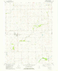
This data set contains imagery from the National Agriculture Imagery Program (NAIP). The NAIP program is administered by USDA FSA and has been established to support two main FSA strategic goals centered on agricultural production. These are, increase stewardship of America's natural resources while enhancing the environment, and to ensure commodities are procured and distributed effectively and efficiently to increase food security. The NAIP program supports these goals by acquiring and providing ortho imagery that has been collected during the agricultural growing season in the U.S. The NAIP ortho imagery is tailored to meet FSA requirements and is a fundamental tool used to support FSA farm and conservation programs....
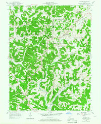
USGS Historical Quadrangle in GeoPDF.
This portion of the data release presents linescan images (photographs) from vibracores collected from Searsville Lake, a reservoir in Jasper Ridge Biological Preserve, Stanford, California in October 2018 (USGS Field Activity 2018-682-FA). Images were obtained from two vibracores (JRBP2018-VC01A and JRBP2018-VC01B) at 50-micron (200 pixel per cm) resolution. Color images in 16-bit TIFF format are provided for each core segment, along with proprietary metadata files containing image scaling information.
Categories: Data;
Tags: CMHRP,
Coastal and Marine Hazards and Resources Program,
Jasper Ridge,
PCMSC,
Pacific Coastal and Marine Science Center,
This data set contains imagery from the National Agriculture Imagery Program (NAIP). The NAIP program is administered by USDA FSA and has been established to support two main FSA strategic goals centered on agricultural production. These are, increase stewardship of America's natural resources while enhancing the environment, and to ensure commodities are procured and distributed effectively and efficiently to increase food security. The NAIP program supports these goals by acquiring and providing ortho imagery that has been collected during the agricultural growing season in the U.S. The NAIP ortho imagery is tailored to meet FSA requirements and is a fundamental tool used to support FSA farm and conservation programs....
This data set contains imagery from the National Agriculture Imagery Program (NAIP). The NAIP program is administered by USDA FSA and has been established to support two main FSA strategic goals centered on agricultural production. These are, increase stewardship of America's natural resources while enhancing the environment, and to ensure commodities are procured and distributed effectively and efficiently to increase food security. The NAIP program supports these goals by acquiring and providing ortho imagery that has been collected during the agricultural growing season in the U.S. The NAIP ortho imagery is tailored to meet FSA requirements and is a fundamental tool used to support FSA farm and conservation programs....
This portion of the data release presents sediment grain-size data from vibracores collected from Searsville Lake, Jasper Ridge Biological Preserve, Stanford, California in October 2018 (USGS Field Activity 2018-682-FA). In total, 36 samples were subsampled from two vibracores: JRBP2018-VC01A and JRBP2018-VC01B. The grain-size distributions of samples were determined using standard techniques developed by the USGS Pacific Coastal and Marine Science Center sediment lab. The grain-size data are provided in a comma-delimited spreadsheet (.csv).
Categories: Data;
Tags: CMHRP,
Coastal and Marine Hazards and Resources Program,
Jasper Ridge,
PCMSC,
Pacific Coastal and Marine Science Center,
USGS Historical Quadrangle in GeoPDF.
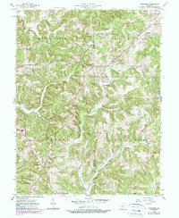
USGS Historical Quadrangle in GeoPDF.
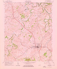
USGS Historical Quadrangle in GeoPDF.
This data set contains imagery from the National Agriculture Imagery Program (NAIP). The NAIP program is administered by USDA FSA and has been established to support two main FSA strategic goals centered on agricultural production. These are, increase stewardship of America's natural resources while enhancing the environment, and to ensure commodities are procured and distributed effectively and efficiently to increase food security. The NAIP program supports these goals by acquiring and providing ortho imagery that has been collected during the agricultural growing season in the U.S. The NAIP ortho imagery is tailored to meet FSA requirements and is a fundamental tool used to support FSA farm and conservation programs....
USGS Historical Quadrangle in GeoPDF.
This portion of the data release presents computed tomography (CT) images from vibracores collected from Searsville Lake, Jasper Ridge Biological Preserve, Stanford, California in October 2018 (USGS Field Activity 2018-682-FA). A Geotek Rotating X-Ray CT (RXCT) system was used to acquire x-ray images and perform CT reconstructions of unsplit core segments. The full three-dimensional data set consists of individual axial slices which are reconstructed images in TIFF format. These axial slices are oriented perpendicular to the long axis of the core. Two-dimensional orthogonal views are also provided that illustrate representative downcore slabs of each core. Geotek software-proprietary XML files are provided in each...
Categories: Data;
Tags: CMHRP,
Coastal and Marine Hazards and Resources Program,
Jasper Ridge,
PCMSC,
Pacific Coastal and Marine Science Center,
This portion of the data release presents gamma-ray bulk density measurements of vibracore JRBP2018-VC01B collected from Searsville Lake, Jasper Ridge Biological Preserve, Stanford, California in October 2018 (USGS Field Activity 2018-682-FA). The gamma-ray bulk density data are provided in a comma-delimited file (.csv).
Categories: Data;
Tags: CMHRP,
Coastal and Marine Hazards and Resources Program,
Jasper Ridge,
PCMSC,
Pacific Coastal and Marine Science Center,
This data set contains imagery from the National Agriculture Imagery Program (NAIP). The NAIP program is administered by USDA FSA and has been established to support two main FSA strategic goals centered on agricultural production. These are, increase stewardship of America's natural resources while enhancing the environment, and to ensure commodities are procured and distributed effectively and efficiently to increase food security. The NAIP program supports these goals by acquiring and providing ortho imagery that has been collected during the agricultural growing season in the U.S. The NAIP ortho imagery is tailored to meet FSA requirements and is a fundamental tool used to support FSA farm and conservation programs....
USGS Historical Quadrangle in GeoPDF.
This data set contains imagery from the National Agriculture Imagery Program (NAIP). The NAIP program is administered by USDA FSA and has been established to support two main FSA strategic goals centered on agricultural production. These are, increase stewardship of America's natural resources while enhancing the environment, and to ensure commodities are procured and distributed effectively and efficiently to increase food security. The NAIP program supports these goals by acquiring and providing ortho imagery that has been collected during the agricultural growing season in the U.S. The NAIP ortho imagery is tailored to meet FSA requirements and is a fundamental tool used to support FSA farm and conservation programs....
This data set contains imagery from the National Agriculture Imagery Program (NAIP). The NAIP program is administered by USDA FSA and has been established to support two main FSA strategic goals centered on agricultural production. These are, increase stewardship of America's natural resources while enhancing the environment, and to ensure commodities are procured and distributed effectively and efficiently to increase food security. The NAIP program supports these goals by acquiring and providing ortho imagery that has been collected during the agricultural growing season in the U.S. The NAIP ortho imagery is tailored to meet FSA requirements and is a fundamental tool used to support FSA farm and conservation programs....
USGS Historical Quadrangle in GeoPDF.
This portion of the data release presents measurements and data from two vibracores (JRBP2018-VC01A and JRBP2018-VC01B) collected from Searsville Lake, a reservoir in the Jasper Ridge Biological Preserve, Stanford, California, on October 29, 2018 (USGS Field Activity 2018-682-FA). Vibracoring introduced significant amounts of sediment compaction. The core depths in other datasets of this data release are not corrected for compaction. Translated depths are provided in this portion of the data release that return the tops of each core to the lakebed surface (0 cm).
Categories: Data;
Tags: CMHRP,
Coastal and Marine Hazards and Resources Program,
Jasper Ridge,
PCMSC,
Pacific Coastal and Marine Science Center,
|

|
