Filters
Date Range
Types
Contacts
Categories
Tag Types
Tag Schemes
|
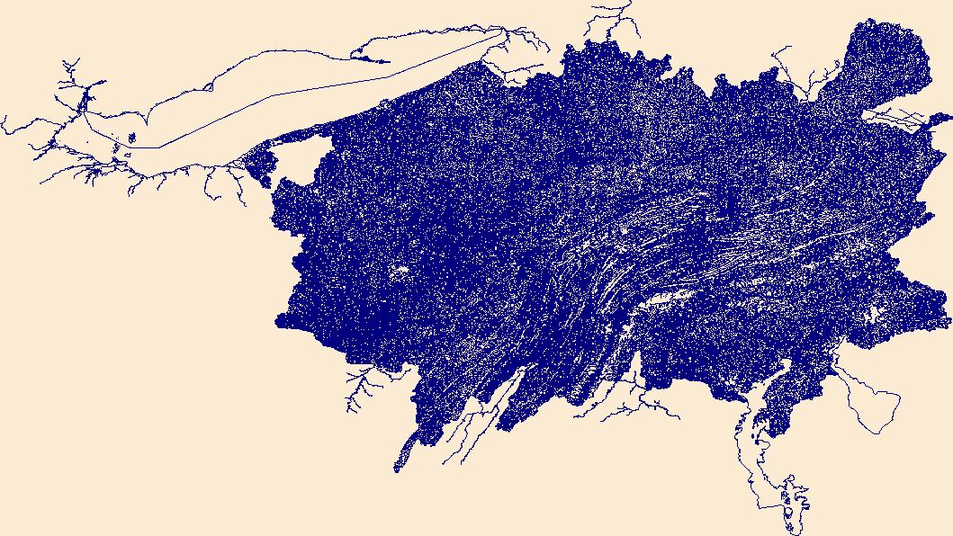
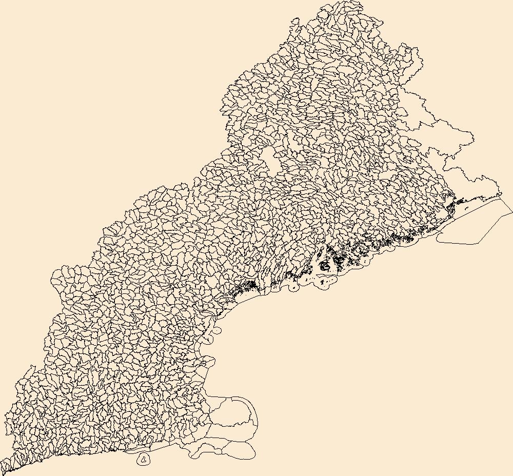
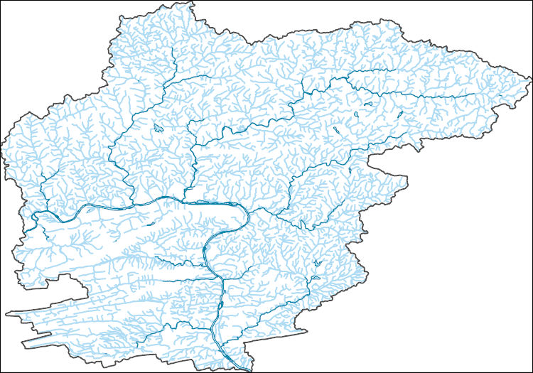
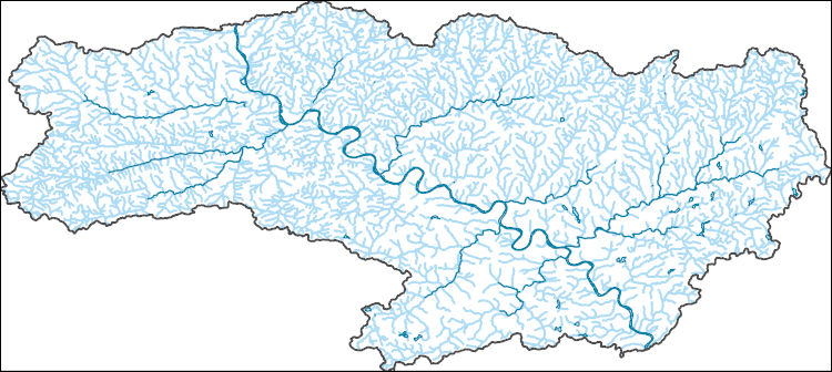
The National Hydrography Dataset (NHD) is a feature-based database that interconnects and uniquely identifies the stream segments or reaches that make up the nation's surface water drainage system. NHD data was originally developed at 1:100,000-scale and exists at that scale for the whole country. This high-resolution NHD, generally developed at 1:24,000/1:12,000 scale, adds detail to the original 1:100,000-scale NHD. (Data for Alaska, Puerto Rico and the Virgin Islands was developed at high-resolution, not 1:100,000 scale.) Local resolution NHD is being developed where partners and data exist. The NHD contains reach codes for networked features, flow direction, names, and centerline representations for areal water...
Tags: Adams,
Administrative watershed units,
Administrative watershed units,
Allegheny,
Area of Complex Channels, All tags...
Area to be submerged,
Armstrong,
Basin,
Basin,
Bay/Inlet,
Beaver,
Bedford,
Berks,
Blair,
Boundaries,
Boundary,
Bradford,
Bridge,
Bucks,
Butler,
Cambria,
Cameron,
Canal/Ditch,
Carbon,
Centre,
Chester,
Clarion,
Clearfield,
Clinton,
Coastline,
Columbia,
Connector,
Crawford,
Cumberland,
Dam/Weir,
Dauphin,
Delaware,
Downloadable Data,
Drainage areas for surface water,
Drainageway,
Elk,
Erie,
Esri File GeoDatabase 10,
Estuary,
Fayette,
FileGDB,
Flow direction network,
Flume,
ForeShore,
Forest,
Franklin,
Fulton,
Gaging Station,
Gate,
Greene,
HU10,
HU12,
HU14,
HU16,
HU2,
HU4,
HU6,
HU8,
HUC,
Hazard Zone,
Huntingdon,
Hydrographic,
Hydrography,
Hydrography,
Hydrography,
Hydrologic Unit Code,
Hydrologic Units,
Ice mass,
Indiana,
Inundation Area,
Jefferson,
Juniata,
Lackawanna,
Lancaster,
Lawrence,
Lebanon,
Lehigh,
Levee,
Line,
Lock Chamber,
Luzerne,
Lycoming,
Marsh,
McKean,
Mercer,
Mifflin,
Monroe,
Montgomery,
Montour,
National Hydrography Dataset (NHD),
National Hydrography Dataset (NHD) Best Resolution,
National Hydrography Dataset (NHD) Best Resolution,
Nonearthen Shore,
Northampton,
Northumberland,
Orthoimage,
PA,
Pennsylvania,
Perry,
Philadelphia,
Pike,
Playa,
Point,
PointEvent,
Pond,
Potter,
Rapids,
Rapids,
Reach,
Reach code,
Reef,
Region,
Reservoir,
Rock,
Schuylkill,
Sea/Ocean,
Sink/Rise,
Snyder,
Somerset,
Sounding Datum Line,
Special Use Zone,
Special Use Zone Limit,
Spillway,
State,
State,
State_Pennsylvania,
Stream,
Stream/River,
Sub-basin,
Sub-region,
Subbasin,
Submerged Stream,
Subregion,
Subwatershed,
Sullivan,
Surface water systems,
Susquehanna,
Swamp,
Tioga,
Topographic,
Tunnel,
US,
Underground Conduit,
Union,
United States,
Venango,
WBD,
WBD,
Wall,
Warren,
Wash,
Washington,
Water Intake Outflow,
Waterfall,
Watershed,
Watershed Boundaries,
Watershed Boundary Dataset,
Watershed Boundary Dataset,
Wayne,
Well,
Westmoreland,
Wyoming,
York,
artificial path,
boundaries,
dams,
drainage systems and characteristics,
inlandWaters,
lakes,
ngda,
rivers, Fewer tags
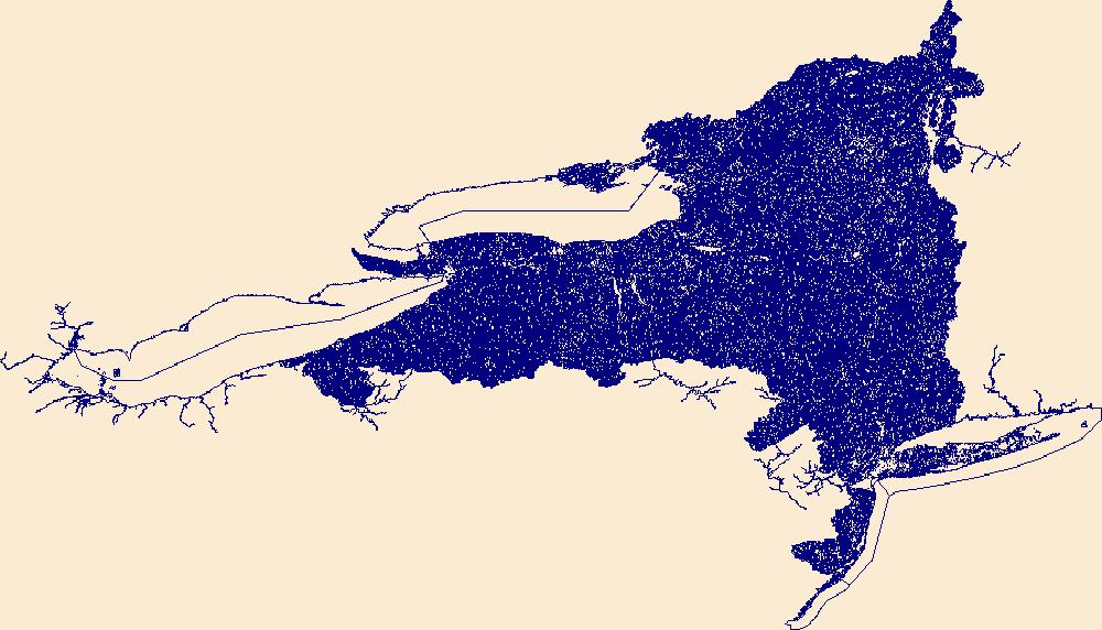
The National Hydrography Dataset (NHD) is a feature-based database that interconnects and uniquely identifies the stream segments or reaches that make up the nation's surface water drainage system. NHD data was originally developed at 1:100,000-scale and exists at that scale for the whole country. This high-resolution NHD, generally developed at 1:24,000/1:12,000 scale, adds detail to the original 1:100,000-scale NHD. (Data for Alaska, Puerto Rico and the Virgin Islands was developed at high-resolution, not 1:100,000 scale.) Local resolution NHD is being developed where partners and data exist. The NHD contains reach codes for networked features, flow direction, names, and centerline representations for areal water...
Tags: Administrative watershed units,
Administrative watershed units,
Albany,
Allegany,
Area of Complex Channels, All tags...
Area to be submerged,
Basin,
Basin,
Bay/Inlet,
Boundaries,
Boundary,
Bridge,
Bronx,
Broome,
Canal/Ditch,
Cattaraugus,
Cayuga,
Chautauqua,
Chemung,
Chenango,
Clinton,
Coastline,
Columbia,
Connector,
Cortland,
Dam/Weir,
Delaware,
Downloadable Data,
Drainage areas for surface water,
Drainageway,
Dutchess,
Erie,
Esri File GeoDatabase 10,
Essex,
Estuary,
FileGDB,
Flow direction network,
Flume,
ForeShore,
Franklin,
Fulton,
Gaging Station,
Gate,
Genesee,
Greene,
HU10,
HU12,
HU14,
HU16,
HU2,
HU4,
HU6,
HU8,
HUC,
Hamilton,
Hazard Zone,
Herkimer,
Hydrographic,
Hydrography,
Hydrography,
Hydrography,
Hydrologic Unit Code,
Hydrologic Units,
Ice mass,
Inundation Area,
Jefferson,
Kings,
Levee,
Lewis,
Line,
Livingston,
Lock Chamber,
Madison,
Marsh,
Monroe,
Montgomery,
NY,
Nassau,
National Hydrography Dataset (NHD),
National Hydrography Dataset (NHD) Best Resolution,
National Hydrography Dataset (NHD) Best Resolution,
New York,
New York,
Niagara,
Nonearthen Shore,
Oneida,
Onondaga,
Ontario,
Orange,
Orleans,
Orthoimage,
Oswego,
Otsego,
Playa,
Point,
PointEvent,
Pond,
Putnam,
Queens,
Rapids,
Rapids,
Reach,
Reach code,
Reef,
Region,
Rensselaer,
Reservoir,
Richmond,
Rock,
Rockland,
Saratoga,
Schenectady,
Schoharie,
Schuyler,
Sea/Ocean,
Seneca,
Sink/Rise,
Sounding Datum Line,
Special Use Zone,
Special Use Zone Limit,
Spillway,
St. Lawrence,
State,
State,
State_New York,
Steuben,
Stream,
Stream/River,
Sub-basin,
Sub-region,
Subbasin,
Submerged Stream,
Subregion,
Subwatershed,
Suffolk,
Sullivan,
Surface water systems,
Swamp,
Tioga,
Tompkins,
Topographic,
Tunnel,
US,
Ulster,
Underground Conduit,
United States,
WBD,
WBD,
Wall,
Warren,
Wash,
Washington,
Water Intake Outflow,
Waterfall,
Watershed,
Watershed Boundaries,
Watershed Boundary Dataset,
Watershed Boundary Dataset,
Wayne,
Well,
Westchester,
Wyoming,
Yates,
artificial path,
boundaries,
dams,
drainage systems and characteristics,
inlandWaters,
lakes,
ngda,
rivers, Fewer tags
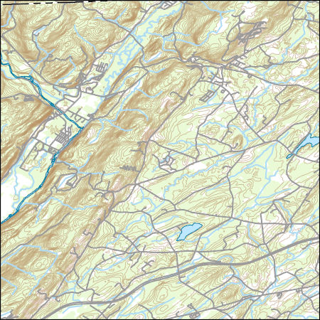
Layers of geospatial data include contours, boundaries, land cover, hydrography, roads, transportation, geographic names, structures, and other selected map features.
Tags: 7.5 x 7.5 minute,
7_5_Min,
Combined Vector,
Combined Vector,
Combined Vector, All tags...
Downloadable Data,
GeoPackage,
NY,
New York,
Open Geospatial Consortium GeoPackage 1.2,
Orange,
Public Land Survey System,
Sullivan,
Topo Map Vector Data,
US,
United States,
boundary,
contours,
geographic names,
hydrography,
structures,
transportation,
woodland, Fewer tags
Layers of geospatial data include contours, boundaries, land cover, hydrography, roads, transportation, geographic names, structures, and other selected map features.
Tags: 7.5 x 7.5 minute,
7_5_Min,
Combined Vector,
Combined Vector,
Combined Vector, All tags...
Delaware,
Downloadable Data,
GeoPackage,
NY,
New York,
Open Geospatial Consortium GeoPackage 1.2,
Public Land Survey System,
Sullivan,
Topo Map Vector Data,
US,
United States,
boundary,
contours,
geographic names,
hydrography,
structures,
transportation,
woodland, Fewer tags
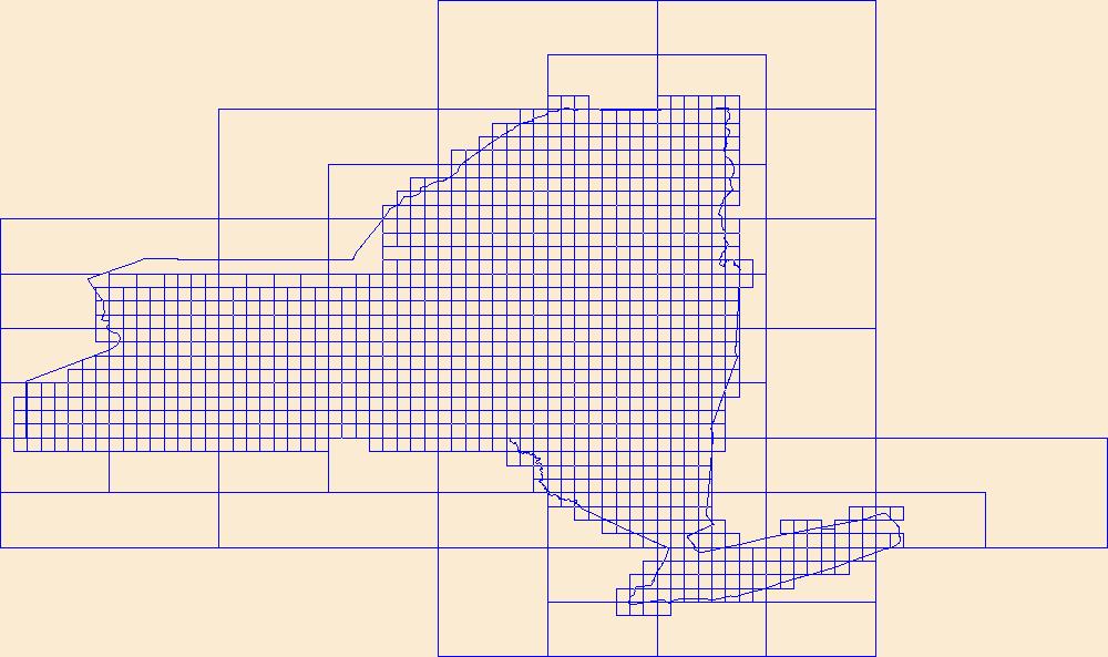
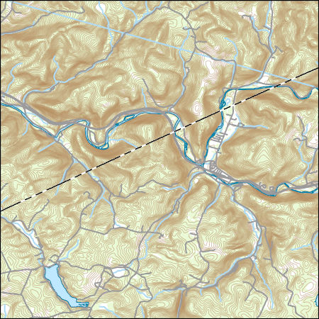
This data represents the map extent for current and historical USGS topographic maps for the United States and Territories, including 1 X 2 Degree, 1 X 1 Degree, 30 X 60 Minute, 15 X 15 Minute, 7.5 X 7.5 Minute, and 3.75 X 3.75 Minute. The grid was generated using ESRI ArcInfo GIS software.
Types: Citation;
Tags: Albany,
Allegany,
Boundaries,
Bronx,
Broome, All tags...
Cattaraugus,
Cayuga,
Chautauqua,
Chemung,
Chenango,
Clinton,
Columbia,
Cortland,
Delaware,
Downloadable Data,
Dutchess,
Erie,
Esri Shapefile nan,
Essex,
Franklin,
Fulton,
Genesee,
Greene,
Hamilton,
Herkimer,
Jefferson,
Kings,
Lewis,
Livingston,
Madison,
Map Indices,
Map Indices,
Map Indices,
Monroe,
Montgomery,
NY,
Nassau,
New York,
New York,
Niagara,
Oneida,
Onondaga,
Ontario,
Orange,
Orleans,
Oswego,
Otsego,
Putnam,
Queens,
Rensselaer,
Richmond,
Rockland,
Saratoga,
Schenectady,
Schoharie,
Schuyler,
Seneca,
Shapefile,
St. Lawrence,
State,
State,
Steuben,
Suffolk,
Sullivan,
Tioga,
Tompkins,
US,
Ulster,
United States,
United States of America,
Warren,
Washington,
Wayne,
Westchester,
Wyoming,
Yates,
cells,
map indices,
polygon grid, Fewer tags
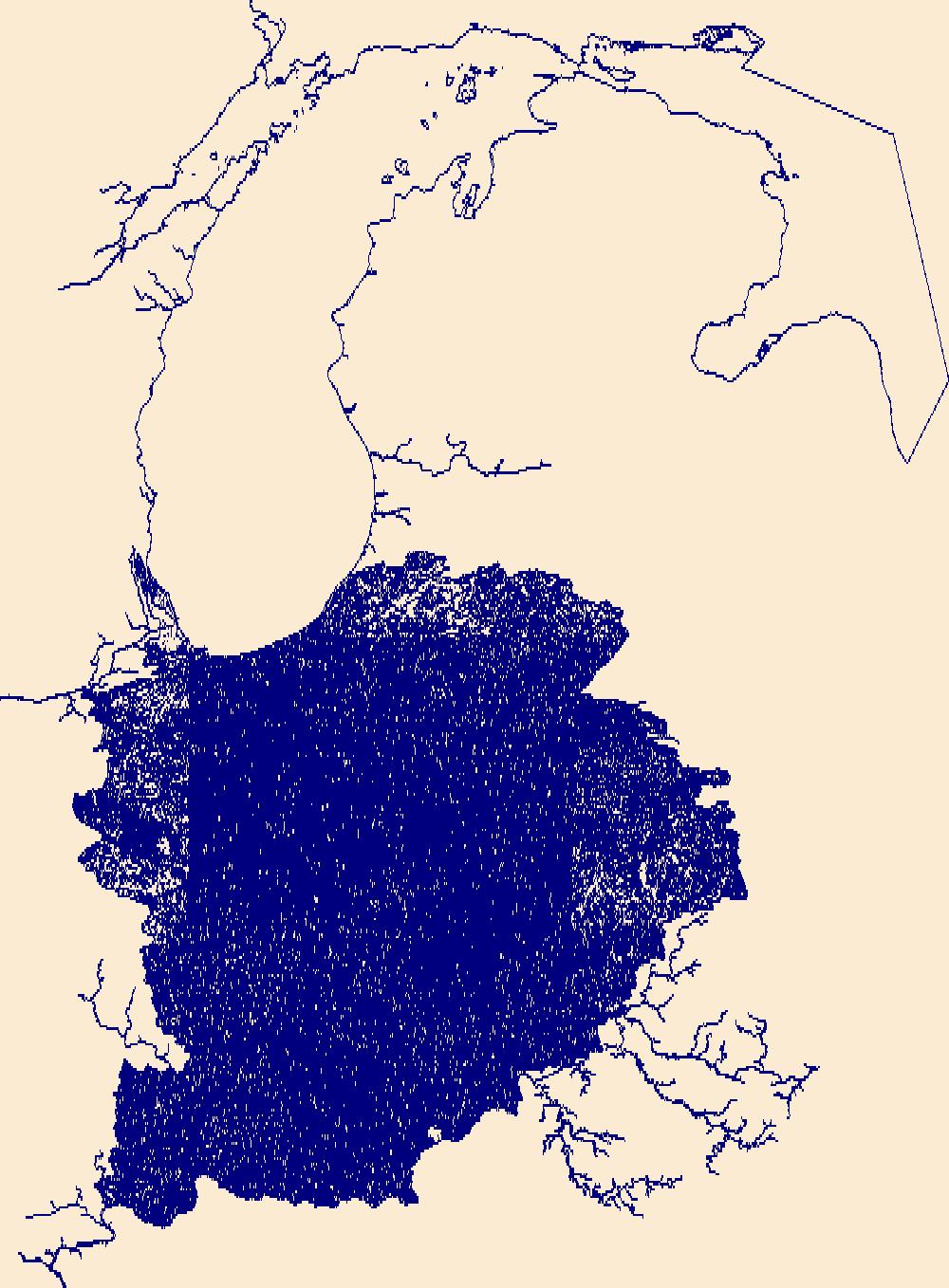
The National Hydrography Dataset (NHD) is a feature-based database that interconnects and uniquely identifies the stream segments or reaches that make up the nation's surface water drainage system. NHD data was originally developed at 1:100,000-scale and exists at that scale for the whole country. This high-resolution NHD, generally developed at 1:24,000/1:12,000 scale, adds detail to the original 1:100,000-scale NHD. (Data for Alaska, Puerto Rico and the Virgin Islands was developed at high-resolution, not 1:100,000 scale.) Local resolution NHD is being developed where partners and data exist. The NHD contains reach codes for networked features, flow direction, names, and centerline representations for areal water...
Tags: Adams,
Administrative watershed units,
Administrative watershed units,
Allen,
Area of Complex Channels, All tags...
Area to be submerged,
Bartholomew,
Basin,
Basin,
Bay/Inlet,
Benton,
Blackford,
Boone,
Boundaries,
Boundary,
Bridge,
Brown,
Canal/Ditch,
Carroll,
Cass,
Clark,
Clay,
Clinton,
Coastline,
Connector,
Crawford,
Dam/Weir,
Daviess,
DeKalb,
Dearborn,
Decatur,
Delaware,
Downloadable Data,
Drainage areas for surface water,
Drainageway,
Dubois,
Elkhart,
Estuary,
Fayette,
Flow direction network,
Floyd,
Flume,
ForeShore,
Fountain,
Franklin,
Fulton,
Gaging Station,
Gate,
GeoPackage,
Gibson,
Grant,
Greene,
HU10,
HU12,
HU14,
HU16,
HU2,
HU4,
HU6,
HU8,
HUC,
Hamilton,
Hancock,
Harrison,
Hazard Zone,
Hendricks,
Henry,
Howard,
Huntington,
Hydrographic,
Hydrography,
Hydrography,
Hydrography,
Hydrologic Unit Code,
Hydrologic Units,
IN,
Ice mass,
Indiana,
Inundation Area,
Jackson,
Jasper,
Jay,
Jefferson,
Jennings,
Johnson,
Knox,
Kosciusko,
LaGrange,
LaPorte,
Lake,
Lawrence,
Levee,
Line,
Lock Chamber,
Madison,
Marion,
Marsh,
Marshall,
Martin,
Miami,
Monroe,
Montgomery,
Morgan,
National Hydrography Dataset (NHD),
National Hydrography Dataset (NHD) Best Resolution,
National Hydrography Dataset (NHD) Best Resolution,
Newton,
Noble,
Nonearthen Shore,
Ohio,
Open Geospatial Consortium GeoPackage 1.2,
Orange,
Orthoimage,
Owen,
Parke,
Perry,
Pike,
Playa,
Point,
PointEvent,
Pond,
Porter,
Posey,
Pulaski,
Putnam,
Randolph,
Rapids,
Rapids,
Reach,
Reach code,
Reef,
Region,
Reservoir,
Ripley,
Rock,
Rush,
Scott,
Sea/Ocean,
Shelby,
Sink/Rise,
Sounding Datum Line,
Special Use Zone,
Special Use Zone Limit,
Spencer,
Spillway,
St. Joseph,
Starke,
State,
State,
State_Indiana,
Steuben,
Stream,
Stream/River,
Sub-basin,
Sub-region,
Subbasin,
Submerged Stream,
Subregion,
Subwatershed,
Sullivan,
Surface water systems,
Swamp,
Switzerland,
Tippecanoe,
Tipton,
Topographic,
Tunnel,
US,
Underground Conduit,
Union,
United States,
Vanderburgh,
Vermillion,
Vigo,
WBD,
WBD,
Wabash,
Wall,
Warren,
Warrick,
Wash,
Washington,
Water Intake Outflow,
Waterfall,
Watershed,
Watershed Boundaries,
Watershed Boundary Dataset,
Watershed Boundary Dataset,
Wayne,
Well,
Wells,
White,
Whitley,
artificial path,
boundaries,
dams,
drainage systems and characteristics,
inlandWaters,
lakes,
ngda,
rivers, Fewer tags

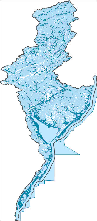
The High Resolution National Hydrography Dataset Plus (NHDPlus HR) is an integrated set of geospatial data layers, including the National Hydrography Dataset (NHD), National Watershed Boundary Dataset (WBD), and 3D Elevation Program Digital Elevation Model (3DEP DEM). The NHDPlus HR combines the NHD, 3DEP DEMs, and WBD to a data suite that includes the NHD stream network with linear referencing functionality, the WBD hydrologic units, elevation-derived catchment areas for each stream segment, "value added attributes" (VAAs), and other features that enhance hydrologic data analysis and routing.
Tags: Belknap,
Carroll,
Cheshire,
Downloadable Data,
Esri File GeoDatabase 10, All tags...
Essex,
FileGDB,
Grafton,
HU-4,
HU-4 Subregion,
HU4_0107,
Hillsborough,
Hydrography,
MA,
Massachusetts,
Merrimack,
Middlesex,
NH,
NHDPlus HR Rasters,
NHDPlus High Resolution (NHDPlus HR),
National Hydrography Dataset (NHD),
National Hydrography Dataset Plus High Resolution (NHDPlus HR),
National Hydrography Dataset Plus High Resolution (NHDPlus HR) Current,
New Hampshire,
Rockingham,
Strafford,
Sullivan,
US,
United States,
Worcester,
base maps,
cartography,
catchments,
channels,
digital elevation models,
drainage basins,
earthsciences,
environment,
geographic information systems,
geoscientificInformation,
geospatial analysis,
hydrographic datasets,
hydrographic features,
hydrology,
inlandWaters,
lakes,
land surface characteristics,
reservoirs,
river reaches,
rivers,
streamflow,
streamflow data,
streams,
surface water quality,
topography,
water resources,
waterbodies,
watersheds, Fewer tags
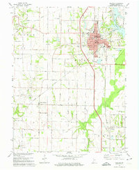
USGS Historical Quadrangle in GeoPDF.
Tags: 7.5 x 7.5 minute,
Downloadable Data,
GeoPDF,
GeoTIFF,
Historical Topographic Maps, All tags...
Historical Topographic Maps 7.5 x 7.5 Minute Map Series,
IN,
Map,
Sullivan,
imageryBaseMapsEarthCover, Fewer tags
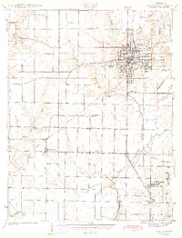
USGS Historical Quadrangle in GeoPDF.
Tags: 7.5 x 7.5 minute,
Downloadable Data,
GeoPDF,
GeoTIFF,
Historical Topographic Maps, All tags...
Historical Topographic Maps 7.5 x 7.5 Minute Map Series,
IN,
Map,
Sullivan,
imageryBaseMapsEarthCover, Fewer tags
The Watershed Boundary Dataset (WBD) is a comprehensive aggregated collection of hydrologic unit data consistent with the national criteria for delineation and resolution. It defines the areal extent of surface water drainage to a point except in coastal or lake front areas where there could be multiple outlets as stated by the "Federal Standards and Procedures for the National Watershed Boundary Dataset (WBD)" "Standard" (https://pubs.usgs.gov/tm/11/a3/). Watershed boundaries are determined solely upon science-based hydrologic principles, not favoring any administrative boundaries or special projects, nor particular program or agency. This dataset represents the hydrologic unit boundaries to the 12-digit (6th level)...
Tags: 10-digit,
12-digit,
14-digit,
16-digit,
2-digit, All tags...
4-digit,
6-digit,
8-digit,
Addison,
Androscoggin,
Aroostook,
Barnstable,
Basin,
Belknap,
Bennington,
Berkshire,
Bristol,
CT,
Caledonia,
Capitol,
Carroll,
Cheshire,
Columbia,
Connecticut,
Coos,
Cumberland,
Downloadable Data,
Dukes,
Dutchess,
Essex,
Franklin,
GeoPackage,
Grafton,
Greater Bridgeport,
HU-2,
HU-2 Region,
HU2_01,
HUC,
Hampden,
Hampshire,
Hancock,
Hillsborough,
Hydrography,
Hydrologic Unit Code,
Hydrologic Units,
Kennebec,
Kent,
Knox,
Lincoln,
Lower Connecticut River Valley,
MA,
ME,
Maine,
Massachusetts,
Merrimack,
Middlesex,
NH,
NY,
Nantucket,
National Watershed Boundary Dataset (WBD),
National Watershed Boundary Dataset (WBD),
Naugatuck Valley,
New Hampshire,
New York,
Newport,
Norfolk,
Northeastern Connecticut,
Northwest Hills,
Open Geospatial Consortium GeoPackage 1.2,
Orange,
Orleans,
Oxford,
Penobscot,
Piscataquis,
Plymouth,
Providence,
Putnam,
RI,
Region,
Rhode Island,
Rockingham,
Rutland,
Sagadahoc,
Somerset,
South Central Connecticut,
Southeastern Connecticut,
Strafford,
Sub-basin,
Sub-region,
Subwatershed,
Suffolk,
Sullivan,
US,
United States,
VT,
Vermont,
WBD,
Waldo,
Washington,
Watershed,
Watershed Boundary Dataset,
Westchester,
Western Connecticut,
Windham,
Windsor,
Worcester,
York,
inlandWaters, Fewer tags
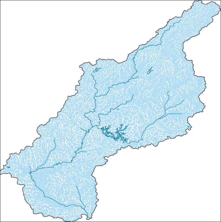
The National Hydrography Dataset (NHD) is a feature-based database that interconnects and uniquely identifies the stream segments or reaches that make up the nation's surface water drainage system. NHD data was originally developed at 1:100,000-scale and exists at that scale for the whole country. This high-resolution NHD, generally developed at 1:24,000/1:12,000 scale, adds detail to the original 1:100,000-scale NHD. (Data for Alaska, Puerto Rico and the Virgin Islands was developed at high-resolution, not 1:100,000 scale.) Local resolution NHD is being developed where partners and data exist. The NHD contains reach codes for networked features, flow direction, names, and centerline representations for areal water...
Tags: Administrative watershed units,
Administrative watershed units,
Area of Complex Channels,
Area to be submerged,
Basin, All tags...
Basin,
Bay/Inlet,
Boone,
Boundaries,
Boundary,
Bridge,
Canal/Ditch,
Clay,
Coastline,
Connector,
Dam/Weir,
Downloadable Data,
Drainage areas for surface water,
Drainageway,
Estuary,
Flow direction network,
Flume,
ForeShore,
Gaging Station,
Gate,
GeoPackage,
Greene,
HU-8,
HU-8 Subbasin,
HU10,
HU12,
HU14,
HU16,
HU2,
HU4,
HU6,
HU8,
HU8_05120203,
HUC,
Hazard Zone,
Hendricks,
Hydrographic,
Hydrography,
Hydrography,
Hydrography,
Hydrologic Unit Code,
Hydrologic Units,
IN,
Ice mass,
Indiana,
Inundation Area,
Levee,
Line,
Lock Chamber,
Marsh,
Morgan,
National Hydrography Dataset (NHD),
National Hydrography Dataset (NHD) Best Resolution,
National Hydrography Dataset (NHD) Best Resolution,
Nonearthen Shore,
Open Geospatial Consortium GeoPackage 1.2,
Orthoimage,
Owen,
Parke,
Playa,
Point,
PointEvent,
Pond,
Putnam,
Rapids,
Rapids,
Reach,
Reach code,
Reef,
Region,
Reservoir,
Rock,
Sea/Ocean,
Sink/Rise,
Sounding Datum Line,
Special Use Zone,
Special Use Zone Limit,
Spillway,
Stream,
Stream/River,
Sub-basin,
Sub-region,
Subbasin,
Submerged Stream,
Subregion,
Subwatershed,
Sullivan,
Surface water systems,
Swamp,
Topographic,
Tunnel,
US,
Underground Conduit,
United States,
Vigo,
WBD,
WBD,
Wall,
Wash,
Water Intake Outflow,
Waterfall,
Watershed,
Watershed Boundaries,
Watershed Boundary Dataset,
Watershed Boundary Dataset,
Well,
artificial path,
boundaries,
dams,
drainage systems and characteristics,
inlandWaters,
lakes,
ngda,
rivers, Fewer tags
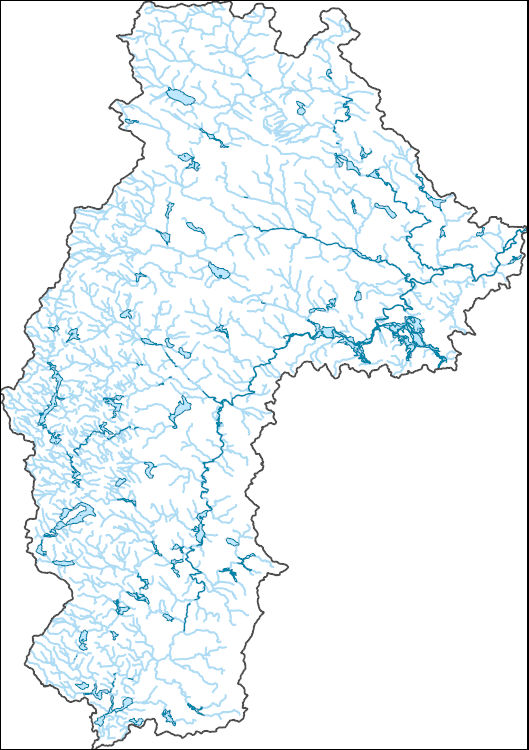
The National Hydrography Dataset (NHD) is a feature-based database that interconnects and uniquely identifies the stream segments or reaches that make up the nation's surface water drainage system. NHD data was originally developed at 1:100,000-scale and exists at that scale for the whole country. This high-resolution NHD, generally developed at 1:24,000/1:12,000 scale, adds detail to the original 1:100,000-scale NHD. (Data for Alaska, Puerto Rico and the Virgin Islands was developed at high-resolution, not 1:100,000 scale.) Local resolution NHD is being developed where partners and data exist. The NHD contains reach codes for networked features, flow direction, names, and centerline representations for areal water...
Tags: Administrative watershed units,
Administrative watershed units,
Area of Complex Channels,
Area to be submerged,
Basin, All tags...
Basin,
Bay/Inlet,
Boundaries,
Boundary,
Bridge,
Canal/Ditch,
Cheshire,
Coastline,
Connector,
Dam/Weir,
Downloadable Data,
Drainage areas for surface water,
Drainageway,
Esri Shapefile nan,
Estuary,
Flow direction network,
Flume,
ForeShore,
Gaging Station,
Gate,
HU-8,
HU-8 Subbasin,
HU10,
HU12,
HU14,
HU16,
HU2,
HU4,
HU6,
HU8,
HU8_01070003,
HUC,
Hazard Zone,
Hillsborough,
Hydrographic,
Hydrography,
Hydrography,
Hydrography,
Hydrologic Unit Code,
Hydrologic Units,
Ice mass,
Inundation Area,
Levee,
Line,
Lock Chamber,
Marsh,
Merrimack,
NH,
National Hydrography Dataset (NHD),
National Hydrography Dataset (NHD) Best Resolution,
National Hydrography Dataset (NHD) Best Resolution,
New Hampshire,
Nonearthen Shore,
Orthoimage,
Playa,
Point,
PointEvent,
Pond,
Rapids,
Rapids,
Reach,
Reach code,
Reef,
Region,
Reservoir,
Rock,
Sea/Ocean,
Shapefile,
Sink/Rise,
Sounding Datum Line,
Special Use Zone,
Special Use Zone Limit,
Spillway,
Stream,
Stream/River,
Sub-basin,
Sub-region,
Subbasin,
Submerged Stream,
Subregion,
Subwatershed,
Sullivan,
Surface water systems,
Swamp,
Topographic,
Tunnel,
US,
Underground Conduit,
United States,
WBD,
WBD,
Wall,
Wash,
Water Intake Outflow,
Waterfall,
Watershed,
Watershed Boundaries,
Watershed Boundary Dataset,
Watershed Boundary Dataset,
Well,
artificial path,
boundaries,
dams,
drainage systems and characteristics,
inlandWaters,
lakes,
ngda,
rivers, Fewer tags
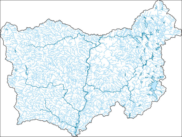
The National Hydrography Dataset (NHD) is a feature-based database that interconnects and uniquely identifies the stream segments or reaches that make up the nation's surface water drainage system. NHD data was originally developed at 1:100,000-scale and exists at that scale for the whole country. This high-resolution NHD, generally developed at 1:24,000/1:12,000 scale, adds detail to the original 1:100,000-scale NHD. (Data for Alaska, Puerto Rico and the Virgin Islands was developed at high-resolution, not 1:100,000 scale.) Local resolution NHD is being developed where partners and data exist. The NHD contains reach codes for networked features, flow direction, names, and centerline representations for areal water...
Tags: Administrative watershed units,
Administrative watershed units,
Area of Complex Channels,
Area to be submerged,
Basin, All tags...
Basin,
Bay/Inlet,
Boundaries,
Boundary,
Bridge,
Canal/Ditch,
Cheshire,
Coastline,
Connector,
Dam/Weir,
Downloadable Data,
Drainage areas for surface water,
Drainageway,
Esri Shapefile nan,
Estuary,
Flow direction network,
Flume,
ForeShore,
Gaging Station,
Gate,
Grafton,
HU-8,
HU-8 Subbasin,
HU10,
HU12,
HU14,
HU16,
HU2,
HU4,
HU6,
HU8,
HU8_01080106,
HUC,
Hazard Zone,
Hydrographic,
Hydrography,
Hydrography,
Hydrography,
Hydrologic Unit Code,
Hydrologic Units,
Ice mass,
Inundation Area,
Levee,
Line,
Lock Chamber,
Marsh,
Merrimack,
NH,
National Hydrography Dataset (NHD),
National Hydrography Dataset (NHD) Best Resolution,
National Hydrography Dataset (NHD) Best Resolution,
New Hampshire,
Nonearthen Shore,
Orthoimage,
Playa,
Point,
PointEvent,
Pond,
Rapids,
Rapids,
Reach,
Reach code,
Reef,
Region,
Reservoir,
Rock,
Rutland,
Sea/Ocean,
Shapefile,
Sink/Rise,
Sounding Datum Line,
Special Use Zone,
Special Use Zone Limit,
Spillway,
Stream,
Stream/River,
Sub-basin,
Sub-region,
Subbasin,
Submerged Stream,
Subregion,
Subwatershed,
Sullivan,
Surface water systems,
Swamp,
Topographic,
Tunnel,
US,
Underground Conduit,
United States,
VT,
Vermont,
WBD,
WBD,
Wall,
Wash,
Water Intake Outflow,
Waterfall,
Watershed,
Watershed Boundaries,
Watershed Boundary Dataset,
Watershed Boundary Dataset,
Well,
Windham,
Windsor,
artificial path,
boundaries,
dams,
drainage systems and characteristics,
inlandWaters,
lakes,
ngda,
rivers, Fewer tags
The National Hydrography Dataset (NHD) is a feature-based database that interconnects and uniquely identifies the stream segments or reaches that make up the nation's surface water drainage system. NHD data was originally developed at 1:100,000-scale and exists at that scale for the whole country. This high-resolution NHD, generally developed at 1:24,000/1:12,000 scale, adds detail to the original 1:100,000-scale NHD. (Data for Alaska, Puerto Rico and the Virgin Islands was developed at high-resolution, not 1:100,000 scale.) Local resolution NHD is being developed where partners and data exist. The NHD contains reach codes for networked features, flow direction, names, and centerline representations for areal water...
Tags: Administrative watershed units,
Administrative watershed units,
Area of Complex Channels,
Area to be submerged,
Basin, All tags...
Basin,
Bay/Inlet,
Boundaries,
Boundary,
Bradford,
Bridge,
Canal/Ditch,
Centre,
Clinton,
Coastline,
Columbia,
Connector,
Dam/Weir,
Downloadable Data,
Drainage areas for surface water,
Drainageway,
Esri Shapefile nan,
Estuary,
Flow direction network,
Flume,
ForeShore,
Gaging Station,
Gate,
HU-8,
HU-8 Subbasin,
HU10,
HU12,
HU14,
HU16,
HU2,
HU4,
HU6,
HU8,
HU8_02050206,
HUC,
Hazard Zone,
Hydrographic,
Hydrography,
Hydrography,
Hydrography,
Hydrologic Unit Code,
Hydrologic Units,
Ice mass,
Inundation Area,
Levee,
Line,
Lock Chamber,
Lycoming,
Marsh,
Montour,
National Hydrography Dataset (NHD),
National Hydrography Dataset (NHD) Best Resolution,
National Hydrography Dataset (NHD) Best Resolution,
Nonearthen Shore,
Northumberland,
Orthoimage,
PA,
Pennsylvania,
Playa,
Point,
PointEvent,
Pond,
Rapids,
Rapids,
Reach,
Reach code,
Reef,
Region,
Reservoir,
Rock,
Sea/Ocean,
Shapefile,
Sink/Rise,
Snyder,
Sounding Datum Line,
Special Use Zone,
Special Use Zone Limit,
Spillway,
Stream,
Stream/River,
Sub-basin,
Sub-region,
Subbasin,
Submerged Stream,
Subregion,
Subwatershed,
Sullivan,
Surface water systems,
Swamp,
Tioga,
Topographic,
Tunnel,
US,
Underground Conduit,
Union,
United States,
WBD,
WBD,
Wall,
Wash,
Water Intake Outflow,
Waterfall,
Watershed,
Watershed Boundaries,
Watershed Boundary Dataset,
Watershed Boundary Dataset,
Well,
Wyoming,
artificial path,
boundaries,
dams,
drainage systems and characteristics,
inlandWaters,
lakes,
ngda,
rivers, Fewer tags
The National Hydrography Dataset (NHD) is a feature-based database that interconnects and uniquely identifies the stream segments or reaches that make up the nation's surface water drainage system. NHD data was originally developed at 1:100,000-scale and exists at that scale for the whole country. This high-resolution NHD, generally developed at 1:24,000/1:12,000 scale, adds detail to the original 1:100,000-scale NHD. (Data for Alaska, Puerto Rico and the Virgin Islands was developed at high-resolution, not 1:100,000 scale.) Local resolution NHD is being developed where partners and data exist. The NHD contains reach codes for networked features, flow direction, names, and centerline representations for areal water...
Tags: Administrative watershed units,
Administrative watershed units,
Area of Complex Channels,
Area to be submerged,
Basin, All tags...
Basin,
Bay/Inlet,
Boundaries,
Boundary,
Bradford,
Bridge,
Canal/Ditch,
Coastline,
Connector,
Dam/Weir,
Downloadable Data,
Drainage areas for surface water,
Drainageway,
Estuary,
Flow direction network,
Flume,
ForeShore,
Gaging Station,
Gate,
GeoPackage,
HU-8,
HU-8 Subbasin,
HU10,
HU12,
HU14,
HU16,
HU2,
HU4,
HU6,
HU8,
HU8_02050106,
HUC,
Hazard Zone,
Hydrographic,
Hydrography,
Hydrography,
Hydrography,
Hydrologic Unit Code,
Hydrologic Units,
Ice mass,
Inundation Area,
Lackawanna,
Levee,
Line,
Lock Chamber,
Luzerne,
Lycoming,
Marsh,
National Hydrography Dataset (NHD),
National Hydrography Dataset (NHD) Best Resolution,
National Hydrography Dataset (NHD) Best Resolution,
Nonearthen Shore,
Open Geospatial Consortium GeoPackage 1.2,
Orthoimage,
PA,
Pennsylvania,
Playa,
Point,
PointEvent,
Pond,
Rapids,
Rapids,
Reach,
Reach code,
Reef,
Region,
Reservoir,
Rock,
Sea/Ocean,
Sink/Rise,
Sounding Datum Line,
Special Use Zone,
Special Use Zone Limit,
Spillway,
Stream,
Stream/River,
Sub-basin,
Sub-region,
Subbasin,
Submerged Stream,
Subregion,
Subwatershed,
Sullivan,
Surface water systems,
Susquehanna,
Swamp,
Tioga,
Topographic,
Tunnel,
US,
Underground Conduit,
United States,
WBD,
WBD,
Wall,
Wash,
Water Intake Outflow,
Waterfall,
Watershed,
Watershed Boundaries,
Watershed Boundary Dataset,
Watershed Boundary Dataset,
Well,
Wyoming,
artificial path,
boundaries,
dams,
drainage systems and characteristics,
inlandWaters,
lakes,
ngda,
rivers, Fewer tags
The National Hydrography Dataset (NHD) is a feature-based database that interconnects and uniquely identifies the stream segments or reaches that make up the nation's surface water drainage system. NHD data was originally developed at 1:100,000-scale and exists at that scale for the whole country. This high-resolution NHD, generally developed at 1:24,000/1:12,000 scale, adds detail to the original 1:100,000-scale NHD. (Data for Alaska, Puerto Rico and the Virgin Islands was developed at high-resolution, not 1:100,000 scale.) Local resolution NHD is being developed where partners and data exist. The NHD contains reach codes for networked features, flow direction, names, and centerline representations for areal water...
Tags: Accomack,
Administrative watershed units,
Administrative watershed units,
Area of Complex Channels,
Area to be submerged, All tags...
Atlantic,
Basin,
Basin,
Bay/Inlet,
Berks,
Boundaries,
Boundary,
Bridge,
Broome,
Bucks,
Burlington,
Camden,
Canal/Ditch,
Cape May,
Carbon,
Cecil,
Chenango,
Chester,
Coastline,
Connector,
Cumberland,
DE,
Dam/Weir,
Delaware,
Delaware,
Downloadable Data,
Drainage areas for surface water,
Drainageway,
Esri Shapefile nan,
Estuary,
Flow direction network,
Flume,
ForeShore,
Gaging Station,
Gate,
Gloucester,
Greene,
HU-4,
HU-4 Subregion,
HU10,
HU12,
HU14,
HU16,
HU2,
HU4,
HU4_0204,
HU6,
HU8,
HUC,
Hazard Zone,
Hunterdon,
Hydrographic,
Hydrography,
Hydrography,
Hydrography,
Hydrologic Unit Code,
Hydrologic Units,
Ice mass,
Inundation Area,
Kent,
Lackawanna,
Lancaster,
Lebanon,
Lehigh,
Levee,
Line,
Lock Chamber,
Luzerne,
MD,
Marsh,
Maryland,
Mercer,
Monmouth,
Monroe,
Montgomery,
Morris,
NJ,
NY,
National Hydrography Dataset (NHD),
National Hydrography Dataset (NHD) Best Resolution,
National Hydrography Dataset (NHD) Best Resolution,
New Castle,
New Jersey,
New York,
Nonearthen Shore,
Northampton,
Ocean,
Orange,
Orthoimage,
PA,
Pennsylvania,
Philadelphia,
Pike,
Playa,
Point,
PointEvent,
Pond,
Queens,
Rapids,
Rapids,
Reach,
Reach code,
Reef,
Region,
Reservoir,
Rock,
Salem,
Schoharie,
Schuylkill,
Sea/Ocean,
Shapefile,
Sink/Rise,
Sounding Datum Line,
Special Use Zone,
Special Use Zone Limit,
Spillway,
Stream,
Stream/River,
Sub-basin,
Sub-region,
Subbasin,
Submerged Stream,
Subregion,
Subwatershed,
Sullivan,
Surface water systems,
Sussex,
Swamp,
Topographic,
Tunnel,
US,
Ulster,
Underground Conduit,
United States,
VA,
Virginia,
Virginia Beach,
WBD,
WBD,
Wall,
Warren,
Wash,
Water Intake Outflow,
Waterfall,
Watershed,
Watershed Boundaries,
Watershed Boundary Dataset,
Watershed Boundary Dataset,
Wayne,
Well,
Worcester,
artificial path,
boundaries,
dams,
drainage systems and characteristics,
inlandWaters,
lakes,
ngda,
rivers, Fewer tags
This data set contains imagery from the National Agriculture Imagery Program (NAIP). The NAIP program is administered by USDA FSA and has been established to support two main FSA strategic goals centered on agricultural production. These are increase stewardship of America's natural resources while enhancing the environment, and to ensure commodities are procured and distributed effectively and efficiently to increase food security. The NAIP program supports these goals by acquiring and providing ortho imagery that has been collected during the agricultural growing season in the U.S. The NAIP ortho imagery is tailored to meet FSA requirements and is a fundamental tool used to support FSA farm and conservation programs....
Types: Citation;
Tags: 29211,
3.75 x 3.75 minute,
4009257,
Aerial Compliance,
Compliance, All tags...
Digital Ortho rectified Image,
Downloadable Data,
JPEG 2000,
JPEG2000,
MO,
MO211,
NAIP,
Ortho Rectification,
Orthoimagery,
Quarter Quadrangle,
SULLIVAN CO MO FSA,
Sullivan,
USDA National Agriculture Imagery Program (NAIP),
WINIGAN,
WINIGAN, NW,
farming,
imageryBaseMapsEarthCover, Fewer tags
This data set contains imagery from the National Agriculture Imagery Program (NAIP). The NAIP program is administered by USDA FSA and has been established to support two main FSA strategic goals centered on agricultural production. These are increase stewardship of America's natural resources while enhancing the environment, and to ensure commodities are procured and distributed effectively and efficiently to increase food security. The NAIP program supports these goals by acquiring and providing ortho imagery that has been collected during the agricultural growing season in the U.S. The NAIP ortho imagery is tailored to meet FSA requirements and is a fundamental tool used to support FSA farm and conservation programs....
Types: Citation;
Tags: 29211,
3.75 x 3.75 minute,
4009356,
Aerial Compliance,
Compliance, All tags...
Digital Ortho rectified Image,
Downloadable Data,
JPEG 2000,
JPEG2000,
MILAN EAST,
MILAN EAST, SW,
MO,
MO211,
NAIP,
Ortho Rectification,
Orthoimagery,
Quarter Quadrangle,
SULLIVAN CO MO FSA,
Sullivan,
USDA National Agriculture Imagery Program (NAIP),
farming,
imageryBaseMapsEarthCover, Fewer tags
This data set contains imagery from the National Agriculture Imagery Program (NAIP). The NAIP program is administered by USDA FSA and has been established to support two main FSA strategic goals centered on agricultural production. These are increase stewardship of America's natural resources while enhancing the environment, and to ensure commodities are procured and distributed effectively and efficiently to increase food security. The NAIP program supports these goals by acquiring and providing ortho imagery that has been collected during the agricultural growing season in the U.S. The NAIP ortho imagery is tailored to meet FSA requirements and is a fundamental tool used to support FSA farm and conservation programs....
Types: Citation;
Tags: 29211,
3.75 x 3.75 minute,
4009362,
Aerial Compliance,
Compliance, All tags...
Digital Ortho rectified Image,
Downloadable Data,
JPEG 2000,
JPEG2000,
LINDLEY,
LINDLEY, NW,
MO,
MO211,
NAIP,
Ortho Rectification,
Orthoimagery,
Quarter Quadrangle,
SULLIVAN CO MO FSA,
Sullivan,
USDA National Agriculture Imagery Program (NAIP),
farming,
imageryBaseMapsEarthCover, Fewer tags
This data set contains imagery from the National Agriculture Imagery Program (NAIP). The NAIP program is administered by USDA FSA and has been established to support two main FSA strategic goals centered on agricultural production. These are increase stewardship of America's natural resources while enhancing the environment, and to ensure commodities are procured and distributed effectively and efficiently to increase food security. The NAIP program supports these goals by acquiring and providing ortho imagery that has been collected during the agricultural growing season in the U.S. The NAIP ortho imagery is tailored to meet FSA requirements and is a fundamental tool used to support FSA farm and conservation programs....
Types: Citation;
Tags: 29211,
3.75 x 3.75 minute,
4009363,
Aerial Compliance,
BROWNING, All tags...
BROWNING, NE,
Compliance,
Digital Ortho rectified Image,
Downloadable Data,
JPEG 2000,
JPEG2000,
MO,
MO211,
NAIP,
Ortho Rectification,
Orthoimagery,
Quarter Quadrangle,
SULLIVAN CO MO FSA,
Sullivan,
USDA National Agriculture Imagery Program (NAIP),
farming,
imageryBaseMapsEarthCover, Fewer tags
|
|

