Filters: Tags: SUPERIOR (X)
96 results (595ms)|
Filters
Date Range
Extensions Types Contacts
Categories Tag Types Tag Schemes |

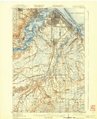
USGS Historical Quadrangle in GeoPDF.
USGS Historical Quadrangle in GeoPDF.
USGS Historical Quadrangle in GeoPDF.
USGS Historical Quadrangle in GeoPDF.
USGS Historical Quadrangle in GeoPDF.
USGS Historical Quadrangle in GeoPDF.
This dataset is comprised of three files containing northing, easting, and elevation ("XYZ") information for light detection and ranging (lidar) data representing the beach topography and sonar data representing near-shore bathymetry of Lake Superior at Minnesota Point, near the Duluth entry, Duluth, Minnesota. The point data are the same as that in LAS files that were used to create the digital elevation models (DEMs) of the approximate 1.75 square kilometer survey area. Lidar data were collected August 22, 2022 using a boat mounted Velodyne VLP-16 unit and methodology similar to that described by Huizinga and Wagner (2019). Multibeam sonar data were collected August 22-23, 2022 using a Norbit integrated wide band...
This data set contains imagery from the National Agriculture Imagery Program (NAIP). The NAIP program is administered by USDA FSA and has been established to support two main FSA strategic goals centered on agricultural production. These are, increase stewardship of America's natural resources while enhancing the environment, and to ensure commodities are procured and distributed effectively and efficiently to increase food security. The NAIP program supports these goals by acquiring and providing ortho imagery that has been collected during the agricultural growing season in the U.S. The NAIP ortho imagery is tailored to meet FSA requirements and is a fundamental tool used to support FSA farm and conservation programs....
This data set contains imagery from the National Agriculture Imagery Program (NAIP). The NAIP program is administered by USDA FSA and has been established to support two main FSA strategic goals centered on agricultural production. These are, increase stewardship of America's natural resources while enhancing the environment, and to ensure commodities are procured and distributed effectively and efficiently to increase food security. The NAIP program supports these goals by acquiring and providing ortho imagery that has been collected during the agricultural growing season in the U.S. The NAIP ortho imagery is tailored to meet FSA requirements and is a fundamental tool used to support FSA farm and conservation programs....
This data set contains imagery from the National Agriculture Imagery Program (NAIP). The NAIP program is administered by USDA FSA and has been established to support two main FSA strategic goals centered on agricultural production. These are, increase stewardship of America's natural resources while enhancing the environment, and to ensure commodities are procured and distributed effectively and efficiently to increase food security. The NAIP program supports these goals by acquiring and providing ortho imagery that has been collected during the agricultural growing season in the U.S. The NAIP ortho imagery is tailored to meet FSA requirements and is a fundamental tool used to support FSA farm and conservation programs....
This data set contains imagery from the National Agriculture Imagery Program (NAIP). The NAIP program is administered by USDA FSA and has been established to support two main FSA strategic goals centered on agricultural production. These are, increase stewardship of America's natural resources while enhancing the environment, and to ensure commodities are procured and distributed effectively and efficiently to increase food security. The NAIP program supports these goals by acquiring and providing ortho imagery that has been collected during the agricultural growing season in the U.S. The NAIP ortho imagery is tailored to meet FSA requirements and is a fundamental tool used to support FSA farm and conservation programs....
The elevation contours in this dataset have a 2-foot (ft) interval and were derived from a digital elevation model (DEM) of beach topography and near-shore bathymetry of Lake Superior at Minnesota Point, Duluth, Minnesota. The DEM has a 10-meter (m; 32.8084 feet) cell size and was created from a LAS dataset of terrestrial light detection and ranging (lidar) data representing the beach topography and multibeam sonar data representing the bathymetry to approximately 1 kilometer (0.62 miles) offshore, for an approximately 2.27 square kilometer surveyed area. Lidar data were collected July 23, 2020 using a boat mounted Velodyne unit. Multibeam sonar data were collected July 20th and 23rd, 2020 using a Norbit integrated...
Categories: Data;
Types: Downloadable,
Map Service,
OGC WFS Layer,
OGC WMS Layer,
Shapefile;
Tags: Bathymetry and Elevation,
Duluth,
Great Lakes,
Lake Superior,
Southwestern Lake Superior,
USGS Historical Quadrangle in GeoPDF.
USGS Historical Quadrangle in GeoPDF.
The elevation contours in this dataset have a 2-foot (ft) interval and were derived from a digital elevation model (DEM) of beach topography and near-shore bathymetry of Minnesota Point near the Superior Entry of Lake Superior, Duluth, Minnesota. The DEM used to derive the contours has a 10-meter (m; 32.8084 feet) cell size and was created from a LAS dataset of terrestrial light detection and ranging (lidar) data representing the beach topography and sonar data representing the bathymetry to approximately 1 kilometer (0.62 miles) offshore, for an approximately 2.27 square kilometer surveyed area. Lidar data were collected using a boat mounted Velodyne unit. Multibeam sonar data were collected using a Norbit integrated...
Categories: Data;
Types: Downloadable,
Map Service,
OGC WFS Layer,
OGC WMS Layer,
Shapefile;
Tags: Bathymetry and Elevation,
Duluth,
Great Lakes,
Lake Superior,
Southwestern Lake Superior,
USGS Historical Quadrangle in GeoPDF.
This data set contains imagery from the National Agriculture Imagery Program (NAIP). The NAIP program is administered by USDA FSA and has been established to support two main FSA strategic goals centered on agricultural production. These are, increase stewardship of America's natural resources while enhancing the environment, and to ensure commodities are procured and distributed effectively and efficiently to increase food security. The NAIP program supports these goals by acquiring and providing ortho imagery that has been collected during the agricultural growing season in the U.S. The NAIP ortho imagery is tailored to meet FSA requirements and is a fundamental tool used to support FSA farm and conservation programs....
The elevation contours in this dataset have a 2-foot (ft) interval and were derived from a digital elevation model (DEM) of beach topography and nearshore bathymetry of Lake Superior at Minnesota Point, Duluth, Minnesota. The DEM has a 10-meter (32.8084 ft) cell size and was created from LiDAR data representing beach topography and sonar data representing bathymetry to a distance of approximately 1.3 kilometers (0.8 miles) offshore. LiDAR data were collected August 10, 2019 using a boat-mounted Optech ILRIS scanner and methodology similar to that described by Huizinga and Wagner (2019). Multi-beam sonar data were collected August 7-11, 2019 using an R2Sonic 2024 sonar unit and methodology similar to that described...
Types: Map Service,
OGC WFS Layer,
OGC WMS Layer,
OGC WMS Service;
Tags: Bathymetry and Elevation,
DEM,
Duluth,
Great Lakes,
Hydroacoustic,
This dataset is a LAS dataset containing light detection and ranging (lidar) data and multibeam sonar data representing the beach topography and near-shore bathymetry of Minnesota Point near the Duluth Entry of Lake Superior, Duluth, Minnesota. The LAS dataset used to create a digital elevation model (DEM) of the approximate 1.87 square kilometer surveyed area. Lidar data were collected using a boat mounted Velodyne VLP-16 unit. Multibeam sonar data were collected using a Norbit integrated wide band multibeam system compact (iWBMSc) sonar unit. Single-beam sonar data were collected using a Ceescope sonar unit. All elevation data were collected June 22-24, 2021. Methodology similar to Wagner, D.M., Lund, J.W., and...
Categories: Data;
Types: Downloadable,
Map Service,
OGC WFS Layer,
OGC WMS Layer,
Shapefile;
Tags: Bathymetry and Elevation,
Duluth,
Great Lakes,
Lake Superior,
Southwestern Lake Superior,
USGS Historical Quadrangle in GeoPDF.
|

|
