Filters: Tags: Saint Johns (X)
14 results (37ms)|
Filters
Date Range
Extensions Types Contacts
Categories Tag Types Tag Schemes |
This data set contains imagery from the National Agriculture Imagery Program (NAIP). The NAIP program is administered by USDA FSA and has been established to support two main FSA strategic goals centered on agricultural production. These are, increase stewardship of America's natural resources while enhancing the environment, and to ensure commodities are procured and distributed effectively and efficiently to increase food security. The NAIP program supports these goals by acquiring and providing ortho imagery that has been collected during the agricultural growing season in the U.S. The NAIP ortho imagery is tailored to meet FSA requirements and is a fundamental tool used to support FSA farm and conservation programs....

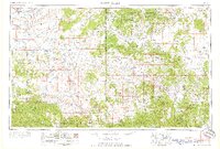
USGS Historical Quadrangle in GeoPDF.

USGS Historical Quadrangle in GeoPDF.
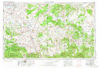
USGS Historical Quadrangle in GeoPDF.
This data release supersedes version 1.0, published in May 2021 at https://doi.org/10.5066/P9FKARIZ. Versioning details are documented in the accompanying Matanzas_revision_history.txt file. The interactions of waves and currents near an inlet influence sediment and alter sea-floor bedforms, especially during winter storms. As part of the Cross-Shore and Inlets Processes project to improve our understanding of cross-shore processes that control sediment budgets, the U.S. Geological Survey deployed instrumented platforms at two sites near Matanzas Inlet between January 24 and April 13, 2018. Matanzas Inlet is a natural, unmaintained inlet on the Florida Atlantic coast that is well suited for study of inlet and cross-shore...
Categories: Data;
Types: Downloadable,
Map Service,
OGC WFS Layer,
OGC WMS Layer,
Shapefile;
Tags: Atlantic Ocean,
Florida,
Fort Matanzas National Monument,
Marine Geology,
Matanzas,
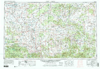
USGS Historical Quadrangle in GeoPDF.
Note: this data release has been deprecated. Find the updated version here: https://doi.org/10.5066/P9X7VIN2 The interactions of waves and currents near an inlet influence sediment and alter sea-floor bedforms, especially during winter storms. As part of the Cross-Shore and Inlets Processes project to improve our understanding of cross-shore processes that control sediment budgets, the U.S. Geological Survey deployed instrumented platforms at two sites near Matanzas Inlet between January 24 and April 13, 2018. Matanzas Inlet is a natural, unmaintained inlet on the Florida Atlantic coast that is well suited for study of inlet and cross-shore processes. The study sites were offshore of the surf zone in a line perpendicular...
This data set contains imagery from the National Agriculture Imagery Program (NAIP). The NAIP program is administered by USDA FSA and has been established to support two main FSA strategic goals centered on agricultural production. These are, increase stewardship of America's natural resources while enhancing the environment, and to ensure commodities are procured and distributed effectively and efficiently to increase food security. The NAIP program supports these goals by acquiring and providing ortho imagery that has been collected during the agricultural growing season in the U.S. The NAIP ortho imagery is tailored to meet FSA requirements and is a fundamental tool used to support FSA farm and conservation programs....
USGS Historical Quadrangle in GeoPDF.
This data set contains imagery from the National Agriculture Imagery Program (NAIP). The NAIP program is administered by USDA FSA and has been established to support two main FSA strategic goals centered on agricultural production. These are, increase stewardship of America's natural resources while enhancing the environment, and to ensure commodities are procured and distributed effectively and efficiently to increase food security. The NAIP program supports these goals by acquiring and providing ortho imagery that has been collected during the agricultural growing season in the U.S. The NAIP ortho imagery is tailored to meet FSA requirements and is a fundamental tool used to support FSA farm and conservation programs....
This data set contains imagery from the National Agriculture Imagery Program (NAIP). The NAIP program is administered by USDA FSA and has been established to support two main FSA strategic goals centered on agricultural production. These are, increase stewardship of America's natural resources while enhancing the environment, and to ensure commodities are procured and distributed effectively and efficiently to increase food security. The NAIP program supports these goals by acquiring and providing ortho imagery that has been collected during the agricultural growing season in the U.S. The NAIP ortho imagery is tailored to meet FSA requirements and is a fundamental tool used to support FSA farm and conservation programs....
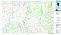
USGS Historical Quadrangle in GeoPDF.

USGS Historical Quadrangle in GeoPDF.

USGS Historical Quadrangle in GeoPDF.
|

|
