Filters
Date Range
Extensions
Types
Contacts
Categories
Tag Types
Tag Schemes
|
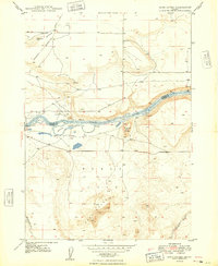
USGS Historical Quadrangle in GeoPDF.
Tags: 7.5 x 7.5 minute,
Downloadable Data,
GeoPDF,
GeoTIFF,
Historical Topographic Maps, All tags...
Historical Topographic Maps 7.5 x 7.5 Minute Map Series,
ID,
Map,
Sand Dunes,
imageryBaseMapsEarthCover, Fewer tags
Core Research Center, cutting CZ06694, from well operated by SUN OILRaw Properties from download, web scrape, MapServer, and Macrostrat API{"Lib Num": "CZ06694", "API Num": "4903720115", "Operator": "SUN OIL", "Well Name": "1 JENKINS-GOVT-A", "Field": "WC", "State": "WY", "County": "SWEETWATER", "Thin Sec": "F", "Analysis": "T", "Latitude": "41.23827", "Longitude": "-108.19085", "coordinates_geohash": "9x74d51y66xn", "Source": "FROM STATE RECORDS", "Min": "300", "Max": "5716", "Security Flag": null, "crc_collection_name": "cutting", "sb_parent_id": "4f4e49d8e4b07f02db5df2d2", "intervals": [{"Formation": null, "Age": null, "Min Depth": null, "Max Depth": null}], "crcwc_url": "https://my.usgs.gov/crcwc/cutting/report/19136",...
Core Research Center, cutting CZ14132, from well operated by DAVIS OILRaw Properties from download, web scrape, MapServer, and Macrostrat API{"Lib Num": "CZ14132", "API Num": "4903721515", "Operator": "DAVIS OIL", "Well Name": "1 EAST STORM SHELTER", "Field": "STORM SHELTER", "State": "WY", "County": "SWEETWATER", "Thin Sec": "F", "Analysis": "F", "Latitude": "42.00323", "Longitude": "-109.93242", "coordinates_geohash": "9x3yfqmwscw6", "Source": "FROM STATE RECORDS", "Min": "120", "Max": "11440", "Security Flag": null, "crc_collection_name": "cutting", "sb_parent_id": "4f4e49d8e4b07f02db5df2d2", "intervals": [{"Formation": null, "Age": null, "Min Depth": null, "Max Depth": null}], "crcwc_url": "https://my.usgs.gov/crcwc/cutting/report/27440",...
Core Research Center, cutting CZ10915, from well operated by WESTCOAST OIL & GASRaw Properties from download, web scrape, MapServer, and Macrostrat API{"Lib Num": "CZ10915", "API Num": "4903720460", "Operator": "WESTCOAST OIL & GAS", "Well Name": "2 FED-TRAPPERS TRAIL UNIT", "Field": "WC", "State": "WY", "County": "SWEETWATER", "Thin Sec": "F", "Analysis": "F", "Latitude": "41.15908", "Longitude": "-108.4398", "coordinates_geohash": "9x6fhku9188e", "Source": "FROM STATE RECORDS", "Min": "1380", "Max": "12250", "Security Flag": null, "crc_collection_name": "cutting", "sb_parent_id": "4f4e49d8e4b07f02db5df2d2", "intervals": [{"Formation": null, "Age": null, "Min Depth": null, "Max Depth": null}], "crcwc_url": "https://my.usgs.gov/crcwc/cutting/report/24232",...
Core Research Center, cutting CZ13184, from well operated by AMOCO PRODUCTIONRaw Properties from download, web scrape, MapServer, and Macrostrat API{"Lib Num": "CZ13184", "API Num": "4903721027", "Operator": "AMOCO PRODUCTION", "Well Name": "1 CHAMPLIN 535 AMOCO-A", "Field": "IRON PIPE", "State": "WY", "County": "SWEETWATER", "Thin Sec": "T", "Analysis": "T", "Latitude": "41.35672", "Longitude": "-108.34896", "coordinates_geohash": "9x6gq2y8q5ru", "Source": "FROM STATE RECORDS", "Min": "3120", "Max": "14200", "Security Flag": null, "crc_collection_name": "cutting", "sb_parent_id": "4f4e49d8e4b07f02db5df2d2", "intervals": [{"Formation": null, "Age": null, "Min Depth": null, "Max Depth": null}], "crcwc_url": "https://my.usgs.gov/crcwc/cutting/report/23770",...
Core Research Center, cutting CZ06230, from well operated by SUN OIL C F BRAUM ROCK ISLANDRaw Properties from download, web scrape, MapServer, and Macrostrat API{"Lib Num": "CZ06230", "API Num": "4903720008", "Operator": "SUN OIL C F BRAUM ROCK ISLAND", "Well Name": "1 JENKINS-GOVT-B", "Field": "WC", "State": "WY", "County": "SWEETWATER", "Thin Sec": "F", "Analysis": "F", "Latitude": "41.19471", "Longitude": "-108.26775", "coordinates_geohash": "9x74273bddd2", "Source": "FROM STATE RECORDS", "Min": "720", "Max": "6500", "Security Flag": null, "crc_collection_name": "cutting", "sb_parent_id": "4f4e49d8e4b07f02db5df2d2", "intervals": [{"Formation": null, "Age": null, "Min Depth": null, "Max Depth": null}], "crcwc_url":...
Core Research Center, core R330, from well operated by THERMAL EXPLORATIONRaw Properties from download, web scrape, MapServer, and Macrostrat API{"Lib Num": "R330", "API Num": "4903722688", "Operator": "THERMAL EXPLORATION", "Well Name": "32-4 RAINTREE FEDERAL", "Field": "WILDCAT", "State": "WY", "County": "SWEETWATER", "Type": "FULL", "Photos": "F", "Thin Sec": "T", "Analysis": "T", "Latitude": "42.00407", "Longitude": "-109.77258", "coordinates_geohash": "9x3yynd53qpv", "Source": "FROM STATE RECORDS", "Security Flag": "NO SPECIAL RESTRICTIONS", "crc_collection_name": "core", "sb_parent_id": "4f4e49dae4b07f02db5e0486", "intervals": [{"Formation": "DAKOTA", "Age": "CRET", "Min Depth": "14935", "Max Depth": "14979"}],...
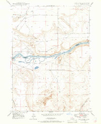
USGS Historical Quadrangle in GeoPDF.
Tags: 7.5 x 7.5 minute,
Downloadable Data,
GeoPDF,
GeoTIFF,
Historical Topographic Maps, All tags...
Historical Topographic Maps 7.5 x 7.5 Minute Map Series,
ID,
Map,
Sand Dunes,
imageryBaseMapsEarthCover, Fewer tags
Core Research Center, cutting CZ15674, from well operated by AMOCO PRODUCTIONRaw Properties from download, web scrape, MapServer, and Macrostrat API{"Lib Num": "CZ15674", "API Num": "4903721736", "Operator": "AMOCO PRODUCTION", "Well Name": "1 CHAMPLIN 269 AMOCO-B", "Field": "IRON PIPE", "State": "WY", "County": "SWEETWATER", "Thin Sec": "T", "Analysis": "T", "Latitude": "41.37128", "Longitude": "-108.36721", "coordinates_geohash": "9x6gq53mhvxd", "Source": "FROM STATE RECORDS", "Min": "3000", "Max": "13670", "Security Flag": null, "crc_collection_name": "cutting", "sb_parent_id": "4f4e49d8e4b07f02db5df2d2", "intervals": [{"Formation": null, "Age": null, "Min Depth": null, "Max Depth": null}], "crcwc_url": "https://my.usgs.gov/crcwc/cutting/report/28743",...
Core Research Center, cutting CZ14237, from well operated by KOCH EXPLORATIONRaw Properties from download, web scrape, MapServer, and Macrostrat API{"Lib Num": "CZ14237", "API Num": "4903721380", "Operator": "KOCH EXPLORATION", "Well Name": "1 FEDERAL TWIN FORK", "Field": "TWIN FORK", "State": "WY", "County": "SWEETWATER", "Thin Sec": "F", "Analysis": "F", "Latitude": "41.15344", "Longitude": "-108.32431", "coordinates_geohash": "9x6fp5b8hthp", "Source": "FROM STATE RECORDS", "Min": "3000", "Max": "11480", "Security Flag": null, "crc_collection_name": "cutting", "sb_parent_id": "4f4e49d8e4b07f02db5df2d2", "intervals": [{"Formation": null, "Age": null, "Min Depth": null, "Max Depth": null}], "crcwc_url": "https://my.usgs.gov/crcwc/cutting/report/25546",...
Core Research Center, core B111, from well operated by AMOCO PRODUCTIONRaw Properties from download, web scrape, MapServer, and Macrostrat API{"Lib Num": "B111", "API Num": "4903721027", "Operator": "AMOCO PRODUCTION", "Well Name": "535 CHAMPLIN", "Field": null, "State": "WY", "County": "SWEETWATER", "Type": "SLABBED", "Photos": "T", "Thin Sec": "T", "Analysis": "T", "Latitude": "41.35672", "Longitude": "-108.34896", "coordinates_geohash": "9x6gq2y8q5ru", "Source": "FROM STATE RECORDS", "Security Flag": "NO SPECIAL RESTRICTIONS", "crc_collection_name": "core", "sb_parent_id": "4f4e49dae4b07f02db5e0486", "intervals": [{"Formation": "MESAVERDE", "Age": "CRET", "Min Depth": "13541", "Max Depth": "13561"}, {"Formation":...
Core Research Center, core E497, from well operated by BASS ENTERPRISESRaw Properties from download, web scrape, MapServer, and Macrostrat API{"Lib Num": "E497", "API Num": "4903723037", "Operator": "BASS ENTERPRISES", "Well Name": "1 POLAR BEAR UNIT", "Field": "WILDCAT", "State": "WY", "County": "SWEETWATER", "Type": "SLABBED", "Photos": "F", "Thin Sec": "T", "Analysis": "T", "Latitude": "41.16739", "Longitude": "-108.19145", "coordinates_geohash": "9x744n33kmxw", "Source": "FROM STATE RECORDS", "Security Flag": "NO SPECIAL RESTRICTIONS", "crc_collection_name": "core", "sb_parent_id": "4f4e49dae4b07f02db5e0486", "intervals": [{"Formation": "ALMOND", "Age": "CRET", "Min Depth": "15225", "Max Depth": "15284"}], "crcwc_url":...
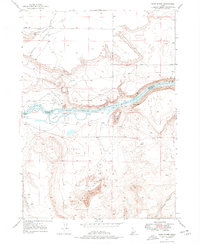
USGS Historical Quadrangle in GeoPDF.
Tags: 7.5 x 7.5 minute,
Downloadable Data,
GeoPDF,
GeoTIFF,
Historical Topographic Maps, All tags...
Historical Topographic Maps 7.5 x 7.5 Minute Map Series,
ID,
Map,
Sand Dunes,
imageryBaseMapsEarthCover, Fewer tags
Core Research Center, cutting CZ15111, from well operated by FLORIDA EXPLORATIONRaw Properties from download, web scrape, MapServer, and Macrostrat API{"Lib Num": "CZ15111", "API Num": "4903721721", "Operator": "FLORIDA EXPLORATION", "Well Name": "1 FEDERAL GOODSTEIN", "Field": "NITCHIE GULCH", "State": "WY", "County": "SWEETWATER", "Thin Sec": "F", "Analysis": "F", "Latitude": "42.00945", "Longitude": "-109.1552", "coordinates_geohash": "9x6qupedg3pd", "Source": "FROM STATE RECORDS", "Min": "610", "Max": "10100", "Security Flag": null, "crc_collection_name": "cutting", "sb_parent_id": "4f4e49d8e4b07f02db5df2d2", "intervals": [{"Formation": null, "Age": null, "Min Depth": null, "Max Depth": null}], "crcwc_url":...
Core Research Center, cutting CZ09179, from well operated by DAVIS OILRaw Properties from download, web scrape, MapServer, and Macrostrat API{"Lib Num": "CZ09179", "API Num": "4903720246", "Operator": "DAVIS OIL", "Well Name": "1-2 GRADY-FEDERAL", "Field": "WC", "State": "WY", "County": "SWEETWATER", "Thin Sec": "F", "Analysis": "F", "Latitude": "42.04549", "Longitude": "-109.29444", "coordinates_geohash": "9x6r0ynhwzqv", "Source": "FROM STATE RECORDS", "Min": "330", "Max": "7997", "Security Flag": null, "crc_collection_name": "cutting", "sb_parent_id": "4f4e49d8e4b07f02db5df2d2", "intervals": [{"Formation": null, "Age": null, "Min Depth": null, "Max Depth": null}], "crcwc_url": "https://my.usgs.gov/crcwc/cutting/report/22170",...
Core Research Center, cutting CZ12600, from well operated by CIG EXPLORATIONRaw Properties from download, web scrape, MapServer, and Macrostrat API{"Lib Num": "CZ12600", "API Num": "4903720947", "Operator": "CIG EXPLORATION", "Well Name": "1-28 HAYSTACK UNIT", "Field": "HAYSTACK", "State": "WY", "County": "SWEETWATER", "Thin Sec": "F", "Analysis": "F", "Latitude": "41.15703", "Longitude": "-108.2083", "coordinates_geohash": "9x741smj5f7r", "Source": "FROM STATE RECORDS", "Min": "3015", "Max": "16250", "Security Flag": null, "crc_collection_name": "cutting", "sb_parent_id": "4f4e49d8e4b07f02db5df2d2", "intervals": [{"Formation": null, "Age": null, "Min Depth": null, "Max Depth": null}], "crcwc_url": "https://my.usgs.gov/crcwc/cutting/report/23742",...
Core Research Center, cutting HH00379, from well operated by ENRON OIL AND GASRaw Properties from download, web scrape, MapServer, and Macrostrat API{"Lib Num": "HH00379", "API Num": "4903722925", "Operator": "ENRON OIL AND GAS", "Well Name": "44-9 CEPO", "Field": "CEPO", "State": "WY", "County": "SWEETWATER", "Thin Sec": "F", "Analysis": "F", "Latitude": "41.19537", "Longitude": "-108.09209", "coordinates_geohash": "9x74k73srtxf", "Source": "FROM STATE RECORDS", "Min": "10900", "Max": "13950", "Security Flag": null, "crc_collection_name": "cutting", "sb_parent_id": "4f4e49d8e4b07f02db5df2d2", "intervals": [{"Formation": null, "Age": null, "Min Depth": null, "Max Depth": null}], "crcwc_url": "https://my.usgs.gov/crcwc/cutting/report/51025",...
Core Research Center, core E748, from well operated by CELSIUS ENERGYRaw Properties from download, web scrape, MapServer, and Macrostrat API{"Lib Num": "E748", "API Num": "4903723092", "Operator": "CELSIUS ENERGY", "Well Name": "3 JEEP TRAIL", "Field": "WILDCAT", "State": "WY", "County": "SWEETWATER", "Type": "SLABBED", "Photos": "T", "Thin Sec": "F", "Analysis": "T", "Latitude": "41.32715", "Longitude": "-108.14721", "coordinates_geohash": "9x75553s575k", "Source": "FROM STATE RECORDS", "Security Flag": "NO SPECIAL RESTRICTIONS", "crc_collection_name": "core", "sb_parent_id": "4f4e49dae4b07f02db5e0486", "intervals": [{"Formation": "ALMOND", "Age": "CRET", "Min Depth": "13703", "Max Depth": "13759"}, {"Formation":...
Core Research Center, cutting HH00573, from well operated by BASS ENTERPRISESRaw Properties from download, web scrape, MapServer, and Macrostrat API{"Lib Num": "HH00573", "API Num": "4903723037", "Operator": "BASS ENTERPRISES", "Well Name": "1 POLAR BEAR", "Field": "POLAR BAR", "State": "WY", "County": "SWEETWATER", "Thin Sec": "F", "Analysis": "F", "Latitude": "41.16739", "Longitude": "-108.19145", "coordinates_geohash": "9x744n33kmxw", "Source": "FROM STATE RECORDS", "Min": "1500", "Max": "11100", "Security Flag": null, "crc_collection_name": "cutting", "sb_parent_id": "4f4e49d8e4b07f02db5df2d2", "intervals": [{"Formation": null, "Age": null, "Min Depth": null, "Max Depth": null}], "crcwc_url": "https://my.usgs.gov/crcwc/cutting/report/51914",...
Core Research Center, cutting CZ15256, from well operated by CIG EXPLORATIONRaw Properties from download, web scrape, MapServer, and Macrostrat API{"Lib Num": "CZ15256", "API Num": "4903721643", "Operator": "CIG EXPLORATION", "Well Name": "4-6-13-96 HAYSTACK UNIT", "Field": "WC", "State": "WY", "County": "SWEETWATER", "Thin Sec": "F", "Analysis": "T", "Latitude": "41.12377", "Longitude": "-108.24684", "coordinates_geohash": "9x71by353f3g", "Source": "FROM STATE RECORDS", "Min": "80", "Max": "16970", "Security Flag": null, "crc_collection_name": "cutting", "sb_parent_id": "4f4e49d8e4b07f02db5df2d2", "intervals": [{"Formation": null, "Age": null, "Min Depth": null, "Max Depth": null}], "crcwc_url": "https://my.usgs.gov/crcwc/cutting/report/27075",...
|
|

