Filters: Tags: Sandwich, MA (X)
4 results (8ms)|
Filters
|
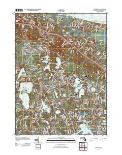
Layered GeoPDF 7.5 Minute Quadrangle Map. Layers of geospatial data include orthoimagery, roads, grids, geographic names, elevation contours, hydrography, and other selected map features.
Low-altitude (80-100 meters above ground level) digital images of Town Neck Beach in Sandwich, Massachusetts, were obtained from a camera mounted on a small unmanned aerial system (UAS; also known as a drone). Imagery was collected at close to low tide on seven days bracketing coastal ocean storms to observe changes in beach and dune morphology. The images were geolocated by using the single-frequency geographic positioning system aboard the UAS. Ground control points (GCPs) were established by using temporary targets on the ground, which were located by using a real-time kinematic global navigation satellite system (RTK-GNSS) base station and rovers. The GCPs can be used as constraints during photogrammetric processing....
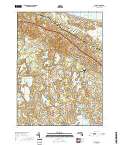
Layered geospatial PDF 7.5 Minute Quadrangle Map. Layers of geospatial data include orthoimagery, roads, grids, geographic names, elevation contours, hydrography, and other selected map features. This map is derived from GIS (geospatial information system) data. It represents a repackaging of GIS data in traditional map form, not creation of new information. The geospatial data in this map are from selected National Map data holdings and other government sources.
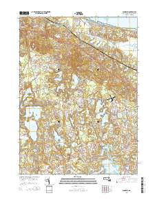
Layered GeoPDF 7.5 Minute Quadrangle Map. Layers of geospatial data include orthoimagery, roads, grids, geographic names, elevation contours, hydrography, and other selected map features.
|

|
