Filters: Tags: Sandwich (X)
65 results (155ms)|
Filters
Date Range
Extensions Types Contacts
Categories Tag Types Tag Schemes |
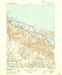
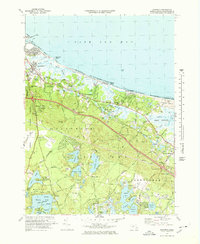
USGS Historical Quadrangle in GeoPDF.

USGS Historical Quadrangle in GeoPDF.
USGS Historical Quadrangle in GeoPDF.
Low-altitude (30-120 meters above ground level) digital images of Town Neck Beach in Sandwich, Massachusetts, were obtained with a series of cameras mounted on small unmanned aerial systems (UAS, also known as a drone). Imagery was collected at close to low tide on five days to observe changes in beach and dune morphology. The images were geolocated by using the single-frequency geographic positioning system aboard the UAS. Ground control points (GCPs) were established by using temporary targets on the ground, which were located by using a real-time kinematic global navigation satellite system (RTK-GNSS) base station and rovers. The GCPs can be used as constraints during photogrammetric processing. Transect points...
This data set contains imagery from the National Agriculture Imagery Program (NAIP). The NAIP program is administered by USDA FSA and has been established to support two main FSA strategic goals centered on agricultural production. These are, increase stewardship of America's natural resources while enhancing the environment, and to ensure commodities are procured and distributed effectively and efficiently to increase food security. The NAIP program supports these goals by acquiring and providing ortho imagery that has been collected during the agricultural growing season in the U.S. The NAIP ortho imagery is tailored to meet FSA requirements and is a fundamental tool used to support FSA farm and conservation programs....
Geophysical and geological survey data were collected off Town Neck Beach in Sandwich, Massachusetts, in May and July 2016. Approximately 130 linear kilometers of subbottom (seismic-reflection) and 234-kilohertz interferometric sonar (bathymetric and backscatter) data were collected along with sediment samples, sea floor photographs, and (or) video at 26 sites within the geophysical survey area. Sediment grab samples were collected at 19 of the 26 sampling sites and video and (or) photographic imagery of the sea floor were taken at all 26 sites. These survey data are used to characterize the sea floor by identifying sediment-texture, seabed morphology, and underlying geologic structure and stratigraphy. Data collected...
Low-altitude (30-120 meters above ground level) digital images of Town Neck Beach in Sandwich, Massachusetts, were obtained with a series of cameras mounted on small unmanned aerial systems (UAS, also known as a drone). Imagery was collected at close to low tide on five days to observe changes in beach and dune morphology. The images were geolocated by using the single-frequency geographic positioning system aboard the UAS. Ground control points (GCPs) were established by using temporary targets on the ground, which were located by using a real-time kinematic global navigation satellite system (RTK-GNSS) base station and rovers. The GCPs can be used as constraints during photogrammetric processing. Transect points...
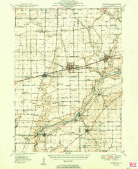
USGS Historical Quadrangle in GeoPDF.
Quantification of mobile/less-mobile porosity dynamics at the sediment/water interface is critical to predicting contaminant storage, release, and transformation processes. Zones in groundwater flow-through lakes where lake water recharges the aquifer can strongly control aquifer water quality. Less-mobile porosity has previously been characterized in aquifers using flow path scale (10's of m+) tracer injections which are analyzed using numerical models. Methodology was recently developed to couple geoelectric measurements (bulk electrical conductivity, EC), which are directly sensitive to less-mobile ionic tracer exchange processes, with pumped fluid EC tracer data over time. If the fluid EC concentration history...
Low-altitude (30-120 meters above ground level) digital images of Town Neck Beach in Sandwich, Massachusetts, were obtained with a series of cameras mounted on small unmanned aerial systems (UAS, also known as a drone). Imagery was collected at close to low tide on five days to observe changes in beach and dune morphology. The images were geolocated by using the single-frequency geographic positioning system aboard the UAS. Ground control points (GCPs) were established by using temporary targets on the ground, which were located by using a real-time kinematic global navigation satellite system (RTK-GNSS) base station and rovers. The GCPs can be used as constraints during photogrammetric processing. Transect points...
Geophysical and geological survey data were collected off Town Neck Beach in Sandwich, Massachusetts, in May and July 2016. Approximately 130 linear kilometers of subbottom (seismic-reflection) and 234-kilohertz interferometric sonar (bathymetric and backscatter) data were collected along with sediment samples, sea floor photographs, and (or) video at 26 sites within the geophysical survey area. Sediment grab samples were collected at 19 of the 26 sampling sites and video and (or) photographic imagery of the sea floor were taken at all 26 sites. These survey data are used to characterize the sea floor by identifying sediment-texture, seabed morphology, and underlying geologic structure and stratigraphy. Data collected...
Geophysical and geological survey data were collected off Town Neck Beach in Sandwich, Massachusetts, in May and July 2016. Approximately 130 linear kilometers of subbottom (seismic-reflection) and 234-kilohertz interferometric sonar (bathymetric and backscatter) data were collected along with sediment samples, sea floor photographs, and (or) video at 26 sites within the geophysical survey area. Sediment grab samples were collected at 19 of the 26 sampling sites and video and (or) photographic imagery of the sea floor were taken at all 26 sites. These survey data are used to characterize the sea floor by identifying sediment-texture, seabed morphology, and underlying geologic structure and stratigraphy. Data collected...
Categories: Data;
Types: Downloadable,
Map Service,
OGC WFS Layer,
OGC WMS Layer,
Shapefile;
Tags: Atlantic Ocean,
CMGP,
Cape Cod Bay,
Coastal and Marine Geology Program,
Gulf of Maine,
Low-altitude (30-120 meters above ground level) digital images of Town Neck Beach in Sandwich, Massachusetts, were obtained with a series of cameras mounted on small unmanned aerial systems (UAS, also known as a drone). Imagery was collected at close to low tide on five days to observe changes in beach and dune morphology. The images were geolocated by using the single-frequency geographic positioning system aboard the UAS. Ground control points (GCPs) were established by using temporary targets on the ground, which were located by using a real-time kinematic global navigation satellite system (RTK-GNSS) base station and rovers. The GCPs can be used as constraints during photogrammetric processing. Transect points...
When water is pumped slowly from saturated sediment-water inteface sediments, the more highly connected, mobile porosity domain is prefferentially sampled, compared to less-mobile pore spaces. Changes in fluid electrical conductivity (EC) during controlled downward ionic tracer injections into interface sediments can be assumed to represent mobile porosity dynamics, which are therefore distinguished from less-mobile porosity dynamics that is measured using bulk EC geoelectrical methods. Fluid EC samples were drawn at flow rates similar to tracer injection rates to prevent inducing preferential flow. The data were collected using a stainless steel tube with slits cut into the bottom (USGS MINIPOINT style) connected...

USGS Historical Quadrangle in GeoPDF.
USGS Historical Quadrangle in GeoPDF.

The U.S. Geological Survey, in cooperation with the Air Force Civil Engineer Center, developed a numerical, steady-state regional model, using MODFLOW-2005, to evaluate current (2010) conditions and the potential effects of future (2030) groundwater withdrawals on water levels, streamflows, hydraulic gradients, and advective transport near the Joint Base Cape Cod (JBCC). Two numerical models were used in this analysis. An existing two-dimensional (one layer) model (termed the “coast model”), developed as part of a previous investigation of the potential effects of sea-level rise on the Cape Cod aquifer system (https://doi.org/10.3133/sir20165058), simulates the position of the freshwater/saltwater interface by using...
Low-altitude (80-100 meters above ground level) digital images of Town Neck Beach in Sandwich, Massachusetts, were obtained from a camera mounted on a small unmanned aerial system (UAS; also known as a drone). Imagery was collected at close to low tide on seven days to observe changes in beach and dune morphology. The images were geolocated by using the single-frequency geographic positioning system aboard the UAS. Ground control points (GCPs) were established by using temporary targets on the ground, which were located by using a real-time kinematic global navigation satellite system (RTK-GNSS) base station and rovers. The GCPs can be used as constraints during photogrammetric processing. Transect points were collected...
Low-altitude (30-120 meters above ground level) digital images of Town Neck Beach in Sandwich, Massachusetts, were obtained with a series of cameras mounted on small unmanned aerial systems (UAS, also known as a drone). Imagery was collected at close to low tide on five days to observe changes in beach and dune morphology. The images were geolocated by using the single-frequency geographic positioning system aboard the UAS. Ground control points (GCPs) were established by using temporary targets on the ground, which were located by using a real-time kinematic global navigation satellite system (RTK-GNSS) base station and rovers. The GCPs can be used as constraints during photogrammetric processing. Transect points...
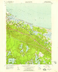
USGS Historical Quadrangle in GeoPDF.
|

|
