Filters: Tags: Santa Ana Pueblo (X)
9 results (13ms)|
Filters
Date Range
Extensions Types Contacts
Categories Tag Types Tag Schemes |
The mule deer (Odocoileus hemionus) of the Pueblo of Santa Ana herds are primarily non-migratory, with two distinct winter ranges separated by U.S. Route 550. The winter ranges consist primarily of Chihuahuan semi‐desert grassland, dominated by black grama (Bouteloua eriopoda), galleta (Pleuraphis jamesii), mesa dropseed (Sporobolus flexuosus), and fourwing saltbush (Atriplex canescens), with higher elevation sections consisting of pinyon-juniper woodland and juniper savannah. There was no movement between the two winter ranges, with only individuals from the winter range northeast of US 550 crossing the highway west of the Jemez Canyon Reservoir. Two individuals from the winter range northeast of US 550 migrated...
Categories: Data;
Types: Downloadable,
Map Service,
OGC WFS Layer,
OGC WMS Layer,
Shapefile;
Tags: New Mexico,
Santa Ana Pueblo,
United States,
animal behavior,
health,
This data set contains imagery from the National Agriculture Imagery Program (NAIP). The NAIP program is administered by USDA FSA and has been established to support two main FSA strategic goals centered on agricultural production. These are increase stewardship of America's natural resources while enhancing the environment, and to ensure commodities are procured and distributed effectively and efficiently to increase food security. The NAIP program supports these goals by acquiring and providing ortho imagery that has been collected during the agricultural growing season in the U.S. The NAIP ortho imagery is tailored to meet FSA requirements and is a fundamental tool used to support FSA farm and conservation programs....
This data set contains imagery from the National Agriculture Imagery Program (NAIP). The NAIP program is administered by USDA FSA and has been established to support two main FSA strategic goals centered on agricultural production. These are increase stewardship of America's natural resources while enhancing the environment, and to ensure commodities are procured and distributed effectively and efficiently to increase food security. The NAIP program supports these goals by acquiring and providing ortho imagery that has been collected during the agricultural growing season in the U.S. The NAIP ortho imagery is tailored to meet FSA requirements and is a fundamental tool used to support FSA farm and conservation programs....
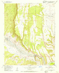
USGS Historical Quadrangle in GeoPDF.
The elk (Cervus canadensis) of the Pueblo of Santa Ana herd are primarily non-migratory and located northeast of U.S. Route 550 and south of the Jemez Mountains. The winter range is dominated by black grama (Bouteloua eriopoda), galleta (Pleuraphis jamesii), mesa dropseed (Sporobolus flexuosus), and fourwing saltbush (Atriplex canescens), with pinyon-juniper woodlands and ponderosa pine forests dominating the higher elevation slopes of the Jemez Mountains. Two individuals exhibited migratory movements from the lower elevation winter range on the Pueblo of Santa Ana to the higher-elevation slopes of the Jemez Mountains via Bear Springs Canyon, east of the town of Ponderosa. Challenges to elk movement include the...
Categories: Data;
Types: Downloadable,
Map Service,
OGC WFS Layer,
OGC WMS Layer,
Shapefile;
Tags: New Mexico,
Santa Ana Pueblo,
United States,
animal behavior,
health,
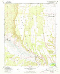
USGS Historical Quadrangle in GeoPDF.
This data set contains imagery from the National Agriculture Imagery Program (NAIP). The NAIP program is administered by USDA FSA and has been established to support two main FSA strategic goals centered on agricultural production. These are increase stewardship of America's natural resources while enhancing the environment, and to ensure commodities are procured and distributed effectively and efficiently to increase food security. The NAIP program supports these goals by acquiring and providing ortho imagery that has been collected during the agricultural growing season in the U.S. The NAIP ortho imagery is tailored to meet FSA requirements and is a fundamental tool used to support FSA farm and conservation programs....
This data set contains imagery from the National Agriculture Imagery Program (NAIP). The NAIP program is administered by USDA FSA and has been established to support two main FSA strategic goals centered on agricultural production. These are increase stewardship of America's natural resources while enhancing the environment, and to ensure commodities are procured and distributed effectively and efficiently to increase food security. The NAIP program supports these goals by acquiring and providing ortho imagery that has been collected during the agricultural growing season in the U.S. The NAIP ortho imagery is tailored to meet FSA requirements and is a fundamental tool used to support FSA farm and conservation programs....
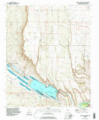
USGS Historical Quadrangle in GeoPDF.
|

|
