Filters: Tags: Santa Catalina Island (X)
7 results (8ms)|
Filters
Date Range
Types (Less) Contacts (Less)
Categories (Less) Tag Types Tag Schemes
|
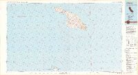
USGS Historical Quadrangle in GeoPDF.
This data release contains 43 chirp sub-bottom profiles that were collected in November of 2014 from the Catalina and Santa Cruz Basins offshore southern California by the U.S. Geological Survey Pacific and Coastal Marine Science Center. Data were collected aboard the University of California’s R/V Robert Gordon Sproul on USGS cruise 2014-645-FA. Chirp profiles were collected to assess earthquake and submarine landslide hazards offshore southern California.
Categories: Data;
Types: Citation;
Tags: Avalon,
Bathymetry and Elevation,
CMHRP,
Catalina Basin,
Catalina Canyon,
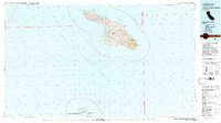
USGS Historical Quadrangle in GeoPDF.
This data release contains 35 multichannel sparker and 24 multichannel minisparker seismic reflection (MCS) profiles that were collected in November of 2014 from the Catalina and Santa Cruz Basins offshore southern California by the U.S. Geological Survey Pacific and Coastal Marine Science Center. Data were collected aboard the University of California’s R/V Robert Gordon Sproul on USGS cruise 2014-645-FA. MCS profiles were collected to assess earthquake and submarine landslide hazards offshore southern California.
Categories: Data;
Types: Citation;
Tags: Avalon,
Bathymetry and Elevation,
CMHRP,
Catalina Basin,
Catalina Canyon,

This data release contains 25 multichannel minisparker seismic reflection (MCS) profiles that were collected in February of 2016 from the Catalina Basin offshore southern California by the U.S. Geological Survey Pacific and Coastal Marine Science Center in cooperation with the University of Washington. Data were collected aboard the University of Washington’s R/V Thomas G. Thompson on USGS cruise 2016-616-FA. MCS profiles were collected to image the Catalina and San Clemente fault systems as well as the San Gabriel Canyon and Channel system.
To support the modeling of storm-induced flooding, the USGS Coastal National Elevation Database (CoNED) Applications Project has created an integrated 1-meter topobathymetric digital elevation model (TBDEM) for the Southern California Coast and Channel Islands. The Channel Islands are a chain of eight islands where years of isolation has created unique fauna, flora, and archeological resources. The archipelago extends for 160 miles (257 km) between San Miguel Island in the north and San Clemente Island in the south. Five of the islands are part of Channel Islands National Park (Anacapa, Santa Cruz, Santa Rosa, San Miguel, and Santa Barbara), and the waters surrounding these islands make up the Channel Islands National...

This data release contains 41 chirp sub-bottom profiles that were collected in February of 2016 from the Catalina Basin offshore southern California by the U.S. Geological Survey Pacific and Coastal Marine Science Center in cooperation with the University of Washington. Data were collected aboard the University of Washington’s R/V Thomas G. Thompson on USGS cruise 2016-616-FA. Chirp profiles were collected to image the Catalina and San Clemente fault systems as well as the San Gabriel Canyon system.
|

|
