Filters: Tags: Santa Cruz, CA (X)
4 results (129ms)|
Filters
Date Range
Types Contacts
Categories Tag Types Tag Schemes |
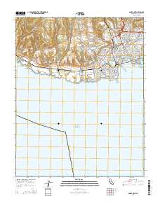
Layered GeoPDF 7.5 Minute Quadrangle Map. Layers of geospatial data include orthoimagery, roads, grids, geographic names, elevation contours, hydrography, and other selected map features.
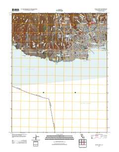
Layered GeoPDF 7.5 Minute Quadrangle Map. Layers of geospatial data include orthoimagery, roads, grids, geographic names, elevation contours, hydrography, and other selected map features.
This dataset contains magnetometry data and design files related to testing of new drone-based magnetometer configurations and magnetic compensation software. Data were collected in Santa Cruz (CA) in September 2020 to compare two magnetometer systems that are flown with Unmanned Aerial Systems (UAS). Each system was flown using different suspension designs. To compare the systems and to characterize noise levels of the systems, calibration patterns and dense grid surveys were flown with each configuration. This dataset was further used to test magnetic compensation software. The overall aim of this study was to compare the variability of different UAS-based magnetometry systems that can be used for geophysical...
Categories: Data;
Types: Map Service,
OGC WFS Layer,
OGC WMS Layer,
OGC WMS Service;
Tags: Geophysics,
Santa Cruz, CA,
Surprise Valley, CA,
UAS,
UAV,
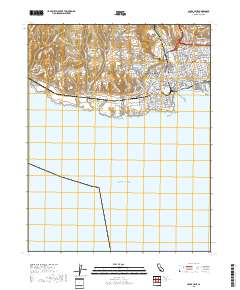
Layered geospatial PDF 7.5 Minute Quadrangle Map. Layers of geospatial data include orthoimagery, roads, grids, geographic names, elevation contours, hydrography, and other selected map features. This map is derived from GIS (geospatial information system) data. It represents a repackaging of GIS data in traditional map form, not creation of new information. The geospatial data in this map are from selected National Map data holdings and other government sources.
|

|
