Filters: Tags: Santa Cruz County (X) > Date Range: {"choice":"year"} (X)
16 results (14ms)|
Filters
Date Types (for Date Range)
Types Contacts
Categories Tag Types
|
This data release presents beach topography and nearshore bathymetry data from repeated surveys in northern Monterey Bay, California to document changes in shoreline position and coastal morphology as they relate to episodic (storms), seasonal, and interannual and longer (e.g. El Niño) processes. The ongoing monitoring program was initiated in October 2014 with semi-annual surveys performed in late summer (September or October) and Spring (March). Nearshore bathymetry and topography data were collected along a series of shore-perpendicular transects spaced primarily at 50-250 m intervals between Santa Cruz and Moss Landing, California (fig. 1). The transects were located along sandy stretches of the coastline...
Categories: Data;
Types: Map Service,
OGC WFS Layer,
OGC WMS Layer,
OGC WMS Service;
Tags: Bathymetry and Elevation,
CMGP,
Coastal and Marine Geology Program,
Echo Sounders,
GPS (Global Positioning System),

The High Resolution National Hydrography Dataset Plus (NHDPlus HR) is an integrated set of geospatial data layers, including the best available National Hydrography Dataset (NHD), the 10-meter 3D Elevation Program Digital Elevation Model (3DEP DEM), and the National Watershed Boundary Dataset (WBD). The NHDPlus HR combines the NHD, 3DEP DEMs, and WBD to create a stream network with linear referencing, feature naming, "value added attributes" (VAAs), elevation-derived catchments, and other features for hydrologic data analysis. The stream network with linear referencing is a system of data relationships applied to hydrographic systems so that one stream reach "flows" into another and "events" can be tied to and traced...
A combination of citizen science inventories and expert assessments will be used to collect critical baseline information on known spring and seep resources using the Spring Ecosystem Inventory and Assessment Protocols and adapting them as needed for the unique arid Sky Island ecosystems. The assessment will collect information on channel morphology, riparian and wetland vegetation, water quality, aquatic macroinvertebrates, and wildlife. This information will be combined with historic data from cooperating agencies (Pima County, Santa Cruz County, USFS, NPA, USGS, USFWS, BLM, and AGFD) in a regional, on-line database to provide a landscape level context for managing resources, which was previously unavailable due...
Categories: Data,
Project;
Types: ArcGIS REST Map Service,
Map Service,
OGC WFS Layer,
OGC WMS Layer,
OGC WMS Service;
Tags: 2011,
AZ-02,
AZ-03,
Arizona,
Arizona,
Rainfall measurements were collected in and near the Dolan Fire burn area, Los Padres National Forest, California. The Dolan Fire ignited on August 18, 2020. By the time of full containment on December 31, 2020, the fire had burned 518 km2 (128,050 acres) in Monterey County. Post-fire debris flows occurred in many watersheds burned by the Dolan Fire during the first post-fire wet season, in winter 2021. The U.S. Geological Survey (USGS) installed seven rain gages within the Dolan Fire burn area in October 2021 to measure rainfall during the second post-fire wet season. The USGS gratefully acknowledges permission granted by Los Padres National Forest for the collection of these data.
Categories: Data;
Tags: CMHRP,
Climatology,
Coastal and Marine Hazards and Resources Program,
Hydrology,
PCMSC,

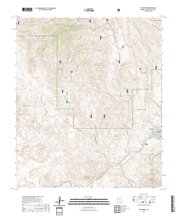
Layered geospatial PDF 7.5 Minute Quadrangle Map. Layers of geospatial data include orthoimagery, roads, grids, geographic names, elevation contours, hydrography, and other selected map features. This map is derived from GIS (geospatial information system) data. It represents a repackaging of GIS data in traditional map form, not creation of new information. The geospatial data in this map are from selected National Map data holdings and other government sources.
Tabular data output from a series of groundwater modeling simulations for five counties along the Central Coast of California, USA. We used a spatially explicit state-and-transition simulation model with stocks and flows that integrates climate, land-use change, human water use, and groundwater gain-loss to examine the impact of future climate and land use change on groundwater balance and water demand at 270-m resolution from 2010 to 2060. The model incorporated downscaled groundwater recharge projections based on a Warm/Wet and a Hot/Dry climate future using output from the Basin Characterization Model, a spatially explicit hydrological process-based model. Two urbanization projections from a parcel-based, regional...
The California Groundwater Ambient Monitoring and Assessment Program Priority Basin Project (GAMA-PBP) analyzed for per-and polyfluoroalkyl substances (PFAS) in groundwater samples collected from domestic and public drinking water supply wells in California. GAMA-PBP is a cooperative program between the U.S. Geological Survey and the California State Water Resources Control Board. This data release contains data for samples collected from May 2019 through December 2022 and includes revisions to earlier data (Kent, 2021) that were either screened or removed after analysis of quality-control data. Please see the quality-control and other descriptions of the data in the processing steps in the xml file. Subsequent...

The High Resolution National Hydrography Dataset Plus (NHDPlus HR) is an integrated set of geospatial data layers, including the best available National Hydrography Dataset (NHD), the 10-meter 3D Elevation Program Digital Elevation Model (3DEP DEM), and the National Watershed Boundary Dataset (WBD). The NHDPlus HR combines the NHD, 3DEP DEMs, and WBD to create a stream network with linear referencing, feature naming, "value added attributes" (VAAs), elevation-derived catchments, and other features for hydrologic data analysis. The stream network with linear referencing is a system of data relationships applied to hydrographic systems so that one stream reach "flows" into another and "events" can be tied to and traced...
Rainfall measurements were collected in and near the CZU Lightning Complex Fire (hereafter, "CZU Fire") burn area, Santa Cruz Mountains, California. The CZU Fire ignited in the Santa Cruz Mountains, California, on August 16, 2020. By the time of full containment on September 22, 2020, the fire had burned 350 km2 (86,510 acres) in Santa Cruz and San Mateo Counties. The U.S. Geological Survey (USGS) installed four rain gages in and near the CZU Fire burn area to measure rainfall during two post-fire wet seasons. The USGS gratefully acknowledges the cooperation of Big Basin Redwoods State Park, the Big Creek Lumber Co., the McCrary family, and Brookdale Lodge in the collection of these data. This data release contains...
Categories: Data;
Types: Map Service,
OGC WFS Layer,
OGC WMS Layer,
OGC WMS Service;
Tags: CMHRP,
Climatology,
Coastal and Marine Hazards and Resources Program,
Geomorphology,
Hydrology,

The High Resolution National Hydrography Dataset Plus (NHDPlus HR) is an integrated set of geospatial data layers, including the National Hydrography Dataset (NHD), National Watershed Boundary Dataset (WBD), and 3D Elevation Program Digital Elevation Model (3DEP DEM). The NHDPlus HR combines the NHD, 3DEP DEMs, and WBD to a data suite that includes the NHD stream network with linear referencing functionality, the WBD hydrologic units, elevation-derived catchment areas for each stream segment, "value added attributes" (VAAs), and other features that enhance hydrologic data analysis and routing.
This data release has been deprecated. Please see new data release here: https://doi.org/10.5066/P9ETQ00R The U.S. Geological Survey Groundwater Ambient Monitoring and Assessment-Priority Basin Project (USGS GAMA-PBP) collected samples to be analyzed for per-and polyfluoroalkyl substances (PFAS) from domestic and public supply wells from May 2019 to June 2021. The datasets presented here include identification of the 28 PFAS constituents monitored by the project, Identification and brief characterization of the 395 GAMA-PBP wells for which samples were analyzed for PFAS during the study period, and analytical results for those groundwater samples, along with results for quality control samples.
Rain gages were deployed temporarily at four sites in Santa Cruz County, California, during a series of atmospheric-river storms that delivered unusually large amounts of rain in January 2023. Data collection focused on the San Lorenzo River, and include three locations in the San Lorenzo Valley (in Boulder Creek along Hilton Drive, in Felton near Glengarry Road, and in Scotts Valley along Green Valley Road), as well as one site within the city of Santa Cruz, on Darwin Street. These data are provided to facilitate emergency response and assessment of continued landscape effects of these storms.
Categories: Data;
Tags: CMHRP,
Climatology,
Coastal and Marine Hazards and Resources Program,
Distributions,
Hydrology,
This project used sound science and best management practices in the development and preparation of a coast redwoods for climate change workshop and related field trip involving multiple partners and others. The main purpose of the workshop was information exchange and shared knowledge on how best to manage coast redwoods for projected climate changes.
Categories: Data,
Project;
Types: Map Service,
OGC WFS Layer,
OGC WMS Layer,
OGC WMS Service;
Tags: 2013,
Academics & scientific researchers,
Adaptation,
Adaptation,
Adaptation,
This data release provides 270-m resolution maps of hotspots of vulnerability to projected changes in land-use, water shortages, and climate from 2001-2061 for agricultural, domestic, and ecological communities in the Central Coast of California, USA, under five management scenarios. This data covers the counties of Santa Cruz, San Benito, Monterey, San Luis Obispo, and Santa Barbara counties, but only cover those areas overlying a groundwater basin (because these contain the overwhelming majority of regional anthropogenic land-uses). Data are provided as .zip compressed file packages containing geospatial raster surfaces (.tif format). Each map is the product of one of three types of exposure to change (land, water,...

The High Resolution National Hydrography Dataset Plus (NHDPlus HR) is an integrated set of geospatial data layers, including the National Hydrography Dataset (NHD), National Watershed Boundary Dataset (WBD), and 3D Elevation Program Digital Elevation Model (3DEP DEM). The NHDPlus HR combines the NHD, 3DEP DEMs, and WBD to a data suite that includes the NHD stream network with linear referencing functionality, the WBD hydrologic units, elevation-derived catchment areas for each stream segment, "value added attributes" (VAAs), and other features that enhance hydrologic data analysis and routing.
Layered geospatial PDF 7.5 Minute Quadrangle Map. Layers of geospatial data include orthoimagery, roads, grids, geographic names, elevation contours, hydrography, and other selected map features. This map is derived from GIS (geospatial information system) data. It represents a repackaging of GIS data in traditional map form, not creation of new information. The geospatial data in this map are from selected National Map data holdings and other government sources.
|

|
