Filters: Tags: Santa Cruz County (X)
639 results (571ms)|
Filters
Date Range
Extensions Types Contacts
Categories Tag Types
|
ADMMR map collection: Ruby-Margarita, Claim Map; 1 in. to 1000 feet; 20 x 17 in.
ADMMR map collection: Bonanza Mine Section; 1 in. to 40 feet; 24 x 14 in.
ADMMR map collection: Bonanza Section N 453; 1 in. to 40 feet; 13 x 15 in.
Heinrichs Geoexploration Co. Maps: Glove Mine, Radial Downhole I.P. Survey from DH No. 8, N/S; 1 in. to 200 feet; 11 x 9 in.
Heinrichs Geoexploration Co. Maps: Glove Mine East, I.P., Line No. 6, Spread 1; 24 x 12 in.
Heinrichs Geoexploration Co. Maps: Glove Mine, I.P., Line No. 2, Spread 1; 25 x 13 in.
Heinrichs Geoexploration Co. Maps: Self Potential of Glove Mine; 22 x 22 in.
Heinrichs Geoexploration Co. Maps: Glove Mine, I.P., Line No. 1, Spread 1; 24 x 12 in.
Heinrichs Geoexploration Co. Maps: California Gulch Placer Project Composite Map; 1 in. to 200 feet; 33 x 42 in.
Heinrichs Geoexploration Co. Maps: S.G. Claims, I.P. Traverse Line No. 1; 1 in. to 500 feet; 25 x 17 in.
Heinrichs Geoexploration Co. Maps: Cobre Mountain, I.P., Line No. 3, Spread 1; 23 x 12 in.
Heinrichs Geoexploration Co. Maps: Carmen, I.P. Traverse Line No. 5-1 Sheet 1; 1 in. to 500 feet; 25 x 21 in.
Heinrichs Geoexploration Co. Maps: World's Fair Mine Surface Geology and Geochemical Sampling; 1 in. to 200 feet; 30 x 30 in.
ADMMR map collection: Red Mountain Mine Plan, Number 2 Adit; 1 in. to 100 feet; 21 x 14 in.
This dataset includes the magnetotelluric (MT) sounding data collected in 2008 in and near the Patagonia Mountains of Arizona. The U.S. Geological Survey (USGS) conducted a series of multidisciplinary studies as part of the Assessment Techniques for Concealed Mineral Resources project funded by the USGS Minerals Resources Program in cooperation with the U.S. Forest Service.
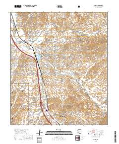
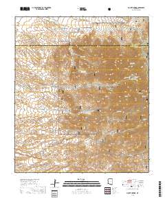
Layered geospatial PDF 7.5 Minute Quadrangle Map. Layers of geospatial data include orthoimagery, roads, grids, geographic names, elevation contours, hydrography, and other selected map features. This map is derived from GIS (geospatial information system) data. It represents a repackaging of GIS data in traditional map form, not creation of new information. The geospatial data in this map are from selected National Map data holdings and other government sources.
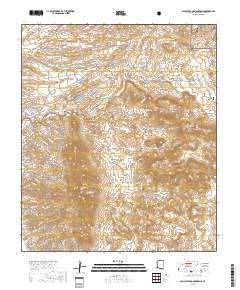
Layered geospatial PDF 7.5 Minute Quadrangle Map. Layers of geospatial data include orthoimagery, roads, grids, geographic names, elevation contours, hydrography, and other selected map features. This map is derived from GIS (geospatial information system) data. It represents a repackaging of GIS data in traditional map form, not creation of new information. The geospatial data in this map are from selected National Map data holdings and other government sources.
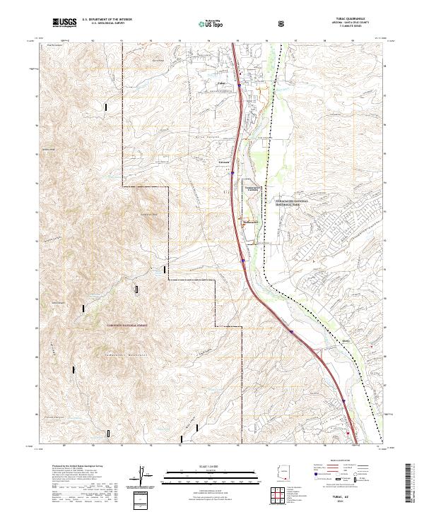
Layered geospatial PDF 7.5 Minute Quadrangle Map. Layers of geospatial data include orthoimagery, roads, grids, geographic names, elevation contours, hydrography, and other selected map features. This map is derived from GIS (geospatial information system) data. It represents a repackaging of GIS data in traditional map form, not creation of new information. The geospatial data in this map are from selected National Map data holdings and other government sources.
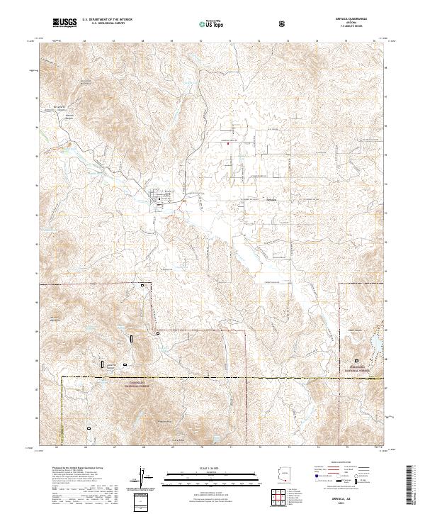
Layered geospatial PDF 7.5 Minute Quadrangle Map. Layers of geospatial data include orthoimagery, roads, grids, geographic names, elevation contours, hydrography, and other selected map features. This map is derived from GIS (geospatial information system) data. It represents a repackaging of GIS data in traditional map form, not creation of new information. The geospatial data in this map are from selected National Map data holdings and other government sources.
Layered geospatial PDF 7.5 Minute Quadrangle Map. Layers of geospatial data include orthoimagery, roads, grids, geographic names, elevation contours, hydrography, and other selected map features. This map is derived from GIS (geospatial information system) data. It represents a repackaging of GIS data in traditional map form, not creation of new information. The geospatial data in this map are from selected National Map data holdings and other government sources.
|

|
