Filters: Tags: Shannon (X)
746 results (12ms)|
Filters
Date Range
Types Contacts
Categories Tag Types Tag Schemes |
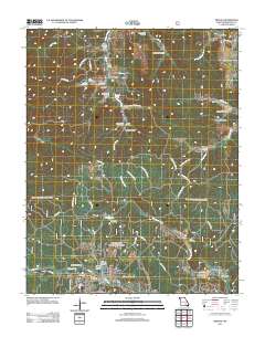
This data set contains imagery from the National Agriculture Imagery Program (NAIP). The NAIP program is administered by USDA FSA and has been established to support two main FSA strategic goals centered on agricultural production. These are increase stewardship of America's natural resources while enhancing the environment, and to ensure commodities are procured and distributed effectively and efficiently to increase food security. The NAIP program supports these goals by acquiring and providing ortho imagery that has been collected during the agricultural growing season in the U.S. The NAIP ortho imagery is tailored to meet FSA requirements and is a fundamental tool used to support FSA farm and conservation programs....
This data set contains imagery from the National Agriculture Imagery Program (NAIP). The NAIP program is administered by USDA FSA and has been established to support two main FSA strategic goals centered on agricultural production. These are increase stewardship of America's natural resources while enhancing the environment, and to ensure commodities are procured and distributed effectively and efficiently to increase food security. The NAIP program supports these goals by acquiring and providing ortho imagery that has been collected during the agricultural growing season in the U.S. The NAIP ortho imagery is tailored to meet FSA requirements and is a fundamental tool used to support FSA farm and conservation programs....
This data set contains imagery from the National Agriculture Imagery Program (NAIP). The NAIP program is administered by USDA FSA and has been established to support two main FSA strategic goals centered on agricultural production. These are increase stewardship of America's natural resources while enhancing the environment, and to ensure commodities are procured and distributed effectively and efficiently to increase food security. The NAIP program supports these goals by acquiring and providing ortho imagery that has been collected during the agricultural growing season in the U.S. The NAIP ortho imagery is tailored to meet FSA requirements and is a fundamental tool used to support FSA farm and conservation programs....
This data set contains imagery from the National Agriculture Imagery Program (NAIP). The NAIP program is administered by USDA FSA and has been established to support two main FSA strategic goals centered on agricultural production. These are increase stewardship of America's natural resources while enhancing the environment, and to ensure commodities are procured and distributed effectively and efficiently to increase food security. The NAIP program supports these goals by acquiring and providing ortho imagery that has been collected during the agricultural growing season in the U.S. The NAIP ortho imagery is tailored to meet FSA requirements and is a fundamental tool used to support FSA farm and conservation programs....
This data set contains imagery from the National Agriculture Imagery Program (NAIP). The NAIP program is administered by USDA FSA and has been established to support two main FSA strategic goals centered on agricultural production. These are increase stewardship of America's natural resources while enhancing the environment, and to ensure commodities are procured and distributed effectively and efficiently to increase food security. The NAIP program supports these goals by acquiring and providing ortho imagery that has been collected during the agricultural growing season in the U.S. The NAIP ortho imagery is tailored to meet FSA requirements and is a fundamental tool used to support FSA farm and conservation programs....
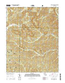
Layered GeoPDF 7.5 Minute Quadrangle Map. Layers of geospatial data include orthoimagery, roads, grids, geographic names, elevation contours, hydrography, and other selected map features.
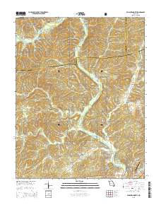
Layered GeoPDF 7.5 Minute Quadrangle Map. Layers of geospatial data include orthoimagery, roads, grids, geographic names, elevation contours, hydrography, and other selected map features.
Layered GeoPDF 7.5 Minute Quadrangle Map. Layers of geospatial data include orthoimagery, roads, grids, geographic names, elevation contours, hydrography, and other selected map features.
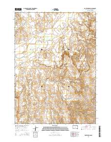
Layered GeoPDF 7.5 Minute Quadrangle Map. Layers of geospatial data include orthoimagery, roads, grids, geographic names, elevation contours, hydrography, and other selected map features.
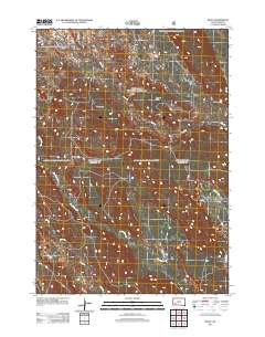
Layered GeoPDF 7.5 Minute Quadrangle Map. Layers of geospatial data include orthoimagery, roads, grids, geographic names, elevation contours, hydrography, and other selected map features.
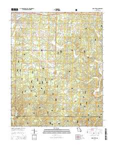
Layered GeoPDF 7.5 Minute Quadrangle Map. Layers of geospatial data include orthoimagery, roads, grids, geographic names, elevation contours, hydrography, and other selected map features.
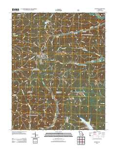
Layered GeoPDF 7.5 Minute Quadrangle Map. Layers of geospatial data include orthoimagery, roads, grids, geographic names, elevation contours, hydrography, and other selected map features.
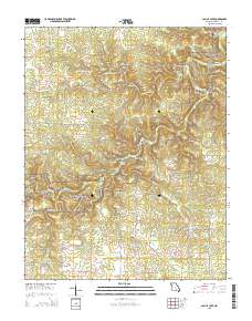
Layered GeoPDF 7.5 Minute Quadrangle Map. Layers of geospatial data include orthoimagery, roads, grids, geographic names, elevation contours, hydrography, and other selected map features.
Core Research Center, core F197, from well operated by OHIO OIL CORaw Properties from download, web scrape, MapServer, and Macrostrat API{"Lib Num": "F197", "API Num": "4902506008", "Operator": "OHIO OIL CO", "Well Name": "1 BOSTON GOVERNMENT", "Field": "HELLS HALF ACRE", "State": "WY", "County": "NATRONA", "Type": "THIN - DISCONTINUOUS SEGMENTS", "Photos": "T", "Thin Sec": "T", "Analysis": "F", "Latitude": "43.0479", "Longitude": "-107.05563", "coordinates_geohash": "9xeuguskpn0t", "Source": "FROM STATE RECORDS", "Security Flag": "NO SPECIAL RESTRICTIONS", "crc_collection_name": "core", "sb_parent_id": "4f4e49dae4b07f02db5e0486", "intervals": [{"Formation": "NIOBRARA", "Age": "CRET", "Min Depth": "1150", "Max Depth":...
Core Research Center, core A607, from well operated by AMOCO PRODUCTIONRaw Properties from download, web scrape, MapServer, and Macrostrat API{"Lib Num": "A607", "API Num": "0501306008", "Operator": "AMOCO PRODUCTION", "Well Name": "1 RAY DOUGHERTY", "Field": "UNNAMED", "State": "CO", "County": "BOULDER", "Type": "SLABBED", "Photos": "T", "Thin Sec": "F", "Analysis": "T", "Latitude": "40.120936", "Longitude": "-105.09875", "coordinates_geohash": "9xjk0rv3msec", "Source": "FROM STATE RECORDS", "Security Flag": "NO SPECIAL RESTRICTIONS", "crc_collection_name": "core", "sb_parent_id": "4f4e49dae4b07f02db5e0486", "intervals": [{"Formation": "SUSSEX", "Age": "CRET", "Min Depth": "4220", "Max Depth": "4274"}, {"Formation":...
Categories: Physical Item;
Tags: CRET,
CRET,
Eolium (Windblown Clay, Silt (Loess), Sand And Granules),
SHANNON,
SUSSEX,
Core Research Center, core D371, from well operated by DAVIS OIL COMPANYRaw Properties from download, web scrape, MapServer, and Macrostrat API{"Lib Num": "D371", "API Num": "4901920495", "Operator": "DAVIS OIL COMPANY", "Well Name": "62 HELDT DRAW", "Field": "TABLE MOUNTAIN", "State": "WY", "County": "JOHNSON", "Type": "SLABBED", "Photos": "T", "Thin Sec": "F", "Analysis": "F", "Latitude": "43.84841", "Longitude": "-106.10099", "coordinates_geohash": "9xu93w7ee8pd", "Source": "FROM STATE RECORDS", "Security Flag": "NO SPECIAL RESTRICTIONS", "crc_collection_name": "core", "sb_parent_id": "4f4e49dae4b07f02db5e0486", "intervals": [{"Formation": "SHANNON", "Age": "CRET", "Min Depth": "9600", "Max Depth": "9636"}],...
Categories: Physical Item;
Tags: CRET,
Eocene and Paleocene?,
SHANNON,
Wasatch Formation,
Wasatch Formation
Core Research Center, core S642, from well operated by CHEVRON OILRaw Properties from download, web scrape, MapServer, and Macrostrat API{"Lib Num": "S642", "API Num": "4900105175", "Operator": "CHEVRON OIL", "Well Name": "1 GEORGE GOVERNMENT", "Field": "JAMES LAKE", "State": "WY", "County": "ALBANY", "Type": "FULL", "Photos": "F", "Thin Sec": "F", "Analysis": "F", "Latitude": "41.47685", "Longitude": "-105.83232", "coordinates_geohash": "9xkezwxk0jnx", "Source": "FROM STATE RECORDS", "Security Flag": "NO SPECIAL RESTRICTIONS", "crc_collection_name": "core", "sb_parent_id": "4f4e49dae4b07f02db5e0486", "intervals": [{"Formation": "LAKOTA", "Age": "CRET", "Min Depth": "4542", "Max Depth": "4594"}, {"Formation": "SUNDANCE",...
Core Research Center, core C301, from well operated by ELF AQUITAINE O&GRaw Properties from download, web scrape, MapServer, and Macrostrat API{"Lib Num": "C301", "API Num": "4901920666", "Operator": "ELF AQUITAINE O&G", "Well Name": "6-15 USA", "Field": "JUNIPER DRAW", "State": "WY", "County": "JOHNSON", "Type": "SLABBED", "Photos": "T", "Thin Sec": "T", "Analysis": "T", "Latitude": "44.22136", "Longitude": "-106.23156", "coordinates_geohash": "9xu7wdk814zx", "Source": "FROM STATE RECORDS", "Security Flag": "NO SPECIAL RESTRICTIONS", "crc_collection_name": "core", "sb_parent_id": "4f4e49dae4b07f02db5e0486", "intervals": [{"Formation": "SHANNON", "Age": "CRET", "Min Depth": "8745", "Max Depth": "8775"}], "crcwc_url":...
Categories: Physical Item;
Tags: CRET,
Eocene and Paleocene?,
SHANNON,
Wasatch Formation,
Wasatch Formation
Core Research Center, core E481, from well operated by CITIES SERVICERaw Properties from download, web scrape, MapServer, and Macrostrat API{"Lib Num": "E481", "API Num": "4900525639", "Operator": "CITIES SERVICE", "Well Name": "1 PFISTER-D", "Field": "PUMPKIN BUTTES", "State": "WY", "County": "CAMPBELL", "Type": "SLABBED", "Photos": "T", "Thin Sec": "F", "Analysis": "F", "Latitude": "43.76916", "Longitude": "-105.96005", "coordinates_geohash": "9xu8uzfjzfu1", "Source": "FROM STATE RECORDS", "Security Flag": "NO SPECIAL RESTRICTIONS", "crc_collection_name": "core", "sb_parent_id": "4f4e49dae4b07f02db5e0486", "intervals": [{"Formation": "SHANNON", "Age": "CRET", "Min Depth": "9782", "Max Depth": "9815"}], "crcwc_url":...
Core Research Center, core A943, from well operated by FENIX & SCISSONRaw Properties from download, web scrape, MapServer, and Macrostrat API{"Lib Num": "A943", "API Num": "4902510307", "Operator": "FENIX & SCISSON", "Well Name": "35-SX-3 NPR", "Field": "TEAPOT DOME", "State": "WY", "County": "NATRONA", "Type": "SLABBED", "Photos": "T", "Thin Sec": "F", "Analysis": "F", "Latitude": "43.28885", "Longitude": "-106.20258", "coordinates_geohash": "9xsqr23xud88", "Source": "FROM STATE RECORDS", "Security Flag": "NO SPECIAL RESTRICTIONS", "crc_collection_name": "core", "sb_parent_id": "4f4e49dae4b07f02db5e0486", "intervals": [{"Formation": "SHANNON", "Age": "CRET", "Min Depth": "311", "Max Depth": "431"}], "crcwc_url":...
|

|
