Filters: Tags: Silverton (X) > partyWithName: U.S. Geological Survey (X)
59 results (123ms)|
Filters
Date Range
Extensions Types Contacts
Categories Tag Types Tag Schemes |
Audiomagnetotelluric sounding data in the Silverton Caldera complex, Colorado, 2018; Station AMTGK02
This dataset includes audiomagnetotelluric (AMT) sounding data collected in July 2018 in the Silverton Caldera complex, Colorado, in the Southern Rocky Mountain Volcanic Field, by the U.S. Geological Survey (USGS). Along with geologic mapping, airborne magnetics, airborne electromagnetics, and magnetotellurics, the USGS collected AMT data at 24 sites along four profiles ranging from 3 to 6 kilometers in length across the north-western structural margin of the Silverton caldera in Mineral Basin (MB01-MB05), across the south-eastern margin of the caldera along Cunningham Creek (CC01-CC05), within the caldera in Eureka Graben (EG01-EG05), and within the caldera along upper Cement Creek near the Gold King mine (GK01-GK09).
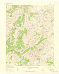
USGS Historical Quadrangle in GeoPDF.
USGS Historical Quadrangle in GeoPDF.
Audiomagnetotelluric sounding data in the Silverton Caldera complex, Colorado, 2018; Station AMTCC05
This dataset includes audiomagnetotelluric (AMT) sounding data collected in July 2018 in the Silverton Caldera complex, Colorado, in the Southern Rocky Mountain Volcanic Field, by the U.S. Geological Survey (USGS). Along with geologic mapping, airborne magnetics, airborne electromagnetics, and magnetotellurics, the USGS collected AMT data at 24 sites along four profiles ranging from 3 to 6 kilometers in length across the north-western structural margin of the Silverton caldera in Mineral Basin (MB01-MB05), across the south-eastern margin of the caldera along Cunningham Creek (CC01-CC05), within the caldera in Eureka Graben (EG01-EG05), and within the caldera along upper Cement Creek near the Gold King mine (GK01-GK09).
On September 25, 1998, SIAL Géosciences Inc. (SIAL) was awarded Department of Interior, contract 98CRCN1018, by the U.S. Geological Survey. This contract required SIAL to carry out a high-sensitivity magnetic and electromagnetic helicopter survey over one block located in the Eureka Graben Area near Silverton, Colorado. The primary goal of this project was to provide digitally recorded and processed magnetic and electromagnetic data in order to evaluate geologic and hydrologic resources of the Eureka Graben Area. The base of on-site field operations was Silverton, Colorado. The survey was carried out by SIAL between May 27th and June 9th, 1999. This report describes the survey parameters, data acquisition and processing...
Categories: Data;
Types: Downloadable,
Map Service,
OGC WFS Layer,
OGC WMS Layer,
Shapefile;
Tags: Animas,
Colorado,
Energy Resources,
Environmental Health,
Geophysics,
USGS Historical Quadrangle in GeoPDF.
USGS Historical Quadrangle in GeoPDF.

USGS Historical Quadrangle in GeoPDF.
Audiomagnetotelluric sounding data in the Silverton Caldera complex, Colorado, 2018; Station AMTEG04
This dataset includes audiomagnetotelluric (AMT) sounding data collected in July 2018 in the Silverton Caldera complex, Colorado, in the Southern Rocky Mountain Volcanic Field, by the U.S. Geological Survey (USGS). Along with geologic mapping, airborne magnetics, airborne electromagnetics, and magnetotellurics, the USGS collected AMT data at 24 sites along four profiles ranging from 3 to 6 kilometers in length across the north-western structural margin of the Silverton caldera in Mineral Basin (MB01-MB05), across the south-eastern margin of the caldera along Cunningham Creek (CC01-CC05), within the caldera in Eureka Graben (EG01-EG05), and within the caldera along upper Cement Creek near the Gold King mine (GK01-GK09).
Audiomagnetotelluric sounding data in the Silverton Caldera complex, Colorado, 2018; Station AMTGK03
This dataset includes audiomagnetotelluric (AMT) sounding data collected in July 2018 in the Silverton Caldera complex, Colorado, in the Southern Rocky Mountain Volcanic Field, by the U.S. Geological Survey (USGS). Along with geologic mapping, airborne magnetics, airborne electromagnetics, and magnetotellurics, the USGS collected AMT data at 24 sites along four profiles ranging from 3 to 6 kilometers in length across the north-western structural margin of the Silverton caldera in Mineral Basin (MB01-MB05), across the south-eastern margin of the caldera along Cunningham Creek (CC01-CC05), within the caldera in Eureka Graben (EG01-EG05), and within the caldera along upper Cement Creek near the Gold King mine (GK01-GK09).
Note: this data release has been deprecated. Please see new data release here: https://doi.org/10.5066/P92IADBP. Airborne electromagnetic (AEM) and magnetic survey data were collected during April and May 2019 along 1,467 line-kilometers in the San Juan-Silverton Caldera complex, Colorado, in the Southern Rocky Mountain Volcanic Field. Data were acquired by Geotech, Ltd. with the versatile time-domain electromagnetic (VTEM) system together with a Geometrics optically pumped cesium vapor magnetometer. The survey was flown at a mean flight height of 140 meters (m) above terrain in various line directions and line spacings ranging from 150 m to 600 m. Multiple variable-spaced lines were flown along rivers and streams...
Audiomagnetotelluric sounding data in the Silverton Caldera complex, Colorado, 2018; Station AMTEG05
This dataset includes audiomagnetotelluric (AMT) sounding data collected in July 2018 in the Silverton Caldera complex, Colorado, in the Southern Rocky Mountain Volcanic Field, by the U.S. Geological Survey (USGS). Along with geologic mapping, airborne magnetics, airborne electromagnetics, and magnetotellurics, the USGS collected AMT data at 24 sites along four profiles ranging from 3 to 6 kilometers in length across the north-western structural margin of the Silverton caldera in Mineral Basin (MB01-MB05), across the south-eastern margin of the caldera along Cunningham Creek (CC01-CC05), within the caldera in Eureka Graben (EG01-EG05), and within the caldera along upper Cement Creek near the Gold King mine (GK01-GK09).
Audiomagnetotelluric sounding data in the Silverton Caldera complex, Colorado, 2018; Station AMTGK04
This dataset includes audiomagnetotelluric (AMT) sounding data collected in July 2018 in the Silverton Caldera complex, Colorado, in the Southern Rocky Mountain Volcanic Field, by the U.S. Geological Survey (USGS). Along with geologic mapping, airborne magnetics, airborne electromagnetics, and magnetotellurics, the USGS collected AMT data at 24 sites along four profiles ranging from 3 to 6 kilometers in length across the north-western structural margin of the Silverton caldera in Mineral Basin (MB01-MB05), across the south-eastern margin of the caldera along Cunningham Creek (CC01-CC05), within the caldera in Eureka Graben (EG01-EG05), and within the caldera along upper Cement Creek near the Gold King mine (GK01-GK09).
USGS Historical Quadrangle in GeoPDF.
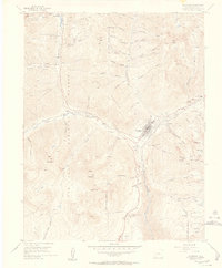
USGS Historical Quadrangle in GeoPDF.
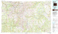
USGS Historical Quadrangle in GeoPDF.
USGS Historical Quadrangle in GeoPDF.
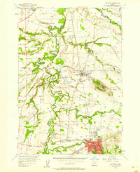
USGS Historical Quadrangle in GeoPDF.

USGS Historical Quadrangle in GeoPDF.
|

|
