Filters: Tags: Silverton (X)
171 results (17ms)|
Filters
Date Range
Extensions (Less) Types (Less)
Contacts (Less)
Categories (Less) Tag Types
|
This data set contains imagery from the National Agriculture Imagery Program (NAIP). The NAIP program is administered by USDA FSA and has been established to support two main FSA strategic goals centered on agricultural production. These are, increase stewardship of America's natural resources while enhancing the environment, and to ensure commodities are procured and distributed effectively and efficiently to increase food security. The NAIP program supports these goals by acquiring and providing ortho imagery that has been collected during the agricultural growing season in the U.S. The NAIP ortho imagery is tailored to meet FSA requirements and is a fundamental tool used to support FSA farm and conservation programs....
Audiomagnetotelluric sounding data in the Silverton Caldera complex, Colorado, 2018; Station AMTCC04
This dataset includes audiomagnetotelluric (AMT) sounding data collected in July 2018 in the Silverton Caldera complex, Colorado, in the Southern Rocky Mountain Volcanic Field, by the U.S. Geological Survey (USGS). Along with geologic mapping, airborne magnetics, airborne electromagnetics, and magnetotellurics, the USGS collected AMT data at 24 sites along four profiles ranging from 3 to 6 kilometers in length across the north-western structural margin of the Silverton caldera in Mineral Basin (MB01-MB05), across the south-eastern margin of the caldera along Cunningham Creek (CC01-CC05), within the caldera in Eureka Graben (EG01-EG05), and within the caldera along upper Cement Creek near the Gold King mine (GK01-GK09).
Audiomagnetotelluric sounding data in the Silverton Caldera complex, Colorado, 2018; Station AMTGK01
This dataset includes audiomagnetotelluric (AMT) sounding data collected in July 2018 in the Silverton Caldera complex, Colorado, in the Southern Rocky Mountain Volcanic Field, by the U.S. Geological Survey (USGS). Along with geologic mapping, airborne magnetics, airborne electromagnetics, and magnetotellurics, the USGS collected AMT data at 24 sites along four profiles ranging from 3 to 6 kilometers in length across the north-western structural margin of the Silverton caldera in Mineral Basin (MB01-MB05), across the south-eastern margin of the caldera along Cunningham Creek (CC01-CC05), within the caldera in Eureka Graben (EG01-EG05), and within the caldera along upper Cement Creek near the Gold King mine (GK01-GK09).
Audiomagnetotelluric sounding data in the Silverton Caldera complex, Colorado, 2018; Station AMTGK06
This dataset includes audiomagnetotelluric (AMT) sounding data collected in July 2018 in the Silverton Caldera complex, Colorado, in the Southern Rocky Mountain Volcanic Field, by the U.S. Geological Survey (USGS). Along with geologic mapping, airborne magnetics, airborne electromagnetics, and magnetotellurics, the USGS collected AMT data at 24 sites along four profiles ranging from 3 to 6 kilometers in length across the north-western structural margin of the Silverton caldera in Mineral Basin (MB01-MB05), across the south-eastern margin of the caldera along Cunningham Creek (CC01-CC05), within the caldera in Eureka Graben (EG01-EG05), and within the caldera along upper Cement Creek near the Gold King mine (GK01-GK09).
Audiomagnetotelluric sounding data in the Silverton Caldera complex, Colorado, 2018; Station AMTGK07
This dataset includes audiomagnetotelluric (AMT) sounding data collected in July 2018 in the Silverton Caldera complex, Colorado, in the Southern Rocky Mountain Volcanic Field, by the U.S. Geological Survey (USGS). Along with geologic mapping, airborne magnetics, airborne electromagnetics, and magnetotellurics, the USGS collected AMT data at 24 sites along four profiles ranging from 3 to 6 kilometers in length across the north-western structural margin of the Silverton caldera in Mineral Basin (MB01-MB05), across the south-eastern margin of the caldera along Cunningham Creek (CC01-CC05), within the caldera in Eureka Graben (EG01-EG05), and within the caldera along upper Cement Creek near the Gold King mine (GK01-GK09).
This dataset includes magnetotelluric (MT) sounding data collected in July 2019 in the Silverton Caldera complex, Colorado, in the Southern Rocky Mountain Volcanic Field, by the U.S. Geological Survey (USGS). Along with geologic mapping, airborne magnetics, airborne electromagnetics, and audiomagnetotellurics, the USGS collected MT data at 24 sites along five profiles ranging from 2 to 5 kilometers in length: across Red Mountain of the Silverton caldera, within the caldera in Eureka Graben, across the south-eastern margin of the caldera along Arrastra Gulch, across the southern margin of the caldera along the western margin of Kendall Mountain, and across the south-western margin of the caldera along South Fork...
Audiomagnetotelluric sounding data in the Silverton Caldera complex, Colorado, 2019; Station AMTMB06
This dataset includes audiomagnetotelluric (AMT) sounding data collected in July 2019 in the Silverton Caldera complex, Colorado, in the Southern Rocky Mountain Volcanic Field, by the U.S. Geological Survey (USGS). Along with geologic mapping, airborne magnetics, airborne electromagnetics, and magnetotellurics, the USGS collected AMT data at 26 sites along five profiles ranging from 2 to 5 kilometers in length: across Red Mountain of the Silverton caldera, within the caldera in Eureka Graben, across the south-eastern margin of the caldera along Arrastra Gulch, across the southern margin of the caldera along the western margin of Kendall Mountain, and across the south-western margin of the caldera along South Fork...
Audiomagnetotelluric sounding data in the Silverton Caldera complex, Colorado, 2018; Station AMTGK05
This dataset includes audiomagnetotelluric (AMT) sounding data collected in July 2018 in the Silverton Caldera complex, Colorado, in the Southern Rocky Mountain Volcanic Field, by the U.S. Geological Survey (USGS). Along with geologic mapping, airborne magnetics, airborne electromagnetics, and magnetotellurics, the USGS collected AMT data at 24 sites along four profiles ranging from 3 to 6 kilometers in length across the north-western structural margin of the Silverton caldera in Mineral Basin (MB01-MB05), across the south-eastern margin of the caldera along Cunningham Creek (CC01-CC05), within the caldera in Eureka Graben (EG01-EG05), and within the caldera along upper Cement Creek near the Gold King mine (GK01-GK09).
Audiomagnetotelluric sounding data in the Silverton Caldera complex, Colorado, 2018; Station AMTMB02
This dataset includes audiomagnetotelluric (AMT) sounding data collected in July 2018 in the Silverton Caldera complex, Colorado, in the Southern Rocky Mountain Volcanic Field, by the U.S. Geological Survey (USGS). Along with geologic mapping, airborne magnetics, airborne electromagnetics, and magnetotellurics, the USGS collected AMT data at 24 sites along four profiles ranging from 3 to 6 kilometers in length across the north-western structural margin of the Silverton caldera in Mineral Basin (MB01-MB05), across the south-eastern margin of the caldera along Cunningham Creek (CC01-CC05), within the caldera in Eureka Graben (EG01-EG05), and within the caldera along upper Cement Creek near the Gold King mine (GK01-GK09).
Audiomagnetotelluric sounding data in the Silverton Caldera complex, Colorado, 2019; Station AMTSF04
This dataset includes audiomagnetotelluric (AMT) sounding data collected in July 2019 in the Silverton Caldera complex, Colorado, in the Southern Rocky Mountain Volcanic Field, by the U.S. Geological Survey (USGS). Along with geologic mapping, airborne magnetics, airborne electromagnetics, and magnetotellurics, the USGS collected AMT data at 26 sites along five profiles ranging from 2 to 5 kilometers in length: across Red Mountain of the Silverton caldera, within the caldera in Eureka Graben, across the south-eastern margin of the caldera along Arrastra Gulch, across the southern margin of the caldera along the western margin of Kendall Mountain, and across the south-western margin of the caldera along South Fork...
Audiomagnetotelluric sounding data in the Silverton Caldera complex, Colorado, 2019; Station AMTAG04
This dataset includes audiomagnetotelluric (AMT) sounding data collected in July 2019 in the Silverton Caldera complex, Colorado, in the Southern Rocky Mountain Volcanic Field, by the U.S. Geological Survey (USGS). Along with geologic mapping, airborne magnetics, airborne electromagnetics, and magnetotellurics, the USGS collected AMT data at 26 sites along five profiles ranging from 2 to 5 kilometers in length: across Red Mountain of the Silverton caldera, within the caldera in Eureka Graben, across the south-eastern margin of the caldera along Arrastra Gulch, across the southern margin of the caldera along the western margin of Kendall Mountain, and across the south-western margin of the caldera along South Fork...
This data release includes magnetotelluric (MT) sounding data collected in July 2018 in the Silverton Caldera complex, Colorado, in the Southern Rocky Mountain Volcanic Field, by the U.S. Geological Survey (USGS). Along with geologic mapping, airborne magnetics, airborne electromagnetics, and audiomagnetotellurics, the USGS collected MT data at 22 sites along four profiles ranging from 3 to 6 kilometers in length across the north-western structural margin of the Silverton caldera in Mineral Basin (MB01-MB05), across the south-eastern margin of the caldera along Cunningham Creek (CC01-CC05), within the caldera in Eureka Graben (EG01-EG05), and within the caldera along upper Cement Creek near the Gold King mine (GK01-GK09).
This data release includes magnetotelluric (MT) sounding data collected in July 2018 in the Silverton Caldera complex, Colorado, in the Southern Rocky Mountain Volcanic Field, by the U.S. Geological Survey (USGS). Along with geologic mapping, airborne magnetics, airborne electromagnetics, and audiomagnetotellurics, the USGS collected MT data at 22 sites along four profiles ranging from 3 to 6 kilometers in length across the north-western structural margin of the Silverton caldera in Mineral Basin (MB01-MB05), across the south-eastern margin of the caldera along Cunningham Creek (CC01-CC05), within the caldera in Eureka Graben (EG01-EG05), and within the caldera along upper Cement Creek near the Gold King mine (GK01-GK09).
This child item contains ground penetrating radar (GPR) data collected over a small alpine wetland between Mogul Mine and Cement Creek located near Silverton, Colorado. Mine-impacted water is transported to Cement Creek via surface channels and groundwater through this wetland. The GPR method transmits radar pulses into the ground and measures the returned amplitude from these pulses over time. Variations in subsurface electromagnetic (EM) properties (dielectric permittivity, electrical conductivity, and magnetic susceptibility) affect the timing and amplitude of returned radar energy. For example, variation in water or mineral content are physical properties that often influence the EM properties that are observed...
This child item contains frequency domain electromagnetic induction (FDEM) data collected along and around Cement Creek and California Gulch near Silverton, Colorado in support of other data collected at the site. The FDEM tool generates an EM field and measures eddy currents generated by conductive and/or magnetic materials in the subsurface in response to the applied field. A Geophex GEM-2 instrument with GPS was used with 5 frequencies ranging from 450 Hz to 18330 Hz. Additional details are contained in the ‘readme.txt’ files within each zip data directory.
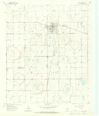
USGS Historical Quadrangle in GeoPDF.
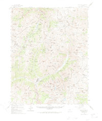
USGS Historical Quadrangle in GeoPDF.
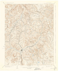
USGS Historical Quadrangle in GeoPDF.
This dataset includes magnetotelluric (MT) sounding data collected in July 2019 in the Silverton Caldera complex, Colorado, in the Southern Rocky Mountain Volcanic Field, by the U.S. Geological Survey (USGS). Along with geologic mapping, airborne magnetics, airborne electromagnetics, and audiomagnetotellurics, the USGS collected MT data at 24 sites along five profiles ranging from 2 to 5 kilometers in length: across Red Mountain of the Silverton caldera, within the caldera in Eureka Graben, across the south-eastern margin of the caldera along Arrastra Gulch, across the southern margin of the caldera along the western margin of Kendall Mountain, and across the south-western margin of the caldera along South Fork...
Audiomagnetotelluric sounding data in the Silverton Caldera complex, Colorado, 2019; Station AMTAG03
This dataset includes audiomagnetotelluric (AMT) sounding data collected in July 2019 in the Silverton Caldera complex, Colorado, in the Southern Rocky Mountain Volcanic Field, by the U.S. Geological Survey (USGS). Along with geologic mapping, airborne magnetics, airborne electromagnetics, and magnetotellurics, the USGS collected AMT data at 26 sites along five profiles ranging from 2 to 5 kilometers in length: across Red Mountain of the Silverton caldera, within the caldera in Eureka Graben, across the south-eastern margin of the caldera along Arrastra Gulch, across the southern margin of the caldera along the western margin of Kendall Mountain, and across the south-western margin of the caldera along South Fork...
|

|
