Filters: Tags: Sioux Falls (X)
9 results (15ms)|
Filters
Date Range
Types Contacts
Tag Types Tag Schemes |
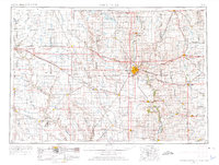
USGS Historical Quadrangle in GeoPDF.

USGS Historical Quadrangle in GeoPDF.
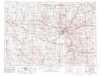
USGS Historical Quadrangle in GeoPDF.

USGS Historical Quadrangle in GeoPDF.
USGS Historical Quadrangle in GeoPDF.

USGS Historical Quadrangle in GeoPDF.

A MODFLOW-6 groundwater flow model of the Big Sioux aquifer near Sioux Falls, South Dakota, was constructed to improve the understanding and management of the water supply resources for the City of Sioux Falls. The model area included the Big Sioux River drainage basin between Del Rapids and Sioux Falls, South Dakota, and simulated groundwater flow in the Big Sioux aquifer and underlying hydrogeologic units. The data release directories contain ancillary, bin, georef, model, output, and source folders with the necessary executable and input files for the following models: (1) a transient MODFLOW-6 groundwater flow model; (2) a steady-state MODFLOW-6 model used for eventual streamflow capture analysis; (3) a modified...
Well and aquifer data were collected from field measurements and drillers’ logs. Multiple slug tests were completed at each well with a transducer to record the change in water level and a U.S. Geological Survey standard mechanical slug to displace the well’s water column. A Solinst Levelogger LT F30/M10 electronic transducer (unvented) was used to record water-level changes during each slug test. Water-level changes for each trial were analyzed in AQTESOLV Pro version 4.50.002 using the Springer and Gelhar method of curve fitting.
A High-Resolution Hydrographic Mapping effort was completed for thirteen 12-digit hydrologic units in the Big Sioux River Basin near Sioux Falls in southeastern South Dakota. A digitial elevation model based on light detection and ranging (lidar) data was prepared from four sources. Known culverts were hydro-enforced into the elevation model, and selective drainage techniques were utilized within geographic information systems software to identify additional locations where bridges or culverts needed to be hydro-enforced. These potential locations were given a preliminary screening using aerial imagery, and likely locations were further screened using high-resolution oblique aerial imagery or with site visits. Locations...
|

|
