Filters
Date Range
Types
Contacts
Tag Types
Tag Schemes
|

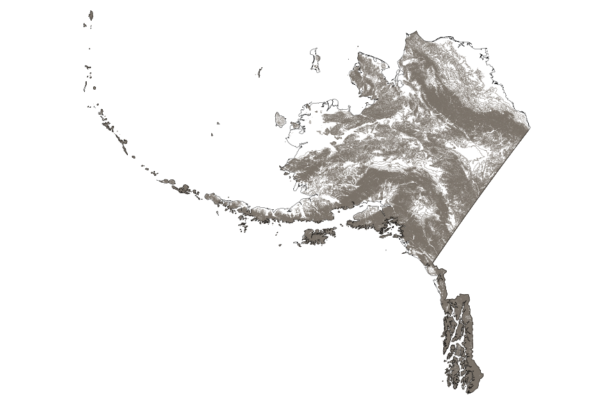
This map layer consists of federally owned or administered lands of the United States, Puerto Rico, and the U.S. Virgin Islands. For the most part, only areas of 320 acres or more are included; some smaller areas deemed to be important or significant are also included. There may be private inholdings within the boundaries of Federal lands in this map layer. Some established Federal lands which are larger than 320 acres are not included in this map layer, because their boundaries were not available from the owning or administering agency.
Tags: Air Force,
Alabama,
Alaska,
Arizona,
Arkansas, All tags...
Army,
BIA,
BLM,
BOR,
Bureau of Indian Affairs,
Bureau of Land Management,
Bureau of Reclamation,
California,
Coast Guard,
Colorado,
Connecticut,
Coordinated Area,
DHS,
DOC,
DOD,
DOE,
DOJ,
DOL,
DOT,
Delaware,
Department of Commerce,
Department of Defense,
Department of Energy,
Department of Health and Human Services,
Department of Homeland Security,
Department of Justice,
Department of Labor,
Department of Transportation,
Department of Veterans Affairs,
District of Columbia,
Downloadable Data,
Downloadable Data,
Experimental Range,
Experimental Station,
FS,
FWS,
Federal Center,
Federal Correctional Complex,
Federal Penitentiary,
Federal lands,
Field Site,
FileGDB 10.1,
FileGDB 10.1,
Fish and Wildlife Service,
Flight Center,
Florida,
Forest Service,
GSA,
General Services Administration,
Georgia,
HHS,
Hawaii,
Idaho,
Illinois,
Indian Reservation,
Indiana,
Iowa,
Job Corps Center,
Kansas,
Kentucky,
Law Enforcement Training Center,
Louisiana,
MWAA,
MWAA,
Maine,
Marine Corps,
Maryland,
Massachusetts,
Metropolitan Washington Airports Authority,
Michigan,
Minnesota,
Mississippi,
Missouri,
Montana,
NASA,
NIH,
NPS,
National,
National,
National Aeronautics and Space Administration,
National Battlefield,
National Cemetery,
National Conservation Area,
National Fish Hatchery,
National Forest,
National Game Preserve,
National Grassland,
National Guard,
National Historic Park,
National Historic Reserve,
National Historic Site,
National Institutes of Health,
National Laboratory,
National Lakeshore,
National Memorial,
National Military Park,
National Monument,
National Natural Landmark,
National Park,
National Park Service,
National Parkway,
National Preserve,
National Recreation Area,
National Reserve,
National Scenic Area,
National Seashore,
National Wild and Scenic River,
National Wilderness Area,
National Wildlife Refuge,
Naval Petroleum Reserve,
Navy,
Nebraska,
Nevada,
New Hampshire,
New Jersey,
New Mexico,
New York,
North Carolina,
North Dakota,
Ohio,
Oklahoma,
Oregon,
Pennsylvania,
Public Domain Land,
Puerto Rico,
Research Facility,
Research Natural Area,
Research Station,
Rhode Island,
Scenic Area,
Small-scale Datasets,
Small-scale Datasets,
Small-scale Datasets,
Small-scale Datasets - Boundaries,
South Carolina,
South Dakota,
Space Center,
TVA,
Tennessee,
Tennessee Valley Authority,
Test Site,
Texas,
U.S. Coast Guard,
U.S. Department of Agriculture,
U.S. Fish and Wildlife Service,
U.S. Forest Service,
U.S. Virgin Islands,
US,
USA,
USDA,
United States,
Utah,
VA,
Vermont,
Virgin Islands,
Virginia,
Washington,
Waterfowl Production Area,
West Virginia,
Wild Horse Range,
Wild and Scenic River,
Wilderness Area,
Wildlife Management Area,
Wisconsin,
Wyoming,
boundaries,
intelligenceMilitary,
society, Fewer tags

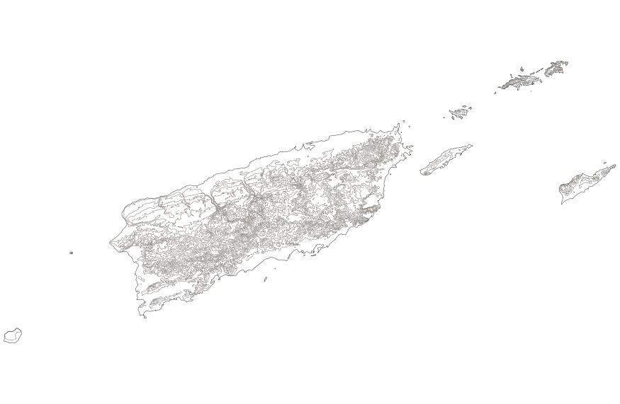
This map layer shows Indian lands of the United States. For the most part, only areas of 320 acres or more are included; some smaller areas deemed to be important or significant are also included. Federally-administered lands within a reservation are included for continuity; these may or may not be considered part of the reservation and are simply described with their feature type and the administrating Federal agency. Some established Indian lands which are larger than 320 acres are not included in this map layer because their boundaries were not available from the owning or administering agency.
Tags: Alabama,
Alaska,
Arizona,
Arkansas,
BIA, All tags...
BLM,
BOR,
Boundaries,
Bureau of Indian Affairs,
Bureau of Land Management,
Bureau of Reclamation,
California,
Colorado,
Connecticut,
Delaware,
District of Columbia,
Downloadable Data,
Downloadable Data,
FWS,
Fish and Wildlife Service,
Florida,
Georgia,
Hawaii,
Idaho,
Illinois,
Indian Reservation,
Indian lands,
Indiana,
Iowa,
Kansas,
Kentucky,
Louisiana,
Maine,
Maryland,
Massachusetts,
Michigan,
Minnesota,
Mississippi,
Missouri,
Montana,
NPS,
National,
National,
National Conservation Area,
National Forest,
National Game Preserve,
National Grassland,
National Monument,
National Park,
National Park Service,
National Wilderness Area,
National Wildlife Refuge,
Nebraska,
Nevada,
New Hampshire,
New Jersey,
New Mexico,
New York,
North Carolina,
North Dakota,
Ohio,
Oklahoma,
Oregon,
Pennsylvania,
Public Domain Land,
Rhode Island,
Shapefile,
Shapefile,
Small-scale Datasets,
Small-scale Datasets,
Small-scale Datasets,
Small-scale Datasets - Boundaries,
Society,
South Carolina,
South Dakota,
Tennessee,
Texas,
US,
USA,
United States,
Utah,
Vermont,
Virginia,
Washington,
Waterfowl Production Area,
West Virginia,
Wisconsin,
Wyoming, Fewer tags

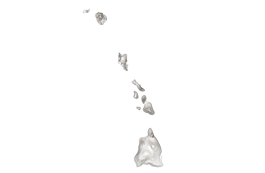
This map layer shows elevation contour lines for Hawaii. The map layer was derived from the 100-meter resolution elevation data set which is published by the National Atlas of the United States, and is in the same Albers Equal-area Conic projection as that source data set. Contour intervals match the steps used in the National Atlas Color-Sliced Elevation data sets. Contours were adjusted so that they are in the proper relationship to National Atlas 1:1,000,000-scale lakes, reservoirs, and wide (double-line) streams.
Types: Citation;
Tags: Contours,
Downloadable Data,
Downloadable Data,
Elevation,
Hawaii, All tags...
Land Surface > Topography > Terrain Elevation,
NED,
National,
National,
National Atlas of the United States,
Shapefile,
Shapefile,
Small-scale Datasets,
Small-scale Datasets,
Small-scale Datasets,
Small-scale Datasets - Contours,
Topographic,
Topography,
US,
USA,
United States,
elevation,
imageryBaseMapsEarthCover, Fewer tags
This map layer shows elevation contour lines for Alaska. The map layer was derived from the 100-meter resolution elevation data set which is published by the National Atlas of the United States, and is in the same Albers Equal-area Conic projection as that source data set. Contour intervals match the steps used in the National Atlas Color-Sliced Elevation data sets. Contours were adjusted so that they are in the proper relationship to National Atlas 1:1,000,000-scale lakes, reservoirs, and wide (double-line) streams.
Types: Citation;
Tags: Alaska,
Contours,
Downloadable Data,
Downloadable Data,
Elevation, All tags...
Land Surface > Topography > Terrain Elevation,
NED,
National,
National,
National Atlas of the United States,
Shapefile,
Shapefile,
Small-scale Datasets,
Small-scale Datasets,
Small-scale Datasets,
Small-scale Datasets - Contours,
Topographic,
Topography,
US,
USA,
United States,
elevation,
imageryBaseMapsEarthCover, Fewer tags

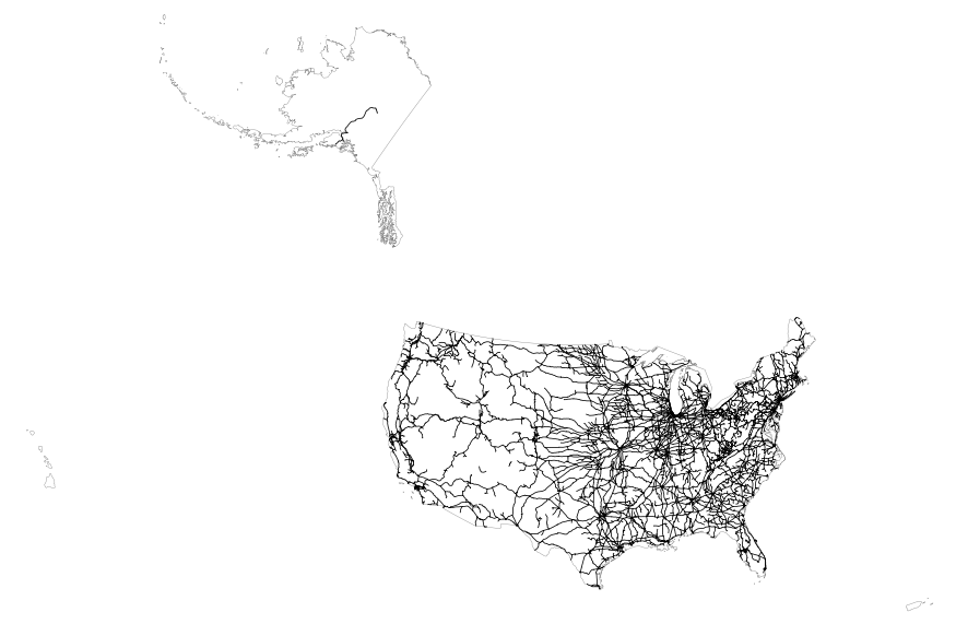
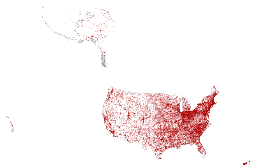
This map layer portrays the major roads in the United States, Puerto Rico, and the U.S. Virgin Islands. The file was produced by joining the individual State roads layers from the National Highway Planning Network (NHPN), Geographic Data Technology (GDT) Dynamap, and TIGER/Line files. This is a revised version of the July 2012 map layer.
Types: Citation;
Tags: Alabama,
Alaska,
Arizona,
Arkansas,
California, All tags...
Colorado,
Connecticut,
Delaware,
District of Columbia,
Downloadable Data,
Downloadable Data,
Florida,
Georgia,
Hawaii,
Highways,
Idaho,
Illinois,
Indiana,
Interstate highways,
Iowa,
Kansas,
Kentucky,
Louisiana,
Maine,
Maryland,
Massachusetts,
Michigan,
Minnesota,
Mississippi,
Missouri,
Montana,
National,
National,
National Atlas of the United States,
Nebraska,
Nevada,
New Hampshire,
New Jersey,
New Mexico,
New York,
North Carolina,
North Dakota,
Ohio,
Oklahoma,
Oregon,
Pennsylvania,
Puerto Rico,
Rhode Island,
Roads,
Shapefile,
Shapefile,
Small-scale Datasets,
Small-scale Datasets,
Small-scale Datasets,
Small-scale Datasets - Transportation,
South Carolina,
South Dakota,
State Route,
Tennessee,
Texas,
U.S. Virgin Islands,
US,
US Route,
USA,
United States,
Utah,
Vermont,
Virgin Islands,
Virginia,
Washington,
West Virginia,
Wisconsin,
Wyoming,
transportation, Fewer tags
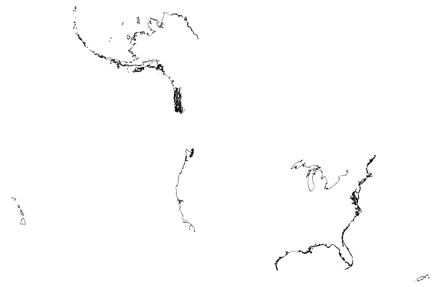
This map layer portrays the coastline of the United States, Puerto Rico, and the U.S. Virgin Islands. The United States shoreline of the Great Lakes is also included. This is a revised version of the July 2012 map layer.
Types: Citation;
Tags: Alabama,
Alaska,
Arizona,
Arkansas,
California, All tags...
Coastline,
Colorado,
Connecticut,
Delaware,
District of Columbia,
Downloadable Data,
Downloadable Data,
Florida,
Georgia,
Great Lakes,
Hawaii,
Idaho,
Illinois,
Indiana,
Iowa,
Kansas,
Kentucky,
Louisiana,
Maine,
Maryland,
Massachusetts,
Michigan,
Minnesota,
Mississippi,
Missouri,
Montana,
National,
National,
National Atlas of the United States,
Nebraska,
Nevada,
New Hampshire,
New Jersey,
New Mexico,
New York,
North Carolina,
North Dakota,
Oceans,
Ohio,
Oklahoma,
Oregon,
Pennsylvania,
Puerto Rico,
Rhode Island,
Shapefile,
Shapefile,
Shoreline,
Small-scale Datasets,
Small-scale Datasets,
Small-scale Datasets,
Small-scale Datasets - Boundaries,
South Carolina,
South Dakota,
Tennessee,
Texas,
U.S. Virgin Islands,
US,
USA,
United States,
Utah,
Vermont,
Virgin Islands,
Virginia,
Washington,
West Virginia,
Wisconsin,
Wyoming,
inlandWaters,
oceans, Fewer tags
This map layer shows elevation contour lines for Hawaii. The map layer was derived from the 100-meter resolution elevation data set which is published by the National Atlas of the United States, and is in the same Albers Equal-area Conic projection as that source data set. Contour intervals match the steps used in the National Atlas Color-Sliced Elevation data sets. Contours were adjusted so that they are in the proper relationship to National Atlas 1:1,000,000-scale lakes, reservoirs, and wide (double-line) streams.
Types: Citation;
Tags: Contours,
Downloadable Data,
Downloadable Data,
Elevation,
FileGDB 10.1, All tags...
FileGDB 10.1,
Hawaii,
Land Surface > Topography > Terrain Elevation,
NED,
National,
National,
National Atlas of the United States,
Small-scale Datasets,
Small-scale Datasets,
Small-scale Datasets,
Small-scale Datasets - Contours,
Topographic,
Topography,
US,
USA,
United States,
elevation,
imageryBaseMapsEarthCover, Fewer tags

This map layer shows elevation contour lines for the conterminous United States. The map layer was derived from the 100-meter resolution elevation data set which is published by the National Atlas of the United States, and is in the same Albers Equal-area Conic projection as that source data set. Contour intervals match the steps used in the National Atlas Color-Sliced Elevation data sets. Contours were adjusted so that they are in the proper relationship to National Atlas 1:1,000,000-scale lakes, reservoirs, and wide (double-line) streams.
Types: Citation;
Tags: Alabama,
Arizona,
Arkansas,
California,
Colorado, All tags...
Connecticut,
Contours,
Delaware,
District of Columbia,
Downloadable Data,
Downloadable Data,
Elevation,
Florida,
Georgia,
Idaho,
Illinois,
Indiana,
Iowa,
Kansas,
Kentucky,
Land Surface > Topography > Terrain Elevation,
Louisiana,
Maine,
Maryland,
Massachusetts,
Michigan,
Minnesota,
Mississippi,
Missouri,
Montana,
NED,
National,
National,
National Atlas of the United States,
Nebraska,
Nevada,
New Hampshire,
New Jersey,
New Mexico,
New York,
North Carolina,
North Dakota,
Ohio,
Oklahoma,
Oregon,
Pennsylvania,
Rhode Island,
Shapefile,
Shapefile,
Small-scale Datasets,
Small-scale Datasets,
Small-scale Datasets,
Small-scale Datasets - Contours,
South Carolina,
South Dakota,
Tennessee,
Texas,
Topographic,
Topography,
US,
USA,
United States,
Utah,
Vermont,
Virginia,
Washington,
West Virginia,
Wisconsin,
Wyoming,
elevation,
imageryBaseMapsEarthCover, Fewer tags
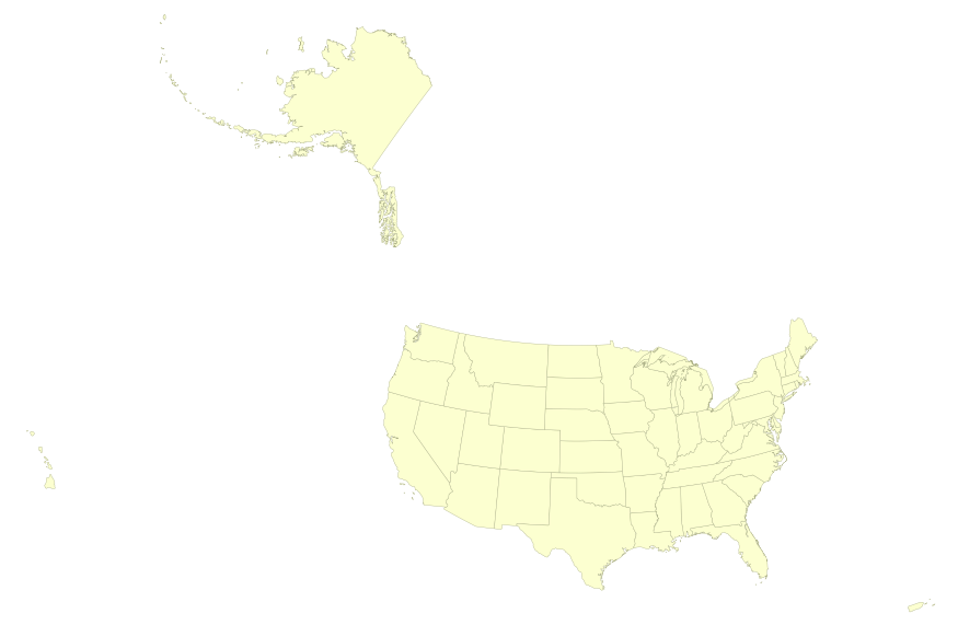
This map layer portrays the State boundaries of the United States, Puerto Rico, and the U.S. Virgin Islands. The map layer was created by extracting county polygon features from the CENSUS 2006 TIGER/Line files produced by the U.S. Census Bureau. These files were then merged into a single file and county boundaries within States were removed. This is a revised version of the July 2012 map layer.
Types: Citation;
Tags: Alabama,
Alaska,
Arizona,
Arkansas,
California, All tags...
Colorado,
Connecticut,
Delaware,
District of Columbia,
Downloadable Data,
Downloadable Data,
FileGDB 10.1,
FileGDB 10.1,
Florida,
Georgia,
Hawaii,
Idaho,
Illinois,
Indiana,
Iowa,
Kansas,
Kentucky,
Louisiana,
Maine,
Maryland,
Massachusetts,
Michigan,
Minnesota,
Mississippi,
Missouri,
Montana,
National,
National,
National Atlas of the United States,
Nebraska,
Nevada,
New Hampshire,
New Jersey,
New Mexico,
New York,
North Carolina,
North Dakota,
Ohio,
Oklahoma,
Oregon,
Pennsylvania,
Puerto Rico,
Rhode Island,
Small-scale Datasets,
Small-scale Datasets,
Small-scale Datasets,
Small-scale Datasets - Boundaries,
South Carolina,
South Dakota,
State,
State boundaries,
Tennessee,
Texas,
U.S. Virgin Islands,
US,
USA,
United States,
Utah,
Vermont,
Virgin Islands,
Virginia,
Washington,
West Virginia,
Wisconsin,
Wyoming,
boundaries, Fewer tags
This map layer shows elevation contour lines for Puerto Rico and the U.S. Virgin Islands. The map layer was derived from the 100-meter resolution elevation data set which is published by the National Atlas of the United States, and is in the same Albers Equal-area Conic projection as that source data set. Contour intervals match the steps used in the National Atlas Color-Sliced Elevation data sets. Contours were adjusted so that they are in the proper relationship to National Atlas 1:1,000,000-scale lakes, reservoirs, and wide (double-line) streams.
Types: Citation;
Tags: Contours,
Downloadable Data,
Downloadable Data,
Elevation,
Land Surface > Topography > Terrain Elevation, All tags...
NED,
National,
National,
National Atlas of the United States,
Puerto Rico,
Shapefile,
Shapefile,
Small-scale Datasets,
Small-scale Datasets,
Small-scale Datasets,
Small-scale Datasets - Contours,
Topographic,
Topography,
U.S. Virgin Islands,
US,
USA,
United States,
Virgin Islands,
elevation,
imageryBaseMapsEarthCover, Fewer tags

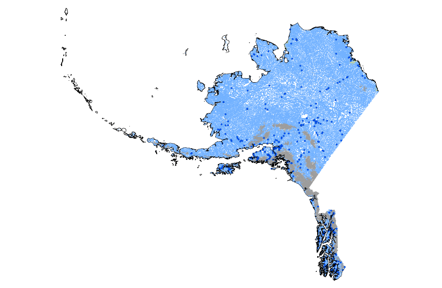
This geodatabase contains streams, waterbodies and wetlands, streamflow gaging stations, and coastlines for the United States, Puerto Rico, and the U.S. Virgin Islands. The streams are incorporated into a geometric network. All feature classes are vertically integrated with each other and with 1:1,000,000-scale transportation and boundary data sets.
Types: Citation;
Tags: Alabama,
Alaska,
Arizona,
Arkansas,
California, All tags...
Coastline,
Colorado,
Connecticut,
Delaware,
District of Columbia,
Downloadable Data,
Downloadable Data,
Drainage,
FileGDB 10.1,
FileGDB 10.1,
Florida,
Georgia,
Hawaii,
Hydrography,
Hydrology,
Idaho,
Illinois,
Indiana,
Iowa,
Kansas,
Kentucky,
Louisiana,
Maine,
Maryland,
Massachusetts,
Michigan,
Minnesota,
Mississippi,
Missouri,
Montana,
National,
National,
National Atlas of the United States,
Nebraska,
Nevada,
New Hampshire,
New Jersey,
New Mexico,
New York,
North Carolina,
North Dakota,
Oceans,
Ohio,
Oklahoma,
Oregon,
Pennsylvania,
Puerto Rico,
Rhode Island,
River,
Shoreline,
Small-scale Datasets,
Small-scale Datasets,
Small-scale Datasets,
Small-scale Datasets - Hydrography,
South Carolina,
South Dakota,
Stream,
Stream Gage,
Stream Gauge,
Streamflow,
Tennessee,
Texas,
U.S. Virgin Islands,
US,
USA,
United States,
Utah,
Vermont,
Virgin Islands,
Virginia,
Washington,
Water,
Waterbody,
West Virginia,
Wetland,
Wisconsin,
Wyoming,
inlandWaters,
oceans, Fewer tags
This geodatabase contains streams, waterbodies and wetlands, streamflow gaging stations, and coastlines for Alaska. The streams are incorporated into a geometric network. All feature classes are vertically integrated with each other and with 1:1,000,000-scale transportation and boundary data sets.
Types: Citation;
Tags: Alaska,
Coastline,
Downloadable Data,
Downloadable Data,
Drainage, All tags...
FileGDB 10.1,
FileGDB 10.1,
Hydrography,
Hydrology,
National Atlas of the United States,
Oceans,
River,
Shoreline,
Small-scale Datasets,
Small-scale Datasets,
Small-scale Datasets,
Small-scale Datasets - Hydrography,
State,
State,
Stream,
Stream Gage,
Stream Gauge,
Streamflow,
US,
USA,
United States,
Water,
Waterbody,
Wetland,
inlandWaters,
oceans, Fewer tags
This map layer includes railroads in the conterminous United States and Alaska. This is a revised version of the July 2012 map layer.
Types: Citation;
Tags: Alabama,
Alaska,
Arizona,
Arkansas,
California, All tags...
Colorado,
Connecticut,
Delaware,
District of Columbia,
Downloadable Data,
Downloadable Data,
Florida,
Georgia,
Idaho,
Illinois,
Indiana,
Iowa,
Kansas,
Kentucky,
Louisiana,
Maine,
Maryland,
Massachusetts,
Michigan,
Minnesota,
Mississippi,
Missouri,
Montana,
National,
National,
National Atlas of the United States,
Nebraska,
Nevada,
New Hampshire,
New Jersey,
New Mexico,
New York,
North Carolina,
North Dakota,
Ohio,
Oklahoma,
Oregon,
Pennsylvania,
Railroads,
Rhode Island,
Shapefile,
Shapefile,
Small-scale Datasets,
Small-scale Datasets,
Small-scale Datasets,
Small-scale Datasets - Transportation,
South Carolina,
South Dakota,
Tennessee,
Texas,
US,
USA,
United States,
Utah,
Vermont,
Virginia,
Washington,
West Virginia,
Wisconsin,
Wyoming,
transportation, Fewer tags
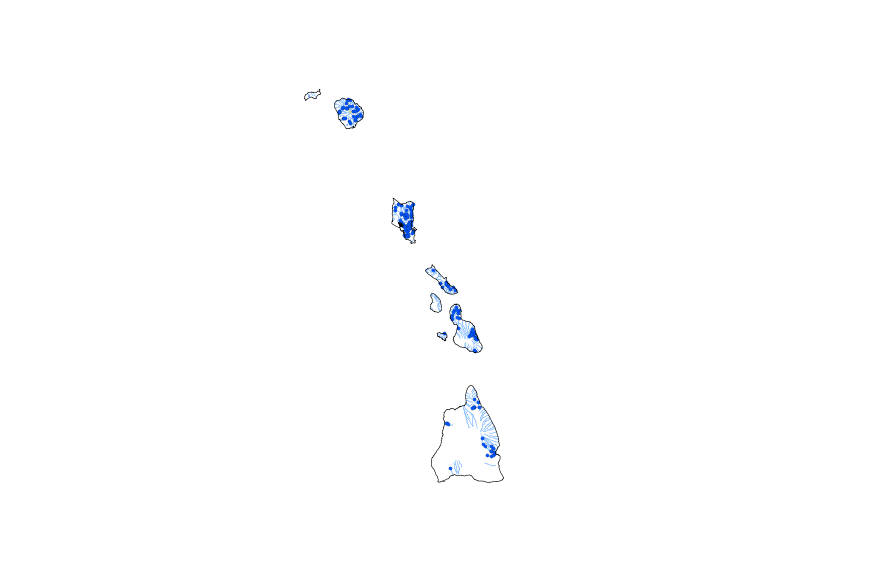
This geodatabase contains streams, waterbodies and wetlands, streamflow gaging stations, and coastlines for Hawaii. The streams are incorporated into a geometric network. All feature classes are vertically integrated with each other and with 1:1,000,000-scale transportation and boundary data sets.
Types: Citation;
Tags: Coastline,
Downloadable Data,
Downloadable Data,
Drainage,
FileGDB 10.1, All tags...
FileGDB 10.1,
Hawaii,
Hydrography,
Hydrology,
National Atlas of the United States,
Oceans,
River,
Shoreline,
Small-scale Datasets,
Small-scale Datasets,
Small-scale Datasets,
Small-scale Datasets - Hydrography,
State,
State,
Stream,
Stream Gage,
Stream Gauge,
Streamflow,
US,
USA,
United States,
Water,
Waterbody,
Wetland,
inlandWaters,
oceans, Fewer tags

This map layer includes railroads in the conterminous United States and Alaska. This is a revised version of the July 2012 map layer.
Types: Citation;
Tags: Alabama,
Alaska,
Arizona,
Arkansas,
California, All tags...
Colorado,
Connecticut,
Delaware,
District of Columbia,
Downloadable Data,
Downloadable Data,
FileGDB 10.1,
FileGDB 10.1,
Florida,
Georgia,
Idaho,
Illinois,
Indiana,
Iowa,
Kansas,
Kentucky,
Louisiana,
Maine,
Maryland,
Massachusetts,
Michigan,
Minnesota,
Mississippi,
Missouri,
Montana,
National,
National,
National Atlas of the United States,
Nebraska,
Nevada,
New Hampshire,
New Jersey,
New Mexico,
New York,
North Carolina,
North Dakota,
Ohio,
Oklahoma,
Oregon,
Pennsylvania,
Railroads,
Rhode Island,
Small-scale Datasets,
Small-scale Datasets,
Small-scale Datasets,
Small-scale Datasets - Transportation,
South Carolina,
South Dakota,
Tennessee,
Texas,
US,
USA,
United States,
Utah,
Vermont,
Virginia,
Washington,
West Virginia,
Wisconsin,
Wyoming,
transportation, Fewer tags
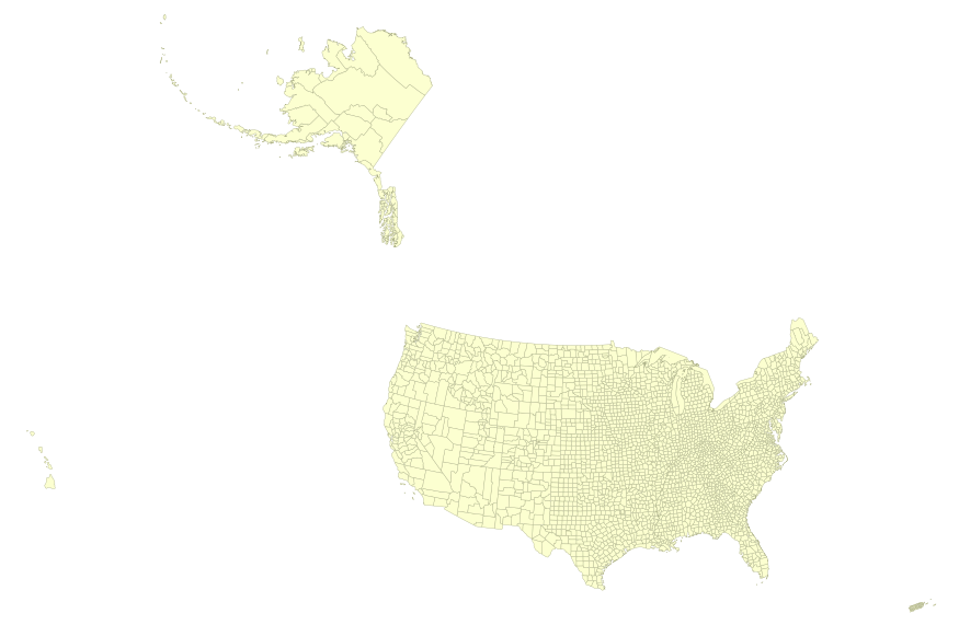
This map layer portrays the county boundaries of the United States, Puerto Rico, and the U.S. Virgin Islands, by showing the counties as areas. The map layer was created by extracting county polygon features from the CENSUS 2006 TIGER/Line files produced by the U.S. Census Bureau. These files were then merged into a single file. This is a revised version of the July 2012 map layer.
Types: Citation;
Tags: Alabama,
Alaska,
Arizona,
Arkansas,
California, All tags...
Colorado,
Connecticut,
Counties,
County boundaries,
Delaware,
District of Columbia,
Downloadable Data,
Downloadable Data,
Florida,
Georgia,
Hawaii,
Idaho,
Illinois,
Indiana,
Iowa,
Kansas,
Kentucky,
Louisiana,
Maine,
Maryland,
Massachusetts,
Michigan,
Minnesota,
Mississippi,
Missouri,
Montana,
National,
National,
National Atlas of the United States,
Nebraska,
Nevada,
New Hampshire,
New Jersey,
New Mexico,
New York,
North Carolina,
North Dakota,
Ohio,
Oklahoma,
Oregon,
Pennsylvania,
Puerto Rico,
Rhode Island,
Shapefile,
Shapefile,
Small-scale Datasets,
Small-scale Datasets,
Small-scale Datasets,
Small-scale Datasets - Boundaries,
South Carolina,
South Dakota,
Tennessee,
Texas,
U.S. Virgin Islands,
US,
USA,
United States,
Utah,
Vermont,
Virgin Islands,
Virginia,
Washington,
West Virginia,
Wisconsin,
Wyoming,
boundaries, Fewer tags

This map layer portrays the county boundaries of the United States, Puerto Rico, and the U.S. Virgin Islands, by showing the counties as areas. The map layer was created by extracting county polygon features from the CENSUS 2006 TIGER/Line files produced by the U.S. Census Bureau. These files were then merged into a single file. This is a revised version of the July 2012 map layer.
Types: Citation;
Tags: Alabama,
Alaska,
Arizona,
Arkansas,
California, All tags...
Colorado,
Connecticut,
Counties,
County boundaries,
Delaware,
District of Columbia,
Downloadable Data,
Downloadable Data,
FileGDB 10.1,
FileGDB 10.1,
Florida,
Georgia,
Hawaii,
Idaho,
Illinois,
Indiana,
Iowa,
Kansas,
Kentucky,
Louisiana,
Maine,
Maryland,
Massachusetts,
Michigan,
Minnesota,
Mississippi,
Missouri,
Montana,
National,
National,
National Atlas of the United States,
Nebraska,
Nevada,
New Hampshire,
New Jersey,
New Mexico,
New York,
North Carolina,
North Dakota,
Ohio,
Oklahoma,
Oregon,
Pennsylvania,
Puerto Rico,
Rhode Island,
Small-scale Datasets,
Small-scale Datasets,
Small-scale Datasets,
Small-scale Datasets - Boundaries,
South Carolina,
South Dakota,
Tennessee,
Texas,
U.S. Virgin Islands,
US,
USA,
United States,
Utah,
Vermont,
Virgin Islands,
Virginia,
Washington,
West Virginia,
Wisconsin,
Wyoming,
boundaries, Fewer tags
This map layer consists of federally owned or administered lands of the United States, Puerto Rico, and the U.S. Virgin Islands. For the most part, only areas of 320 acres or more are included; some smaller areas deemed to be important or significant are also included. There may be private inholdings within the boundaries of Federal lands in this map layer. Some established Federal lands which are larger than 320 acres are not included in this map layer, because their boundaries were not available from the owning or administering agency.
Tags: Air Force,
Alabama,
Alaska,
Arizona,
Arkansas, All tags...
Army,
BIA,
BLM,
BOR,
Bureau of Indian Affairs,
Bureau of Land Management,
Bureau of Reclamation,
California,
Coast Guard,
Colorado,
Connecticut,
Coordinated Area,
DHS,
DOC,
DOD,
DOE,
DOJ,
DOL,
DOT,
Delaware,
Department of Commerce,
Department of Defense,
Department of Energy,
Department of Health and Human Services,
Department of Homeland Security,
Department of Justice,
Department of Labor,
Department of Transportation,
Department of Veterans Affairs,
District of Columbia,
Downloadable Data,
Downloadable Data,
Experimental Range,
Experimental Station,
FS,
FWS,
Federal Center,
Federal Correctional Complex,
Federal Penitentiary,
Federal lands,
Field Site,
Fish and Wildlife Service,
Flight Center,
Florida,
Forest Service,
GSA,
General Services Administration,
Georgia,
HHS,
Hawaii,
Idaho,
Illinois,
Indian Reservation,
Indiana,
Iowa,
Job Corps Center,
Kansas,
Kentucky,
Law Enforcement Training Center,
Louisiana,
MWAA,
MWAA,
Maine,
Marine Corps,
Maryland,
Massachusetts,
Metropolitan Washington Airports Authority,
Michigan,
Minnesota,
Mississippi,
Missouri,
Montana,
NASA,
NIH,
NPS,
National,
National,
National Aeronautics and Space Administration,
National Battlefield,
National Cemetery,
National Conservation Area,
National Fish Hatchery,
National Forest,
National Game Preserve,
National Grassland,
National Guard,
National Historic Park,
National Historic Reserve,
National Historic Site,
National Institutes of Health,
National Laboratory,
National Lakeshore,
National Memorial,
National Military Park,
National Monument,
National Natural Landmark,
National Park,
National Park Service,
National Parkway,
National Preserve,
National Recreation Area,
National Reserve,
National Scenic Area,
National Seashore,
National Wild and Scenic River,
National Wilderness Area,
National Wildlife Refuge,
Naval Petroleum Reserve,
Navy,
Nebraska,
Nevada,
New Hampshire,
New Jersey,
New Mexico,
New York,
North Carolina,
North Dakota,
Ohio,
Oklahoma,
Oregon,
Pennsylvania,
Public Domain Land,
Puerto Rico,
Research Facility,
Research Natural Area,
Research Station,
Rhode Island,
Scenic Area,
Shapefile,
Shapefile,
Small-scale Datasets,
Small-scale Datasets,
Small-scale Datasets,
Small-scale Datasets - Boundaries,
South Carolina,
South Dakota,
Space Center,
TVA,
Tennessee,
Tennessee Valley Authority,
Test Site,
Texas,
U.S. Coast Guard,
U.S. Department of Agriculture,
U.S. Fish and Wildlife Service,
U.S. Forest Service,
U.S. Virgin Islands,
US,
USA,
USDA,
United States,
Utah,
VA,
Vermont,
Virgin Islands,
Virginia,
Washington,
Waterfowl Production Area,
West Virginia,
Wild Horse Range,
Wild and Scenic River,
Wilderness Area,
Wildlife Management Area,
Wisconsin,
Wyoming,
boundaries,
intelligenceMilitary,
society, Fewer tags
This map layer portrays the major roads in the United States, Puerto Rico, and the U.S. Virgin Islands. The file was produced by joining the individual State roads layers from the National Highway Planning Network (NHPN), Geographic Data Technology (GDT) Dynamap, and TIGER/Line files. This is a revised version of the July 2012 map layer.
Types: Citation;
Tags: Alabama,
Alaska,
Arizona,
Arkansas,
California, All tags...
Colorado,
Connecticut,
Delaware,
District of Columbia,
Downloadable Data,
Downloadable Data,
FileGDB 10.1,
FileGDB 10.1,
Florida,
Georgia,
Hawaii,
Highways,
Idaho,
Illinois,
Indiana,
Interstate highways,
Iowa,
Kansas,
Kentucky,
Louisiana,
Maine,
Maryland,
Massachusetts,
Michigan,
Minnesota,
Mississippi,
Missouri,
Montana,
National,
National,
National Atlas of the United States,
Nebraska,
Nevada,
New Hampshire,
New Jersey,
New Mexico,
New York,
North Carolina,
North Dakota,
Ohio,
Oklahoma,
Oregon,
Pennsylvania,
Puerto Rico,
Rhode Island,
Roads,
Small-scale Datasets,
Small-scale Datasets,
Small-scale Datasets,
Small-scale Datasets - Transportation,
South Carolina,
South Dakota,
State Route,
Tennessee,
Texas,
U.S. Virgin Islands,
US,
US Route,
USA,
United States,
Utah,
Vermont,
Virgin Islands,
Virginia,
Washington,
West Virginia,
Wisconsin,
Wyoming,
transportation, Fewer tags
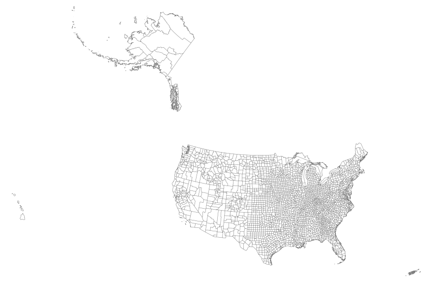
This map layer portrays the county boundaries of the United States, Puerto Rico, and the U.S. Virgin Islands as linework. The map layer was derived from the 1:1,000,000-Scale County Boundaries of the United States polygon data set by applying the Arc/Info Clean function. The Clean function eliminates the duplicate arcs present in polygon shapefiles, leaving one copy of each line.
Types: Citation;
Tags: Alabama,
Alaska,
Arizona,
Arkansas,
California, All tags...
Colorado,
Connecticut,
Counties,
County boundaries,
Delaware,
District of Columbia,
Downloadable Data,
Downloadable Data,
Florida,
Georgia,
Hawaii,
Idaho,
Illinois,
Indiana,
Iowa,
Kansas,
Kentucky,
Louisiana,
Maine,
Maryland,
Massachusetts,
Michigan,
Minnesota,
Mississippi,
Missouri,
Montana,
National,
National,
National Atlas of the United States,
Nebraska,
Nevada,
New Hampshire,
New Jersey,
New Mexico,
New York,
North Carolina,
North Dakota,
Ohio,
Oklahoma,
Oregon,
Pennsylvania,
Puerto Rico,
Rhode Island,
Shapefile,
Shapefile,
Small-scale Datasets,
Small-scale Datasets,
Small-scale Datasets,
Small-scale Datasets - Boundaries,
South Carolina,
South Dakota,
Tennessee,
Texas,
U.S. Virgin Islands,
US,
USA,
United States,
Utah,
Vermont,
Virgin Islands,
Virginia,
Washington,
West Virginia,
Wisconsin,
Wyoming,
boundaries, Fewer tags
|
|

