Filters
Date Range
Extensions
Types
Contacts
Categories
Tag Types
Tag Schemes
|

This map layer consists of federally owned or administered lands of the United States, Puerto Rico, and the U.S. Virgin Islands. For the most part, only areas of 320 acres or more are included; some smaller areas deemed to be important or significant are also included. There may be private inholdings within the boundaries of Federal lands in this map layer. Some established Federal lands which are larger than 320 acres are not included in this map layer, because their boundaries were not available from the owning or administering agency.
Tags: Air Force,
Alabama,
Alaska,
Arizona,
Arkansas, All tags...
Army,
BIA,
BLM,
BOR,
Bureau of Indian Affairs,
Bureau of Land Management,
Bureau of Reclamation,
California,
Coast Guard,
Colorado,
Connecticut,
Coordinated Area,
DHS,
DOC,
DOD,
DOE,
DOJ,
DOL,
DOT,
Delaware,
Department of Commerce,
Department of Defense,
Department of Energy,
Department of Health and Human Services,
Department of Homeland Security,
Department of Justice,
Department of Labor,
Department of Transportation,
Department of Veterans Affairs,
District of Columbia,
Downloadable Data,
Downloadable Data,
Experimental Range,
Experimental Station,
FS,
FWS,
Federal Center,
Federal Correctional Complex,
Federal Penitentiary,
Federal lands,
Field Site,
FileGDB 10.1,
FileGDB 10.1,
Fish and Wildlife Service,
Flight Center,
Florida,
Forest Service,
GSA,
General Services Administration,
Georgia,
HHS,
Hawaii,
Idaho,
Illinois,
Indian Reservation,
Indiana,
Iowa,
Job Corps Center,
Kansas,
Kentucky,
Law Enforcement Training Center,
Louisiana,
MWAA,
MWAA,
Maine,
Marine Corps,
Maryland,
Massachusetts,
Metropolitan Washington Airports Authority,
Michigan,
Minnesota,
Mississippi,
Missouri,
Montana,
NASA,
NIH,
NPS,
National,
National,
National Aeronautics and Space Administration,
National Battlefield,
National Cemetery,
National Conservation Area,
National Fish Hatchery,
National Forest,
National Game Preserve,
National Grassland,
National Guard,
National Historic Park,
National Historic Reserve,
National Historic Site,
National Institutes of Health,
National Laboratory,
National Lakeshore,
National Memorial,
National Military Park,
National Monument,
National Natural Landmark,
National Park,
National Park Service,
National Parkway,
National Preserve,
National Recreation Area,
National Reserve,
National Scenic Area,
National Seashore,
National Wild and Scenic River,
National Wilderness Area,
National Wildlife Refuge,
Naval Petroleum Reserve,
Navy,
Nebraska,
Nevada,
New Hampshire,
New Jersey,
New Mexico,
New York,
North Carolina,
North Dakota,
Ohio,
Oklahoma,
Oregon,
Pennsylvania,
Public Domain Land,
Puerto Rico,
Research Facility,
Research Natural Area,
Research Station,
Rhode Island,
Scenic Area,
Small-scale Datasets,
Small-scale Datasets,
Small-scale Datasets,
Small-scale Datasets - Boundaries,
South Carolina,
South Dakota,
Space Center,
TVA,
Tennessee,
Tennessee Valley Authority,
Test Site,
Texas,
U.S. Coast Guard,
U.S. Department of Agriculture,
U.S. Fish and Wildlife Service,
U.S. Forest Service,
U.S. Virgin Islands,
US,
USA,
USDA,
United States,
Utah,
VA,
Vermont,
Virgin Islands,
Virginia,
Washington,
Waterfowl Production Area,
West Virginia,
Wild Horse Range,
Wild and Scenic River,
Wilderness Area,
Wildlife Management Area,
Wisconsin,
Wyoming,
boundaries,
intelligenceMilitary,
society, Fewer tags
All roads in the western United States from the 2000 US Census Bureau 1:100,000 scale TIGER/line files.
Categories: Data;
Types: Downloadable,
Map Service,
OGC WFS Layer,
OGC WMS Layer,
Shapefile;
Tags: Arizona,
California,
Census 2000,
Colorado,
Idaho, All tags...
Montana,
Nevada,
New Mexico,
Oregon,
TIGER/line,
Utah,
Washington,
Western United States,
Wyoming,
built environments,
roads,
roadways,
secondary roads,
society,
transportation,
transportation networks, Fewer tags
Map containing historical census data from 1900 - 2000 throughout the western United States at the county level. Data includes total population, population density, and percent population change by decade for each county. Population data was obtained from the US Census Bureau and joined to 1:2,000,000 scale National Atlas counties shapefile.
Categories: Data;
Types: Downloadable,
Map Service,
OGC WFS Layer,
OGC WMS Layer,
Shapefile;
Tags: Arizona,
California,
Colorado,
Idaho,
Montana, All tags...
Nebraska,
Nevada,
New Mexico,
North Dakota,
Oregon,
South Dakota,
US Census,
Utah,
Washington,
Western United States,
Wyoming,
census,
culture and demographics,
historic population,
population (human),
population dynamics,
society, Fewer tags

The Geographic Names Information System (GNIS) is the Federal standard for geographic nomenclature. The U.S. Geological Survey developed the GNIS for the U.S. Board on Geographic Names, a Federal inter-agency body chartered by public law to maintain uniform feature name usage throughout the Government and to promulgate standard names to the public. The GNIS is the official repository of domestic geographic names data; the official vehicle for geographic names use by all departments of the Federal Government; and the source for applying geographic names to Federal electronic and printed products of all types. See http://geonames.usgs.gov for additional information.
Types: Citation;
Tags: Antarctica,
Borough,
Census Area,
Commonwealth,
County, All tags...
District,
Downloadable Data,
Feature class,
Feature coordinates,
Feature county,
Feature description,
Feature designation,
Feature history,
Feature identification,
Feature name,
Feature state,
Geographic Names,
Geographic feature,
Geographic name,
Geographical feature,
Geographical name,
Legacy GNIS,
Municipio,
National Geographic Names Information System (GNIS),
Official feature name,
Outlying Area,
Parish,
Place name,
Populated Place,
State,
State,
TXT (pipes),
Territory,
Topographic Map,
United States,
Variant name,
economy,
environment,
imageryBaseMapsEarthCover,
inlandWaters,
location,
society,
structure,
transportation,
utilitiesCommunication, Fewer tags

The Geographic Names Information System (GNIS) is the Federal standard for geographic nomenclature. The U.S. Geological Survey developed the GNIS for the U.S. Board on Geographic Names, a Federal inter-agency body chartered by public law to maintain uniform feature name usage throughout the Government and to promulgate standard names to the public. The GNIS is the official repository of domestic geographic names data; the official vehicle for geographic names use by all departments of the Federal Government; and the source for applying geographic names to Federal electronic and printed products of all types.
Tags: AK,
AL,
AR,
AS,
AZ, All tags...
Alabama,
Alaska,
American Samoa,
Antarctica,
Antarctica,
Arizona,
Arkansas,
BGN,
Board on Geographic Names,
Borough,
CA,
CO,
CT,
California,
Census Area,
Colorado,
Commonwealth,
Connecticut,
County,
DC,
DE,
Delaware,
District,
District of Columbia,
Downloadable Data,
Esri File GeoDatabase 10,
FL,
Feature class,
Feature coordinates,
Feature county,
Feature description,
Feature designation,
Feature history,
Feature indentification,
Feature name,
Feature state,
FileGDB,
Florida,
GA,
GNIS,
GU,
Geographic Names,
Geographic Names Full Model,
Geographic Names Information System,
Geographic feature,
Geographic name,
Geographical feature,
Geographical name,
Georgia,
Guam,
HI,
Hawaii,
IA,
ID,
IL,
IN,
Idaho,
Illinois,
Indiana,
Iowa,
KS,
KY,
Kansas,
Kentucky,
LA,
Louisiana,
MA,
MD,
ME,
MI,
MN,
MO,
MP,
MS,
MT,
Maine,
Maryland,
Massachusetts,
Michigan,
Minnesota,
Mississippi,
Missouri,
Montana,
Municipio,
NC,
ND,
NE,
NH,
NJ,
NM,
NV,
NY,
National,
National,
National Geographic Names Information System (GNIS),
National Geographic Names Information System (GNIS),
Nebraska,
Nevada,
New Hampshire,
New Jersey,
New Mexico,
New York,
North Carolina,
North Dakota,
Northern Mariana Islands,
OH,
OK,
OR,
Official feature name,
Ohio,
Oklahoma,
Oregon,
Outlying Area,
PA,
PR,
Parish,
Pennsylvania,
Place name,
Populated Place,
Puerto Rico,
RI,
Rhode Island,
SC,
SD,
South Carolina,
South Dakota,
TN,
TX,
Tennessee,
Territories,
Territory,
Texas,
Topographic Map,
U.S. Board on Geographic Names,
U.S. Geological Survey,
US,
USA,
USBGN,
USGS,
UT,
United States,
United States,
United States,
Utah,
VA,
VI,
VT,
Variant name,
Vermont,
Virgin Islands,
Virginia,
WA,
WI,
WV,
WY,
Washington,
West Virginia,
Wisconsin,
Wyoming,
antarctic,
database,
economy,
environment,
feature,
gazetteer,
geographic,
geographic names,
geographical,
geography,
geospatial,
imageryBaseMapsEarthCover,
inlandWaters,
location,
map,
name,
place,
placename,
society,
structure,
topographic map,
toponymy, Fewer tags

The Geographic Names Information System (GNIS) is the Federal standard for geographic nomenclature. The U.S. Geological Survey developed the GNIS for the U.S. Board on Geographic Names, a Federal inter-agency body chartered by public law to maintain uniform feature name usage throughout the Government and to promulgate standard names to the public. The GNIS is the official repository of domestic geographic names data; the official vehicle for geographic names use by all departments of the Federal Government; and the source for applying geographic names to Federal electronic and printed products of all types.
Tags: Adams,
Alexander,
Antarctica,
Antarctica,
BGN, All tags...
Board on Geographic Names,
Bond,
Boone,
Borough,
Brown,
Bureau,
Calhoun,
Carroll,
Cass,
Census Area,
Champaign,
Christian,
Clark,
Clay,
Clinton,
Coles,
Commonwealth,
Cook,
County,
Crawford,
Cumberland,
De Witt,
DeKalb,
District,
Douglas,
Downloadable Data,
DuPage,
Edgar,
Edwards,
Effingham,
Fayette,
Feature class,
Feature coordinates,
Feature county,
Feature description,
Feature designation,
Feature history,
Feature indentification,
Feature name,
Feature state,
Ford,
Franklin,
Fulton,
GNIS,
Gallatin,
Geographic Names,
Geographic Names Federal Codes,
Geographic Names Information System,
Geographic feature,
Geographic name,
Geographical feature,
Geographical name,
Greene,
Grundy,
Hamilton,
Hancock,
Hardin,
Henderson,
Henry,
IL,
Illinois,
Iroquois,
Jackson,
Jasper,
Jefferson,
Jersey,
Jo Daviess,
Johnson,
Kane,
Kankakee,
Kendall,
Knox,
LaSalle,
Lake,
Lawrence,
Lee,
Livingston,
Logan,
Macon,
Macoupin,
Madison,
Marion,
Marshall,
Mason,
Massac,
McDonough,
McHenry,
McLean,
Menard,
Mercer,
Monroe,
Montgomery,
Morgan,
Moultrie,
Municipio,
National Geographic Names Information System (GNIS),
National Geographic Names Information System (GNIS),
Official feature name,
Ogle,
Outlying Area,
Parish,
Peoria,
Perry,
Piatt,
Pike,
Place name,
Pope,
Populated Place,
Pulaski,
Putnam,
Randolph,
Richland,
Rock Island,
Saline,
Sangamon,
Schuyler,
Scott,
Shelby,
St. Clair,
Stark,
State,
Stephenson,
TXT (pipes),
Tazewell,
Territories,
Territory,
Topographic Map,
U.S. Board on Geographic Names,
U.S. Geological Survey,
US,
USA,
USBGN,
USGS,
UTF-8 Pipe Delimited Text File nan,
Union,
United States,
United States,
United States,
Variant name,
Vermilion,
Wabash,
Warren,
Washington,
Wayne,
White,
Whiteside,
Will,
Williamson,
Winnebago,
Woodford,
antarctic,
database,
economy,
environment,
feature,
gazetteer,
geographic,
geographic names,
geographical,
geography,
geospatial,
imageryBaseMapsEarthCover,
inlandWaters,
location,
map,
name,
place,
placename,
society,
structure,
topographic map,
toponymy, Fewer tags
The Geographic Names Information System (GNIS) is the Federal standard for geographic nomenclature. The U.S. Geological Survey developed the GNIS for the U.S. Board on Geographic Names, a Federal inter-agency body chartered by public law to maintain uniform feature name usage throughout the Government and to promulgate standard names to the public. The GNIS is the official repository of domestic geographic names data; the official vehicle for geographic names use by all departments of the Federal Government; and the source for applying geographic names to Federal electronic and printed products of all types.
Tags: AL,
Alabama,
Antarctica,
Antarctica,
Autauga, All tags...
BGN,
Baldwin,
Barbour,
Bibb,
Blount,
Board on Geographic Names,
Borough,
Bullock,
Butler,
Calhoun,
Census Area,
Chambers,
Cherokee,
Chilton,
Choctaw,
Clarke,
Clay,
Cleburne,
Coffee,
Colbert,
Commonwealth,
Conecuh,
Coosa,
County,
Covington,
Crenshaw,
Cullman,
Dale,
Dallas,
DeKalb,
District,
Downloadable Data,
Elmore,
Escambia,
Etowah,
Fayette,
Feature class,
Feature coordinates,
Feature county,
Feature description,
Feature designation,
Feature history,
Feature indentification,
Feature name,
Feature state,
Franklin,
GNIS,
Geneva,
Geographic Names,
Geographic Names Federal Codes,
Geographic Names Information System,
Geographic feature,
Geographic name,
Geographical feature,
Geographical name,
Greene,
Hale,
Henry,
Houston,
Jackson,
Jefferson,
Lamar,
Lauderdale,
Lawrence,
Lee,
Limestone,
Lowndes,
Macon,
Madison,
Marengo,
Marion,
Marshall,
Mobile,
Monroe,
Montgomery,
Morgan,
Municipio,
National Geographic Names Information System (GNIS),
National Geographic Names Information System (GNIS),
Official feature name,
Outlying Area,
Parish,
Perry,
Pickens,
Pike,
Place name,
Populated Place,
Randolph,
Russell,
Shelby,
St. Clair,
State,
Sumter,
TXT (pipes),
Talladega,
Tallapoosa,
Territories,
Territory,
Topographic Map,
Tuscaloosa,
U.S. Board on Geographic Names,
U.S. Geological Survey,
US,
USA,
USBGN,
USGS,
UTF-8 Pipe Delimited Text File nan,
United States,
United States,
United States,
Variant name,
Walker,
Washington,
Wilcox,
Winston,
antarctic,
database,
economy,
environment,
feature,
gazetteer,
geographic,
geographic names,
geographical,
geography,
geospatial,
imageryBaseMapsEarthCover,
inlandWaters,
location,
map,
name,
place,
placename,
society,
structure,
topographic map,
toponymy, Fewer tags
The Geographic Names Information System (GNIS) is the Federal standard for geographic nomenclature. The U.S. Geological Survey developed the GNIS for the U.S. Board on Geographic Names, a Federal inter-agency body chartered by public law to maintain uniform feature name usage throughout the Government and to promulgate standard names to the public. The GNIS is the official repository of domestic geographic names data; the official vehicle for geographic names use by all departments of the Federal Government; and the source for applying geographic names to Federal electronic and printed products of all types.
Tags: Ada,
Adams,
Antarctica,
Antarctica,
BGN, All tags...
Bannock,
Bear Lake,
Benewah,
Bingham,
Blaine,
Board on Geographic Names,
Boise,
Bonner,
Bonneville,
Borough,
Boundary,
Butte,
Camas,
Canyon,
Caribou,
Cassia,
Census Area,
Clark,
Clearwater,
Commonwealth,
County,
Custer,
District,
Downloadable Data,
Elmore,
Feature class,
Feature coordinates,
Feature county,
Feature description,
Feature designation,
Feature history,
Feature indentification,
Feature name,
Feature state,
Franklin,
Fremont,
GNIS,
Gem,
Geographic Names,
Geographic Names Federal Codes,
Geographic Names Information System,
Geographic feature,
Geographic name,
Geographical feature,
Geographical name,
Gooding,
ID,
Idaho,
Idaho,
Jefferson,
Jerome,
Kootenai,
Latah,
Lemhi,
Lewis,
Lincoln,
Madison,
Minidoka,
Municipio,
National Geographic Names Information System (GNIS),
National Geographic Names Information System (GNIS),
Nez Perce,
Official feature name,
Oneida,
Outlying Area,
Owyhee,
Parish,
Payette,
Place name,
Populated Place,
Power,
Shoshone,
State,
TXT (pipes),
Territories,
Territory,
Teton,
Topographic Map,
Twin Falls,
U.S. Board on Geographic Names,
U.S. Geological Survey,
US,
USA,
USBGN,
USGS,
UTF-8 Pipe Delimited Text File nan,
United States,
United States,
United States,
Valley,
Variant name,
Washington,
antarctic,
database,
economy,
environment,
feature,
gazetteer,
geographic,
geographic names,
geographical,
geography,
geospatial,
imageryBaseMapsEarthCover,
inlandWaters,
location,
map,
name,
place,
placename,
society,
structure,
topographic map,
toponymy, Fewer tags
The Geographic Names Information System (GNIS) is the Federal standard for geographic nomenclature. The U.S. Geological Survey developed the GNIS for the U.S. Board on Geographic Names, a Federal inter-agency body chartered by public law to maintain uniform feature name usage throughout the Government and to promulgate standard names to the public. The GNIS is the official repository of domestic geographic names data; the official vehicle for geographic names use by all departments of the Federal Government; and the source for applying geographic names to Federal electronic and printed products of all types.
Tags: Antarctica,
Antarctica,
BGN,
Board on Geographic Names,
Borough, All tags...
Carson City,
Census Area,
Churchill,
Clark,
Commonwealth,
County,
District,
Douglas,
Downloadable Data,
Elko,
Esmeralda,
Eureka,
Feature class,
Feature coordinates,
Feature county,
Feature description,
Feature designation,
Feature history,
Feature indentification,
Feature name,
Feature state,
GNIS,
Geographic Names,
Geographic Names Federal Codes,
Geographic Names Information System,
Geographic feature,
Geographic name,
Geographical feature,
Geographical name,
Humboldt,
Lander,
Lincoln,
Lyon,
Mineral,
Municipio,
NV,
National Geographic Names Information System (GNIS),
National Geographic Names Information System (GNIS),
Nevada,
Nye,
Official feature name,
Outlying Area,
Parish,
Pershing,
Place name,
Populated Place,
State,
Storey,
TXT (pipes),
Territories,
Territory,
Topographic Map,
U.S. Board on Geographic Names,
U.S. Geological Survey,
US,
USA,
USBGN,
USGS,
UTF-8 Pipe Delimited Text File nan,
United States,
United States,
United States,
Variant name,
Washoe,
White Pine,
antarctic,
database,
economy,
environment,
feature,
gazetteer,
geographic,
geographic names,
geographical,
geography,
geospatial,
imageryBaseMapsEarthCover,
inlandWaters,
location,
map,
name,
place,
placename,
society,
structure,
topographic map,
toponymy, Fewer tags

The Geographic Names Information System (GNIS) is the Federal standard for geographic nomenclature. The U.S. Geological Survey developed the GNIS for the U.S. Board on Geographic Names, a Federal inter-agency body chartered by public law to maintain uniform feature name usage throughout the Government and to promulgate standard names to the public. The GNIS is the official repository of domestic geographic names data; the official vehicle for geographic names use by all departments of the Federal Government; and the source for applying geographic names to Federal electronic and printed products of all types.
Tags: Adams,
Allegheny,
Antarctica,
Antarctica,
Armstrong, All tags...
BGN,
Beaver,
Bedford,
Berks,
Blair,
Board on Geographic Names,
Borough,
Bradford,
Bucks,
Butler,
Cambria,
Cameron,
Carbon,
Census Area,
Centre,
Chester,
Clarion,
Clearfield,
Clinton,
Columbia,
Commonwealth,
County,
Crawford,
Cumberland,
Dauphin,
Delaware,
District,
Downloadable Data,
Elk,
Erie,
Fayette,
Feature class,
Feature coordinates,
Feature county,
Feature description,
Feature designation,
Feature history,
Feature indentification,
Feature name,
Feature state,
Forest,
Franklin,
Fulton,
GNIS,
Geographic Names,
Geographic Names Federal Codes,
Geographic Names Information System,
Geographic feature,
Geographic name,
Geographical feature,
Geographical name,
Greene,
Huntingdon,
Indiana,
Jefferson,
Juniata,
Lackawanna,
Lancaster,
Lawrence,
Lebanon,
Lehigh,
Luzerne,
Lycoming,
McKean,
Mercer,
Mifflin,
Monroe,
Montgomery,
Montour,
Municipio,
National Geographic Names Information System (GNIS),
National Geographic Names Information System (GNIS),
Northampton,
Northumberland,
Official feature name,
Outlying Area,
PA,
Parish,
Pennsylvania,
Perry,
Philadelphia,
Pike,
Place name,
Populated Place,
Potter,
Schuylkill,
Snyder,
Somerset,
State,
Sullivan,
Susquehanna,
TXT (pipes),
Territories,
Territory,
Tioga,
Topographic Map,
U.S. Board on Geographic Names,
U.S. Geological Survey,
US,
USA,
USBGN,
USGS,
UTF-8 Pipe Delimited Text File nan,
Union,
United States,
United States,
United States,
Variant name,
Venango,
Warren,
Washington,
Wayne,
Westmoreland,
Wyoming,
York,
antarctic,
database,
economy,
environment,
feature,
gazetteer,
geographic,
geographic names,
geographical,
geography,
geospatial,
imageryBaseMapsEarthCover,
inlandWaters,
location,
map,
name,
place,
placename,
society,
structure,
topographic map,
toponymy, Fewer tags

The Geographic Names Information System (GNIS) is the Federal standard for geographic nomenclature. The U.S. Geological Survey developed the GNIS for the U.S. Board on Geographic Names, a Federal inter-agency body chartered by public law to maintain uniform feature name usage throughout the Government and to promulgate standard names to the public. The GNIS is the official repository of domestic geographic names data; the official vehicle for geographic names use by all departments of the Federal Government; and the source for applying geographic names to Federal electronic and printed products of all types.
Tags: Adams,
Alamosa,
Antarctica,
Antarctica,
Arapahoe, All tags...
Archuleta,
BGN,
Baca,
Bent,
Board on Geographic Names,
Borough,
Boulder,
Broomfield,
CO,
Census Area,
Chaffee,
Cheyenne,
Clear Creek,
Colorado,
Commonwealth,
Conejos,
Costilla,
County,
Crowley,
Custer,
Delta,
Denver,
District,
Dolores,
Douglas,
Downloadable Data,
Eagle,
El Paso,
Elbert,
Feature class,
Feature coordinates,
Feature county,
Feature description,
Feature designation,
Feature history,
Feature indentification,
Feature name,
Feature state,
Fremont,
GNIS,
Garfield,
Geographic Names,
Geographic Names Domestic Names,
Geographic Names Information System,
Geographic feature,
Geographic name,
Geographical feature,
Geographical name,
Gilpin,
Grand,
Gunnison,
Hinsdale,
Huerfano,
Jackson,
Jefferson,
Kiowa,
Kit Carson,
La Plata,
Lake,
Larimer,
Las Animas,
Lincoln,
Logan,
Mesa,
Mineral,
Moffat,
Montezuma,
Montrose,
Morgan,
Municipio,
National Geographic Names Information System (GNIS),
National Geographic Names Information System (GNIS),
Official feature name,
Otero,
Ouray,
Outlying Area,
Parish,
Park,
Phillips,
Pitkin,
Place name,
Populated Place,
Prowers,
Pueblo,
Rio Blanco,
Rio Grande,
Routt,
Saguache,
San Juan,
San Miguel,
Sedgwick,
State,
Summit,
TXT (pipes),
Teller,
Territories,
Territory,
Topographic Map,
U.S. Board on Geographic Names,
U.S. Geological Survey,
US,
USA,
USBGN,
USGS,
UTF-8 Pipe Delimited Text File nan,
United States,
United States,
United States,
Variant name,
Washington,
Weld,
Yuma,
antarctic,
database,
economy,
environment,
feature,
gazetteer,
geographic,
geographic names,
geographical,
geography,
geospatial,
imageryBaseMapsEarthCover,
inlandWaters,
location,
map,
name,
place,
placename,
society,
structure,
topographic map,
toponymy, Fewer tags

The Geographic Names Information System (GNIS) is the Federal standard for geographic nomenclature. The U.S. Geological Survey developed the GNIS for the U.S. Board on Geographic Names, a Federal inter-agency body chartered by public law to maintain uniform feature name usage throughout the Government and to promulgate standard names to the public. The GNIS is the official repository of domestic geographic names data; the official vehicle for geographic names use by all departments of the Federal Government; and the source for applying geographic names to Federal electronic and printed products of all types.
Tags: Adams,
Antarctica,
Antarctica,
BGN,
Barnes, All tags...
Benson,
Billings,
Board on Geographic Names,
Borough,
Bottineau,
Bowman,
Burke,
Burleigh,
Cass,
Cavalier,
Census Area,
Commonwealth,
County,
Dickey,
District,
Divide,
Downloadable Data,
Dunn,
Eddy,
Emmons,
Feature class,
Feature coordinates,
Feature county,
Feature description,
Feature designation,
Feature history,
Feature indentification,
Feature name,
Feature state,
Foster,
GNIS,
Geographic Names,
Geographic Names Domestic Names,
Geographic Names Information System,
Geographic feature,
Geographic name,
Geographical feature,
Geographical name,
Golden Valley,
Grand Forks,
Grant,
Griggs,
Hettinger,
Kidder,
LaMoure,
Logan,
McHenry,
McIntosh,
McKenzie,
McLean,
Mercer,
Morton,
Mountrail,
Municipio,
ND,
National Geographic Names Information System (GNIS),
National Geographic Names Information System (GNIS),
Nelson,
North Dakota,
Official feature name,
Oliver,
Outlying Area,
Parish,
Pembina,
Pierce,
Place name,
Populated Place,
Ramsey,
Ransom,
Renville,
Richland,
Rolette,
Sargent,
Sheridan,
Sioux,
Slope,
Stark,
State,
Steele,
Stutsman,
TXT (pipes),
Territories,
Territory,
Topographic Map,
Towner,
Traill,
U.S. Board on Geographic Names,
U.S. Geological Survey,
US,
USA,
USBGN,
USGS,
UTF-8 Pipe Delimited Text File nan,
United States,
United States,
United States,
Variant name,
Walsh,
Ward,
Wells,
Williams,
antarctic,
database,
economy,
environment,
feature,
gazetteer,
geographic,
geographic names,
geographical,
geography,
geospatial,
imageryBaseMapsEarthCover,
inlandWaters,
location,
map,
name,
place,
placename,
society,
structure,
topographic map,
toponymy, Fewer tags
The Geographic Names Information System (GNIS) is the Federal standard for geographic nomenclature. The U.S. Geological Survey developed the GNIS for the U.S. Board on Geographic Names, a Federal inter-agency body chartered by public law to maintain uniform feature name usage throughout the Government and to promulgate standard names to the public. The GNIS is the official repository of domestic geographic names data; the official vehicle for geographic names use by all departments of the Federal Government; and the source for applying geographic names to Federal electronic and printed products of all types.
Tags: Adams,
Antarctica,
Antarctica,
Asotin,
BGN, All tags...
Benton,
Board on Geographic Names,
Borough,
Census Area,
Chelan,
Clallam,
Clark,
Columbia,
Commonwealth,
County,
Cowlitz,
District,
Douglas,
Downloadable Data,
Feature class,
Feature coordinates,
Feature county,
Feature description,
Feature designation,
Feature history,
Feature indentification,
Feature name,
Feature state,
Ferry,
Franklin,
GNIS,
Garfield,
Geographic Names,
Geographic Names Federal Codes,
Geographic Names Information System,
Geographic feature,
Geographic name,
Geographical feature,
Geographical name,
Grant,
Grays Harbor,
Island,
Jefferson,
King,
Kitsap,
Kittitas,
Klickitat,
Lewis,
Lincoln,
Mason,
Municipio,
National Geographic Names Information System (GNIS),
National Geographic Names Information System (GNIS),
Official feature name,
Okanogan,
Outlying Area,
Pacific,
Parish,
Pend Oreille,
Pierce,
Place name,
Populated Place,
San Juan,
Skagit,
Skamania,
Snohomish,
Spokane,
State,
Stevens,
TXT (pipes),
Territories,
Territory,
Thurston,
Topographic Map,
U.S. Board on Geographic Names,
U.S. Geological Survey,
US,
USA,
USBGN,
USGS,
UTF-8 Pipe Delimited Text File nan,
United States,
United States,
United States,
Variant name,
WA,
Wahkiakum,
Walla Walla,
Washington,
Whatcom,
Whitman,
Yakima,
antarctic,
database,
economy,
environment,
feature,
gazetteer,
geographic,
geographic names,
geographical,
geography,
geospatial,
imageryBaseMapsEarthCover,
inlandWaters,
location,
map,
name,
place,
placename,
society,
structure,
topographic map,
toponymy, Fewer tags
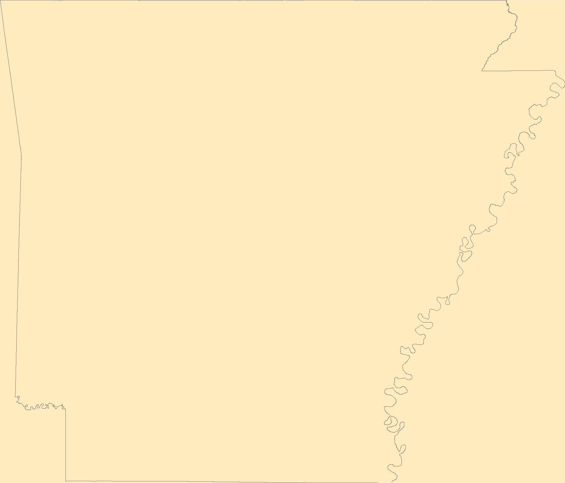
The Geographic Names Information System (GNIS) is the Federal standard for geographic nomenclature. The U.S. Geological Survey developed the GNIS for the U.S. Board on Geographic Names, a Federal inter-agency body chartered by public law to maintain uniform feature name usage throughout the Government and to promulgate standard names to the public. The GNIS is the official repository of domestic geographic names data; the official vehicle for geographic names use by all departments of the Federal Government; and the source for applying geographic names to Federal electronic and printed products of all types.
Tags: AR,
Antarctica,
Antarctica,
Arkansas,
Arkansas, All tags...
Ashley,
BGN,
Baxter,
Benton,
Board on Geographic Names,
Boone,
Borough,
Bradley,
Calhoun,
Carroll,
Census Area,
Chicot,
Clark,
Clay,
Cleburne,
Cleveland,
Columbia,
Commonwealth,
Conway,
County,
Craighead,
Crawford,
Crittenden,
Cross,
Dallas,
Desha,
District,
Downloadable Data,
Drew,
Faulkner,
Feature class,
Feature coordinates,
Feature county,
Feature description,
Feature designation,
Feature history,
Feature indentification,
Feature name,
Feature state,
Franklin,
Fulton,
GNIS,
Garland,
Geographic Names,
Geographic Names Federal Codes,
Geographic Names Information System,
Geographic feature,
Geographic name,
Geographical feature,
Geographical name,
Grant,
Greene,
Hempstead,
Hot Spring,
Howard,
Independence,
Izard,
Jackson,
Jefferson,
Johnson,
Lafayette,
Lawrence,
Lee,
Lincoln,
Little River,
Logan,
Lonoke,
Madison,
Marion,
Miller,
Mississippi,
Monroe,
Montgomery,
Municipio,
National Geographic Names Information System (GNIS),
National Geographic Names Information System (GNIS),
Nevada,
Newton,
Official feature name,
Ouachita,
Outlying Area,
Parish,
Perry,
Phillips,
Pike,
Place name,
Poinsett,
Polk,
Pope,
Populated Place,
Prairie,
Pulaski,
Randolph,
Saline,
Scott,
Searcy,
Sebastian,
Sevier,
Sharp,
St. Francis,
State,
Stone,
TXT (pipes),
Territories,
Territory,
Topographic Map,
U.S. Board on Geographic Names,
U.S. Geological Survey,
US,
USA,
USBGN,
USGS,
UTF-8 Pipe Delimited Text File nan,
Union,
United States,
United States,
United States,
Van Buren,
Variant name,
Washington,
White,
Woodruff,
Yell,
antarctic,
database,
economy,
environment,
feature,
gazetteer,
geographic,
geographic names,
geographical,
geography,
geospatial,
imageryBaseMapsEarthCover,
inlandWaters,
location,
map,
name,
place,
placename,
society,
structure,
topographic map,
toponymy, Fewer tags
|
|

