Filters: Tags: Soquel (X)
15 results (75ms)|
Filters
Date Range
Extensions Types Contacts
Categories Tag Types Tag Schemes |
This part of DS 781 presents data for the sediment-thickness map of the Pigeon Point to Monterey, California, map region. The raster data file is included in "SedimentThickness_PigeonPointToMontereyBay.zip," which is accessible from https://doi.org/10.5066/F7N29V0Z. As part of the USGS's California State Waters Mapping Project, a 50-m-resolution grid of sediment thickness for the seafloor within the limit of California’s State Waters between Pigeon Point and southern Monterey Bay was generated from seismic-reflection data collected in 2009, 2010, and 2011 (USGS activities (S-15-10-NC, S-N1-09-MB, and S-06-11-MB) supplemented with outcrop and geologic structure from DS 781. Isopach contours at 2.5-meter intervals...
Categories: Data;
Types: Downloadable,
GeoTIFF,
Map Service,
Raster;
Tags: Ano Nuevo,
Aptos,
Distributions,
Marina,
Monterey,
This part of DS 781 presents data for the sediment-thickness isopachs for the Pigeon Point to Monterey Bay, California, map region. The vector data file is included in "Isopachs_PigeonPointToMonterey.zip," which is accessible from https://doi.org/10.5066/F7N29V0Z. As part of the USGS's California State Waters Mapping Project, a 50-m-resolution grid of sediment thickness for the seafloor within the limit of California’s State Waters between Pigeon Point and southern Monterey Bay was generated from seismic-reflection data collected in 2009, 2010, and 2011 (USGS activities (S-15-10-NC, S-N1-09-MB, and S-06-11-MB) supplemented with outcrop and geologic structure from DS 781. Isopach contours at 2.5-meter intervals were...
Categories: Data;
Types: Downloadable,
Map Service,
OGC WFS Layer,
OGC WMS Layer,
Shapefile;
Tags: Ano Nuevo,
Aptos,
Distributions,
Marina,
Monterey,
This part of DS 781 presents data for the transgressive contours for the depth-to-transition map of the Pigeon Point to Monterey, California, map region. The vector file is included in T "TransgressiveContours_PigeonPointToMonterey.zip," which is accessible from https://doi.org/10.5066/F7N29V0Z. As part of the USGS's California State Waters Mapping Project, a 50-m grid of sediment thickness for the seafloor within the limit of California’s State Waters between Pigeon Point and southern Monterey Bay was generated from seismic-reflection data collected in 2009 and 2010 (USGS activities (S-15-10-NC, S-N1-09-MB, and S-06-11-MB) supplemented with outcrop and geologic structure from DS 781. The resulting grid covers was...
Categories: Data;
Types: Downloadable,
Map Service,
OGC WFS Layer,
OGC WMS Layer,
Shapefile;
Tags: Ano Nuevo,
Aptos,
Distributions,
Marina,
Monterey,
USGS Historical Quadrangle in GeoPDF.
This part of DS 781 presents data for the folds for the geologic and geomorphic map of the Offshore Aptos map area, California. The vector data file is included in "Folds_OffshoreAptos.zip," which is accessible from https://doi.org/10.5066/F7K35RQB. These data accompany the pamphlet and map sheets of Cochrane, G.R., Johnson, S.Y., Dartnell, P., Greene, H.G., Erdey, M.D, Dieter, B.E., Golden, N.E., Hartwell, S.R., Ritchie, A.C., Kvitek, r.G., Maier, K.L., Endris, C.A., Davenport, C.W., Watt, J.T., Sliter, R.W., Finlayson, D.P., and Krigsman, L.M., (G.R. Cochrane and S.A. Cochran, eds.), 2016, California State Waters Map Series—Offshore of Aptos, California: U.S. Geological Survey Open-File Report 2016–1025, 43 p.,...
Categories: Data;
Types: Downloadable,
Map Service,
OGC WFS Layer,
OGC WMS Layer,
Shapefile;
Tags: Aptos,
CMHRP,
Capitola,
Coastal and Marine Hazards and Resources Program,
Continental/Island Shelf,
This part of DS 781 presents data for the faults for the geologic and geomorphic map of the Offshore Aptos map area, California. The vector data file is included in "Faults_OffshoreAptos.zip," which is accessible from https://doi.org/10.5066/F7K35RQB. These data accompany the pamphlet and map sheets of Cochrane, G.R., Johnson, S.Y., Dartnell, P., Greene, H.G., Erdey, M.D, Dieter, B.E., Golden, N.E., Hartwell, S.R., Ritchie, A.C., Kvitek, r.G., Maier, K.L., Endris, C.A., Davenport, C.W., Watt, J.T., Sliter, R.W., Finlayson, D.P., and Krigsman, L.M., (G.R. Cochrane and S.A. Cochran, eds.), 2016, California State Waters Map Series—Offshore of Aptos, California: U.S. Geological Survey Open-File Report 2016–1025, 43...
Categories: Data;
Types: Downloadable,
Map Service,
OGC WFS Layer,
OGC WMS Layer,
Shapefile;
Tags: Aptos,
CMHRP,
Capitola,
Coastal and Marine Hazards and Resources Program,
Continental/Island Shelf,
This data set contains imagery from the National Agriculture Imagery Program (NAIP). The NAIP program is administered by USDA FSA and has been established to support two main FSA strategic goals centered on agricultural production. These are, increase stewardship of America's natural resources while enhancing the environment, and to ensure commodities are procured and distributed effectively and efficiently to increase food security. The NAIP program supports these goals by acquiring and providing ortho imagery that has been collected during the agricultural growing season in the U.S. The NAIP ortho imagery is tailored to meet FSA requirements and is a fundamental tool used to support FSA farm and conservation programs....
This part of DS 781 presents data for the geologic and geomorphic map of the Offshore Aptos map area, California. The vector data file is included in "Geology_OffshoreAptos.zip," which is accessible from https://doi.org/10.5066/F7K35RQB. These data accompany the pamphlet and map sheets of Cochrane, G.R., Johnson, S.Y., Dartnell, P., Greene, H.G., Erdey, M.D, Dieter, B.E., Golden, N.E., Hartwell, S.R., Ritchie, A.C., Kvitek, r.G., Maier, K.L., Endris, C.A., Davenport, C.W., Watt, J.T., Sliter, R.W., Finlayson, D.P., and Krigsman, L.M., (G.R. Cochrane and S.A. Cochran, eds.), 2016, California State Waters Map Series—Offshore of Aptos, California: U.S. Geological Survey Open-File Report 2016–1025, 43 p., 10 sheets,...
Categories: Data;
Types: Downloadable,
Map Service,
OGC WFS Layer,
OGC WMS Layer,
Shapefile;
Tags: Aptos,
CMHRP,
Capitola,
Coastal and Marine Hazards and Resources Program,
Continental/Island Shelf,
USGS Historical Quadrangle in GeoPDF.
This part of DS 781 presents data for the habitat map of the seafloor of the Offshore of Aptos map area, California. The vector data file is included in "Habitat_OffshoreAptos.zip," which is accessible from https://doi.org/10.5066/F7K35RQB. These data accompany the pamphlet and map sheets of Cochrane, G.R., Johnson, S.Y., Dartnell, P., Greene, H.G., Erdey, M.D, Dieter, B.E., Golden, N.E., Hartwell, S.R., Ritchie, A.C., Kvitek, r.G., Maier, K.L., Endris, C.A., Davenport, C.W., Watt, J.T., Sliter, R.W., Finlayson, D.P., and Krigsman, L.M., (G.R. Cochrane and S.A. Cochran, eds.), 2016, California State Waters Map Series—Offshore of Aptos, California: U.S. Geological Survey Open-File Report 2016–1025, 43 p., 10 sheets,...
Categories: Data;
Types: Downloadable,
Map Service,
OGC WFS Layer,
OGC WMS Layer,
Shapefile;
Tags: Aptos,
CMHRP,
Coastal and Marine Hazards and Resources Program,
Continental/Island Shelf,
Fisheries,
USGS Historical Quadrangle in GeoPDF.
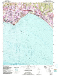
USGS Historical Quadrangle in GeoPDF.
USGS Historical Quadrangle in GeoPDF.
This data set contains imagery from the National Agriculture Imagery Program (NAIP). The NAIP program is administered by USDA FSA and has been established to support two main FSA strategic goals centered on agricultural production. These are, increase stewardship of America's natural resources while enhancing the environment, and to ensure commodities are procured and distributed effectively and efficiently to increase food security. The NAIP program supports these goals by acquiring and providing ortho imagery that has been collected during the agricultural growing season in the U.S. The NAIP ortho imagery is tailored to meet FSA requirements and is a fundamental tool used to support FSA farm and conservation programs....
This part of DS 781 presents data for the depth-to-transition map of the Pigeon Point to Monterey, California, map region. The raster data file is included in "DepthToTransition_PigeonPointToMonterey.zip," which is accessible from https://doi.org/10.5066/F7N29V0Z. As part of the USGS's California State Waters Mapping Project, a 50-m grid of sediment thickness for the seafloor within the limit of California’s State Waters between Pigeon Point and southern Monterey Bay was generated from seismic-reflection data collected in 2009 and 2010 (USGS activities (S-15-10-NC, S-N1-09-MB, and S-06-11-MB) supplemented with outcrop and geologic structure from DS 781. The resulting grid covers was subtracted from regional bathymetry...
Categories: Data;
Types: Downloadable,
GeoTIFF,
Map Service,
Raster;
Tags: Ano Nuevo,
Aptos,
Distributions,
Marina,
Monterey,
|

|
