Filters: Tags: South Carolina (X) > Date Range: {"choice":"year"} (X)
678 results (42ms)|
Filters
Date Types (for Date Range)
Types
Contacts
Categories
Tag Types
|
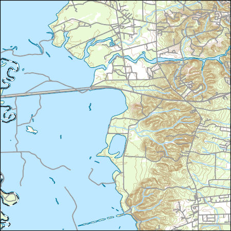
Layers of geospatial data include contours, boundaries, land cover, hydrography, roads, transportation, geographic names, structures, and other selected map features.

The Watershed Boundary Dataset (WBD) is a comprehensive aggregated collection of hydrologic unit data consistent with the national criteria for delineation and resolution. It defines the areal extent of surface water drainage to a point except in coastal or lake front areas where there could be multiple outlets as stated by the "Federal Standards and Procedures for the National Watershed Boundary Dataset (WBD)" "Standard" (https://pubs.usgs.gov/tm/11/a3/). Watershed boundaries are determined solely upon science-based hydrologic principles, not favoring any administrative boundaries or special projects, nor particular program or agency. This dataset represents the hydrologic unit boundaries to the 12-digit (6th level)...
Forest Retention Index classes for the southeastern United States at 2040 were processed using the Forest Retention Decision Tree and rendered on a 30-meter by 30-meter grid. The Forest Retention Index is used only for current forestland, identified using National Land Cover Database 2011. Many datasets were used as inputs for the Forest Retention Decision Tree, and they can be grouped into five broad categories: Protected, Tier 1 Priority, Tier 2 Priority, Threats to Forest Retention, and Socio-Economic Value of Forests. Protected datasets include Protected Areas Database-United States, National Conservation Easement Database, state-maintained databases, and private datasets volunteered by conservation partners....
Categories: Data;
Types: ArcGIS REST Map Service,
ArcGIS Service Definition,
Downloadable,
Map Service;
Tags: Alabama,
Arkansas,
Florida,
Georgia,
Illinois,
The U.S. Geological Survey (USGS) has compiled national shoreline data for more than 20 years to document coastal change and serve the needs of research, management, and the public. Maintaining a record of historical shoreline positions is an effective method to monitor national shoreline evolution over time, enabling scientists to identify areas most susceptible to erosion or accretion. These data can help coastal managers and planners understand which areas of the coast are vulnerable to change. This data release includes two new mean high water (MHW) shorelines extracted from lidar data collected in 2010 and 2017-2018. Previously published historical shorelines for South Carolina (Kratzmann and others, 2017)...
Categories: Data;
Types: Downloadable,
Map Service,
OGC WFS Layer,
OGC WMS Layer,
Shapefile;
Tags: Atlantic Coast,
Atlantic Coast,
Baseline,
DSAS,
Digital Shoreline Analysis System,
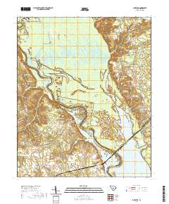
Layered geospatial PDF 7.5 Minute Quadrangle Map. Layers of geospatial data include orthoimagery, roads, grids, geographic names, elevation contours, hydrography, and other selected map features. This map is derived from GIS (geospatial information system) data. It represents a repackaging of GIS data in traditional map form, not creation of new information. The geospatial data in this map are from selected National Map data holdings and other government sources.

These data were released prior to the October 1, 2016 effective date for the USGS’s policy dictating the review, approval, and release of scientific data as referenced in USGS Survey Manual Chapter 502.8 Fundamental Science Practices: Review and Approval of Scientific Data for Release. Digital surfaces and thicknesses of selected hydrogeologic units of the Floridan aquifer system were developed to define an updated hydrogeologic framework as part of the U.S. Geological Survey Groundwater Resources Program. This map layer shows areal and linear water features of Florida, Georgia, South Carolina, and Alabama. The original file was produced by joining the individual State hydrography layers from the 1:2,000,000- scale...

These data were released prior to the October 1, 2016 effective date for the USGS’s policy dictating the review, approval, and release of scientific data as referenced in USGS Survey Manual Chapter 502.8 Fundamental Science Practices: Review and Approval of Scientific Data for Release. Digital surfaces and thicknesses of selected hydrogeologic units of the Floridan aquifer system were developed to define an updated hydrogeologic framework as part of the U.S. Geological Survey Groundwater Resources Program. This feature class contains a gridded surface depicting thickness of the upper confining unit of the FAS in feet.

These data were released prior to the October 1, 2016 effective date for the USGS’s policy dictating the review, approval, and release of scientific data as referenced in USGS Survey Manual Chapter 502.8 Fundamental Science Practices: Review and Approval of Scientific Data for Release. Digital surfaces and thicknesses of selected hydrogeologic units of the Floridan aquifer system were developed to define an updated hydrogeologic framework as part of the U.S. Geological Survey Groundwater Resources Program. This feature class contains contour lines generated from the thickness of the regional Lower Floridan raster.

These data were released prior to the October 1, 2016 effective date for the USGS’s policy dictating the review, approval, and release of scientific data as referenced in USGS Survey Manual Chapter 502.8 Fundamental Science Practices: Review and Approval of Scientific Data for Release. Digital surfaces and thicknesses of selected hydrogeologic units of the Floridan aquifer system were developed to define an updated hydrogeologic framework as part of the U.S. Geological Survey Groundwater Resources Program. This feature class contains data points used to generate the top of the Lower Floridan aquifer raster.

These data were released prior to the October 1, 2016 effective date for the USGS’s policy dictating the review, approval, and release of scientific data as referenced in USGS Survey Manual Chapter 502.8 Fundamental Science Practices: Review and Approval of Scientific Data for Release. Digital surfaces and thicknesses of selected hydrogeologic units of the Floridan aquifer system were developed to define an updated hydrogeologic framework as part of the U.S. Geological Survey Groundwater Resources Program. This feature class contains selected faults of the Floridan aquifer system as depicted by Miller 1986.

These data were released prior to the October 1, 2016 effective date for the USGS’s policy dictating the review, approval, and release of scientific data as referenced in USGS Survey Manual Chapter 502.8 Fundamental Science Practices: Review and Approval of Scientific Data for Release. Digital surfaces and thicknesses of selected hydrogeologic units of the Floridan aquifer system were developed to define an updated hydrogeologic framework as part of the U.S. Geological Survey Groundwater Resources Program. This feature class contains a gridded surface depicting the top of the OCAPLPZ in feet relative to NGVD29.

These data were released prior to the October 1, 2016 effective date for the USGS’s policy dictating the review, approval, and release of scientific data as referenced in USGS Survey Manual Chapter 502.8 Fundamental Science Practices: Review and Approval of Scientific Data for Release. Digital surfaces and thicknesses of selected hydrogeologic units of the Floridan aquifer system were developed to define an updated hydrogeologic framework as part of the U.S. Geological Survey Groundwater Resources Program. This feature class contains polygon regions of units that form the base of the Upper Floridan aquifer. The regions are defined by geographic and hydraulic properties.

These data were released prior to the October 1, 2016 effective date for the USGS’s policy dictating the review, approval, and release of scientific data as referenced in USGS Survey Manual Chapter 502.8 Fundamental Science Practices: Review and Approval of Scientific Data for Release. Digital surfaces and thicknesses of selected hydrogeologic units of the Floridan aquifer system were developed to define an updated hydrogeologic framework as part of the U.S. Geological Survey Groundwater Resources Program. This feature class contains a polygon representing the extent of the Bucatunna clay confining unit. Used to clip contours and rasters of this unit.

These data were released prior to the October 1, 2016 effective date for the USGS’s policy dictating the review, approval, and release of scientific data as referenced in USGS Survey Manual Chapter 502.8 Fundamental Science Practices: Review and Approval of Scientific Data for Release. Digital surfaces and thicknesses of selected hydrogeologic units of the Floridan aquifer system were developed to define an updated hydrogeologic framework as part of the U.S. Geological Survey Groundwater Resources Program. This feature class contains a gridded surface depicting thickness of residuum in feet. It was calculated by surface subtraction: land surface DEM - fig19_top_FAS_raster

These data were released prior to the October 1, 2016 effective date for the USGS’s policy dictating the review, approval, and release of scientific data as referenced in USGS Survey Manual Chapter 502.8 Fundamental Science Practices: Review and Approval of Scientific Data for Release. Digital surfaces and thicknesses of selected hydrogeologic units of the Floridan aquifer system were developed to define an updated hydrogeologic framework as part of the U.S. Geological Survey Groundwater Resources Program. This feature class contains a gridded surface depicting the base of the FAS in feet relative to NGVD29.

These data were released prior to the October 1, 2016 effective date for the USGS’s policy dictating the review, approval, and release of scientific data as referenced in USGS Survey Manual Chapter 502.8 Fundamental Science Practices: Review and Approval of Scientific Data for Release. Digital surfaces and thicknesses of selected hydrogeologic units of the Floridan aquifer system were developed to define an updated hydrogeologic framework as part of the U.S. Geological Survey Groundwater Resources Program. This feature class contains a polygon showing the extent of the Fernandina permeable zone in northeastern Florida and southeastern Georgia. From Miller, 1986

These data were released prior to the October 1, 2016 effective date for the USGS’s policy dictating the review, approval, and release of scientific data as referenced in USGS Survey Manual Chapter 502.8 Fundamental Science Practices: Review and Approval of Scientific Data for Release. Digital surfaces and thicknesses of selected hydrogeologic units of the Floridan aquifer system were developed to define an updated hydrogeologic framework as part of the U.S. Geological Survey Groundwater Resources Program. This feature class contains data points used to generate FWZ_FAS raster.

These data were released prior to the October 1, 2016 effective date for the USGS’s policy dictating the review, approval, and release of scientific data as referenced in USGS Survey Manual Chapter 502.8 Fundamental Science Practices: Review and Approval of Scientific Data for Release. Digital surfaces and thicknesses of selected hydrogeologic units of the Floridan aquifer system were developed to define an updated hydrogeologic framework as part of the U.S. Geological Survey Groundwater Resources Program. This feature class contains data points used to generate the Lower Floridan aquifer below the LISAPCU raster. It also includes additional points used to constrain the surface to land surface.

These data were released prior to the October 1, 2016 effective date for the USGS’s policy dictating the review, approval, and release of scientific data as referenced in USGS Survey Manual Chapter 502.8 Fundamental Science Practices: Review and Approval of Scientific Data for Release. Digital surfaces and thicknesses of selected hydrogeologic units of the Floridan aquifer system were developed to define an updated hydrogeologic framework as part of the U.S. Geological Survey Groundwater Resources Program. This feature class contains a gridded surface depicting the top of the Lower Floridan aquifer below the Lisbon-Avon Park composite unit (LISAPCU) in feet relative to NGVD29.

These data were released prior to the October 1, 2016 effective date for the USGS’s policy dictating the review, approval, and release of scientific data as referenced in USGS Survey Manual Chapter 502.8 Fundamental Science Practices: Review and Approval of Scientific Data for Release. Digital surfaces and thicknesses of selected hydrogeologic units of the Floridan aquifer system were developed to define an updated hydrogeologic framework as part of the U.S. Geological Survey Groundwater Resources Program. This feature class contains a gridded surface depicting the top of the Oldsmar permeable zone in feet relative to NGVD29.
|

|
