Filters: Tags: South Pass (X)
29 results (130ms)|
Filters
Date Range
Extensions Types Contacts Categories Tag Types Tag Schemes |
High resolution bathymetric, sea-floor backscatter, and seismic-reflection data were collected offshore of southeastern Louisiana aboard the research vessel Point Sur on May 19-26, 2017, in an effort to characterize mudflow hazards on the Mississippi River Delta front. As the initial field program of a research cooperative between the U.S. Geological Survey, the Bureau of Ocean Energy Management, and other Federal and academic partners, the primary objective of this cruise was to assess the suitability of sea-floor mapping and shallow subsurface imaging tools in the challenging environmental conditions found across delta fronts (for example, variably distributed water column stratification and widespread biogenic...
High resolution bathymetric, sea-floor backscatter, and seismic-reflection data were collected offshore of southeastern Louisiana aboard the research vessel Point Sur on May 19-26, 2017, in an effort to characterize mudflow hazards on the Mississippi River Delta front. As the initial field program of a research cooperative between the U.S. Geological Survey, the Bureau of Ocean Energy Management, and other Federal and academic partners, the primary objective of this cruise was to assess the suitability of sea-floor mapping and shallow subsurface imaging tools in the challenging environmental conditions found across delta fronts (for example, variably distributed water column stratification and widespread biogenic...
Categories: Data;
Types: Downloadable,
Map Service,
OGC WFS Layer,
OGC WMS Layer,
Shapefile;
Tags: BOEM,
Bureau of Ocean Energy Management,
CMGP,
Coastal and Marine Geology Program,
Gulf of Mexico,
High resolution bathymetric, sea-floor backscatter, and seismic-reflection data were collected offshore of southeastern Louisiana aboard the research vessel Point Sur on May 19-26, 2017, in an effort to characterize mudflow hazards on the Mississippi River Delta front. As the initial field program of a research cooperative between the U.S. Geological Survey, the Bureau of Ocean Energy Management, and other Federal and academic partners, the primary objective of this cruise was to assess the suitability of sea-floor mapping and shallow subsurface imaging tools in the challenging environmental conditions found across delta fronts (for example, variably distributed water column stratification and widespread biogenic...
High resolution bathymetric, sea-floor backscatter, and seismic-reflection data were collected offshore of southeastern Louisiana aboard the research vessel Point Sur on May 19-26, 2017, in an effort to characterize mudflow hazards on the Mississippi River Delta front. As the initial field program of a research cooperative between the U.S. Geological Survey, the Bureau of Ocean Energy Management, and other Federal and academic partners, the primary objective of this cruise was to assess the suitability of sea-floor mapping and shallow subsurface imaging tools in the challenging environmental conditions found across delta fronts (for example, variably distributed water column stratification and widespread biogenic...
Categories: Data;
Types: Downloadable,
Map Service,
OGC WFS Layer,
OGC WMS Layer,
Shapefile;
Tags: Applied Acoustics,
BOEM,
Bureau of Ocean Energy Management,
CMGP,
Coastal and Marine Geology Program,
High resolution bathymetric, sea-floor backscatter, and seismic-reflection data were collected offshore of southeastern Louisiana aboard the research vessel Point Sur on May 19-26, 2017, in an effort to characterize mudflow hazards on the Mississippi River Delta front. As the initial field program of a research cooperative between the U.S. Geological Survey, the Bureau of Ocean Energy Management, and other Federal and academic partners, the primary objective of this cruise was to assess the suitability of sea-floor mapping and shallow subsurface imaging tools in the challenging environmental conditions found across delta fronts (for example, variably distributed water column stratification and widespread biogenic...
Categories: Data;
Types: Downloadable,
GeoTIFF,
Map Service,
Raster;
Tags: BOEM,
Bureau of Ocean Energy Management,
CMGP,
Coastal and Marine Geology Program,
GeoTIFF,
High resolution bathymetric, sea-floor backscatter, and seismic-reflection data were collected offshore of southeastern Louisiana aboard the research vessel Point Sur on May 19-26, 2017, in an effort to characterize mudflow hazards on the Mississippi River Delta front. As the initial field program of a research cooperative between the U.S. Geological Survey, the Bureau of Ocean Energy Management, and other Federal and academic partners, the primary objective of this cruise was to assess the suitability of sea-floor mapping and shallow subsurface imaging tools in the challenging environmental conditions found across delta fronts (for example, variably distributed water column stratification and widespread biogenic...
This data set contains imagery from the National Agriculture Imagery Program (NAIP). The NAIP program is administered by USDA FSA and has been established to support two main FSA strategic goals centered on agricultural production. These are, increase stewardship of America's natural resources while enhancing the environment, and to ensure commodities are procured and distributed effectively and efficiently to increase food security. The NAIP program supports these goals by acquiring and providing ortho imagery that has been collected during the agricultural growing season in the U.S. The NAIP ortho imagery is tailored to meet FSA requirements and is a fundamental tool used to support FSA farm and conservation programs....
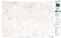
USGS Historical Quadrangle in GeoPDF.

USGS Historical Quadrangle in GeoPDF.
This data contains fences within the southwest portion of Wyoming at a 1:100,000 scale. A two and one-half year inventory of fences on federal lands was conducted by the Bureau of Land Management (BLM) from 1990 to 1992. The attribute fields describe the type of fences, the 30 x 60- minute quadrangle map which they are found, the ownership of the land, the year the fence was built, and their location according to township, range and section.
High resolution bathymetric, sea-floor backscatter, and seismic-reflection data were collected offshore of southeastern Louisiana aboard the research vessel Point Sur on May 19-26, 2017, in an effort to characterize mudflow hazards on the Mississippi River Delta front. As the initial field program of a research cooperative between the U.S. Geological Survey, the Bureau of Ocean Energy Management, and other Federal and academic partners, the primary objective of this cruise was to assess the suitability of sea-floor mapping and shallow subsurface imaging tools in the challenging environmental conditions found across delta fronts (for example, variably distributed water column stratification and widespread biogenic...
Categories: Data;
Types: Downloadable,
GeoTIFF,
Map Service,
Raster;
Tags: BOEM,
Bureau of Ocean Energy Management,
CMGP,
Coastal and Marine Geology Program,
GeoTIFF,
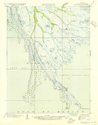
USGS Historical Quadrangle in GeoPDF.

USGS Historical Quadrangle in GeoPDF.
This data set contains imagery from the National Agriculture Imagery Program (NAIP). The NAIP program is administered by USDA FSA and has been established to support two main FSA strategic goals centered on agricultural production. These are, increase stewardship of America's natural resources while enhancing the environment, and to ensure commodities are procured and distributed effectively and efficiently to increase food security. The NAIP program supports these goals by acquiring and providing ortho imagery that has been collected during the agricultural growing season in the U.S. The NAIP ortho imagery is tailored to meet FSA requirements and is a fundamental tool used to support FSA farm and conservation programs....
High resolution bathymetric, sea-floor backscatter, and seismic-reflection data were collected offshore of southeastern Louisiana aboard the research vessel Point Sur on May 19-26, 2017, in an effort to characterize mudflow hazards on the Mississippi River Delta front. As the initial field program of a research cooperative between the U.S. Geological Survey, the Bureau of Ocean Energy Management, and other Federal and academic partners, the primary objective of this cruise was to assess the suitability of sea-floor mapping and shallow subsurface imaging tools in the challenging environmental conditions found across delta fronts (for example, variably distributed water column stratification and widespread biogenic...
Categories: Data;
Types: Downloadable,
GeoTIFF,
Map Service,
Raster;
Tags: BOEM,
Bureau of Ocean Energy Management,
CMGP,
Coastal and Marine Geology Program,
GeoTIFF,
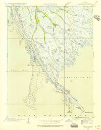
USGS Historical Quadrangle in GeoPDF.
High resolution bathymetric, sea-floor backscatter, and seismic-reflection data were collected offshore of southeastern Louisiana aboard the research vessel Point Sur on May 19-26, 2017, in an effort to characterize mudflow hazards on the Mississippi River Delta front. As the initial field program of a research cooperative between the U.S. Geological Survey, the Bureau of Ocean Energy Management, and other Federal and academic partners, the primary objective of this cruise was to assess the suitability of sea-floor mapping and shallow subsurface imaging tools in the challenging environmental conditions found across delta fronts (for example, variably distributed water column stratification and widespread biogenic...
Categories: Data;
Types: Downloadable,
GeoTIFF,
Map Service,
Raster;
Tags: BOEM,
Bureau of Ocean Energy Management,
CMGP,
Coastal and Marine Geology Program,
GeoTIFF,
High resolution bathymetric, sea-floor backscatter, and seismic-reflection data were collected offshore of southeastern Louisiana aboard the research vessel Point Sur on May 19-26, 2017, in an effort to characterize mudflow hazards on the Mississippi River Delta front. As the initial field program of a research cooperative between the U.S. Geological Survey, the Bureau of Ocean Energy Management, and other Federal and academic partners, the primary objective of this cruise was to assess the suitability of sea-floor mapping and shallow subsurface imaging tools in the challenging environmental conditions found across delta fronts (for example, variably distributed water column stratification and widespread biogenic...
Categories: Data;
Types: Downloadable,
Map Service,
OGC WFS Layer,
OGC WMS Layer,
Shapefile;
Tags: Applied Acoustics,
BOEM,
Bureau of Ocean Energy Management,
CMGP,
Coastal and Marine Geology Program,
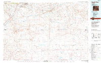
USGS Historical Quadrangle in GeoPDF.

USGS Historical Quadrangle in GeoPDF.
|

|
