Filters: Tags: Spanish Bottom (X)
8 results (17ms)|
Filters
Date Range
Types Contacts
Tag Types Tag Schemes |
This data set contains imagery from the National Agriculture Imagery Program (NAIP). The NAIP program is administered by USDA FSA and has been established to support two main FSA strategic goals centered on agricultural production. These are, increase stewardship of America's natural resources while enhancing the environment, and to ensure commodities are procured and distributed effectively and efficiently to increase food security. The NAIP program supports these goals by acquiring and providing ortho imagery that has been collected during the agricultural growing season in the U.S. The NAIP ortho imagery is tailored to meet FSA requirements and is a fundamental tool used to support FSA farm and conservation programs....
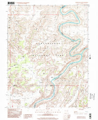
USGS Historical Quadrangle in GeoPDF.
This data set contains imagery from the National Agriculture Imagery Program (NAIP). The NAIP program is administered by USDA FSA and has been established to support two main FSA strategic goals centered on agricultural production. These are, increase stewardship of America's natural resources while enhancing the environment, and to ensure commodities are procured and distributed effectively and efficiently to increase food security. The NAIP program supports these goals by acquiring and providing ortho imagery that has been collected during the agricultural growing season in the U.S. The NAIP ortho imagery is tailored to meet FSA requirements and is a fundamental tool used to support FSA farm and conservation programs....
These data consist of rectified aerial photographs, measurements of active channel width, measurements of river and floodplain bathymetry and topography, and ancillary data. These data are specific to the corridor of the Colorado River in Canyonlands National Park between Potash, Utah and the confluence of the Green and Colorado Rivers near Spanish Bottom, Utah. The time period for these data are 1940 to 2018. The shapefile data are measurements of features of the active river channel and floodplains of the Colorado River. The raster data are aerial images and digital elevation models (DEMs) for segments of the Colorado River in Canyonlands National Park, Utah. The aerial images depict the river channel and adjacent...
These data consist of measurements of riverbed and floodplain bathymetry and topography, measurements of water-surface elevations and ancillary data. These data are specific to the corridor of the Colorado River from the confluence of the Green and Colorado Rivers near Spanish Bottom, Utah in Canyonlands National Park to the confluence with the Dirty Devil River in Glen Canyon National Recreation Area. The time period for these data are 2020 and 2021. The raster data are digital elevation models (DEMs) for segments of the Colorado River in Canyonlands National Park, Utah and include both bathymetric and topographic data. The data collected in 2020 consist of bathymetric and topographic data for segments of the Colorado...
This data set contains imagery from the National Agriculture Imagery Program (NAIP). The NAIP program is administered by USDA FSA and has been established to support two main FSA strategic goals centered on agricultural production. These are, increase stewardship of America's natural resources while enhancing the environment, and to ensure commodities are procured and distributed effectively and efficiently to increase food security. The NAIP program supports these goals by acquiring and providing ortho imagery that has been collected during the agricultural growing season in the U.S. The NAIP ortho imagery is tailored to meet FSA requirements and is a fundamental tool used to support FSA farm and conservation programs....
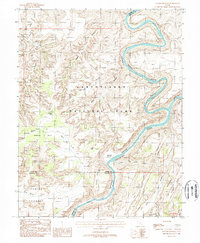
USGS Historical Quadrangle in GeoPDF.
This data set contains imagery from the National Agriculture Imagery Program (NAIP). The NAIP program is administered by USDA FSA and has been established to support two main FSA strategic goals centered on agricultural production. These are, increase stewardship of America's natural resources while enhancing the environment, and to ensure commodities are procured and distributed effectively and efficiently to increase food security. The NAIP program supports these goals by acquiring and providing ortho imagery that has been collected during the agricultural growing season in the U.S. The NAIP ortho imagery is tailored to meet FSA requirements and is a fundamental tool used to support FSA farm and conservation programs....
|

|
