Filters: Tags: Spring (X) > partyWithName: U.S. Geological Survey (X)
54 results (51ms)|
Filters
Date Range
Extensions Types
Contacts
Categories Tag Types
|
These data were released prior to the October 1, 2016 effective date for the USGS’s policy dictating the review, approval, and release of scientific data as referenced in USGS Survey Manual Chapter 502.8 Fundamental Science Practices: Review and Approval of Scientific Data for Release. This map shows the USGS (United States Geologic Survey), NWIS (National Water Inventory System) Hydrologic Data Sites for Millard County, Utah. The scope and purpose of NWIS is defined on the web site: http://water.usgs.gov/public/pubs/FS/FS-027-98/
These data were released prior to the October 1, 2016 effective date for the USGS’s policy dictating the review, approval, and release of scientific data as referenced in USGS Survey Manual Chapter 502.8 Fundamental Science Practices: Review and Approval of Scientific Data for Release. This map shows the USGS (United States Geologic Survey), NWIS (National Water Inventory System) Hydrologic Data Sites for Juab County, Utah. The scope and purpose of NWIS is defined on the web site: http://water.usgs.gov/public/pubs/FS/FS-027-98/
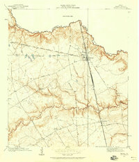
USGS Historical Quadrangle in GeoPDF.
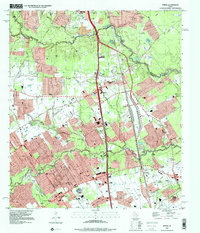
USGS Historical Quadrangle in GeoPDF.

The Watershed Boundary Dataset (WBD) from The National Map (TNM) defines the perimeter of drainage areas formed by the terrain and other landscape characteristics. The drainage areas are nested within each other so that a large drainage area, such as the Upper Mississippi River, will be composed of multiple smaller drainage areas, such as the Wisconsin River. Each of these smaller areas can further be subdivided into smaller and smaller drainage areas. The WBD uses six different levels in this hierarchy, with the smallest averaging about 30,000 acres. The WBD is made up of polygons nested into six levels of data respectively defined by Regions, Subregions, Basins, Subbasins, Watersheds, and Subwatersheds. For additional...

The USGS National Hydrography Dataset (NHD) service from The National Map (TNM) is a comprehensive set of digital spatial data that encodes information about naturally occurring and constructed bodies of surface water (lakes, ponds, and reservoirs), paths through which water flows (canals, ditches, streams, and rivers), and related entities such as point features (springs, wells, stream gages, and dams). The information encoded about these features includes classification and other characteristics, delineation, geographic name, position and related measures, a "reach code" through which other information can be related to the NHD, and the direction of water flow. The network of reach codes delineating water and...

USGS Historical Quadrangle in GeoPDF.
These data were released prior to the October 1, 2016 effective date for the USGS’s policy dictating the review, approval, and release of scientific data as referenced in USGS Survey Manual Chapter 502.8 Fundamental Science Practices: Review and Approval of Scientific Data for Release. This map shows the USGS (United States Geologic Survey), NWIS (National Water Inventory System) Hydrologic Data Sites for Weber County, Utah. The scope and purpose of NWIS is defined on the web site: https://water.usgs.gov/public/pubs/FS/FS-027-98/
These data were released prior to the October 1, 2016 effective date for the USGS’s policy dictating the review, approval, and release of scientific data as referenced in USGS Survey Manual Chapter 502.8 Fundamental Science Practices: Review and Approval of Scientific Data for Release. This map shows the USGS (United States Geologic Survey), NWIS (National Water Inventory System) Hydrologic Data Sites for Beaver County, Utah. The scope and purpose of NWIS is defined on the web site: http://water.usgs.gov/public/pubs/FS/FS-027-98/
These data were released prior to the October 1, 2016 effective date for the USGS’s policy dictating the review, approval, and release of scientific data as referenced in USGS Survey Manual Chapter 502.8 Fundamental Science Practices: Review and Approval of Scientific Data for Release. This map shows the USGS (United States Geologic Survey), NWIS (National Water Inventory System) Hydrologic Data Sites for Boxelder County, Utah. The scope and purpose of NWIS is defined on the web site: http://water.usgs.gov/public/pubs/FS/FS-027-98/
These data were released prior to the October 1, 2016 effective date for the USGS’s policy dictating the review, approval, and release of scientific data as referenced in USGS Survey Manual Chapter 502.8 Fundamental Science Practices: Review and Approval of Scientific Data for Release. This map shows the USGS (United States Geologic Survey), NWIS (National Water Inventory System) Hydrologic Data Sites for Carbon County, Utah. The scope and purpose of NWIS is defined on the web site: http://water.usgs.gov/public/pubs/FS/FS-027-98/
These data were released prior to the October 1, 2016 effective date for the USGS’s policy dictating the review, approval, and release of scientific data as referenced in USGS Survey Manual Chapter 502.8 Fundamental Science Practices: Review and Approval of Scientific Data for Release. This map shows the USGS (United States Geologic Survey), NWIS (National Water Inventory System) Hydrologic Data Sites for Emery County, Utah. The scope and purpose of NWIS is defined on the web site: http://water.usgs.gov/public/pubs/FS/FS-027-98/
These data were released prior to the October 1, 2016 effective date for the USGS’s policy dictating the review, approval, and release of scientific data as referenced in USGS Survey Manual Chapter 502.8 Fundamental Science Practices: Review and Approval of Scientific Data for Release. This map shows the USGS (United States Geologic Survey), NWIS (National Water Inventory System) Hydrologic Data Sites for Iron County, Utah. The scope and purpose of NWIS is defined on the web site: http://water.usgs.gov/public/pubs/FS/FS-027-98/
These data were released prior to the October 1, 2016 effective date for the USGS’s policy dictating the review, approval, and release of scientific data as referenced in USGS Survey Manual Chapter 502.8 Fundamental Science Practices: Review and Approval of Scientific Data for Release. This map shows the USGS (United States Geologic Survey), NWIS (National Water Inventory System) Hydrologic Data Sites for Grand County, Utah. The scope and purpose of NWIS is defined on the web site: http://water.usgs.gov/public/pubs/FS/FS-027-98/
A combination of citizen science inventories and expert assessments will be used to collect critical baseline information on known spring and seep resources using the Spring Ecosystem Inventory and Assessment Protocols and adapting them as needed for the unique arid Sky Island ecosystems. The assessment will collect information on channel morphology, riparian and wetland vegetation, water quality, aquatic macroinvertebrates, and wildlife. This information will be combined with historic data from cooperating agencies (Pima County, Santa Cruz County, USFS, NPA, USGS, USFWS, BLM, and AGFD) in a regional, on-line database to provide a landscape level context for managing resources, which was previously unavailable due...
Categories: Data,
Project;
Types: ArcGIS REST Map Service,
Map Service,
OGC WFS Layer,
OGC WMS Layer,
OGC WMS Service;
Tags: 2011,
AZ-02,
AZ-03,
Arizona,
Arizona,
These data were released prior to the October 1, 2016 effective date for the USGS’s policy dictating the review, approval, and release of scientific data as referenced in USGS Survey Manual Chapter 502.8 Fundamental Science Practices: Review and Approval of Scientific Data for Release. This map shows the USGS (United States Geologic Survey), NWIS (National Water Inventory System) Hydrologic Data Sites for Morgan County, Utah. The scope and purpose of NWIS is defined on the web site: http://water.usgs.gov/public/pubs/FS/FS-027-98/
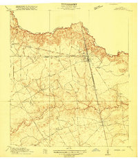
USGS Historical Quadrangle in GeoPDF.
These data were released prior to the October 1, 2016 effective date for the USGS’s policy dictating the review, approval, and release of scientific data as referenced in USGS Survey Manual Chapter 502.8 Fundamental Science Practices: Review and Approval of Scientific Data for Release. This map shows the USGS (United States Geologic Survey), NWIS (National Water Inventory System) Hydrologic Data Sites for Uintah County, Utah. The scope and purpose of NWIS is defined on the web site: http://water.usgs.gov/public/pubs/FS/FS-027-98/
These data were released prior to the October 1, 2016 effective date for the USGS’s policy dictating the review, approval, and release of scientific data as referenced in USGS Survey Manual Chapter 502.8 Fundamental Science Practices: Review and Approval of Scientific Data for Release. This map shows the USGS (United States Geologic Survey), NWIS (National Water Inventory System) Hydrologic Data Sites for Wasatch County, Utah. The scope and purpose of NWIS is defined on the web site: http://water.usgs.gov/public/pubs/FS/FS-027-98/

These data were released prior to the October 1, 2016 effective date for the USGS’s policy dictating the review, approval, and release of scientific data as referenced in USGS Survey Manual Chapter 502.8 Fundamental Science Practices: Review and Approval of Scientific Data for Release. This data set consists of 1:1,000,000-scale large springs defined as where discharge is generally greater than 1,000 gallons per minute in Utah and most of Nevada; and greater than 200 gallons per minute in more arid parts of Nevada and in California. The source of this data set is sheet 2 of a 1988 U.S. Geological Survey hydrologic investigations atlas map (Harrill and others, 1988.) Reference Cited Harrill, J.R., Gates, J.S., and...
|

|
