Filters: Tags: Spring (X)
136 results (75ms)|
Filters
Date Range
Extensions Types
Contacts
Categories Tag Types Tag Schemes |
This data set contains imagery from the National Agriculture Imagery Program (NAIP). The NAIP program is administered by USDA FSA and has been established to support two main FSA strategic goals centered on agricultural production. These are increase stewardship of America's natural resources while enhancing the environment, and to ensure commodities are procured and distributed effectively and efficiently to increase food security. The NAIP program supports these goals by acquiring and providing ortho imagery that has been collected during the agricultural growing season in the U.S. The NAIP ortho imagery is tailored to meet FSA requirements and is a fundamental tool used to support FSA farm and conservation programs....
This data set contains imagery from the National Agriculture Imagery Program (NAIP). The NAIP program is administered by USDA FSA and has been established to support two main FSA strategic goals centered on agricultural production. These are, increase stewardship of America's natural resources while enhancing the environment, and to ensure commodities are procured and distributed effectively and efficiently to increase food security. The NAIP program supports these goals by acquiring and providing ortho imagery that has been collected during the agricultural growing season in the U.S. The NAIP ortho imagery is tailored to meet FSA requirements and is a fundamental tool used to support FSA farm and conservation programs....
The National Hydrography Dataset (NHD) is a feature-based database that interconnects and uniquely identifies the sream segments or reaches that comprise the nation's surface water drainage system. Medium resolution NHD is based on the content of the U.S. Geological Survey 1:100,000-scale Digital Line Graph (DLG) hydrography data, integrated with reach-related information from the U.S. Environmental Protection Agency Reach File Version 3.0 (RF3). More specifically, it contains reach codes for networked features and isolated lakes, flow direction, names, stream level, and centerline representations for areal water bodies. Reaches are also defined to represent water bodies and the approximate shorelines of the Great...
Categories: Data;
Types: Downloadable;
Tags: Artificial Path,
Canal / Ditch,
FWHydrography,
Gaging Station,
Hydrography,

Data comes from the Parameter-elevation Regressions on Independent Slopes Model (PRISM). March, April, and May values were summed for each year from 1992 to 2008 and the sums were averaged. Units: mm/3 months.
Concerns exist that the degradation of water quality in Salado Creek near Salado, Texas could adversely affect recreational uses and harm salamander populations that live in and near springs that discharge into the stream. Salado is part of the rapidly growing Killeen-Temple-Fort Hood area; land-use changes in the Salado Creek watershed could adversely affect water quality in Salado Creek. Streamflow in Salado Creek is generally derived from the Salado Springs complex during low-flow conditions (dry weather) and from the springs and surface runoff during high-flow conditions (wet weather). A better understanding of the types of waste (human, animal, or both) that may be entering the stream and springs is needed...
The National Hydrography Dataset (NHD) is a feature-based database that interconnects and uniquely identifies the stream segments or reaches that make up the nation's surface water drainage system. NHD data was originally developed at 1:100,000-scale and exists at that scale for the whole country. This high-resolution NHD, generally developed at 1:24,000/1:12,000 scale, adds detail to the original 1:100,000-scale NHD. (Data for Alaska, Puerto Rico and the Virgin Islands was developed at high-resolution, not 1:100,000 scale.) Local resolution NHD is being developed where partners and data exist. The NHD contains reach codes for networked features, flow direction, names, and centerline representations for areal water...
The NHDPlus Version 1.0 is an integrated suite of application-ready geospatial data sets that incorporate many of the best features of the National Hydrography Dataset (NHD) and the National Elevation Dataset (NED). The NHDPlus includes a stream network (based on the 1:100,000-scale NHD), improved networking, naming, and "value-added attributes" (VAA's). NHDPlus also includes elevation-derived catchments (drainage areas) produced using a drainage enforcement technique first broadly applied in New England, and thus dubbed "The New-England Method". This technique involves "burning-in" the 1:100,000-scale NHD and when available building "walls" using the national Watershed Boundary Dataset (WBD). The resulting modified...
This data set represents canals and ditches as represented by the National Hydrography Dataset (NHD), clipped to the Central Basin and Range ecoregion boundary. The USGS/EPA metadata has been retained as this most accurately represents the source and origin of the data. However as this is a deliverable for the BLM Rapid Ecoregional Assessment, the use and access constraints have been changed to reflect the BLM's recommended language. The NHD is a feature-based database that interconnects and uniquely identifies the stream segments or reaches that make up the nation's surface water drainage system. NHD data was originally developed at 1:100,000-scale and exists at that scale for the whole country. This high-resolution...
This data set represents canals and ditches as represented by the National Hydrography Dataset (NHD), clipped to the Central Basin and Range ecoregion boundary. The USGS/EPA metadata has been retained as this most accurately represents the source and origin of the data. However as this is a deliverable for the BLM Rapid Ecoregional Assessment, the use and access constraints have been changed to reflect the BLM's recommended language. The NHD is a feature-based database that interconnects and uniquely identifies the stream segments or reaches that make up the nation's surface water drainage system. NHD data was originally developed at 1:100,000-scale and exists at that scale for the whole country. This high-resolution...
The NHDPlus Version 1.0 is an integrated suite of application-ready geospatial data sets that incorporate many of the best features of the National Hydrography Dataset (NHD) and the National Elevation Dataset (NED). The NHDPlus includes a stream network (based on the 1:100,000-scale NHD), improved networking, naming, and "value-added attributes" (VAA's). NHDPlus also includes elevation-derived catchments (drainage areas) produced using a drainage enforcement technique first broadly applied in New England, and thus dubbed "The New-England Method". This technique involves "burning-in" the 1:100,000-scale NHD and when available building "walls" using the national Watershed Boundary Dataset (WBD). The resulting modified...
This report is volume 2 of a two-volume ecological assessment of grassland ecosystems in the Southwestern United States. Broad-scale assessments are syntheses of current scientific knowledge, including a description of uncertainties and assumptions, to provide a characterization and comprehensive description of ecological, social, and economic components within an assessment area. Volume 1 of this assessment focused on the ecology, types, conditions, and management practices of Southwestern grasslands. Volume 2 (this volume) describes wildlife and fish species, their habitat requirements, and species-specific management concerns, in Southwestern grasslands. This assessment is regional in scale and pertains primarily...
Categories: Publication;
Types: Citation,
Map Service,
OGC WFS Layer,
OGC WMS Layer,
OGC WMS Service;
Tags: BMP,
Chihuahuan Desert,
English,
Sonoran Desert,
agriculture,
Our Mission & History Volunteers in the Tumacacoris. Photo by Trevor Hare Sky Island Alliance is a science-based conservation organization. We are dedicated to the protection and restoration of the rich natural heritage of native species and habitats in the Sky Island region of the southwestern United States and northwestern Mexico. We work with volunteers, scientists, land owners, public officials, and government agencies to establish protected areas, restore healthy landscapes, and promote public appreciation of the region's unique biological diversity. Sky Island Alliance pioneered landscape-level conservation planning by integrating the science of conservation biology with grassroots organizing and on-the-ground...
Types: Map Service,
OGC WFS Layer,
OGC WMS Layer,
OGC WMS Service;
Tags: English,
Madrean,
Mexico,
OHV,
US,
La planificación para la conservación y el uso sustentable de la biodiversidad es un proceso continuo y dinámico que debe reflejar los cambios en el entorno socio-ambiental. La generación de estrategias y planes de acción representan instrumentos importantes para determinar metas y objetivos básicos (a corto, mediano y largo plazo), cursos de acción y asignación de recursos necesarios para alcanzar las metas previstas. En este sentido, la Estrategia Nacional sobre Biodiversidad de México (ENBM) constituye el conjunto de líneas estratégicas y acciones de participación de los sectores de la sociedad mexicana con el propósito de dar cumplimiento a los tres objetivos establecidos en el Convenio sobre Diversidad Biológica...
Types: Map Service,
OGC WFS Layer,
OGC WMS Layer,
OGC WMS Service;
Tags: Mexico,
adaptation,
biodiversity,
climate,
grassland,
Most groundwater conservation and management efforts focus on protecting groundwater for drinking water and for other human uses with little understanding or focus on the ecosystems that depend on groundwater. However, groundwater plays an integral role in sustaining certain types of aquatic, terrestrial and coastal ecosystems, and their associated landscapes. Our aim was to illuminate the connection between groundwater and surface ecosystems by identifying and mapping the distribution of groundwater dependent ecosystems (GDEs) in California. This layer includes watersheds from the Watershed Boundary Database at the 12-digit hydrologic unit code (HUC12) scale. Each watershed is attributed with summary information...
Categories: Publication;
Types: Citation,
Map Service,
OGC WFS Layer,
OGC WMS Layer,
OGC WMS Service;
Tags: GIS,
groundwater,
map,
spring,
stream,
These data were released prior to the October 1, 2016 effective date for the USGS’s policy dictating the review, approval, and release of scientific data as referenced in USGS Survey Manual Chapter 502.8 Fundamental Science Practices: Review and Approval of Scientific Data for Release. This map shows the USGS (United States Geologic Survey), NWIS (National Water Inventory System) Hydrologic Data Sites for Cache County, Utah. The scope and purpose of NWIS is defined on the web site: http://water.usgs.gov/public/pubs/FS/FS-027-98/
These data were released prior to the October 1, 2016 effective date for the USGS’s policy dictating the review, approval, and release of scientific data as referenced in USGS Survey Manual Chapter 502.8 Fundamental Science Practices: Review and Approval of Scientific Data for Release. This map shows the USGS (United States Geologic Survey), NWIS (National Water Inventory System) Hydrologic Data Sites for Tooele County, Utah. The scope and purpose of NWIS is defined on the web site: http://water.usgs.gov/public/pubs/FS/FS-027-98/
These data were released prior to the October 1, 2016 effective date for the USGS’s policy dictating the review, approval, and release of scientific data as referenced in USGS Survey Manual Chapter 502.8 Fundamental Science Practices: Review and Approval of Scientific Data for Release. This map shows the USGS (United States Geologic Survey), NWIS (National Water Inventory System) Hydrologic Data Sites for Kane County, Utah. The scope and purpose of NWIS is defined on the web site: http://water.usgs.gov/public/pubs/FS/FS-027-98/
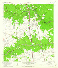
USGS Historical Quadrangle in GeoPDF.
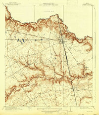
USGS Historical Quadrangle in GeoPDF.
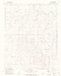
USGS Historical Quadrangle in GeoPDF.
|

|
