Filters
Date Range
Contacts
Tag Types
Tag Schemes
|

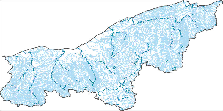
The High Resolution National Hydrography Dataset Plus (NHDPlus HR) is an integrated set of geospatial data layers, including the best available National Hydrography Dataset (NHD), the 10-meter 3D Elevation Program Digital Elevation Model (3DEP DEM), and the National Watershed Boundary Dataset (WBD). The NHDPlus HR combines the NHD, 3DEP DEMs, and WBD to create a stream network with linear referencing, feature naming, "value added attributes" (VAAs), elevation-derived catchments, and other features for hydrologic data analysis. The stream network with linear referencing is a system of data relationships applied to hydrographic systems so that one stream reach "flows" into another and "events" can be tied to and traced...
Tags: Ashland County,
Athens County,
Belmont County,
Carroll County,
Columbiana County, All tags...
Coshocton County,
Crawford County,
Downloadable Data,
Fairfield County,
FileGDB,
FileGDB 10.1,
Guernsey County,
HU-4 Subregion,
HU-4 Subregion,
HU4_0504,
Harrison County,
Holmes County,
Hydrography,
Knox County,
Licking County,
Medina County,
Monroe County,
Morgan County,
Morrow County,
Muskingum County,
NHDPlus HR Rasters,
NHDPlus High Resolution (NHDPlus HR),
National Hydrography Dataset (NHD),
National Hydrography Dataset Plus High Resolution (NHDPlus HR),
National Hydrography Dataset Plus High Resolution (NHDPlus HR) Current,
Noble County,
OH,
Ohio,
Perry County,
Portage County,
Richland County,
Stark County,
Summit County,
Tuscarawas County,
US,
United States,
Washington County,
Wayne County,
base maps,
cartography,
catchments,
channels,
digital elevation models,
drainage basins,
earth sciences,
elevation,
environment,
geographic information systems,
geoscientific,
geospatial analysis,
hydrographic datasets,
hydrographic features,
hydrology,
imagery,
inland waters,
lakes,
land surface characteristics,
reservoirs,
river reaches,
rivers,
streamflow,
streamflow data,
streams,
topography,
water bodies,
water quality,
water resources,
watersheds, Fewer tags

The High Resolution National Hydrography Dataset Plus (NHDPlus HR) is an integrated set of geospatial data layers, including the best available National Hydrography Dataset (NHD), the 10-meter 3D Elevation Program Digital Elevation Model (3DEP DEM), and the National Watershed Boundary Dataset (WBD). The NHDPlus HR combines the NHD, 3DEP DEMs, and WBD to create a stream network with linear referencing, feature naming, "value added attributes" (VAAs), elevation-derived catchments, and other features for hydrologic data analysis. The stream network with linear referencing is a system of data relationships applied to hydrographic systems so that one stream reach "flows" into another and "events" can be tied to and traced...
Tags: Allegheny County,
Ashtabula County,
Athens County,
Beaver County,
Belmont County, All tags...
Braxton County,
Brooke County,
Butler County,
Calhoun County,
Carroll County,
Clay County,
Columbiana County,
Crawford County,
Doddridge County,
Downloadable Data,
Fairfield County,
FileGDB,
FileGDB 10.1,
Gallia County,
Geauga County,
Gilmer County,
Greene County,
Guernsey County,
HU-4 Subregion,
HU-4 Subregion,
HU4_0503,
Hancock County,
Harrison County,
Harrison County,
Hocking County,
Hydrography,
Jackson County,
Jefferson County,
Lawrence County,
Lewis County,
Mahoning County,
Marion County,
Marshall County,
Mason County,
Meigs County,
Mercer County,
Monongalia County,
Monroe County,
Morgan County,
NHDPlus HR Rasters,
NHDPlus High Resolution (NHDPlus HR),
National Hydrography Dataset (NHD),
National Hydrography Dataset Plus High Resolution (NHDPlus HR),
National Hydrography Dataset Plus High Resolution (NHDPlus HR) Current,
Noble County,
OH,
Ohio,
Ohio County,
PA,
Pennsylvania,
Perry County,
Pleasants County,
Portage County,
Ritchie County,
Roane County,
Stark County,
Trumbull County,
Tyler County,
US,
United States,
Upshur County,
Venango County,
WV,
Washington County,
Washington County,
Webster County,
West Virginia,
Wetzel County,
Wirt County,
Wood County,
base maps,
cartography,
catchments,
channels,
digital elevation models,
drainage basins,
earth sciences,
elevation,
environment,
geographic information systems,
geoscientific,
geospatial analysis,
hydrographic datasets,
hydrographic features,
hydrology,
imagery,
inland waters,
lakes,
land surface characteristics,
reservoirs,
river reaches,
rivers,
streamflow,
streamflow data,
streams,
topography,
water bodies,
water quality,
water resources,
watersheds, Fewer tags

The High Resolution National Hydrography Dataset Plus (NHDPlus HR) is an integrated set of geospatial data layers, including the best available National Hydrography Dataset (NHD), the 10-meter 3D Elevation Program Digital Elevation Model (3DEP DEM), and the National Watershed Boundary Dataset (WBD). The NHDPlus HR combines the NHD, 3DEP DEMs, and WBD to create a stream network with linear referencing, feature naming, "value added attributes" (VAAs), elevation-derived catchments, and other features for hydrologic data analysis. The stream network with linear referencing is a system of data relationships applied to hydrographic systems so that one stream reach "flows" into another and "events" can be tied to and traced...
Tags: Adams County,
Brown County,
Bureau County,
Calhoun County,
Cass County, All tags...
Champaign County,
Christian County,
De Witt County,
Downloadable Data,
FileGDB,
FileGDB 10.1,
Ford County,
Fulton County,
Greene County,
HU-4 Subregion,
HU-4 Subregion,
HU4_0713,
Hancock County,
Henderson County,
Henry County,
Hydrography,
IL,
Illinois,
Iroquois County,
Jersey County,
Knox County,
LaSalle County,
Lee County,
Livingston County,
Logan County,
Macon County,
Macoupin County,
Marshall County,
Mason County,
McDonough County,
McLean County,
Menard County,
Montgomery County,
Morgan County,
Moultrie County,
NHDPlus HR Rasters,
NHDPlus High Resolution (NHDPlus HR),
National Hydrography Dataset (NHD),
National Hydrography Dataset Plus High Resolution (NHDPlus HR),
National Hydrography Dataset Plus High Resolution (NHDPlus HR) Current,
Peoria County,
Piatt County,
Pike County,
Putnam County,
Sangamon County,
Schuyler County,
Scott County,
Shelby County,
Stark County,
Tazewell County,
US,
United States,
Warren County,
Woodford County,
base maps,
cartography,
catchments,
channels,
digital elevation models,
drainage basins,
earth sciences,
elevation,
environment,
geographic information systems,
geoscientific,
geospatial analysis,
hydrographic datasets,
hydrographic features,
hydrology,
imagery,
inland waters,
lakes,
land surface characteristics,
reservoirs,
river reaches,
rivers,
streamflow,
streamflow data,
streams,
topography,
water bodies,
water quality,
water resources,
watersheds, Fewer tags
The High Resolution National Hydrography Dataset Plus (NHDPlus HR) is an integrated set of geospatial data layers, including the best available National Hydrography Dataset (NHD), the 10-meter 3D Elevation Program Digital Elevation Model (3DEP DEM), and the National Watershed Boundary Dataset (WBD). The NHDPlus HR combines the NHD, 3DEP DEMs, and WBD to create a stream network with linear referencing, feature naming, "value added attributes" (VAAs), elevation-derived catchments, and other features for hydrologic data analysis. The stream network with linear referencing is a system of data relationships applied to hydrographic systems so that one stream reach "flows" into another and "events" can be tied to and traced...
Tags: Ashland County,
Ashtabula County,
Crawford County,
Cuyahoga County,
Downloadable Data, All tags...
Erie County,
Erie County,
FileGDB,
FileGDB 10.1,
Geauga County,
HU-4 Subregion,
HU-4 Subregion,
HU4_0411,
Huron County,
Hydrography,
Lake County,
Lorain County,
Medina County,
NHDPlus HR Rasters,
NHDPlus High Resolution (NHDPlus HR),
National Hydrography Dataset (NHD),
National Hydrography Dataset Plus High Resolution (NHDPlus HR),
National Hydrography Dataset Plus High Resolution (NHDPlus HR) Current,
OH,
Ohio,
PA,
Pennsylvania,
Portage County,
Stark County,
Summit County,
Trumbull County,
US,
United States,
base maps,
cartography,
catchments,
channels,
digital elevation models,
drainage basins,
earth sciences,
elevation,
environment,
geographic information systems,
geoscientific,
geospatial analysis,
hydrographic datasets,
hydrographic features,
hydrology,
imagery,
inland waters,
lakes,
land surface characteristics,
reservoirs,
river reaches,
rivers,
streamflow,
streamflow data,
streams,
topography,
water bodies,
water quality,
water resources,
watersheds, Fewer tags
|
|

