Filters: Tags: Stream Gage (X)
15 results (26ms)|
Filters
Date Range
Types Contacts
Tag Types
|
Bull trout stream gages were reviewed for stream temperature and hydrographs. This layer was created from a CSV file downloaded from the USGS NWIS website. There was no metadata that could be found for stream gages as this data is outputed as graphs or tables on demand from their website. http://waterdata.usgs.gov/usa/nwis/rt
White sturgeon stream gages were reviewed for dissolved oxygen, stream temperature and hydrographs. This layer was created from a CSV file downloaded from the USGS NWIS website. There was no metadata that could be found for stream gages as this data is outputed as graphs or tables on demand from their website. http://waterdata.usgs.gov/usa/nwis/rt
Coldwater fish stream gages were reviewed for stream temperature and hydrographs. This layer was created from a CSV file downloaded from the USGS NWIS website. There was no metadata that could be found for stream gages as this data is outputed as graphs or tables on demand from their website. http://waterdata.usgs.gov/usa/nwis/rt

This geodatabase contains streams, waterbodies and wetlands, streamflow gaging stations, and coastlines for the United States, Puerto Rico, and the U.S. Virgin Islands. The streams are incorporated into a geometric network. All feature classes are vertically integrated with each other and with 1:1,000,000-scale transportation and boundary data sets.
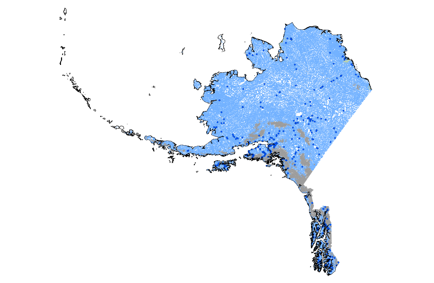
This geodatabase contains streams, waterbodies and wetlands, streamflow gaging stations, and coastlines for Alaska. The streams are incorporated into a geometric network. All feature classes are vertically integrated with each other and with 1:1,000,000-scale transportation and boundary data sets.
One-percent annual exceedance probability (AEP) flood-flow estimates were computed at flood insurance study (FIS) locations across Pennsylvania using methods identified in Scientific Investigation Report (SIR) 2019-5094. Following guidance outlined in SIR 2016-5149, valid statistical reaches (VSRs) were identified for streamgages, which were used to assist with the determination of the applicable method used to compute a USGS-derived 1-percent AEP flood-flow estimate at an FIS location. Methods included: weighting, weighting and transferring, and regression equations. The USGS-derived 1-percent AEP flood-flow estimates were then compared to 1-percent AEP flood-flow estimates published in FIS's and furnished by the...
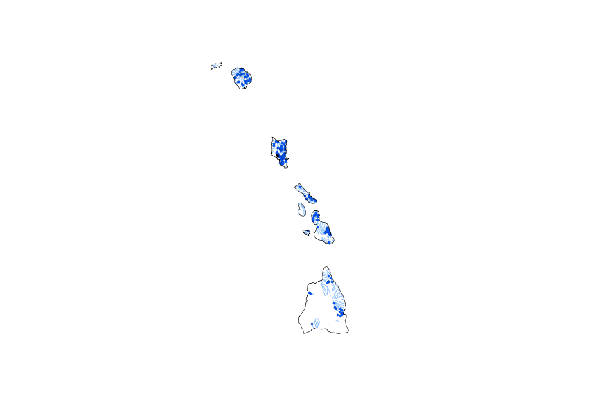
This geodatabase contains streams, waterbodies and wetlands, streamflow gaging stations, and coastlines for Hawaii. The streams are incorporated into a geometric network. All feature classes are vertically integrated with each other and with 1:1,000,000-scale transportation and boundary data sets.
White sturgeon stream gages were reviewed for dissolved oxygen, stream temperature and hydrographs. This layer was created from a CSV file downloaded from the USGS NWIS website. There was no metadata that could be found for stream gages as this data is outputed as graphs or tables on demand from their website. http://waterdata.usgs.gov/usa/nwis/rt
Bull trout stream gages were reviewed for stream temperature and hydrographs. This layer was created from a CSV file downloaded from the USGS NWIS website. There was no metadata that could be found for stream gages as this data is outputed as graphs or tables on demand from their website. http://waterdata.usgs.gov/usa/nwis/rt
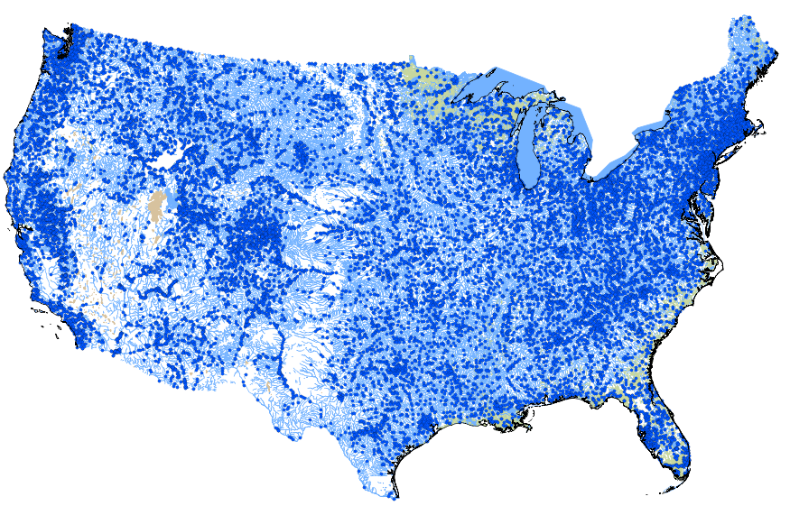
This geodatabase contains streams, waterbodies and wetlands, streamflow gaging stations, and coastlines for the conterminous United States. The streams are incorporated into a geometric network. All feature classes are vertically integrated with each other and with 1:1,000,000-scale transportation and boundary data sets.
Water management planners and researchers throughout the world rely on hydrological models to forecast and simulate streamflow hydrology and hydrological events. These simulations are used to inform water management, municipal planning, and ecosystem conservation decisions, as well as to investigate potential effects of climate and land-use change on hydrology.
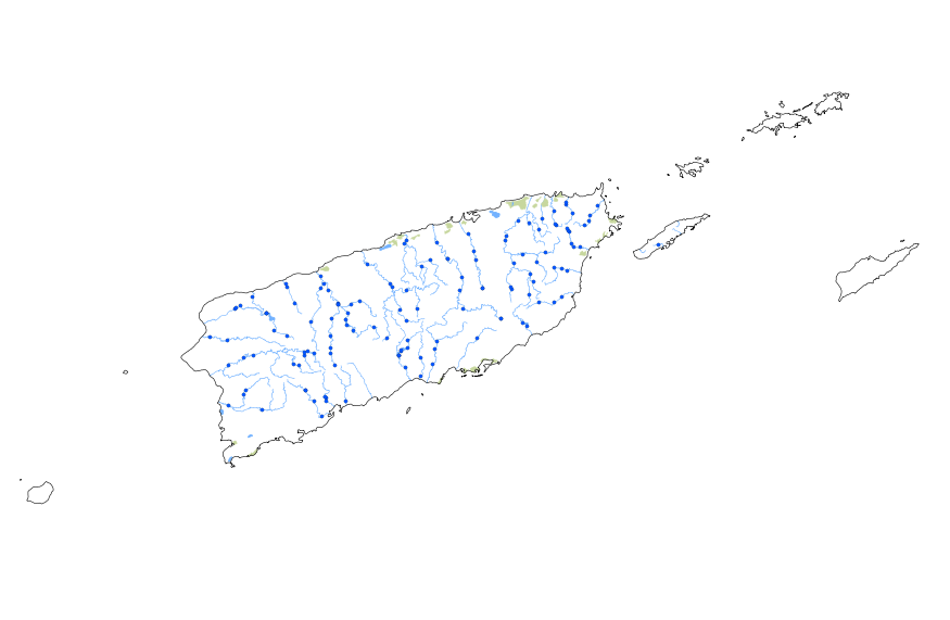
This geodatabase contains streams, waterbodies and wetlands, streamflow gaging stations, and coastlines for Puerto Rico and the U.S. Virgin Islands. The streams are incorporated into a geometric network. All feature classes are vertically integrated with each other and with 1:1,000,000-scale transportation and boundary data sets.
USGS stream gages within the ecoregion. This layer was created from a CSV file downloaded from the USGS NWIS website. There was no metadata that could be found for stream gages as this data is outputed as graphs or tables on demand from their website. http://waterdata.usgs.gov/usa/nwis/rt
|

|
