Filters: Tags: Sundance (X)
45 results (14ms)|
Filters
Date Range
Types Contacts
Categories Tag Types Tag Schemes |
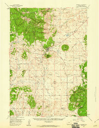
This data set contains imagery from the National Agriculture Imagery Program (NAIP). The NAIP program is administered by USDA FSA and has been established to support two main FSA strategic goals centered on agricultural production. These are, increase stewardship of America's natural resources while enhancing the environment, and to ensure commodities are procured and distributed effectively and efficiently to increase food security. The NAIP program supports these goals by acquiring and providing ortho imagery that has been collected during the agricultural growing season in the U.S. The NAIP ortho imagery is tailored to meet FSA requirements and is a fundamental tool used to support FSA farm and conservation programs....
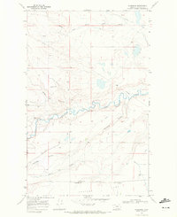
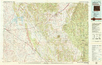
USGS Historical Quadrangle in GeoPDF.
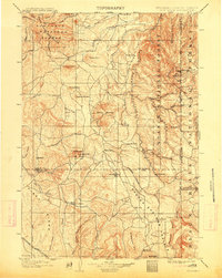
USGS Historical Quadrangle in GeoPDF.
USGS Historical Quadrangle in GeoPDF.
Core Research Center, core S642, from well operated by CHEVRON OILRaw Properties from download, web scrape, MapServer, and Macrostrat API{"Lib Num": "S642", "API Num": "4900105175", "Operator": "CHEVRON OIL", "Well Name": "1 GEORGE GOVERNMENT", "Field": "JAMES LAKE", "State": "WY", "County": "ALBANY", "Type": "FULL", "Photos": "F", "Thin Sec": "F", "Analysis": "F", "Latitude": "41.47685", "Longitude": "-105.83232", "coordinates_geohash": "9xkezwxk0jnx", "Source": "FROM STATE RECORDS", "Security Flag": "NO SPECIAL RESTRICTIONS", "crc_collection_name": "core", "sb_parent_id": "4f4e49dae4b07f02db5e0486", "intervals": [{"Formation": "LAKOTA", "Age": "CRET", "Min Depth": "4542", "Max Depth": "4594"}, {"Formation": "SUNDANCE",...
Core Research Center, core A244, from well operated by SINCLAIR OIL & GASRaw Properties from download, web scrape, MapServer, and Macrostrat API{"Lib Num": "A244", "API Num": "4900705995", "Operator": "SINCLAIR OIL & GAS", "Well Name": "11-H WERTZ", "Field": "WERTZ", "State": "WY", "County": "CARBON", "Type": "SLABBED", "Photos": "T", "Thin Sec": "F", "Analysis": "F", "Latitude": "42.24442", "Longitude": "-107.51962", "coordinates_geohash": "9xe8366ee68m", "Source": "FROM STATE RECORDS", "Security Flag": "NO SPECIAL RESTRICTIONS", "crc_collection_name": "core", "sb_parent_id": "4f4e49dae4b07f02db5e0486", "intervals": [{"Formation": "SUNDANCE", "Age": "JURA", "Min Depth": "4012", "Max Depth": "4089"}, {"Formation":...
Core Research Center, core T419, from well operated by ROCK WELL PETROLEUMRaw Properties from download, web scrape, MapServer, and Macrostrat API{"Lib Num": "T419", "API Num": "4902523466", "Operator": "ROCK WELL PETROLEUM", "Well Name": "FEDERAL WYC-037870 CORE 8", "Field": "POISON SPIDER", "State": "WY", "County": "NATRONA", "Type": "SLABBED & FULL", "Photos": "T", "Thin Sec": "F", "Analysis": "F", "Latitude": "42.4949", "Longitude": "-106.4346", "coordinates_geohash": "9xs3dpbwwpd0", "Source": "PROVIDED BY DONOR", "Security Flag": "NO SPECIAL RESTRICTIONS", "crc_collection_name": "core", "sb_parent_id": "4f4e49dae4b07f02db5e0486", "intervals": [{"Formation": "FRONTIER", "Age": "CRETACEOUS", "Min Depth": "48",...
This data set contains imagery from the National Agriculture Imagery Program (NAIP). The NAIP program is administered by USDA FSA and has been established to support two main FSA strategic goals centered on agricultural production. These are, increase stewardship of America's natural resources while enhancing the environment, and to ensure commodities are procured and distributed effectively and efficiently to increase food security. The NAIP program supports these goals by acquiring and providing ortho imagery that has been collected during the agricultural growing season in the U.S. The NAIP ortho imagery is tailored to meet FSA requirements and is a fundamental tool used to support FSA farm and conservation programs....
Core Research Center, core S024, from well operated by CALIFORNIA OILRaw Properties from download, web scrape, MapServer, and Macrostrat API{"Lib Num": "S024", "API Num": "4900105164", "Operator": "CALIFORNIA OIL", "Well Name": "3 SEVEN MILE", "Field": "SEVEN MILE", "State": "WY", "County": "ALBANY", "Type": "FULL", "Photos": "F", "Thin Sec": "F", "Analysis": "F", "Latitude": "41.45673", "Longitude": "-106.05423", "coordinates_geohash": "9xkefdvwvqd7", "Source": "FROM STATE RECORDS", "Security Flag": "NO SPECIAL RESTRICTIONS", "crc_collection_name": "core", "sb_parent_id": "4f4e49dae4b07f02db5e0486", "intervals": [{"Formation": "MORRISON", "Age": "JURA", "Min Depth": "6304", "Max Depth": "6335"}, {"Formation": "SUNDANCE",...
Core Research Center, core T866, from well operated by OHIO OILRaw Properties from download, web scrape, MapServer, and Macrostrat API{"Lib Num": "T866", "API Num": "4900705625", "Operator": "OHIO OIL", "Well Name": "2 HAZLETT", "Field": "ALLEN LAKE", "State": "WY", "County": "CARBON", "Type": "FULL", "Photos": "F", "Thin Sec": "F", "Analysis": "F", "Latitude": "41.92741", "Longitude": "-106.27958", "coordinates_geohash": "9xkqt89sf79q", "Source": "FROM STATE RECORDS", "Security Flag": "NO SPECIAL RESTRICTIONS", "crc_collection_name": "core", "sb_parent_id": "4f4e49dae4b07f02db5e0486", "intervals": [{"Formation": "SUNDANCE", "Age": "TRIA", "Min Depth": "2117", "Max Depth": "2312"}, {"Formation": "MORRISON", "Age":...
Categories: Physical Item;
Tags: Late Cretaceous,
MORRISON,
Niobrara Formation,
Niobrara Formation,
SUNDANCE,
Core Research Center, core T881, from well operated by MARATHON OIL COMPANYRaw Properties from download, web scrape, MapServer, and Macrostrat API{"Lib Num": "T881", "API Num": "4900320853", "Operator": "MARATHON OIL COMPANY", "Well Name": "13 EASTON", "Field": "GARLAND", "State": "WY", "County": "BIG HORN", "Type": "SLABBED", "Photos": "F", "Thin Sec": "F", "Analysis": "F", "Latitude": "44.79368", "Longitude": "-108.54519", "coordinates_geohash": "9xfycfry1g0j", "Source": "PROVIDED BY DONOR", "Security Flag": "NO SPECIAL RESTRICTIONS", "crc_collection_name": "core", "sb_parent_id": "4f4e49dae4b07f02db5e0486", "intervals": [{"Formation": "SUNDANCE", "Age": "TRIA", "Min Depth": "2062", "Max Depth": "2113"}], "crcwc_url":...
Categories: Physical Item;
Tags: Gravel, pediment, and fan deposits,
Pleistocene - Holocene,
SUNDANCE,
TRIA,
gravel
Core Research Center, core S360, from well operated by SINCLAIR OIL & GASRaw Properties from download, web scrape, MapServer, and Macrostrat API{"Lib Num": "S360", "API Num": "4900705861", "Operator": "SINCLAIR OIL & GAS", "Well Name": "3F GOVERNMENT", "Field": "MAHONEY", "State": "WY", "County": "CARBON", "Type": "CHIPS", "Photos": "F", "Thin Sec": "F", "Analysis": "F", "Latitude": "42.1765", "Longitude": "-107.33038", "coordinates_geohash": "9x7xvturuvkn", "Source": "FROM STATE RECORDS", "Security Flag": "NO SPECIAL RESTRICTIONS", "crc_collection_name": "core", "sb_parent_id": "4f4e49dae4b07f02db5e0486", "intervals": [{"Formation": "MORRISON", "Age": null, "Min Depth": "2580", "Max Depth": "2587"}, {"Formation":...
Core Research Center, core S102, from well operated by TRUE OIL LLCRaw Properties from download, web scrape, MapServer, and Macrostrat API{"Lib Num": "S102", "API Num": "4900723506", "Operator": "TRUE OIL LLC", "Well Name": "BOWEN 13-17", "Field": "WILDCAT", "State": "WY", "County": "CARBON", "Type": "THICK SLAB", "Photos": "T", "Thin Sec": "T", "Analysis": "F", "Latitude": "41.87775", "Longitude": "-106.207758", "coordinates_geohash": "9xkqpptgef7t", "Source": "FROM STATE RECORDS", "Security Flag": null, "crc_collection_name": "core", "sb_parent_id": "4f4e49dae4b07f02db5e0486", "intervals": [{"Formation": "SUNDANCE", "Age": "JURASSIC", "Min Depth": "1985", "Max Depth": "2026"}], "crcwc_url": "https://my.usgs.gov/crcwc/core/report/63151",...
This data set contains imagery from the National Agriculture Imagery Program (NAIP). The NAIP program is administered by USDA FSA and has been established to support two main FSA strategic goals centered on agricultural production. These are, increase stewardship of America's natural resources while enhancing the environment, and to ensure commodities are procured and distributed effectively and efficiently to increase food security. The NAIP program supports these goals by acquiring and providing ortho imagery that has been collected during the agricultural growing season in the U.S. The NAIP ortho imagery is tailored to meet FSA requirements and is a fundamental tool used to support FSA farm and conservation programs....
USGS Historical Quadrangle in GeoPDF.
Core Research Center, core T883, from well operated by ROCKY MTN GASRaw Properties from download, web scrape, MapServer, and Macrostrat API{"Lib Num": "T883", "API Num": "4900705967", "Operator": "ROCKY MTN GAS", "Well Name": "1 UNIT BIG SANDY", "Field": "BIG SANDY", "State": "WY", "County": "CARBON", "Type": "THIN - DISCONTINUOUS SEGMENTS", "Photos": "T", "Thin Sec": "F", "Analysis": "F", "Latitude": "42.22968", "Longitude": "-107.13986", "coordinates_geohash": "9xeb1zxjsqfj", "Source": "FROM STATE RECORDS", "Security Flag": "NO SPECIAL RESTRICTIONS", "crc_collection_name": "core", "sb_parent_id": "4f4e49dae4b07f02db5e0486", "intervals": [{"Formation": "CLOVERLY", "Age": "CRET", "Min Depth": "1941", "Max Depth":...
Core Research Center, core W093, from well operated by OHIO OIL CORaw Properties from download, web scrape, MapServer, and Macrostrat API{"Lib Num": "W093", "API Num": "4900705289", "Operator": "OHIO OIL CO", "Well Name": "13 HARRISON & COOPER", "Field": "ROCK RIVER", "State": "WY", "County": "CARBON", "Type": "SLABBED", "Photos": "F", "Thin Sec": "F", "Analysis": "F", "Latitude": "41.64949", "Longitude": "-106.12355", "coordinates_geohash": "9xkscn51y59t", "Source": "FROM STATE RECORDS", "Security Flag": "NO SPECIAL RESTRICTIONS", "crc_collection_name": "core", "sb_parent_id": "4f4e49dae4b07f02db5e0486", "intervals": [{"Formation": "SUNDANCE", "Age": "JURA", "Min Depth": "2534", "Max Depth": "2570"}, {"Formation":...
Categories: Physical Item;
Tags: Alluvium and Colluvium,
CRET,
DAKOTA,
JURA,
Pleistocene - Holocene,
Core Research Center, core T918, from well operated by OHIO OILRaw Properties from download, web scrape, MapServer, and Macrostrat API{"Lib Num": "T918", "API Num": "4902705422", "Operator": "OHIO OIL", "Well Name": "4 CONVERSE SHEEP CO", "Field": "LANCE CREEK", "State": "WY", "County": "NIOBRARA", "Type": null, "Photos": "T", "Thin Sec": "T", "Analysis": "F", "Latitude": "43.04608", "Longitude": "-104.67804", "coordinates_geohash": "9xtscurc8fuj", "Source": "FROM STATE RECORDS", "Security Flag": "NO SPECIAL RESTRICTIONS", "crc_collection_name": "core", "sb_parent_id": "4f4e49dae4b07f02db5e0486", "intervals": [{"Formation": "SUNDANCE", "Age": "PERM", "Min Depth": "3666", "Max Depth": "3689"}, {"Formation": "SUNDANCE",...
This data set contains imagery from the National Agriculture Imagery Program (NAIP). The NAIP program is administered by USDA FSA and has been established to support two main FSA strategic goals centered on agricultural production. These are, increase stewardship of America's natural resources while enhancing the environment, and to ensure commodities are procured and distributed effectively and efficiently to increase food security. The NAIP program supports these goals by acquiring and providing ortho imagery that has been collected during the agricultural growing season in the U.S. The NAIP ortho imagery is tailored to meet FSA requirements and is a fundamental tool used to support FSA farm and conservation programs....
Geologic polygon features within the Sundance, Wyoming 30' X 60' quadrangle. It is a digitized version of bedrock geology map series developed by the Wyoming State Geological Survey. The information provides basic bedrock geologic information and features to include named and geologic map units based on the rock types present. STATEMAP product. This dataset is available for purchase through the WSGS, Digital Product MS-78. http://sales.wsgs.uwyo.edu/catalog/index.php
|

|
