Filters: Tags: TIFF (X)
1,195 results (122ms)|
Filters
Date Range
Extensions Types Contacts
Categories Tag Types
|

These data are orthorectified radar intensity images (ORI) derived from interferometric synthetic aperture radar (ifsar) data. An ORI is a high-resolution image derived from ifsar which has geometric distortions removed. Unlike optical imagery, ifsar can be collected in cloudy conditions. The USGS performs minimal quality assurance and no reprocessing of the ORI data. USGS distributes the ORI data as received from the contractors, partners or contributing entities.

These data are orthorectified radar intensity images (ORI) derived from interferometric synthetic aperture radar (ifsar) data. An ORI is a high-resolution image derived from ifsar which has geometric distortions removed. Unlike optical imagery, ifsar can be collected in cloudy conditions. The USGS performs minimal quality assurance and no reprocessing of the ORI data. USGS distributes the ORI data as received from the contractors, partners or contributing entities.

These data are orthorectified radar intensity images (ORI) derived from interferometric synthetic aperture radar (ifsar) data. An ORI is a high-resolution image derived from ifsar which has geometric distortions removed. Unlike optical imagery, ifsar can be collected in cloudy conditions. The USGS performs minimal quality assurance and no reprocessing of the ORI data. USGS distributes the ORI data as received from the contractors, partners or contributing entities.

These data are orthorectified radar intensity images (ORI) derived from interferometric synthetic aperture radar (ifsar) data. An ORI is a high-resolution image derived from ifsar which has geometric distortions removed. Unlike optical imagery, ifsar can be collected in cloudy conditions. The USGS performs minimal quality assurance and no reprocessing of the ORI data. USGS distributes the ORI data as received from the contractors, partners or contributing entities.

These data are orthorectified radar intensity images (ORI) derived from interferometric synthetic aperture radar (ifsar) data. An ORI is a high-resolution image derived from ifsar which has geometric distortions removed. Unlike optical imagery, ifsar can be collected in cloudy conditions. The USGS performs minimal quality assurance and no reprocessing of the ORI data. USGS distributes the ORI data as received from the contractors, partners or contributing entities.

These data are orthorectified radar intensity images (ORI) derived from interferometric synthetic aperture radar (ifsar) data. An ORI is a high-resolution image derived from ifsar which has geometric distortions removed. Unlike optical imagery, ifsar can be collected in cloudy conditions. The USGS performs minimal quality assurance and no reprocessing of the ORI data. USGS distributes the ORI data as received from the contractors, partners or contributing entities.
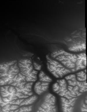
These data are Digital Surface Models (DSM) derived from interferometric synthetic aperture radar (ifsar) data. A DSM is a 3 dimensional representation of surface elevations in an area, including elevations of man-made structures and vegetation. The USGS performs minimal quality assurance and no reprocessing of the DSM data. USGS distributes the DSM data as received from the contractors, partners or contributing entities.

Aerial Photograph, AL_AP200017, of Wythe Co. is part of the New Jersey Zinc Company Historic Collection ; topic area is 'Aerial Photograph'. The location is Wythe Co. (estimated). The image was scanned from a paper file as part of the USGS NGGDPP deliverable for 2018-2019. The author is United States Department of Agriculture. The scale is 1''= 660'. The paper file was dated 19740101. Physical Storage: Room 3, Austinville Limestone Company, Newtown Church Rd, Austinville, VA 24312, Room No: 3. Digital Storage: \\NG00222222\ARCHIVE\Collections\NewJerseyZinc\AERIALPHOTOS\AL_AP200017.TIF Additional Information: None

Aerial Photograph, AL_AP200061, of Wythe Co. is part of the New Jersey Zinc Company Historic Collection ; topic area is 'Aerial Photograph'. The location is Wythe Co. (estimated). The image was scanned from a paper file as part of the USGS NGGDPP deliverable for 2018-2019. The author is United States Department of Agriculture. The scale is 1''=660'. The paper file was dated 19380101. Physical Storage: Room 3, Austinville Limestone Company, Newtown Church Rd, Austinville, VA 24312, Room No: 3. Digital Storage: \\NG00222222\ARCHIVE\Collections\NewJerseyZinc\AERIALPHOTOS\AL_AP200061.TIF Additional Information: None
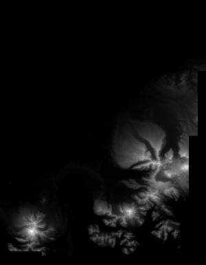
These data are Digital Surface Models (DSM) derived from interferometric synthetic aperture radar (ifsar) data. A DSM is a 3 dimensional representation of surface elevations in an area, including elevations of man-made structures and vegetation. The USGS performs minimal quality assurance and no reprocessing of the DSM data. USGS distributes the DSM data as received from the contractors, partners or contributing entities.

Aerial Photograph Index, AL_AP200329, of Wythe Co. is part of the New Jersey Zinc Company Historic Collection ; topic area is 'Aerial Photograph Index'. The location is Wythe Co. (estimated). The image was scanned from a paper file as part of the USGS NGGDPP deliverable for 2018-2019. The author is United States Department of Agriculture, Soil Conservation Service (USDA SCC). The scale is 1''=2000'. The paper file was dated 19380407. Physical Storage: Room 3 ,Austinville Limestone Company, Newtown Church Rd, Austinville, VA 24312, Room No: 3. Digital Storage: \\NG00222222\ARCHIVE\Collections\NewJerseyZinc\AERIALPHOTOS\AL_AP200329.TIF Additional Information: Sheet 1/2

Aerial Photograph, AL_AP200209, of Wythe Co. is part of the New Jersey Zinc Company Historic Collection ; topic area is 'Aerial Photograph'. The location is Wythe Co. (estimated). The image was scanned from a paper file as part of the USGS NGGDPP deliverable for 2018-2019. The author is United States Department of Agriculture. The scale is 1''=700. The paper file was dated 19621011. Physical Storage: Room 3, Austinville Limestone Company, Newtown Church Rd, Austinville, VA 24312, Room No: 3. Digital Storage: \\NG00222222\ARCHIVE\Collections\NewJerseyZinc\AERIALPHOTOS\AL_AP200209.TIF Additional Information: None

Aerial Photograph, AL_AP200154, of Wythe Co. is part of the New Jersey Zinc Company Historic Collection ; topic area is 'Aerial Photograph'. The location is Wythe Co. (estimated). The image was scanned from a paper file as part of the USGS NGGDPP deliverable for 2018-2019. The author is United States Department of Agriculture. The scale is 1''=1320. The paper file was dated 19741005. Physical Storage: Room 3, Austinville Limestone Company, Newtown Church Rd, Austinville, VA 24312, Room No: 3. Digital Storage: \\NG00222222\ARCHIVE\Collections\NewJerseyZinc\AERIALPHOTOS\AL_AP200154.TIF Additional Information: None

Aerial Photograph, AL_AP200085, of Wythe Co. is part of the New Jersey Zinc Company Historic Collection ; topic area is 'Aerial Photograph'. The location is Wythe Co. (estimated). The image was scanned from a paper file as part of the USGS NGGDPP deliverable for 2018-2019. The author is United States Department of Agriculture. The scale is 1''=660'. The paper file was dated 19740101. Physical Storage: Room 3, Austinville Limestone Company, Newtown Church Rd, Austinville, VA 24312, Room No: 3. Digital Storage: \\NG00222222\ARCHIVE\Collections\NewJerseyZinc\AERIALPHOTOS\AL_AP200085.TIF Additional Information: None

These data are orthorectified radar intensity images (ORI) derived from interferometric synthetic aperture radar (ifsar) data. An ORI is a high-resolution image derived from ifsar which has geometric distortions removed. Unlike optical imagery, ifsar can be collected in cloudy conditions. The USGS performs minimal quality assurance and no reprocessing of the ORI data. USGS distributes the ORI data as received from the contractors, partners or contributing entities.

These data are orthorectified radar intensity images (ORI) derived from interferometric synthetic aperture radar (ifsar) data. An ORI is a high-resolution image derived from ifsar which has geometric distortions removed. Unlike optical imagery, ifsar can be collected in cloudy conditions. The USGS performs minimal quality assurance and no reprocessing of the ORI data. USGS distributes the ORI data as received from the contractors, partners or contributing entities.

These data are orthorectified radar intensity images (ORI) derived from interferometric synthetic aperture radar (ifsar) data. An ORI is a high-resolution image derived from ifsar which has geometric distortions removed. Unlike optical imagery, ifsar can be collected in cloudy conditions. The USGS performs minimal quality assurance and no reprocessing of the ORI data. USGS distributes the ORI data as received from the contractors, partners or contributing entities.
These data are Digital Surface Models (DSM) derived from interferometric synthetic aperture radar (ifsar) data. A DSM is a 3 dimensional representation of surface elevations in an area, including elevations of man-made structures and vegetation. The USGS performs minimal quality assurance and no reprocessing of the DSM data. USGS distributes the DSM data as received from the contractors, partners or contributing entities.
Low-altitude (80 and 100 meters above ground level) digital images were collected at Sage Lot Pond in Waquoit, Massachusetts, two sites on the Mill River in Taunton, MA, Great Marsh in Barnstable, MA, the Wells National Estuarine Research Reserve in Wells, ME, and on the Woods Hole Oceanographic Institution Quissett Campus in Woods Hole, MA using 3DR Solo unoccupied aircraft systems (UAS) during 2018. These images were collected to support science and data needs in wetland research, topographic mapping, and landcover detection at the U.S. Geological Survey Woods Hole Coastal and Marine Science Center. The imagery and associated ground control points can be used to create Digital Elevation Models (DEMs), orthoimages,...
Categories: Data,
Image;
Tags: 3DR Solo quadcopter,
Barnstable,
Barnstable Harbor,
CMHRP,
Coastal/Marine Hazards and Resources Program,

These data are orthorectified radar intensity images (ORI) derived from interferometric synthetic aperture radar (ifsar) data. An ORI is a high-resolution image derived from ifsar which has geometric distortions removed. Unlike optical imagery, ifsar can be collected in cloudy conditions. The USGS performs minimal quality assurance and no reprocessing of the ORI data. USGS distributes the ORI data as received from the contractors, partners or contributing entities.
|

|
