Filters: Tags: Tacoma (X)
27 results (16ms)|
Filters
Date Range
Types Contacts
Categories Tag Types Tag Schemes |
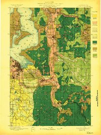
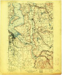
USGS Historical Quadrangle in GeoPDF.
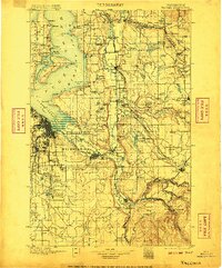
USGS Historical Quadrangle in GeoPDF.
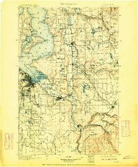
USGS Historical Quadrangle in GeoPDF.
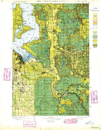
USGS Historical Quadrangle in GeoPDF.
This portion of the data release presents topographic point clouds of the intertidal zone at Puget Creek and Dickman Mill Park, Tacoma, WA, derived from structure-from-motion (SfM) processing of aerial imagery collected with an unmanned aerial system (UAS) on 2019-06-03. The point clouds for Puget Creek and Dickman Mill Park contain 74,565,548 and 122,791,637 points, respectively, at an approximate point spacing of 1 point every 2 centimeters. Each point contains an explicit horizontal and vertical coordinate, color, intensity, and classification. Water portions of the point cloud were classified using a polygon digitized from the orthomosaic imagery derived from these surveys (also available in this data release)....
Album caption: Tacoma office and field force. Back row John McCombs, Lasley Lee, G.L. Parker, R.B. Kilgore. Front row: D.J. F. Calkins, Claudia Underwood, H.P. Newton. 11/8/20. No index card.
USGS Historical Quadrangle in GeoPDF.
|

|
