Filters
Date Range
Types
Contacts
Tag Types
Tag Schemes
|
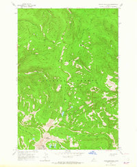
USGS Historical Quadrangle in GeoPDF.
Tags: 7.5 x 7.5 minute,
Downloadable Data,
GeoPDF,
GeoTIFF,
Historical Topographic Maps, All tags...
Historical Topographic Maps 7.5 x 7.5 Minute Map Series,
ID,
Map,
Taylor Mountain,
imageryBaseMapsEarthCover, Fewer tags

Airborne geophysical data for the Tanacross area were acquired and processed by Goldak Airborne Surveys under contract with the State of Alaska, Department of Natural Resources, Division of Geological & Geophysical Surveys (DGGS). Project funded by the US Geological Survey, Mineral Resources Program. This high sensitivity aeromagnetic survey was carried out by Goldak Airborne Surveys (Goldak) on behalf of the Alaska Department of Geological and Geophysical Surveys (DGGS) between June 17th and July 31st, 2015. Aircraft equipment operated included three cesium vapor magnetometers, a GPS/GLONASS real-time and post-corrected differential positioning system, a flight path recovery camera, a digital video titling and...
Tags: Big Delta Quadrangle,
Bush Prospect,
Dennis Ladue Prospect,
Dennison Fork,
Diamond Mountain, All tags...
Eagle Quadrangle,
Fish Prospect,
Fortymile Mining District,
Fortymile River,
Friden Prospect,
Geophysical Survey,
Geophysics,
Geophysics Search Tag,
Goodpaster Mining District,
Hajdukovich Molybdenum? Prospect,
J-26 Prospect,
July 26 Prospect,
June 26 Prospect,
Kechumstuck Mountain,
Ketchumstuk Prospect,
LWM Occurrence,
Ladue River,
Little Enchilada Prospect,
Little Whiteman Creek Prospect,
Magnetic Data,
Magnetic Survey,
Magnetics,
McArthur Creek,
Middle Fork Fortymile River,
Mitchell Prospect,
Mosquito Flats,
Mosquito Fork,
Mosquito Prospect,
Mount Fairplay,
Mount Harper,
Mount Hayes Quadrangle,
Move Prospect,
Mt. Fairplay Prospect,
Nabesna Quadrangle,
North Mosquito Flats Prospect,
North Peternie Prospect,
Peternie Prospect,
Prindle Volcano,
Rainy Mountain Lode Prospect,
Raven Prospect,
Section 21 Prospect,
Shady Ridge Prospect,
Sheba Mountain,
Silver Lining Prospect,
Sixtymile Butte,
Sixtymile Butte Prospect,
South Fork of the Fortymile River,
Tanacross Quadrangle,
Taurus Prospect,
Taylor Highway,
Taylor Mountain,
VABM West Prospect,
VW Prospect,
geoscientificInformation, Fewer tags
This data set contains imagery from the National Agriculture Imagery Program (NAIP). The NAIP program is administered by USDA FSA and has been established to support two main FSA strategic goals centered on agricultural production. These are increase stewardship of America's natural resources while enhancing the environment, and to ensure commodities are procured and distributed effectively and efficiently to increase food security. The NAIP program supports these goals by acquiring and providing ortho imagery that has been collected during the agricultural growing season in the U.S. The NAIP ortho imagery is tailored to meet FSA requirements and is a fundamental tool used to support FSA farm and conservation programs....
Types: Citation;
Tags: 3.75 x 3.75 minute,
3210725,
35029,
Aerial Compliance,
Compliance, All tags...
Digital Ortho rectified Image,
Downloadable Data,
JPEG 2000,
JPEG2000,
LUNA CO NM FSA,
Luna,
NAIP,
NM,
NM029,
Ortho Rectification,
Orthoimagery,
Quarter Quadrangle,
TAYLOR MOUNTAIN,
TAYLOR MOUNTAIN, SW,
USDA National Agriculture Imagery Program (NAIP),
farming,
imageryBaseMapsEarthCover, Fewer tags
This data set contains imagery from the National Agriculture Imagery Program (NAIP). The NAIP program is administered by USDA FSA and has been established to support two main FSA strategic goals centered on agricultural production. These are, increase stewardship of America's natural resources while enhancing the environment, and to ensure commodities are procured and distributed effectively and efficiently to increase food security. The NAIP program supports these goals by acquiring and providing ortho imagery that has been collected during the agricultural growing season in the U.S. The NAIP ortho imagery is tailored to meet FSA requirements and is a fundamental tool used to support FSA farm and conservation programs....
Types: Citation;
Tags: 16059,
3.75 x 3.75 minute,
4411407,
Aerial Compliance,
Compliance, All tags...
Digital Ortho rectified Image,
Downloadable Data,
ID,
ID059,
JPEG2000,
LEMHI CO ID FSA,
Lemhi,
NAIP,
Ortho Rectification,
Orthoimagery,
Quarter Quadrangle,
TAYLOR MOUNTAIN,
TAYLOR MOUNTAIN, SW,
USDA National Agriculture Imagery Program (NAIP),
farming, Fewer tags
This data set contains imagery from the National Agriculture Imagery Program (NAIP). The NAIP program is administered by USDA FSA and has been established to support two main FSA strategic goals centered on agricultural production. These are increase stewardship of America's natural resources while enhancing the environment, and to ensure commodities are procured and distributed effectively and efficiently to increase food security. The NAIP program supports these goals by acquiring and providing ortho imagery that has been collected during the agricultural growing season in the U.S. The NAIP ortho imagery is tailored to meet FSA requirements and is a fundamental tool used to support FSA farm and conservation programs....
Types: Citation;
Tags: 3.75 x 3.75 minute,
3210725,
35029,
Aerial Compliance,
Compliance, All tags...
Digital Ortho rectified Image,
Downloadable Data,
JPEG 2000,
JPEG2000,
LUNA CO NM FSA,
Luna,
NAIP,
NM,
NM029,
Ortho Rectification,
Orthoimagery,
Quarter Quadrangle,
TAYLOR MOUNTAIN,
TAYLOR MOUNTAIN, SE,
USDA National Agriculture Imagery Program (NAIP),
farming,
imageryBaseMapsEarthCover, Fewer tags

USGS Historical Quadrangle in GeoPDF.
Tags: 7.5 x 7.5 minute,
Downloadable Data,
GeoPDF,
GeoTIFF,
Historical Topographic Maps, All tags...
Historical Topographic Maps 7.5 x 7.5 Minute Map Series,
Map,
NM,
Provisional,
Taylor Mountain,
imageryBaseMapsEarthCover, Fewer tags

This data set contains imagery from the National Agriculture Imagery Program (NAIP). The NAIP program is administered by USDA FSA and has been established to support two main FSA strategic goals centered on agricultural production. These are, increase stewardship of America's natural resources while enhancing the environment, and to ensure commodities are procured and distributed effectively and efficiently to increase food security. The NAIP program supports these goals by acquiring and providing ortho imagery that has been collected during the agricultural growing season in the U.S. The NAIP ortho imagery is tailored to meet FSA requirements and is a fundamental tool used to support FSA farm and conservation programs....
Types: Citation;
Tags: 3.75 x 3.75 minute,
4010919,
49047,
Aerial Compliance,
Compliance, All tags...
Digital Ortho rectified Image,
Downloadable Data,
JPEG2000,
NAIP,
Ortho Rectification,
Orthoimagery,
Quarter Quadrangle,
TAYLOR MOUNTAIN,
TAYLOR MOUNTAIN, NE,
UINTAH CO UT FSA,
USDA National Agriculture Imagery Program (NAIP),
UT,
UT047,
Uintah,
farming, Fewer tags
This data set contains imagery from the National Agriculture Imagery Program (NAIP). The NAIP program is administered by USDA FSA and has been established to support two main FSA strategic goals centered on agricultural production. These are, increase stewardship of America's natural resources while enhancing the environment, and to ensure commodities are procured and distributed effectively and efficiently to increase food security. The NAIP program supports these goals by acquiring and providing ortho imagery that has been collected during the agricultural growing season in the U.S. The NAIP ortho imagery is tailored to meet FSA requirements and is a fundamental tool used to support FSA farm and conservation programs....
Types: Citation;
Tags: 16059,
3.75 x 3.75 minute,
4411407,
Aerial Compliance,
Compliance, All tags...
Digital Ortho rectified Image,
Downloadable Data,
ID,
ID059,
JPEG2000,
LEMHI CO ID FSA,
Lemhi,
NAIP,
Ortho Rectification,
Orthoimagery,
Quarter Quadrangle,
TAYLOR MOUNTAIN,
TAYLOR MOUNTAIN, NW,
USDA National Agriculture Imagery Program (NAIP),
farming, Fewer tags
This data set contains imagery from the National Agriculture Imagery Program (NAIP). The NAIP program is administered by USDA FSA and has been established to support two main FSA strategic goals centered on agricultural production. These are, increase stewardship of America's natural resources while enhancing the environment, and to ensure commodities are procured and distributed effectively and efficiently to increase food security. The NAIP program supports these goals by acquiring and providing ortho imagery that has been collected during the agricultural growing season in the U.S. The NAIP ortho imagery is tailored to meet FSA requirements and is a fundamental tool used to support FSA farm and conservation programs....
Types: Citation;
Tags: 16059,
3.75 x 3.75 minute,
4411407,
Aerial Compliance,
Compliance, All tags...
Digital Ortho rectified Image,
Downloadable Data,
ID,
ID059,
JPEG2000,
LEMHI CO ID FSA,
Lemhi,
NAIP,
Ortho Rectification,
Orthoimagery,
Quarter Quadrangle,
TAYLOR MOUNTAIN,
TAYLOR MOUNTAIN, SE,
USDA National Agriculture Imagery Program (NAIP),
farming, Fewer tags
This data set contains imagery from the National Agriculture Imagery Program (NAIP). The NAIP program is administered by USDA FSA and has been established to support two main FSA strategic goals centered on agricultural production. These are increase stewardship of America's natural resources while enhancing the environment, and to ensure commodities are procured and distributed effectively and efficiently to increase food security. The NAIP program supports these goals by acquiring and providing ortho imagery that has been collected during the agricultural growing season in the U.S. The NAIP ortho imagery is tailored to meet FSA requirements and is a fundamental tool used to support FSA farm and conservation programs....
Types: Citation;
Tags: 3.75 x 3.75 minute,
3210725,
35029,
Aerial Compliance,
Compliance, All tags...
Digital Ortho rectified Image,
Downloadable Data,
JPEG 2000,
JPEG2000,
LUNA CO NM FSA,
Luna,
NAIP,
NM,
NM029,
Ortho Rectification,
Orthoimagery,
Quarter Quadrangle,
TAYLOR MOUNTAIN,
TAYLOR MOUNTAIN, NE,
USDA National Agriculture Imagery Program (NAIP),
farming,
imageryBaseMapsEarthCover, Fewer tags

This data set contains imagery from the National Agriculture Imagery Program (NAIP). The NAIP program is administered by USDA FSA and has been established to support two main FSA strategic goals centered on agricultural production. These are, increase stewardship of America's natural resources while enhancing the environment, and to ensure commodities are procured and distributed effectively and efficiently to increase food security. The NAIP program supports these goals by acquiring and providing ortho imagery that has been collected during the agricultural growing season in the U.S. The NAIP ortho imagery is tailored to meet FSA requirements and is a fundamental tool used to support FSA farm and conservation programs....
Types: Citation;
Tags: 3.75 x 3.75 minute,
4010919,
49047,
Aerial Compliance,
Compliance, All tags...
Digital Ortho rectified Image,
Downloadable Data,
JPEG2000,
NAIP,
Ortho Rectification,
Orthoimagery,
Quarter Quadrangle,
TAYLOR MOUNTAIN,
TAYLOR MOUNTAIN, SW,
UINTAH CO UT FSA,
USDA National Agriculture Imagery Program (NAIP),
UT,
UT047,
Uintah,
farming, Fewer tags
This data set contains imagery from the National Agriculture Imagery Program (NAIP). The NAIP program is administered by USDA FSA and has been established to support two main FSA strategic goals centered on agricultural production. These are, increase stewardship of America's natural resources while enhancing the environment, and to ensure commodities are procured and distributed effectively and efficiently to increase food security. The NAIP program supports these goals by acquiring and providing ortho imagery that has been collected during the agricultural growing season in the U.S. The NAIP ortho imagery is tailored to meet FSA requirements and is a fundamental tool used to support FSA farm and conservation programs....
Types: Citation;
Tags: 16059,
3.75 x 3.75 minute,
4411407,
Aerial Compliance,
Compliance, All tags...
Digital Ortho rectified Image,
Downloadable Data,
ID,
ID059,
JPEG2000,
LEMHI CO ID FSA,
Lemhi,
NAIP,
Ortho Rectification,
Orthoimagery,
Quarter Quadrangle,
TAYLOR MOUNTAIN,
TAYLOR MOUNTAIN, NE,
USDA National Agriculture Imagery Program (NAIP),
farming, Fewer tags

This data set contains imagery from the National Agriculture Imagery Program (NAIP). The NAIP program is administered by USDA FSA and has been established to support two main FSA strategic goals centered on agricultural production. These are, increase stewardship of America's natural resources while enhancing the environment, and to ensure commodities are procured and distributed effectively and efficiently to increase food security. The NAIP program supports these goals by acquiring and providing ortho imagery that has been collected during the agricultural growing season in the U.S. The NAIP ortho imagery is tailored to meet FSA requirements and is a fundamental tool used to support FSA farm and conservation programs....
Types: Citation;
Tags: 3.75 x 3.75 minute,
4010919,
49047,
Aerial Compliance,
Compliance, All tags...
Digital Ortho rectified Image,
Downloadable Data,
JPEG2000,
NAIP,
Ortho Rectification,
Orthoimagery,
Quarter Quadrangle,
TAYLOR MOUNTAIN,
TAYLOR MOUNTAIN, NW,
UINTAH CO UT FSA,
USDA National Agriculture Imagery Program (NAIP),
UT,
UT047,
Uintah,
farming, Fewer tags
This data set contains imagery from the National Agriculture Imagery Program (NAIP). The NAIP program is administered by USDA FSA and has been established to support two main FSA strategic goals centered on agricultural production. These are increase stewardship of America's natural resources while enhancing the environment, and to ensure commodities are procured and distributed effectively and efficiently to increase food security. The NAIP program supports these goals by acquiring and providing ortho imagery that has been collected during the agricultural growing season in the U.S. The NAIP ortho imagery is tailored to meet FSA requirements and is a fundamental tool used to support FSA farm and conservation programs....
Types: Citation;
Tags: 3.75 x 3.75 minute,
3210725,
35017,
Aerial Compliance,
Compliance, All tags...
Digital Ortho rectified Image,
Downloadable Data,
GRANT CO NM FSA,
Grant,
JPEG 2000,
JPEG2000,
NAIP,
NM,
NM017,
Ortho Rectification,
Orthoimagery,
Quarter Quadrangle,
TAYLOR MOUNTAIN,
TAYLOR MOUNTAIN, NW,
USDA National Agriculture Imagery Program (NAIP),
farming,
imageryBaseMapsEarthCover, Fewer tags
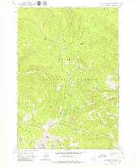
USGS Historical Quadrangle in GeoPDF.
Tags: 7.5 x 7.5 minute,
Downloadable Data,
GeoPDF,
GeoTIFF,
Historical Topographic Maps, All tags...
Historical Topographic Maps 7.5 x 7.5 Minute Map Series,
ID,
Map,
Taylor Mountain,
imageryBaseMapsEarthCover, Fewer tags

This data set contains imagery from the National Agriculture Imagery Program (NAIP). The NAIP program is administered by USDA FSA and has been established to support two main FSA strategic goals centered on agricultural production. These are, increase stewardship of America's natural resources while enhancing the environment, and to ensure commodities are procured and distributed effectively and efficiently to increase food security. The NAIP program supports these goals by acquiring and providing ortho imagery that has been collected during the agricultural growing season in the U.S. The NAIP ortho imagery is tailored to meet FSA requirements and is a fundamental tool used to support FSA farm and conservation programs....
Types: Citation;
Tags: 3.75 x 3.75 minute,
4010919,
49047,
Aerial Compliance,
Compliance, All tags...
Digital Ortho rectified Image,
Downloadable Data,
JPEG2000,
NAIP,
Ortho Rectification,
Orthoimagery,
Quarter Quadrangle,
TAYLOR MOUNTAIN,
TAYLOR MOUNTAIN, SE,
UINTAH CO UT FSA,
USDA National Agriculture Imagery Program (NAIP),
UT,
UT047,
Uintah,
farming, Fewer tags
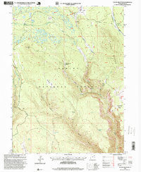
USGS Historical Quadrangle in GeoPDF.
Tags: 7.5 x 7.5 minute,
Downloadable Data,
GeoPDF,
GeoTIFF,
Historical Topographic Maps, All tags...
Historical Topographic Maps 7.5 x 7.5 Minute Map Series,
Map,
Taylor Mountain,
UT,
imageryBaseMapsEarthCover, Fewer tags
|
|

