Filters: Tags: Temperature (X) > partyWithName: Conservation Biology Institute (X)
350 results (9ms)|
Filters
Date Range
Contacts Tag Types Tag Schemes |

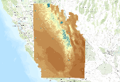
This dataset is a Basin Characterization Model (BCM) output using the PCM A2 Scenario for annual recharge, 2010-2039, clipped to the DRECP 12 km buffered boundary. Recharge: Amount of water exceeding field capacity that enters bedrock, occurs at a rate determined by the hydraulic conductivity of the underlying materials, excess water (rejected recharge) is added to runoff. The California Basin Characterization Model (BCM) climate dataset provides historical and projected climate surfaces for the state at a 270 meter resolution. The historical data is based on 4 kilometer PRISM data, and the projected climate surfaces are based on the A2 and B1 scenarios of the PCM and GFDL GCMs. The BCM approach uses a regional...
This dataset is a Basin Characterization Model (BCM) output using the GFDL A2 Scenario for Climatic Water Deficit (CWD) in southern Sierra Nevada California, for 2010-2039. The term climatic water deficit defined by Stephenson (1998) is quantified as the amount of water by which potential evapotranspiration (PET) exceeds actual evapotranspiration (AET). This term effectively integrates the combined effects of solar radiation, evapotranspiration, and air temperature on watershed conditions given available soil moisture derived from precipitation. Climatic water deficit can be thought of as the amount of additional water that would have evaporated or transpired had it been present in the soils given the temperature...

This dataset is a Basin Characterization Model (BCM) output using the PCM A2 Scenario for annual Climatic Water Deficit (CWD), 2070-2099, clipped to the DRECP 12 km buffered boundary. The term climatic water deficit defined by Stephenson (1998) is quantified as the amount of water by which potential evapotranspiration (PET) exceeds actual evapotranspiration (AET). This term effectively integrates the combined effects of solar radiation, evapotranspiration, and air temperature on watershed conditions given available soil moisture derived from precipitation. Climatic water deficit can be thought of as the amount of additional water that would have evaporated or transpired had it been present in the soils given the...

This dataset is a Basin Characterization Model (BCM) output using the PCM A2 Scenario for average Spring (March, April, May) snowpack, in central Sierra Nevada California, for 2040-2069. Snowpack: Amount of snow accumulated per month summed annually, or if divided by 12 average monthly snowpack. This is calculated as prior month's snowpack plus snowfall minus sublimation and snow melt. The California Basin Characterization Model (BCM) climate dataset provides historical and projected climate surfaces for the state at a 270 meter resolution. The historical data is based on 4 kilometer PRISM data, and the projected climate surfaces are based on the A2 and B1 scenarios of the PCM and GFDL GCMs. The BCM approach uses...
This dataset is a Basin Characterization Model (BCM) output using the GFDL A2 Scenario for Runoff, in central Sierra Nevada California, for 2040-2069. Runoff: Amount of water that becomes stream flow, summed annually. Modeled as amount of water that exceeds total soil storage and rejected recharge. The California Basin Characterization Model (BCM) climate dataset provides historical and projected climate surfaces for the state at a 270 meter resolution. The historical data is based on 4 kilometer PRISM data, and the projected climate surfaces are based on the A2 and B1 scenarios of the PCM and GFDL GCMs. The BCM approach uses a regional water balance model based on high resolution downscaled precipitation and...

NARCCAP: http://www.narccap.ucar.edu/ The North American Regional Climate Change Assessment Program (NARCCAP) is an international program that will serve the climate scenario needs of the United States, Canada, and northern Mexico. NARCCAP is systematically investigating the uncertainties in future climate projections on the regional level. NARCCAP closely matches the regional climate models (RCMs) with multiple atmosphere-ocean general circulation models (AOGCMs) along with the A2 scenario from the Special Report on Emission Scenarios (SRES) over an area covering most of North America. NARCCAP also validates the regional climate model performance by driving the RCMs with reanalyses, which is similar to driving...

NARCCAP: http://www.narccap.ucar.edu/ The North American Regional Climate Change Assessment Program (NARCCAP) is an international program that will serve the climate scenario needs of the United States, Canada, and northern Mexico. NARCCAP is systematically investigating the uncertainties in future climate projections on the regional level. NARCCAP closely matches the regional climate models (RCMs) with multiple atmosphere-ocean general circulation models (AOGCMs) along with the A2 scenario from the Special Report on Emission Scenarios (SRES) over an area covering most of North America. NARCCAP also validates the regional climate model performance by driving the RCMs with reanalyses, which is similar to driving...

NARCCAP: http://www.narccap.ucar.edu/ The North American Regional Climate Change Assessment Program (NARCCAP) is an international program that will serve the climate scenario needs of the United States, Canada, and northern Mexico. NARCCAP is systematically investigating the uncertainties in future climate projections on the regional level. NARCCAP closely matches the regional climate models (RCMs) with multiple atmosphere-ocean general circulation models (AOGCMs) along with the A2 scenario from the Special Report on Emission Scenarios (SRES) over an area covering most of North America. NARCCAP also validates the regional climate model performance by driving the RCMs with reanalyses, which is similar to driving...

NARCCAP: http://www.narccap.ucar.edu/ The North American Regional Climate Change Assessment Program (NARCCAP) is an international program that will serve the climate scenario needs of the United States, Canada, and northern Mexico. NARCCAP is systematically investigating the uncertainties in future climate projections on the regional level. NARCCAP closely matches the regional climate models (RCMs) with multiple atmosphere-ocean general circulation models (AOGCMs) along with the A2 scenario from the Special Report on Emission Scenarios (SRES) over an area covering most of North America. NARCCAP also validates the regional climate model performance by driving the RCMs with reanalyses, which is similar to driving...

NARCCAP: http://www.narccap.ucar.edu/ The North American Regional Climate Change Assessment Program (NARCCAP) is an international program that will serve the climate scenario needs of the United States, Canada, and northern Mexico. NARCCAP is systematically investigating the uncertainties in future climate projections on the regional level. NARCCAP closely matches the regional climate models (RCMs) with multiple atmosphere-ocean general circulation models (AOGCMs) along with the A2 scenario from the Special Report on Emission Scenarios (SRES) over an area covering most of North America. NARCCAP also validates the regional climate model performance by driving the RCMs with reanalyses, which is similar to driving...

NARCCAP: http://www.narccap.ucar.edu/ The North American Regional Climate Change Assessment Program (NARCCAP) is an international program that will serve the climate scenario needs of the United States, Canada, and northern Mexico. NARCCAP is systematically investigating the uncertainties in future climate projections on the regional level. NARCCAP closely matches the regional climate models (RCMs) with multiple atmosphere-ocean general circulation models (AOGCMs) along with the A2 scenario from the Special Report on Emission Scenarios (SRES) over an area covering most of North America. NARCCAP also validates the regional climate model performance by driving the RCMs with reanalyses, which is similar to driving...

NARCCAP: http://www.narccap.ucar.edu/ The North American Regional Climate Change Assessment Program (NARCCAP) is an international program that will serve the climate scenario needs of the United States, Canada, and northern Mexico. NARCCAP is systematically investigating the uncertainties in future climate projections on the regional level. NARCCAP closely matches the regional climate models (RCMs) with multiple atmosphere-ocean general circulation models (AOGCMs) along with the A2 scenario from the Special Report on Emission Scenarios (SRES) over an area covering most of North America. NARCCAP also validates the regional climate model performance by driving the RCMs with reanalyses, which is similar to driving...

Two future climate change scenarios at a resolution of 0.5 degree latitude/longitude for the conterminous United States were used in the Vegetation Ecosystems Modelling Analysis Project (VEMAP): a moderately warm scenario produced by the general circulation model from the Hadley Climate Centre [Johns et al., 1997; Mitchell and Johns, 1997], HADCM2SUL (up to a 2.8oC increase in average annual U.S. temperature in 2100) and a warmer scenario (up to a 5.8oC increase in average annual U.S. temperature in 2100), CGCM1, from the Canadian Climate Center [Boer et al., 1999a, 1999b; Flato et al., 1999]. Both general circulation models (GCMs) included sulfate aerosols and a fully dynamic 3-D ocean. Both transient scenarios...

This dataset is a Basin Characterization Model (BCM) output using the GFDL A2 Scenario for average Spring (March, April, May) snowpack change, 2010-2039, clipped to the Sierra Nevada Zone for CA LCC. Snowpack: Amount of snow accumulated per month summed annually, or if divided by 12 average monthly snowpack. This is calculated as prior month's snowpack plus snowfall minus sublimation and snow melt.Snowpack change was calculated using GFDL A2 scenario 2010-2039 minus Historic Snowpack 1971-2000. The California Basin Characterization Model (BCM) climate dataset provides historical and projected climate surfaces for the state at a 270 meter resolution. The historical data is based on 4 kilometer PRISM data, and the...

This dataset is a Basin Characterization Model (BCM) output using the GFDL A2 Scenario calculated to represent percentage of annual precipitation received during summer months (June, July, August and September), 2040-2069, clipped to the DRECP 12 km buffered boundary.Total Precipitation:Â Total monthly precipitation (rain or snow), also summed by water year. Averaged over 30 year ranges.Calculation of Percentage: Summer Months Precipitation (June, July, August, September)/Annual Precipitation. The California Basin Characterization Model (BCM) climate dataset provides historical and projected climate surfaces for the state at a 270 meter resolution. The historical data is based on 4 kilometer PRISM data, and the...

This dataset is a Basin Characterization Model (BCM) output using the GFDL A2 Scenario for annual Minimum Temperature, 2070-2099, clipped to the DRECP 12 km buffered boundary.Minimum Temperature:Â The modeled daily maximum and minimum are averaged to give daily average; the minimum daily average in a calendar month becomes the monthly minimum; this is averaged over a 30 year period to determine TMin for each month of the year, and for the water year. The California Basin Characterization Model (BCM) climate dataset provides historical and projected climate surfaces for the state at a 270 meter resolution. The historical data is based on 4 kilometer PRISM data, and the projected climate surfaces are based on the...

This dataset represents Recharge change, from Basin Characterization Model (BCM) output using the PCM A2 Scenario in southern California, for 2070-2099. The data was processed using historic Recharge (1979-2000) and PCM A2 Scenario Recharge (2070-2099) to calculate change. Recharge: Amount of water exceeding field capacity that enters bedrock, occurs at a rate determined by the hydraulic conductivity of the underlying materials, excess water (rejected recharge) is added to runoff. The California Basin Characterization Model (BCM) climate dataset provides historical and projected climate surfaces for the state at a 270 meter resolution. The historical data is based on 4 kilometer PRISM data, and the projected...

This dataset is a Basin Characterization Model (BCM) output using the PCM A2 Scenario for annual runoff, 2040-2069, clipped to the DRECP 12 km buffered boundary. Runoff: Amount of water that becomes stream flow, summed annually. Modeled as amount of water that exceeds total soil storage and rejected recharge. The California Basin Characterization Model (BCM) climate dataset provides historical and projected climate surfaces for the state at a 270 meter resolution. The historical data is based on 4 kilometer PRISM data, and the projected climate surfaces are based on the A2 and B1 scenarios of the PCM and GFDL GCMs. The BCM approach uses a regional water balance model based on high resolution downscaled precipitation...

This dataset is historic annual runoff, for 1971-2000, clipped to the DRECP 12 km buffered boundary from the California Basin Characterization Model (BCM) Runoff: Amount of water that becomes stream flow, summed annually. Modeled as amount of water that exceeds total soil storage and rejected recharge. The California Basin Characterization Model (BCM) climate dataset provides historical and projected climate surfaces for the state at a 270 meter resolution. The historical data is based on 4 kilometer PRISM data, and the projected climate surfaces are based on the A2 and B1 scenarios of the PCM and GFDL GCMs. The BCM approach uses a regional water balance model based on high resolution downscaled precipitation...

This dataset represents the soil temperature regimes from SSURGO and STATSGO soil descriptions for soil map units in the state of southern Alaska (b) that lie within the North Pacific Landscape Conservation Cooperative. Definition.—“Soil temperature” is the mean monthly soil temperature at the specified depth (the average of the daily high and daily low temperature for the month). Significance.—Soil temperature is important to many biological and physical processes that occur in the soil. Plant germination and growth are closely related to soil temperature. Cold soil temperatures effectively create a thermal pan in the soil. Roots cannot uptake moisture or nutrients below the threshold temperatures specific to...
|

|
