Filters: Tags: Tephra (X) > partyWithName: State of Alaska, Department of Natural Resources, Division of Geological & Geophysical Surveys (X)
3 results (51ms)|
Filters
Date Range
Contacts Tag Types Tag Schemes |
This map illustrates extents and types of unconsolidated deposits and bedrock in the Big Delta A-4 Quadrangle, Alaska. This map is based on field observations begun by P�w� in 1949 and by Reger in 1976. Unit characteristics and extents were determined during field visits and by interpreting 1:40,000-scale black-and-white aerial photographs taken in August 1949 and 1:63,360-scale, false-color infrared aerial photographs taken in July 1978, August 1980, and August 1981.
Between 27 and 11 kyr ago, during the last major (Naptowne) glaciation, the northwestern and western Kenai Peninsula and the Cook Inlet trough were covered by ice except for local nunataks and small refugia, like the Caribou Hills. Landforms related to four glacial stades are recognized and paleogeographic maps document ice limits, drainage systems, glacial-impounded lakes, and glaciomarine terraces. Numerous multidisciplinary studies of glacial, vegetation, and insect histories document Holocene climatic changes.
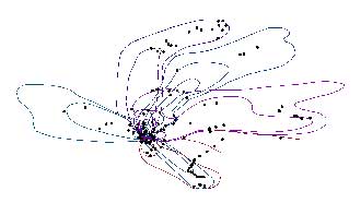
The 2009 eruption of Redoubt Volcano included 19 major tephra-producing explosions. Mass per unit area (MPUA) ash fall sampling of the resulting deposits allowed us to create isomass contours of the ash fall. This dataset contains the vector digital shapefiles of the ash fall contours for the explosive events. In addition, a point digital shapefile is included that describes more than 400 ash fall samples that were collected. For a detailed account of the 2009 eruption of Redoubt Volcano, see Schaefer, J.R., ed., 2012, The 2009 eruption of Redoubt Volcano, Alaska, with contributions by Bull, Katharine, Cameron, Cheryl, Coombs, Michelle, Diefenbach, Angie, Lopez, Taryn, McNutt, Steve, Neal, Christina, Payne, Allison,...
|

|
