Filters: Tags: Timber (X)
23 results (35ms)|
Filters
Date Range
Extensions (Less) Types (Less) Contacts (Less)
Categories (Less) Tag Types Tag Schemes |
This data set contains imagery from the National Agriculture Imagery Program (NAIP). The NAIP program is administered by USDA FSA and has been established to support two main FSA strategic goals centered on agricultural production. These are, increase stewardship of America's natural resources while enhancing the environment, and to ensure commodities are procured and distributed effectively and efficiently to increase food security. The NAIP program supports these goals by acquiring and providing ortho imagery that has been collected during the agricultural growing season in the U.S. The NAIP ortho imagery is tailored to meet FSA requirements and is a fundamental tool used to support FSA farm and conservation programs....
This data set contains imagery from the National Agriculture Imagery Program (NAIP). The NAIP program is administered by USDA FSA and has been established to support two main FSA strategic goals centered on agricultural production. These are, increase stewardship of America's natural resources while enhancing the environment, and to ensure commodities are procured and distributed effectively and efficiently to increase food security. The NAIP program supports these goals by acquiring and providing ortho imagery that has been collected during the agricultural growing season in the U.S. The NAIP ortho imagery is tailored to meet FSA requirements and is a fundamental tool used to support FSA farm and conservation programs....
Hydraulic fracturing is a common method used to improve the productivity of gas-condensate wells. Previous simulation studies have predicted much larger increases in well productivity than observed in the field. This study showed the large effects of non-Darcy flow and condensate accumulation on the productivity of a hydraulically fractured gas-condensate well.
Hydraulic fracturing is a common method used to improve the productivity of gas-condensate wells. Previous simulation studies have predicted much larger increases in well productivity than observed in the field. This study showed the large effects of non-Darcy flow and condensate accumulation on the productivity of a hydraulically fractured gas-condensate well.
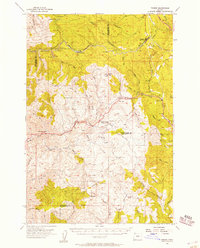
USGS Historical Quadrangle in GeoPDF.
This data set contains imagery from the National Agriculture Imagery Program (NAIP). The NAIP program is administered by USDA FSA and has been established to support two main FSA strategic goals centered on agricultural production. These are, increase stewardship of America's natural resources while enhancing the environment, and to ensure commodities are procured and distributed effectively and efficiently to increase food security. The NAIP program supports these goals by acquiring and providing ortho imagery that has been collected during the agricultural growing season in the U.S. The NAIP ortho imagery is tailored to meet FSA requirements and is a fundamental tool used to support FSA farm and conservation programs....
This data set contains imagery from the National Agriculture Imagery Program (NAIP). The NAIP program is administered by USDA FSA and has been established to support two main FSA strategic goals centered on agricultural production. These are, increase stewardship of America's natural resources while enhancing the environment, and to ensure commodities are procured and distributed effectively and efficiently to increase food security. The NAIP program supports these goals by acquiring and providing ortho imagery that has been collected during the agricultural growing season in the U.S. The NAIP ortho imagery is tailored to meet FSA requirements and is a fundamental tool used to support FSA farm and conservation programs....

This dataset depicts sales of a non-mineral resource by the State of Alaska. These sales include timber sales in addition to sand and gravel sales. This shape file characterizes the geographic representation of land parcels within the State of Alaska contained by the Resource Sale category. It has been extracted from data sets used to produce the State status plats. This data set includes cases noted on the digital status plats up to one day prior to data extraction. Each feature has an associated attribute record, including a Land Administration System (LAS) file-type and file-number which serves as an index to related LAS case-file information. Additional LAS case-file and customer information may be obtained...
Hydraulic fracturing is a common method used to improve the productivity of gas-condensate wells. Previous simulation studies have predicted much larger increases in well productivity than observed in the field. This study showed the large effects of non-Darcy flow and condensate accumulation on the productivity of a hydraulically fractured gas-condensate well.

USGS Historical Quadrangle in GeoPDF.

The original CoverType Dataset was clipped by the four Ranger Districts of interest:Â Thorne Bay, Craig, Wrangell, and Petersburg.Below is the information from the original dataset:CoverType is a photo-interpreted delineation of the Tongass National Forest by land type and timber cover type. Classification of lands was done sequentially: 1) land and water identified; 2) forested and non-forested areas were identified; 3) forested areas were classified by forest type and forest productivity; and 4) productive forest lands were further characterized by volume class, tree size, species composition. The original classifications were based on photo-interpretation of 1:15840 aerial photographs in 1978. The minimum map...
Hydraulic fracturing is a common method used to improve the productivity of gas-condensate wells. Previous simulation studies have predicted much larger increases in well productivity than observed in the field. This study showed the large effects of non-Darcy flow and condensate accumulation on the productivity of a hydraulically fractured gas-condensate well.

This dataset displays PCT and CT second growth forest suitable for harvest overlapping open, FS-roaded areas on the Craig, Petersburg, Thorne Bay, Wrangell and Ketchikan-Misty Ranger Districts of the Tongass National Forest. The Conservation Biology Institute performed GIS analysis identifying the following areas based on criteria specified by Mater Engineering and NRDC:Forest stands with at least some portion within (overlapping) 800 feet of USFS-operable roads where 1. commercial and precommercial thinning have previously taken place 2. on acreage suitable for timber harvest with less than 72% slope (based on prior Forest Service analysis) 3. with null suitability values removed, 4. karst formations removed,...

This dataset displays PCT and CT second growth forest suitable for timber harvest on the Craig, Petersburg, Thorne Bay, Wrangell, and Ketchikan-Misty Ranger Districts of the Tongass National Forest. The Conservation Biology Institute performed GIS analysis identifying the following areas based on criteria specified by Mater Engineering and NRDC:Places where commercial and precommercial thinning have previously taken place on acreage suitable for timber harvest with less than 72% slope (based on prior Forest Service analysis) with null suitability values removed, karst formations removed, potential habitat conservation areas removed using Land Use Designations (âDESCRIPTIONâ = âOld Growth Habitatâ), and...
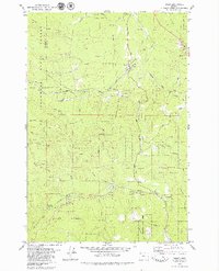
USGS Historical Quadrangle in GeoPDF.
Wenatchee National Forest Suitable Timberlands. This layer was developed for timber suitability analysis for the Wenatchee Forest Plan. Although it is named for suitability, it was really mostly used as a resource to show areas "unsuitable" for timber management. Very important historical reference.
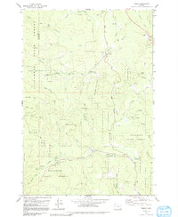
USGS Historical Quadrangle in GeoPDF.

The spatial representation for a Tree Farm License, which is an agreement entered into under Part 3, Division 5 of the Forest Act which grants the rights to harvest timber. A tree farm licence has a term of 25 years and requires a management plan providing for the establishment, management, and harvesting of timber in a described area (Crown and private land) on a sustained or perpetual yield basis Date of Data Creation: 2003-03-24 Update Cycle: As Needed Downloaded from the LRDW Oct 16, 2013 Metadata URL: https://apps.gov.bc.ca/pub/geometadata/metadataDetail.do?recordUID=3731&recordSet=ISO19115
This tabular data set contains annual information on forestry activity, compiled for two spatial components of the NHDPlus version 2 data suite (NHDPlusv2) for the conterminous United States; 1) individual reach catchments and 2) reach catchments accumulated upstream through the river network. This dataset can be linked to the NHDPlus version 2 data suite by the unique identifier COMID. The source data is from the NAWQA Wall-to-Wall Anthropogenic Land Use Trends (NWALT) produced by James Falcone (USGS, 2015). The data provided here contains yearly information from 1999-2012, compiled as described above. The units are percents. Reach catchment information characterizes data at the local scale. Reach catchments accumulated...

This dataset displays PCT and CT second growth forest suitable for timber harvest in open, FS-roaded areas on the Craig, Petersburg, Thorne Bay, Wrangell and Ketchikan-Misty Ranger Districts of the Tongass National Forest. The Conservation Biology Institute performed GIS analysis identifying the following areas based on criteria specified by Mater Engineering and NRDC:Areas within 800 feet of USFS-operable roads where 1. commercial and precommercial thinning have previously taken place 2. on acreage suitable for timber harvest with less than 72% slope (based on prior Forest Service analysis) 3. with null suitability values removed, 4. karst formations removed, 5. potential habitat conservation areas removed using...
|

|
