Filters: Tags: Tool (X)
19 results (36ms)|
Filters
Date Range
Extensions Types Contacts
Categories Tag Types
|
The Appalachians are a landscape filled with globally-significant biological diversity and cultural resources that provides essential benefits to large cities and surrounding human communities. The region is also rich in energy resources that meet national and regional demands for energy. As wind, natural gas, and oil energy development expand along with traditional coal, there is an increasing need for research to inform discussions on how to meet immediate and future energy needs while sustaining the health of natural systems. To help address this need, the Appalachian LCC awarded a grant to The Nature Conservancy to assess current and future energy development across the entire region. Assessing Future Energy...
Categories: Data;
Tags: Academics & scientific researchers,
AppLCC,
Appalachian,
Conservation NGOs,
Data,
In this study, we simulate global CO2 emissions and their reduction potentials in the industrial sector up to the year 2030. Future industrial CO2 emissions depend on changes in both technology and industrial activity. However, earlier bottom-up analyses mainly focused on technology change. In this study, we estimate changes in both technology and industrial activity. We developed a three-part simulation system. The first part is a macro economic model that simulates macro economic indicators, such as GDP and value added by sector. The second part consists of industrial production models that simulate future steel and cement production. The third part is a bottom-up type technology model that estimates future CO2...
Categories: Publication;
Types: Citation;
Tags: Promotion,
decision,
efficiency,
energy,
investments,
This data set contains imagery from the National Agriculture Imagery Program (NAIP). The NAIP program is administered by USDA FSA and has been established to support two main FSA strategic goals centered on agricultural production. These are increase stewardship of America's natural resources while enhancing the environment, and to ensure commodities are procured and distributed effectively and efficiently to increase food security. The NAIP program supports these goals by acquiring and providing ortho imagery that has been collected during the agricultural growing season in the U.S. The NAIP ortho imagery is tailored to meet FSA requirements and is a fundamental tool used to support FSA farm and conservation programs....
Present power markets are designed for trading conventional generation. For wind generation to participate in a short-term energy market, lengthy wind power production forecasts are required. Although wind speed forecasting techniques are constantly improving, wind speed forecasts are never perfect, and resulting wind power forecast errors imply imbalance costs for wind farm owners. In this paper, a new method for minimization of imbalance costs is developed. Stochastic programming is used to generate optimal wind power production bids for a short-term power market. A Wind power forecast error is represented as a stochastic process. The imbalance costs resulting from this strategy are then compared to the case when...
Categories: Publication;
Types: Citation;
Tags: Development,
collision,
marine,
migration,
planning,
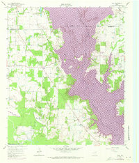
USGS Historical Quadrangle in GeoPDF.
USGS Historical Quadrangle in GeoPDF.
This data set contains imagery from the National Agriculture Imagery Program (NAIP). The NAIP program is administered by USDA FSA and has been established to support two main FSA strategic goals centered on agricultural production. These are increase stewardship of America's natural resources while enhancing the environment, and to ensure commodities are procured and distributed effectively and efficiently to increase food security. The NAIP program supports these goals by acquiring and providing ortho imagery that has been collected during the agricultural growing season in the U.S. The NAIP ortho imagery is tailored to meet FSA requirements and is a fundamental tool used to support FSA farm and conservation programs....
In this study, we simulate global CO2 emissions and their reduction potentials in the industrial sector up to the year 2030. Future industrial CO2 emissions depend on changes in both technology and industrial activity. However, earlier bottom-up analyses mainly focused on technology change. In this study, we estimate changes in both technology and industrial activity. We developed a three-part simulation system. The first part is a macro economic model that simulates macro economic indicators, such as GDP and value added by sector. The second part consists of industrial production models that simulate future steel and cement production. The third part is a bottom-up type technology model that estimates future CO2...
Categories: Publication;
Types: Citation;
Tags: Promotion,
decision,
efficiency,
energy,
investments,
Ecological systems are already responding to modern changes in climate. Many species are moving in directions and at rates that correspond with recent climatic change. Understanding how species distributions and abundances are likely to be altered can inform management and planning activities resulting in more robust management decisions. We projected climate-driven changes in the abundances and distributions of 31 focal bird species in Oregon and Washington using the latest downscaled CMIP5 climate projections and corresponding vegetation model outputs. Vegetation models were informed by the results of MC2, a dynamic global vegetation model (DGVM). We mapped these future projections and integrated them here to...
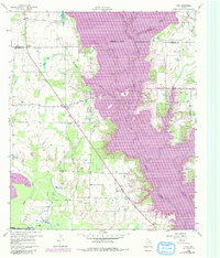
USGS Historical Quadrangle in GeoPDF.
We have developed a state-scale version of the MARKAL energy optimization model, commonly used to model energy policy at the US national scale and internationally. We apply the model to address state-scale impacts of a renewable electricity standard (RES) and a carbon tax in one southeastern state, Georgia. Biomass is the lowest cost option for large-scale renewable generation in Georgia; we find that electricity can be generated from biomass co-firing at existing coal plants for a marginal cost above baseline of 0.2-2.2 cents/kWh and from dedicated biomass facilities for 3.0-5.5 cents/kWh above baseline. We evaluate the cost and amount of renewable electricity that would be produced in-state and the amount of out-of-state...
As technical efficiency improvement in energy use remains a touchstone measure to curb greenhouse gas (GHG) emissions, there is substantial concern about whether this approach can offset the large and expanding impacts of human actions. Critics contend that without adjustments to the prevailing consumptive lifestyle, energy efficiency improvement will generate only token reductions in GHG emissions. I address this concern by examining the extent to which technical efficiency improvement in energy use offsets the impacts of housing-related lifestyle on GHG emissions. I build from two perspectives, the physical-technical-economic models that consider energy efficiency improvement as a potent strategy to curb residential...
Categories: Publication;
Types: Citation;
Tags: creation,
energy,
energy intensive industry,
energy market,
evaluation,
Oil spill response, whether planned by government agencies, oil spill cooperatives or individual companies, can be planned and carried out with the goal of minimizing ecological impacts, not merely removing visible oil. Two oil spill cooperatives on the west coast are implementing such planning. First, a coastal survey was conducted in the cooperative's area of responsibility. Physical processes and habitat types were examined. Oil spill cleanup guidelines were written for each habitat type. Biologically sensitive areas, those sites most vulnerable to oil spill impacts, were identified. Strategies were developed to protect most sensitive areas, i.e., prevent spilled oil from reaching them. Protection is the preferred...
Categories: Publication;
Types: Citation;
Tags: Development,
collision,
marine,
migration,
planning,
Properties and uses of storage for enhancing the grid penetration of very large photovoltaic systems
In this study, we simulate global CO2 emissions and their reduction potentials in the industrial sector up to the year 2030. Future industrial CO2 emissions depend on changes in both technology and industrial activity. However, earlier bottom-up analyses mainly focused on technology change. In this study, we estimate changes in both technology and industrial activity. We developed a three-part simulation system. The first part is a macro economic model that simulates macro economic indicators, such as GDP and value added by sector. The second part consists of industrial production models that simulate future steel and cement production. The third part is a bottom-up type technology model that estimates future CO2...
Categories: Publication;
Types: Citation;
Tags: Promotion,
decision,
efficiency,
energy,
investments,
On the question of whether natural resources are a curse for growth, the jury is still out. While waiting for a decision, we study whether resource intensity has any effect on social development over and above the effect it might have on income or growth. We measure social development by a combination of health and education outcomes and resource intensity by the share of primary commodities in total merchandise exports. We find that, after controlling for per-capita income and other macroeconomic and institutional factors, a higher dependence on primary commodity exports is negative for social development. The transmission mechanism seems to operate via income inequality and macroeconomic volatility.
Categories: Publication;
Types: Citation;
Tags: Applications,
Social,
analysis,
community,
corporate,
This data set contains imagery from the National Agriculture Imagery Program (NAIP). The NAIP program is administered by USDA FSA and has been established to support two main FSA strategic goals centered on agricultural production. These are increase stewardship of America's natural resources while enhancing the environment, and to ensure commodities are procured and distributed effectively and efficiently to increase food security. The NAIP program supports these goals by acquiring and providing ortho imagery that has been collected during the agricultural growing season in the U.S. The NAIP ortho imagery is tailored to meet FSA requirements and is a fundamental tool used to support FSA farm and conservation programs....
This data set contains imagery from the National Agriculture Imagery Program (NAIP). The NAIP program is administered by USDA FSA and has been established to support two main FSA strategic goals centered on agricultural production. These are increase stewardship of America's natural resources while enhancing the environment, and to ensure commodities are procured and distributed effectively and efficiently to increase food security. The NAIP program supports these goals by acquiring and providing ortho imagery that has been collected during the agricultural growing season in the U.S. The NAIP ortho imagery is tailored to meet FSA requirements and is a fundamental tool used to support FSA farm and conservation programs....
This project supports a collaborative, multi-stakeholder effort led by the U.S. Forest Service (USFS) to develop a largescale vulnerability assessment and associated adaptation strategies for focal resources of the Sierra Nevada. The purpose of this effort is to provide information and tools for Forest Planning and management (e.g., NEPA analyses, Forest Plan revisions, Climate Scorecard) and other natural resource management (e.g., SWAP) and conservation efforts to prepare for climate change impacts in the Sierra Nevada. Specifically, our objectives are to: (1) assess the vulnerability of focal resources to climate change, (2) use spatial analysis and expert input to prioritize conservation areas or actions, and...
Categories: Data,
Project;
Tags: 2012,
2013,
Applications and Tools,
CA,
California Landscape Conservation Cooperative,
This simple interface is designed to help inform conservation decisions by allowing you to explore a suite of data layers and models. You’ll find information on priority natural resources, biodiversity richness, landscape connectivity and integrity, surface waters and factors contributing to potential landscape change (sea level rise, urban development). 1 Compare Key Characteristics across FloridaUse one of the tabs above to explore different combinations of key characteristics assessed at the watershed scale across the state. Click on the bars in the charts to filter the map by that class. You can combine filters across tabs and across factors within a tab. You can also display that factor on the map by clicking...
Categories: Data,
Web Site;
Types: Map Service,
OGC WFS Layer,
OGC WMS Layer,
OGC WMS Service;
Tags: 2014,
Applications and Tools,
Conservation Planning,
LCC,
LCC Network Science Catalog,
|

|
