Filters: Tags: Trinidad (X)
38 results (156ms)|
Filters
Date Range
Extensions Types Contacts
Categories Tag Types Tag Schemes |
The USGS Central Region Energy Team assesses oil and gas resources of the United States. The onshore and State water areas of the United States comprise 71 provinces. Within these provinces, Total Petroleum Systems are defined and Assessment Units are defined and assessed. Each of these provinces is defined geologically, and most province boundaries are defined by major geologic changes. The Raton Basin-Sierra Grande Uplift Province is located in South Eastern Colorado and North Eastern New Mexico, encompassing all or parts of Custer, Huerfano, and Las Animas counties in Colorado and all or parts of Colfax, Harding, Mora, and Union counties in New Mexico. The main population centers within the study area are Trinidad,...
Categories: Data,
pre-SM502.8;
Types: Downloadable,
Map Service,
OGC WFS Layer,
OGC WMS Layer,
Shapefile;
Tags: 41 = Raton Basin-Sierra Grande Uplift Province,
504101 = Upper Cretaceous-Tertiary Coalbed Gas,
50410101 = Upper Cretaceous-Tertiary Sandstones,
50410181 = Raton Coalbed Gas,
50410182 = Vermejo Coalbed Gas,
The Assessment Unit is the fundamental unit used in the National Assessment Project for the assessment of undiscovered oil and gas resources. The Assessment Unit is defined within the context of the higher-level Total Petroleum System. The Assessment Unit is shown here as a geographic boundary interpreted, defined, and mapped by the geologist responsible for the province and incorporates a set of known or postulated oil and (or) gas accumulations sharing similar geologic, geographic, and temporal properties within the Total Petroleum System, such as source rock, timing, migration pathways, trapping mechanism, and hydrocarbon type. The Assessment Unit boundary is defined geologically as the limits of the geologic...
Categories: Data,
pre-SM502.8;
Types: Downloadable,
Map Service,
OGC WFS Layer,
OGC WMS Layer,
Shapefile;
Tags: 41 = Raton Basin-Sierra Grande Uplift Province,
504101 = Upper Cretaceous-Tertiary Coalbed Gas,
50410101 = Upper Cretaceous-Tertiary Sandstones,
50410181 = Raton Coalbed Gas,
50410182 = Vermejo Coalbed Gas,
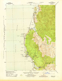
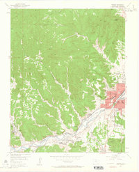
USGS Historical Quadrangle in GeoPDF.
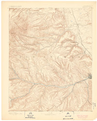
USGS Historical Quadrangle in GeoPDF.

USGS Historical Quadrangle in GeoPDF.
Core Research Center, core E272, from well operated by CABOT CORPORATIONRaw Properties from download, web scrape, MapServer, and Macrostrat API{"Lib Num": "E272", "API Num": "0505506100", "Operator": "CABOT CORPORATION", "Well Name": "43-17 1 SMITH", "Field": "WILDCAT", "State": "CO", "County": "HUERFANO", "Type": "SLABBED", "Photos": "F", "Thin Sec": "F", "Analysis": "T", "Latitude": "37.519505", "Longitude": "-105.022566", "coordinates_geohash": "9wtm6nhyuydv", "Source": "FROM STATE RECORDS", "Security Flag": "NO SPECIAL RESTRICTIONS", "crc_collection_name": "core", "sb_parent_id": "4f4e49dae4b07f02db5e0486", "intervals": [{"Formation": "TRINIDAD", "Age": "CRET", "Min Depth": "5105", "Max Depth": "5112"}, {"Formation":...
Core Research Center, core U975, from well operated by RIVER GASRaw Properties from download, web scrape, MapServer, and Macrostrat API{"Lib Num": "U975", "API Num": null, "Operator": "RIVER GAS", "Well Name": "2 RGC-CO", "Field": "NORTH RATON BASIN", "State": "CO", "County": "HUERFANO", "Type": "FULL", "Photos": "F", "Thin Sec": "F", "Analysis": "T", "Latitude": "37.51217", "Longitude": "-104.939", "coordinates_geohash": "9wtmkhcu0p64", "Source": "CENTER OF QUARTER SECTION", "Security Flag": "NO SPECIAL RESTRICTIONS", "crc_collection_name": "core", "sb_parent_id": "4f4e49dae4b07f02db5e0486", "intervals": [{"Formation": "RATON", "Age": "CRET", "Min Depth": "302", "Max Depth": "3200"}, {"Formation": "TRINIDAD", "Age":...
USGS Historical Quadrangle in GeoPDF.
This data set contains imagery from the National Agriculture Imagery Program (NAIP). The NAIP program is administered by USDA FSA and has been established to support two main FSA strategic goals centered on agricultural production. These are, increase stewardship of America's natural resources while enhancing the environment, and to ensure commodities are procured and distributed effectively and efficiently to increase food security. The NAIP program supports these goals by acquiring and providing ortho imagery that has been collected during the agricultural growing season in the U.S. The NAIP ortho imagery is tailored to meet FSA requirements and is a fundamental tool used to support FSA farm and conservation programs....
Core Research Center, core U976, from well operated by RIVER GASRaw Properties from download, web scrape, MapServer, and Macrostrat API{"Lib Num": "U976", "API Num": null, "Operator": "RIVER GAS", "Well Name": "3 RGC-CO", "Field": "NORTH RATON BASIN", "State": "CO", "County": "HUERFANO", "Type": "FULL", "Photos": "T", "Thin Sec": "F", "Analysis": "T", "Latitude": "37.52784", "Longitude": "-104.82524", "coordinates_geohash": "9wtmqxsxdb7v", "Source": "CENTER OF QUARTER SECTION", "Security Flag": "NO SPECIAL RESTRICTIONS", "crc_collection_name": "core", "sb_parent_id": "4f4e49dae4b07f02db5e0486", "intervals": [{"Formation": "RATON", "Age": "CRET", "Min Depth": "910", "Max Depth": "1325"}, {"Formation": "VERMEJO",...
Core Research Center, core U293, from well operated by USGS-CGRaw Properties from download, web scrape, MapServer, and Macrostrat API{"Lib Num": "U293", "API Num": null, "Operator": "USGS-CG", "Well Name": "DH78-4", "Field": null, "State": "CO", "County": "LAS ANIMAS", "Type": "FULL", "Photos": "F", "Thin Sec": "F", "Analysis": "F", "Latitude": "37.12805", "Longitude": "-104.62151", "coordinates_geohash": "9wte5qbyw45v", "Source": "CENTER OF SECTION", "Security Flag": "NO SPECIAL RESTRICTIONS", "crc_collection_name": "core", "sb_parent_id": "4f4e49dae4b07f02db5e0486", "intervals": [{"Formation": "VERMEJO", "Age": "CRET", "Min Depth": "23", "Max Depth": "28"}, {"Formation": "VERMEJO", "Age": "CRET", "Min Depth":...

USGS Historical Quadrangle in GeoPDF.
Core Research Center, core R171, from well operated by PIONEER NATURAL RESOURCESRaw Properties from download, web scrape, MapServer, and Macrostrat API{"Lib Num": "R171", "API Num": "0507107269", "Operator": "PIONEER NATURAL RESOURCES", "Well Name": "1-2-3-RIGHT 24-31", "Field": "PURGATOIRE RIVER ", "State": "CO", "County": "LAS ANIMAS", "Type": "SLABBED", "Photos": "T", "Thin Sec": "F", "Analysis": "T", "Latitude": "37.208772", "Longitude": "-104.714605", "coordinates_geohash": "9wte9jthucg6", "Source": "FROM STATE RECORDS", "Security Flag": "NO SPECIAL RESTRICTIONS", "crc_collection_name": "core", "sb_parent_id": "4f4e49dae4b07f02db5e0486", "intervals": [{"Formation": "VERMEJO", "Age": "CRETACEOUS", "Min Depth":...
Categories: Physical Item;
Tags: CRETACEOUS,
CRETACEOUS,
Late Cretaceous - Paleocene,
Raton Fm,
Raton Formation,
Core Research Center, core R338, from well operated by PIONEER NATURAL RESOURCESRaw Properties from download, web scrape, MapServer, and Macrostrat API{"Lib Num": "R338", "API Num": "0507107650", "Operator": "PIONEER NATURAL RESOURCES", "Well Name": "NANNY 34-27", "Field": "RATON", "State": "CO", "County": "LAS ANIMAS", "Type": "SLABBED", "Photos": "F", "Thin Sec": "F", "Analysis": "T", "Latitude": "37.04903", "Longitude": "-104.65693", "coordinates_geohash": "9wtdf2x4hzbb", "Source": "PROVIDED BY DONOR", "Security Flag": "NO SPECIAL RESTRICTIONS", "crc_collection_name": "core", "sb_parent_id": "4f4e49dae4b07f02db5e0486", "intervals": [{"Formation": "VERMEJO", "Age": "CRETACEOUS", "Min Depth": "835", "Max Depth":...
Categories: Physical Item;
Tags: CRETACEOUS,
CRETACEOUS,
Late Cretaceous - Paleocene,
Raton Fm,
Raton Formation,

USGS Historical Quadrangle in GeoPDF.
This data set contains imagery from the National Agriculture Imagery Program (NAIP). The NAIP program is administered by USDA FSA and has been established to support two main FSA strategic goals centered on agricultural production. These are, increase stewardship of America's natural resources while enhancing the environment, and to ensure commodities are procured and distributed effectively and efficiently to increase food security. The NAIP program supports these goals by acquiring and providing ortho imagery that has been collected during the agricultural growing season in the U.S. The NAIP ortho imagery is tailored to meet FSA requirements and is a fundamental tool used to support FSA farm and conservation programs....
Core Research Center, core R378, from well operated by PIONEER NATURAL RESOURCESRaw Properties from download, web scrape, MapServer, and Macrostrat API{"Lib Num": "R378", "API Num": "0507108234", "Operator": "PIONEER NATURAL RESOURCES", "Well Name": "NEW MEXICO 21-5", "Field": "RATON", "State": "CO", "County": "LAS ANIMAS", "Type": "SLABBED", "Photos": "T", "Thin Sec": "F", "Analysis": "F", "Latitude": "37.03285", "Longitude": "-104.59", "coordinates_geohash": "9wtdevxgure7", "Source": "PROVIDED BY DONOR", "Security Flag": "NO SPECIAL RESTRICTIONS", "crc_collection_name": "core", "sb_parent_id": "4f4e49dae4b07f02db5e0486", "intervals": [{"Formation": "VERMEJO", "Age": "CRETACEOUS", "Min Depth": "553", "Max Depth":...
Categories: Physical Item;
Tags: CRETACEOUS,
CRETACEOUS,
Late Cretaceous - Paleocene,
Raton Fm,
Raton Formation,
Core Research Center, core R279, from well operated by PIONEER NATURAL RESOURCESRaw Properties from download, web scrape, MapServer, and Macrostrat API{"Lib Num": "R279", "API Num": "0507106895", "Operator": "PIONEER NATURAL RESOURCES", "Well Name": "JOSEPHINE 22-10", "Field": "RATON", "State": "CO", "County": "LAS ANIMAS", "Type": "SLABBED", "Photos": "F", "Thin Sec": "F", "Analysis": "T", "Latitude": "37.273063", "Longitude": "-104.662016", "coordinates_geohash": "9wts4377q683", "Source": "PROVIDED BY DONOR", "Security Flag": "NO SPECIAL RESTRICTIONS", "crc_collection_name": "core", "sb_parent_id": "4f4e49dae4b07f02db5e0486", "intervals": [{"Formation": "VERMEJO", "Age": "CRETACEOUS", "Min Depth": "1226", "Max...
Categories: Physical Item;
Tags: CRETACEOUS,
CRETACEOUS,
Late Cretaceous - Paleocene,
Raton Fm,
Raton Formation,
Core Research Center, core R201, from well operated by PIONEER NATURAL RESOURCESRaw Properties from download, web scrape, MapServer, and Macrostrat API{"Lib Num": "R201", "API Num": "0507107569", "Operator": "PIONEER NATURAL RESOURCES", "Well Name": "CHEETAH 14-2", "Field": "RATON", "State": "CO", "County": "LAS ANIMAS", "Type": "SLABBED", "Photos": "T", "Thin Sec": "F", "Analysis": "T", "Latitude": "37.28126", "Longitude": "-104.75598", "coordinates_geohash": "9wts04z50dxf", "Source": "PROVIDED BY DONOR", "Security Flag": "NO SPECIAL RESTRICTIONS", "crc_collection_name": "core", "sb_parent_id": "4f4e49dae4b07f02db5e0486", "intervals": [{"Formation": "TRINIDAD", "Age": "CRETACEOUS", "Min Depth": "1936", "Max Depth":...
Categories: Physical Item;
Tags: CRETACEOUS,
Paleocene,
Poison Canyon Fm,
Poison Canyon Formation,
RATON,
Core Research Center, core R291, from well operated by PIONEER NATURAL RESOURCESRaw Properties from download, web scrape, MapServer, and Macrostrat API{"Lib Num": "R291", "API Num": "0507107483", "Operator": "PIONEER NATURAL RESOURCES", "Well Name": "LUZ 12-28", "Field": "RATON", "State": "CO", "County": "LAS ANIMAS", "Type": "SLABBED", "Photos": "F", "Thin Sec": "F", "Analysis": "T", "Latitude": "37.14298", "Longitude": "-104.68127", "coordinates_geohash": "9wte3ctmt97d", "Source": "PROVIDED BY DONOR", "Security Flag": "NO SPECIAL RESTRICTIONS", "crc_collection_name": "core", "sb_parent_id": "4f4e49dae4b07f02db5e0486", "intervals": [{"Formation": "VERMEJO", "Age": "CRETACEOUS", "Min Depth": "693", "Max Depth":...
Categories: Physical Item;
Tags: CRETACEOUS,
CRETACEOUS,
Late Cretaceous - Paleocene,
Raton Fm,
Raton Formation,
|

|
