Filters: Tags: Truth or Consequences (X)
3 results (19ms)|
Filters
Date Range
Types Contacts Tag Types Tag Schemes |
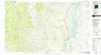
USGS Historical Quadrangle in GeoPDF.
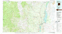
USGS Historical Quadrangle in GeoPDF.
This Data Release contains various types of hydrologic and geologic data from the Upper Rio Grande Focus Area Study from 1921-2017, including groundwater-level measurement data compiled and synthesized from various sources, water-level altitude and water-level change maps developed from the water-level measurement data every 5 years from 1980-2015, and the horizontal extent of 13 alluvial basins in the Upper Rio Grande Basin
Types: Map Service,
OGC WFS Layer,
OGC WMS Layer,
OGC WMS Service;
Tags: Abiquiu Reservoir,
Ahumada,
Alamosa,
Alamosa County,
Alamosa Creek,
|

|
